
26 Jan 2011
LRT-1 Vito Cruz Station Routes & Destinations
There's a lot of places you can get to from Vito Cruz Station of LRT-1 the Yellow Line. First off, surrounding this station are landmarks and institutions that are so important in Philippine history and culture. Aside from De La Salle University, one ride away is CCP Complex with its terminal located just outside Rizal Memorial Sports Complex. Second, you can get to a back door of Makati Financial District by jeep from Vito Cruz Station. Pablo Ocampo Senior Street formerly Vito Cruz from which the name of this station was derived extends up to northeast part of Makati, intersecting a main thoroughfare there - Chino Roces formerly Pasong Tamo. Here are important places, in alphabetical order, you can get to from Vito Cruz Station either on foot or by shuttle and jeep:
 CCP Complex Shuttle Terminal is located along Pablo Ocampo Senior Street formerly Vito Cruz near main gate of Rizal Memorial Sports Complex. From Vito Cruz Station, walk toward corner of Taft Avenue and Pablo Ocampo, turn right, walk on until you see the terminal. These shuttles take passengers to the following: CCP, Harbor Square, Aliw Theater, Star City, Folk Arts Theater, PICC, PCSO, Coconut Palace, Gloriamaris, Sofitel Hotel Philippine Plaza, Amazing Show at Manila Film Center, Senate of the Philippines at GSIS Building.

Central Bank of the Philippines' entrance is located along Harrison Street. You can ride the shuttle of CCP, get off at corner of Pablo Ocampo and Harrison Street and walk to the gate. Or you can take a taxi and get off at the exact gate of Central Bank.

Century Park Hotel is next to Rizal Memorial Sports Complex along Pablo Ocampo Street, opposite corner of M. Adriatico Sreet and Pablo Ocampo. You can either ride a taxi or a CCP shuttle. But you know what? It's a walking distance, around 500 meters.

Friedenshaus Residence Hall is located at the corner of Estrada and Leon Guinto streets. From Vito Cruz Station walk toward Dela Salle University, which is northward along Taft Avenue. First Street from Vito Cruz Station to the right is Estrada Street. Walk along Estrada up to the next street which is Leon Guinto Street. Friendenshaus is visible momentarily.
 Harrison Plaza Shopping Mall is located along M. Adriatico Street opposite Rizal Memorial Sports Complex. From Vito Cruz Station, walk toward corner of Taft Avenue and Pablo Ocampo. You can ride a pedicab to get there. Before you board a pedicab make sure you and the driver agree on the fare. If you decide to walk, from the corner of Taft Avenue and Pablo Ocampo Street, walk toward Rizal Memorial Sports Complex until you reach M. Adriatico. Turn right on Adriatico, walk on until you see SM to the left of Adriatico. Walk across Adriatico toward SM. Next to SM is the entrance of Harrison Plaza or you can pass through inside SM and head toward Harrison Plaza.
 Jeepney Terminal of jeeps going to Zobel Roxas, Makati. These jeepneys pass by Zobel Roxas cor Osmena Highway or South Luzon Expressway. The terminal is located at the corner of Pablo Ocampo Sr and Leon Guinto streets. From Vito Cruz Station walk southward along Taft Avenue, walk across Taft toward Jollibee Taft. Walk pass Jollibee, next street from Taft is Leon Guinto, and right there is the terminal of these jeepneys. Their sign read "Zobel Roxas - Dulo".

La Salle - Dela Salle School of Design and Arts Campus. This is along Pablo Ocampo Street, 100 meters away from the terminal of "Zobel Roxas-Dulo" jeepneys.

La Salle - De La Salle University Taft is next to McDonald's which is very visible from Vito Cruz Station.

Legazpi Towers is located at the corner of Roxas Boulevard and Pablo Ocampo Street. Ride a CCP shuttle and ask the driver to drop you off right there.

Manila Yacht Club - located in Manila Bay next to Philippine Navy Headquarters, approximately 200 meters from CCP Complex. How to commute to Manila Yacht Club? You can ride a shuttle bound to CCP Complex and get off at the corner of Roxas Boulevard and CCP Complex or Pedro Bukaneg, then walk northward along Roxas Boulevard pass Philippine Navy Headquarters, until you see Manila Yacht Club entrance.

Ninoy Aquino Stadium is located at the northwest tip of Rizal Memorial Sports Complex. By walking its 650 meters from Taft. Walk toward Pablo Ocampo from Vito Cruz Station, turn right on Pablo Ocampo, walk pass terminal of CCP Complex shuttles, turn right on Adriatico Street, walk along Adriatico Street pass Wushu Federation and Rizal Memorial Stadium until you get to the next gate of Rizal Memorial Sports Complex. Right there is the Ninoy Aquino Stadium.

Orchids Garden Suites is located along Pablo Ocampo Street opposite Century Park Hotel, approximately 450 meters from corner of Taft Avenue and Pablo Ocampo Street.

Philippine Sports Commission is located along Pablo Ocampo Street next to the main gate of Rizal Memorial Sports Complex, approximately 217 meters from corner of Taft Avenue and Pablo Ocampo Street formerly Vito Cruz.

Philippine Taekwondo Headquarters is located along Pablo Ocampo Street next to Philippine Sports Commission and approximately 240 meters from corner of Taft Avenue and Pablo Ocampo Sr Street.

PSC Badminton Hall is the first Sport Facility you get to see along Pablo Ocampo Street, 70 meters walk from corner of Taft Avenue and Pablo Ocampo Street.

Rizal Memorial Baseball Stadium - located at the corner of Pablo Ocampo and Adriatico streets, next to Philippine Taekwondo Headquarters, approximately 300 meters away from corner of Taft Avenue and Pablo Ocampo Street.

Rizal Memorial Sports Complex Gate along Pablo Ocampo Street, approximately 170 meters from corner of Taft Avenue and Pablo Ocampo Street.

Rizal Memorial Stadium Track & Football - located along Adriatico Street, opposite Harrison Plaza, approximately 580 meters from Taft Avenue.

SM Department Store at Harrison Plaza - along Adriatico Street, opposite Rizal Memorial Sports Complex, around 550-meter walk from corner of Taft Avenue and Pablo Ocampo Street. You can ride a pedicab to get there, just make sure you and the driver of pedicab are in agreement on the fare before you board.

SM Hypermart Harrison Plaza - along Adriatico Street, next to the main building of Harrison Plaza, opposite Ninoy Aquino Stadium and approximately 680 meters from Taft Avenue.

St. Scholastica's Church - located in St. Scholastica's College Campus along Leon Guinto Street near terminal of jeepneys going to Zobel Roxas Makati. From Jollibee Taft, walk along Pablo Ocampo Street up to Leon Guinto, until you see the church from the corner of Pablo Ocampo and Leon Guinto. Approximately 130 meters from Jollibee Taft.
 St. Scholastica's Archives-Museum - located along Pablo Ocampo Street opposite the terminal of jeepneys going to Zobel Roxas Makati. From Vito Cruz Station, walk toward Jollibee Taft at the corner of Taft Avenue and Pablo Ocampo formerly Vito Cruz. From Jollibee Taft walk along Pablo Ocampo eastward up to Leon Guinto Street. The museum is to the right of Pablo Ocampo, approximately 90 meters from Taft Avenue.

Student's Place - it's a students' need oriented commercial building with fast food restaurants like Tropical Hut, internet cafes like I.T. Log P@rk, book shops and many others. It's located at the corner of Taft Avenue and Estrada Street exactly opposite Dela Salle University. From Vito Cruz Station, walk northward until you see the building, approximately 100 meters from LRT Vito Cruz Station.

The Buoy Cafe Bar Grill & Restaurant - located along Pablo Ocampo Street formerly Vito Cruz just ouside Orchids Garden Suites and approximately 400 meters from Taft. Practical way to get there is to ride a shuttle going to CCP Complex. Or, just walk!

The Grand Towers and Pacific Regency - two condominium buildings standing side by side along Pablo Ocampo Sr Street formerly Vito Cruz opposite Rizal Memorial Sports Complex and approximately 120 meters from corner of Taft Avenue and Pablo Ocampo. Walking distance to DLSU or Dela Salle University.

The Providence Tower Condominium - located along Leon Guinto Street near corner Estrada. From Vito Cruz Station walk northward up to Estrada Street, walk along Estrada and turn left on Leon Guinto. Approximately 218 meters from Vito Cruz Station of LRT-1.

De La Salle College of Saint Benilde - located just around 20 meters from Vito Cruz Station of LRT-1 along north bound side of Taft Avenue.

Torre Lorenzo Residences - located at the corner of Taft Avenue and Pablo Ocampo Sr. Street. Most of the occupants are De La Salle students. Starbucks Cafe occupies a portion of the ground floor facing the corner of the intersection. Approximately 73 meters from Vito Cruz Station.

United Evangelical Church of Manila - along Leon Guinto Street. From Vito Cruz station walk northward, turn right onto Estrada Street then left on Leon Guinto Street. Walk to the left side of Leon Guinto, passing by The Providence tower, until you see this building, standing approximately 130 meters from the corner of Estrada and Leon Guinto streets.
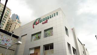
University Mall - is connected to Vito Cruz Station of LRT-1 but only passengers from the north can pass through the crossway connecting the two buildings. Passengers from south need to get on the ground and walk across Taft Avenue to get to the University Mall.

Vietnam Embassy - located alongside The Buoy and Orchids Garden Suites. It's visible from the corner of Pablo Ocampo Street formerly Vito Cruz and Adriatico Street. The most practical way to get there is by riding a shuttle going to CCP or you can just walk. Approximate distance from Taft Avenue is 390 meters.

HP Village Square - a mini mall with fast food as well as fine dining restaurants, bank and atm machines around it, located at the corner of Pablo Ocampo Street formerly Vito Cruz and Harrison Street. This one is a bit far for you to walk so the best way is to ride a shuttle going to CCP Complex and ask the driver to drop you off the location.

Vito Cruz Towers - Condominiums owned by Citiland Groups, located alongside Pacific Regency but a little bit far. Approximately 250 meters from corner of Taft Avenue and Pablo Ocampo Street formerly Vito Cruz.

Wushu Federation Philippines - located along Adriatico Street, approximately 140 meters from corner of Adriatico and Pablo Ocampo streets where the Baseball Stadium is located and around 450 meters from Taft Avenue. Pedicabs can take you there if you don't feel like walking. Just make sure you and the pedicab driver agree on the amount of fare before you board the pedicab.
Read more...


Central Bank of the Philippines' entrance is located along Harrison Street. You can ride the shuttle of CCP, get off at corner of Pablo Ocampo and Harrison Street and walk to the gate. Or you can take a taxi and get off at the exact gate of Central Bank.

Century Park Hotel is next to Rizal Memorial Sports Complex along Pablo Ocampo Street, opposite corner of M. Adriatico Sreet and Pablo Ocampo. You can either ride a taxi or a CCP shuttle. But you know what? It's a walking distance, around 500 meters.

Friedenshaus Residence Hall is located at the corner of Estrada and Leon Guinto streets. From Vito Cruz Station walk toward Dela Salle University, which is northward along Taft Avenue. First Street from Vito Cruz Station to the right is Estrada Street. Walk along Estrada up to the next street which is Leon Guinto Street. Friendenshaus is visible momentarily.


La Salle - Dela Salle School of Design and Arts Campus. This is along Pablo Ocampo Street, 100 meters away from the terminal of "Zobel Roxas-Dulo" jeepneys.

La Salle - De La Salle University Taft is next to McDonald's which is very visible from Vito Cruz Station.

Legazpi Towers is located at the corner of Roxas Boulevard and Pablo Ocampo Street. Ride a CCP shuttle and ask the driver to drop you off right there.

Manila Yacht Club - located in Manila Bay next to Philippine Navy Headquarters, approximately 200 meters from CCP Complex. How to commute to Manila Yacht Club? You can ride a shuttle bound to CCP Complex and get off at the corner of Roxas Boulevard and CCP Complex or Pedro Bukaneg, then walk northward along Roxas Boulevard pass Philippine Navy Headquarters, until you see Manila Yacht Club entrance.

Ninoy Aquino Stadium is located at the northwest tip of Rizal Memorial Sports Complex. By walking its 650 meters from Taft. Walk toward Pablo Ocampo from Vito Cruz Station, turn right on Pablo Ocampo, walk pass terminal of CCP Complex shuttles, turn right on Adriatico Street, walk along Adriatico Street pass Wushu Federation and Rizal Memorial Stadium until you get to the next gate of Rizal Memorial Sports Complex. Right there is the Ninoy Aquino Stadium.

Orchids Garden Suites is located along Pablo Ocampo Street opposite Century Park Hotel, approximately 450 meters from corner of Taft Avenue and Pablo Ocampo Street.

Philippine Sports Commission is located along Pablo Ocampo Street next to the main gate of Rizal Memorial Sports Complex, approximately 217 meters from corner of Taft Avenue and Pablo Ocampo Street formerly Vito Cruz.

Philippine Taekwondo Headquarters is located along Pablo Ocampo Street next to Philippine Sports Commission and approximately 240 meters from corner of Taft Avenue and Pablo Ocampo Sr Street.

PSC Badminton Hall is the first Sport Facility you get to see along Pablo Ocampo Street, 70 meters walk from corner of Taft Avenue and Pablo Ocampo Street.

Rizal Memorial Baseball Stadium - located at the corner of Pablo Ocampo and Adriatico streets, next to Philippine Taekwondo Headquarters, approximately 300 meters away from corner of Taft Avenue and Pablo Ocampo Street.

Rizal Memorial Sports Complex Gate along Pablo Ocampo Street, approximately 170 meters from corner of Taft Avenue and Pablo Ocampo Street.

Rizal Memorial Stadium Track & Football - located along Adriatico Street, opposite Harrison Plaza, approximately 580 meters from Taft Avenue.

SM Department Store at Harrison Plaza - along Adriatico Street, opposite Rizal Memorial Sports Complex, around 550-meter walk from corner of Taft Avenue and Pablo Ocampo Street. You can ride a pedicab to get there, just make sure you and the driver of pedicab are in agreement on the fare before you board.

SM Hypermart Harrison Plaza - along Adriatico Street, next to the main building of Harrison Plaza, opposite Ninoy Aquino Stadium and approximately 680 meters from Taft Avenue.

St. Scholastica's Church - located in St. Scholastica's College Campus along Leon Guinto Street near terminal of jeepneys going to Zobel Roxas Makati. From Jollibee Taft, walk along Pablo Ocampo Street up to Leon Guinto, until you see the church from the corner of Pablo Ocampo and Leon Guinto. Approximately 130 meters from Jollibee Taft.


Student's Place - it's a students' need oriented commercial building with fast food restaurants like Tropical Hut, internet cafes like I.T. Log P@rk, book shops and many others. It's located at the corner of Taft Avenue and Estrada Street exactly opposite Dela Salle University. From Vito Cruz Station, walk northward until you see the building, approximately 100 meters from LRT Vito Cruz Station.

The Buoy Cafe Bar Grill & Restaurant - located along Pablo Ocampo Street formerly Vito Cruz just ouside Orchids Garden Suites and approximately 400 meters from Taft. Practical way to get there is to ride a shuttle going to CCP Complex. Or, just walk!

The Grand Towers and Pacific Regency - two condominium buildings standing side by side along Pablo Ocampo Sr Street formerly Vito Cruz opposite Rizal Memorial Sports Complex and approximately 120 meters from corner of Taft Avenue and Pablo Ocampo. Walking distance to DLSU or Dela Salle University.

The Providence Tower Condominium - located along Leon Guinto Street near corner Estrada. From Vito Cruz Station walk northward up to Estrada Street, walk along Estrada and turn left on Leon Guinto. Approximately 218 meters from Vito Cruz Station of LRT-1.
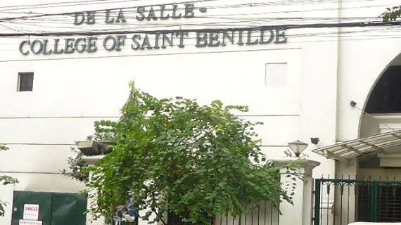
De La Salle College of Saint Benilde - located just around 20 meters from Vito Cruz Station of LRT-1 along north bound side of Taft Avenue.

Torre Lorenzo Residences - located at the corner of Taft Avenue and Pablo Ocampo Sr. Street. Most of the occupants are De La Salle students. Starbucks Cafe occupies a portion of the ground floor facing the corner of the intersection. Approximately 73 meters from Vito Cruz Station.

United Evangelical Church of Manila - along Leon Guinto Street. From Vito Cruz station walk northward, turn right onto Estrada Street then left on Leon Guinto Street. Walk to the left side of Leon Guinto, passing by The Providence tower, until you see this building, standing approximately 130 meters from the corner of Estrada and Leon Guinto streets.

University Mall - is connected to Vito Cruz Station of LRT-1 but only passengers from the north can pass through the crossway connecting the two buildings. Passengers from south need to get on the ground and walk across Taft Avenue to get to the University Mall.

Vietnam Embassy - located alongside The Buoy and Orchids Garden Suites. It's visible from the corner of Pablo Ocampo Street formerly Vito Cruz and Adriatico Street. The most practical way to get there is by riding a shuttle going to CCP or you can just walk. Approximate distance from Taft Avenue is 390 meters.

HP Village Square - a mini mall with fast food as well as fine dining restaurants, bank and atm machines around it, located at the corner of Pablo Ocampo Street formerly Vito Cruz and Harrison Street. This one is a bit far for you to walk so the best way is to ride a shuttle going to CCP Complex and ask the driver to drop you off the location.

Vito Cruz Towers - Condominiums owned by Citiland Groups, located alongside Pacific Regency but a little bit far. Approximately 250 meters from corner of Taft Avenue and Pablo Ocampo Street formerly Vito Cruz.

Wushu Federation Philippines - located along Adriatico Street, approximately 140 meters from corner of Adriatico and Pablo Ocampo streets where the Baseball Stadium is located and around 450 meters from Taft Avenue. Pedicabs can take you there if you don't feel like walking. Just make sure you and the pedicab driver agree on the amount of fare before you board the pedicab.
22 Jan 2011
Direction Bytes: LRT Station Near Padre Faura
You can get to Padre Faura from U.N. Avenue by walking along Taft Avenue southward. You will pass by NBI Headquarters to your right and Pearl Hotel to your left. At the corner of Padre Faura and Taft Avenue, where the Supreme Court is located, you can ride a jeep that will pass by Robinson's Place Faura Wing. All jeepneys plying this route pass by Robinson's Place.If you're going to Pedro Gil Wing of Robinson's Place or Midtown, don't get off at Padre Faura. The jeep will make a round trip. From Padre Faura, these jeepneys turn left on M.H. Del Pilar Street and turn left again on Pedto Gil. You can immediately see Midtown once the jeepney you're riding gets near. Next to Midtown is the Pedro Gil Wing of Robinson's Place where National Bookstore is located. Midtown and Robinson's Place are attached to each other and you can get to one from the other. They're only one mall. Midtown is the annex, just constructed a few years ago.
Read more...
21 Jan 2011
How To Get To Pambansang Muziklaban! Francis Magalona Tribute
Pambansang Muziklaban! Francis Magalona Tribute happens on January 22, 2011 in the Open Field at the corner of Roxas Boulevard and EDSA Extension. How do we get there? Here's direction guide to the Open Field Roxas Boulevard corner EDSA Extension.
Look for your location from the routes given below and follow the direction.
Route #1
From south of Metro Manila - Alabang, Pacita, Muntinlupa, Metropolis Star Mall, Festival Mall and southern Tagalog provinces of Laguna, Batangas and Quezon. There are terminals of jeepneys going to Pasay Rotonda located in Alabang near Metropolis Star Mall. Some of them just pick up passengers along East Service Road near corner Montillano Street. Ride jeepney with Pasay Rotonda sign. Get off at Pasay Rotonda. Some jeepney drivers drop off passengers right at the MRT Taft Station. Some of them drop off passengers after crossing Taft Avenue. You can either ride just below the elevated MRT Station or near Save More Supermarket after crossing Taft. Ride another jeepney or bus with MOA or Mall of Asia sign. Get off at Toyota Manila Bay, which is located along EDSA Extension after passing Roxas Boulevard under EDSA-Roxas Boulevard Flyover. The Open Field is opposite Toyota, across EDSA Extension.
Route #2
From north of Metro Manila - Monumento, Caloocan, Malabon, Navotas, Valenzuela and other areas in these vicinities. Ride a jeep or bus from your location to Monumento for those who live far. Ride a south bound train or Baclaran bound train in Monumento Station of LRT-1, the Yellow Line. Get off at EDSA Station. At the foot of the elevated EDSA Station is the terminal of passenger shuttles going to MOA. Ride one of these shuttles. They don't like jeepneys, that's why we call them shuttles. Get off at Toyota Manila Bay, which is located along EDSA Extension after passing Roxas Boulevard under EDSA-Roxas Boulevard Flyover. The Open Field is opposite Toyota, across EDSA Extension.
Route #3
From Fairview, Commonwealth, U.P. Diliman, Philcoa, East Avenue, Quezon Memorial Circle. You only need a one ride which by bus and you get off at the exact location of this venue. Ride a bus with "Baclaran MOA" sign. It's going to be a long trip. Ask the conductor to drop you off at Toyota Manila Bay, which is located along EDSA Extension after passing Roxas Boulevard under EDSA-Roxas Boulevard Flyover. The Open Field is opposite Toyota, across EDSA Extension.
Route #4
From Project 7, Project 8, Munoz, Roosevelt, Congressional and areas nearby. Get to Roosevelt Station of LRT-1, the Yellow Line. Ride a Baclaran bound train and get off at EDSA Station. At the foot of the elevated EDSA Station is the terminal of passenger shuttles going to MOA. Ride one of these shuttles. They don't like jeepneys, that's why we call them shuttles. Get off at Toyota Manila Bay, which is located along EDSA Extension after passing Roxas Boulevard under EDSA-Roxas Boulevard Flyover. The Open Field is opposite Toyota, across EDSA Extension.
Route #5
From Project 2-3. Ride a jeep going to Quiapo, get off at the corner of EDSA and West Avenue, walk to North Station of MRT-3, the Blue Line. Ride a train going to Taft. Get off at Taft Station. If you're from Trinoma and SM North EDSA, just walk your way toward MRT. Under the elevated MRT Taft Station, ride a jeepney or bus going to MOA or Mall of Asia. Jeepneys stop right before the MRT Station so you might walk a little bit backward. If at any case, you find it hard to get a ride there, you can go across Taft Avenue and ride a jeepney going to MOA along EDSA just in front of Save More Supermarket. Get off at Toyota Manila Bay, which is located along EDSA Extension after passing Roxas Boulevard under EDSA-Roxas Boulevard Flyover. The Open Field is opposite Toyota, across EDSA Extension.
Route #6
From Antipolo, Ortigas, Pasig, Mandaluyong and nearby areas. From your respective locations ride a jeep or bus that will take you to EDSA. Once you're along EDSA, walk your way toward the nearest MRT Station. If the MRT Station is too far from your location, ride a bus. The MRT Stations you can get to are any of these: Ortigas Station, Shaw Station and Boni Station. Ride a train going to Taft. Get off at Taft Station. Under the elevated MRT Taft Station, ride a jeepney or bus going to MOA or Mall of Asia. Jeepneys stop right before the MRT Station so you might walk a little bit backward. If at any case, you find it hard to get a ride there, you can go across Taft Avenue and ride a jeepney going to MOA along EDSA just in front of Save More Supermarket. Get off at Toyota Manila Bay, which is located along EDSA Extension after passing Roxas Boulevard under EDSA-Roxas Boulevard Flyover. The Open Field is opposite Toyota, across EDSA Extension.
Route #7
From Cavite, SM South Mall, Bacoor, Zapote, Tagaytay and nearby areas. Ride a bus or jeep that will bring you to Baclaran. Get off before the bus or jeep you're riding get to Redemptorist Church. There's a terminal of jeepneys going to MOA along the service road of Roxas Boulevard near to Lydia's Lechon Restaurant. Ride right there. Get off at Toyota Manila Bay, which is located along EDSA Extension after passing Roxas Boulevard under EDSA-Roxas Boulevard Flyover. The Open Field is opposite Toyota, across EDSA Extension.
Route #8
From Novaliches and Bulacan. You can ride a bus or jeepney bound to Blumentritt or Doroteo Jose then ride a train going to Baclaran in either Blumentritt Station or Doroteo Station of LRT-1, the Yellow Line. Or you can get off at Balintawak and walk your way toward Balintawak Station of LRT-1 and ride a train going to Baclaran. Get off at EDSA Station. At the foot of the elevated EDSA Station is the terminal of passenger shuttles going to MOA. Ride one of these shuttles. They don't like jeepneys, that's why we call them shuttles. Get off at Toyota Manila Bay, which is located along EDSA Extension after passing Roxas Boulevard under EDSA-Roxas Boulevard Flyover. The Open Field is opposite Toyota, across EDSA Extension.
Route #9
From Araneta Center and Gateway Mall. Proceed to Araneta Center-Cubao Station of MRT. Ride a train going to Taft. Get off at Taft Station. Under the elevated MRT Taft Station, ride a jeepney or bus going to MOA or Mall of Asia. Jeepneys stop right before the MRT Station so you might walk a little bit backward. If at any case, you find it hard to get a ride there, you can go across Taft Avenue and ride a jeepney going to MOA along EDSA just in front of Save More Supermarket. Get off at Toyota Manila Bay, which is located along EDSA Extension after passing Roxas Boulevard under EDSA-Roxas Boulevard Flyover. The Open Field is opposite Toyota, across EDSA Extension.
Route #10
From Marikina, Santolan Pasig, Project 4, Katipunan, Sta. Mesa, SM Centerpoint, and other nearby areas. Ride a train from any station of LRT-2, the purple line. Get off at Recto Station. Walk your way to Doroteo Station of LRT-1 via the crossway that connects LRT-2 to LRT-1. Ride a Baclaran bound train and get off at EDSA Station. At the foot of the elevated EDSA Station is the terminal of passenger shuttles going to MOA. Ride one of these shuttles. They don't like jeepneys, that's why we call them shuttles. Get off at Toyota Manila Bay, which is located along EDSA Extension after passing Roxas Boulevard under EDSA-Roxas Boulevard Flyover. The Open Field is opposite Toyota, across EDSA Extension.
If you're going to "Pambansang Muziklaban! Francis Magalona Tribute" by car, follow directions on how to get to Blue Wave Macapagal. Blue Wave Macapagal is very near to the Open Field of Roxas Boulevard corner EDSA Extension. Search "how to get to blue wave macapagal" in our Search Direction Box located at the sidebar of this blog.
Location Map of the Open Field Roxas Boulevard corner EDSA Extension
Read more...
Look for your location from the routes given below and follow the direction.
Route #1
From south of Metro Manila - Alabang, Pacita, Muntinlupa, Metropolis Star Mall, Festival Mall and southern Tagalog provinces of Laguna, Batangas and Quezon. There are terminals of jeepneys going to Pasay Rotonda located in Alabang near Metropolis Star Mall. Some of them just pick up passengers along East Service Road near corner Montillano Street. Ride jeepney with Pasay Rotonda sign. Get off at Pasay Rotonda. Some jeepney drivers drop off passengers right at the MRT Taft Station. Some of them drop off passengers after crossing Taft Avenue. You can either ride just below the elevated MRT Station or near Save More Supermarket after crossing Taft. Ride another jeepney or bus with MOA or Mall of Asia sign. Get off at Toyota Manila Bay, which is located along EDSA Extension after passing Roxas Boulevard under EDSA-Roxas Boulevard Flyover. The Open Field is opposite Toyota, across EDSA Extension.
Route #2
From north of Metro Manila - Monumento, Caloocan, Malabon, Navotas, Valenzuela and other areas in these vicinities. Ride a jeep or bus from your location to Monumento for those who live far. Ride a south bound train or Baclaran bound train in Monumento Station of LRT-1, the Yellow Line. Get off at EDSA Station. At the foot of the elevated EDSA Station is the terminal of passenger shuttles going to MOA. Ride one of these shuttles. They don't like jeepneys, that's why we call them shuttles. Get off at Toyota Manila Bay, which is located along EDSA Extension after passing Roxas Boulevard under EDSA-Roxas Boulevard Flyover. The Open Field is opposite Toyota, across EDSA Extension.
Route #3
From Fairview, Commonwealth, U.P. Diliman, Philcoa, East Avenue, Quezon Memorial Circle. You only need a one ride which by bus and you get off at the exact location of this venue. Ride a bus with "Baclaran MOA" sign. It's going to be a long trip. Ask the conductor to drop you off at Toyota Manila Bay, which is located along EDSA Extension after passing Roxas Boulevard under EDSA-Roxas Boulevard Flyover. The Open Field is opposite Toyota, across EDSA Extension.
Route #4
From Project 7, Project 8, Munoz, Roosevelt, Congressional and areas nearby. Get to Roosevelt Station of LRT-1, the Yellow Line. Ride a Baclaran bound train and get off at EDSA Station. At the foot of the elevated EDSA Station is the terminal of passenger shuttles going to MOA. Ride one of these shuttles. They don't like jeepneys, that's why we call them shuttles. Get off at Toyota Manila Bay, which is located along EDSA Extension after passing Roxas Boulevard under EDSA-Roxas Boulevard Flyover. The Open Field is opposite Toyota, across EDSA Extension.
Route #5
From Project 2-3. Ride a jeep going to Quiapo, get off at the corner of EDSA and West Avenue, walk to North Station of MRT-3, the Blue Line. Ride a train going to Taft. Get off at Taft Station. If you're from Trinoma and SM North EDSA, just walk your way toward MRT. Under the elevated MRT Taft Station, ride a jeepney or bus going to MOA or Mall of Asia. Jeepneys stop right before the MRT Station so you might walk a little bit backward. If at any case, you find it hard to get a ride there, you can go across Taft Avenue and ride a jeepney going to MOA along EDSA just in front of Save More Supermarket. Get off at Toyota Manila Bay, which is located along EDSA Extension after passing Roxas Boulevard under EDSA-Roxas Boulevard Flyover. The Open Field is opposite Toyota, across EDSA Extension.
Route #6
From Antipolo, Ortigas, Pasig, Mandaluyong and nearby areas. From your respective locations ride a jeep or bus that will take you to EDSA. Once you're along EDSA, walk your way toward the nearest MRT Station. If the MRT Station is too far from your location, ride a bus. The MRT Stations you can get to are any of these: Ortigas Station, Shaw Station and Boni Station. Ride a train going to Taft. Get off at Taft Station. Under the elevated MRT Taft Station, ride a jeepney or bus going to MOA or Mall of Asia. Jeepneys stop right before the MRT Station so you might walk a little bit backward. If at any case, you find it hard to get a ride there, you can go across Taft Avenue and ride a jeepney going to MOA along EDSA just in front of Save More Supermarket. Get off at Toyota Manila Bay, which is located along EDSA Extension after passing Roxas Boulevard under EDSA-Roxas Boulevard Flyover. The Open Field is opposite Toyota, across EDSA Extension.
Route #7
From Cavite, SM South Mall, Bacoor, Zapote, Tagaytay and nearby areas. Ride a bus or jeep that will bring you to Baclaran. Get off before the bus or jeep you're riding get to Redemptorist Church. There's a terminal of jeepneys going to MOA along the service road of Roxas Boulevard near to Lydia's Lechon Restaurant. Ride right there. Get off at Toyota Manila Bay, which is located along EDSA Extension after passing Roxas Boulevard under EDSA-Roxas Boulevard Flyover. The Open Field is opposite Toyota, across EDSA Extension.
Route #8
From Novaliches and Bulacan. You can ride a bus or jeepney bound to Blumentritt or Doroteo Jose then ride a train going to Baclaran in either Blumentritt Station or Doroteo Station of LRT-1, the Yellow Line. Or you can get off at Balintawak and walk your way toward Balintawak Station of LRT-1 and ride a train going to Baclaran. Get off at EDSA Station. At the foot of the elevated EDSA Station is the terminal of passenger shuttles going to MOA. Ride one of these shuttles. They don't like jeepneys, that's why we call them shuttles. Get off at Toyota Manila Bay, which is located along EDSA Extension after passing Roxas Boulevard under EDSA-Roxas Boulevard Flyover. The Open Field is opposite Toyota, across EDSA Extension.
Route #9
From Araneta Center and Gateway Mall. Proceed to Araneta Center-Cubao Station of MRT. Ride a train going to Taft. Get off at Taft Station. Under the elevated MRT Taft Station, ride a jeepney or bus going to MOA or Mall of Asia. Jeepneys stop right before the MRT Station so you might walk a little bit backward. If at any case, you find it hard to get a ride there, you can go across Taft Avenue and ride a jeepney going to MOA along EDSA just in front of Save More Supermarket. Get off at Toyota Manila Bay, which is located along EDSA Extension after passing Roxas Boulevard under EDSA-Roxas Boulevard Flyover. The Open Field is opposite Toyota, across EDSA Extension.
Route #10
From Marikina, Santolan Pasig, Project 4, Katipunan, Sta. Mesa, SM Centerpoint, and other nearby areas. Ride a train from any station of LRT-2, the purple line. Get off at Recto Station. Walk your way to Doroteo Station of LRT-1 via the crossway that connects LRT-2 to LRT-1. Ride a Baclaran bound train and get off at EDSA Station. At the foot of the elevated EDSA Station is the terminal of passenger shuttles going to MOA. Ride one of these shuttles. They don't like jeepneys, that's why we call them shuttles. Get off at Toyota Manila Bay, which is located along EDSA Extension after passing Roxas Boulevard under EDSA-Roxas Boulevard Flyover. The Open Field is opposite Toyota, across EDSA Extension.
If you're going to "Pambansang Muziklaban! Francis Magalona Tribute" by car, follow directions on how to get to Blue Wave Macapagal. Blue Wave Macapagal is very near to the Open Field of Roxas Boulevard corner EDSA Extension. Search "how to get to blue wave macapagal" in our Search Direction Box located at the sidebar of this blog.
Location Map of the Open Field Roxas Boulevard corner EDSA Extension
Direction Bytes: Direction To Malate From Taft Avenue
Now, here's the quick guide. The heart of Malate is Remedios Circle. Once you're feet is on Remedios Circle you can walk to all bars and clubs surrounding this mini-park. You can get to places like Forbes Grill, The Library, Cafe Adriatico, Cafe Havana, Padis Point and many others. If you're commuting along Taft Avenue, get off at Remedios Street. Drivers know this street so ask them to drop you off. From corner of Taft and Remedios walk toward where the sun sets until you see Remedios Circle. Well, it look's like a rotonda or a roundabout in technical term with park inside and surrounded by bars and clubs. Once there, you can explore different places with some kind of bar-hopping. If you're driving from Taft Avenue, take Nakpil Street, it's the street that borders PWU or Philippine Women's University to the south. Let's say you're in PWU, along Nakpil, which is one way going to Malate, cross Taft Avenue and drive all the way up to Adriatico Street, where Nakpil ends. From Taft Avenue, count the streets intersecting Nakpil with the Street next to Taft as the first. The sixth street is M. Adriatico. Turn left on M. Adriatico to get to the Remedios Circle where you can look for open parking with some "back-up" boys guarding your car while you're enjoying the night away.
Read more...
Direction Bytes: Nagtahan To Chino Roces
From either Nagtahan Flyover or Nagtahan Boulevard itself, take the south bound lane toward Nagtahan Bridge. Pass through the Nagtahan Bridge. After crossing the bridge, cross the first intersection next to it which is Paz Mendoza Guazon Street. As soon as you cross Guazon, road name becomes President Quirino Avenue. It's the same road you're taking only the name had changed. Now stay to the middle of President Quirino Avenue and cross another intersection with the same street name as Pas Mendoza Guazon. This road seems to be running somewhere and bends back again toward Quirino Avenue. After you cross the second intersection from Nagtahan Bridge, you'll notice President Quirino Avenue's island becomes wider. Drive on, stay to the middle and cross intersections of Gonzales, Obisis and Zamora Street. Quirino Avenue bends to the right after you pass UNICEF. Continue driving, stay to the middle, until you pass by Plaza Dilaw where CRS Tower Apartelle is located along Plaza Dilao Road, the road that borders Plaza Dilao aside from Quirino Avenue. You'll also pass by junction of Quirino Avenue and Plaza Dilao Road. Now after you pass by Plaza Dilao Road, change lane to the right of President Quirino Avenue and turn right onto the next street after Plaza Dilao Road. This street is Sto. Sepulcro. Turn right onto Sto. Sepulcro Street. Cross Figueroa Street then turn left on the second street which is Penafrancia Street. Finally, turn left on Pedro Gil Street. We're now done in our first stage of traversing the route to Chino Roces.
Now, stay on Pedro Gil Street and cross President Quirino Avenue. You will pass by PNR Paco Station to the left of Pedro Gil next to President Quirino Avenue. Continue your drive, you will pass by Paraiso ng Batang Maynila Park to your right, and then Pasig Line Street, followed by Aragon Street. Next to Aragon is Tejeron. Turn right onto Tejeron and drive all the way until its name becomes J.P. Rizal after passing Delpan Street to the left of Tejeron. Now you've just entered Makati and to your right now is the Puregold Makati. Continue driving, follow the direction of passenger jeepneys, turn right onto Pasong Tirad Street and finally, turn left on one way Kalayaan Avenue. You're now approaching Chino Roces formerly Pasong Tamo. From the corner of Pasong Tirad to Chino Roces the distance is around 200 meters. Chino Roces begins in J.P. Rizal which is around 130 meters away from the corner of Kalayaan Avenue. You turned right onto Pasong Tirad instead of going straight on J.P. Rizal Because J.P. Rizal Street is one way up to Pasong Tirad. Once you reach the corner of Chino Roces and Kalayaan Avenue, stage clears, you're now completed the route from Nagtahan to Chino Roces. Turn right onto Chino Roces to get to your destination.
Read more...
Now, stay on Pedro Gil Street and cross President Quirino Avenue. You will pass by PNR Paco Station to the left of Pedro Gil next to President Quirino Avenue. Continue your drive, you will pass by Paraiso ng Batang Maynila Park to your right, and then Pasig Line Street, followed by Aragon Street. Next to Aragon is Tejeron. Turn right onto Tejeron and drive all the way until its name becomes J.P. Rizal after passing Delpan Street to the left of Tejeron. Now you've just entered Makati and to your right now is the Puregold Makati. Continue driving, follow the direction of passenger jeepneys, turn right onto Pasong Tirad Street and finally, turn left on one way Kalayaan Avenue. You're now approaching Chino Roces formerly Pasong Tamo. From the corner of Pasong Tirad to Chino Roces the distance is around 200 meters. Chino Roces begins in J.P. Rizal which is around 130 meters away from the corner of Kalayaan Avenue. You turned right onto Pasong Tirad instead of going straight on J.P. Rizal Because J.P. Rizal Street is one way up to Pasong Tirad. Once you reach the corner of Chino Roces and Kalayaan Avenue, stage clears, you're now completed the route from Nagtahan to Chino Roces. Turn right onto Chino Roces to get to your destination.
20 Jan 2011
Open Parking Space Along Roxas Boulevard Beside U.S. Embassy
Flash Update!!! The place written on this post may not available at this moment because of what had happened to Roxas Blvd wrought by the havoc of typhoon Pedring. Roxas Blvd seawall is currently under major reconstruction today.
There's an open space converted into parking space along Roxas Boulevard near U.S. Embassy. It's just a walking distance from the embassy. But take note that this parking space, as I've noticed upon passing by here on my cruising from time to time, is not open all the time. There are times a lot of cars are parked. There are times, not one, and some iron sticks are set up across the entrance. Now let me share to you an experience that had happened in a similar parking near Manila Yacht Club right before Quirino Avenue. Those "back-up boys" were setting up those iron structure to control the parking area and convey the message to the drivers that they must be paid for watching after the cars. What we did that time was to blow our horn and they immediately allow us. That time I was carrying a handycam and when they noticed it, they disappeared. When we're about to leave the parking area, not single person approach us to collect parking fees.

Before I guide you to that public parking area along Roxas Boulevard. let's just learn how to get to U.S. Embassy. So here's the directions to U.S. Embassy from different parts of Metro Manila. Each route contains direction to the open space that's now converted into public parking area along Roxas Boulevard.
Route #1
From north of Metro Manila including Bulacan, Novaliches, Caloocan City, Balintawak, Bagong Baryo and other areas near these vicinities - you can take the route via Quiapo. Take A. Bonifacio Avenue and Dimasalang Street to Quezon Boulevard. On Quezon Boulevard go straight up to Quiapo, passing through the Quezon Boulevard underpas, and Lawton, crossing Pasig river via Quezon Bridge. Road name changes to Padre Burgos after passing Lawton area, and the road also bends to the left. Stay to the right of P. Burgos Street to avoid getting onto the Lagusnilad underpass and Taft Avenue. Again let me reiterate, after crossing the intersection of the street next to Lawton that borders Manila City Hall, avoid passing through the Lagusnilad underpass by staying to the right of Padre Burgos. After passing that junction, stay to the middle of Padre Burgos, to your left now is the National Museum.
Cross intersections of Finance Road, General Luna Street which is the way going to Intramuros, and Palacio Street. After crossing Palacio Street, stay to the left of Padre Burgos Street and then turn left on Roxas Blvd. You're now at Luneta Park also known as Rizal Park. If your destination is Manila Ocean Park, Luneta Park, H2O Hotel, Harbor View Restaurant, Manila Hotel, Museum of the City of Manila and Quirino Grandstand, then from Padre Burgos, stay to the middle and cross Roxas Boulevard and follow the road onto the public parking area in front of Quirino Grandstand and walk to your destination.
Now since you're going to U.S. Embassy, you've turned left on Roxas Boulevard. Stay to the middle of Roxas Boulevard. Cross the next intersection that borders Luneta or Rizal Park to the south which is T.M. Kalaw Street. Next to Kalaw is U.N. Avenue intersection and next to it is the U.S. Embassy compound to your right. U.S. Embassy compound is big. So drive on, but as soon as you pass the gate of U.S. Embassy change lane to the rightmost lane, slow down a little bit and turn on right signal. After you pass the ground of U.S. Embassy, next to it is the parking area. Slow down so that you don't go beyond the driveway onto the parking lot.
Route #2
From South of Metro Manila - Alabang, Muntinlupa, Pacita, Metropolis Star Mall, Festival Mall as well as Southern Tagalog provinces e.g. Laguna, Batangas and Quezon. Take the Skyway and President Osmena Highway then turn left on Quirino Avenue. Go all the way to Roxas Blvd passing under the elevated Quirino Station of LRT-1 and crossing the intersections of Adriatico, Mabini and M.H. Del Pilar streets. Turn right onto Roxas Boulevard and stay to the middle. Cross intersections of Pedro Gil, Padre Faura and U.N. Avenue. After crossing U.N. Avenue intersection, stay to the left of Roxas Boulevard in preparation for left turn. Turn left on the next main intersection before Luneta Park. This intersection is T.M. Kalaw Street to the right and South Drive to the left. It borders Luneta Park to the south. Turn left on South Drive. Now, you've just taken the direction going to Manila Ocean Park as well as Luneta Park or Rizal Park from the places mentioned above. Other destinations that you'll see here are the following: H2O Hotel, Harbor View Restaurant, Manila Hotel, Museum of the City of Manila and Quirino Grandstand. We need to pass through this direction to get to the parking space located very near to U.S. Embassy.
Along South Drive, make a U-Turn to get back to Roxas Boulevard. Turn right onto Roxas Boulevard. Next traffic light is on U.N. Avenue intersection and next to it is the U.S. Embassy compound to your right. U.S. Embassy compound is big. So drive on, but as soon as you pass the gate of U.S. Embassy change lane to the rightmost lane, slow your drive and turn on right signal. After you pass the compound of U.S. Embassy, next to it is the parking area. Slow down so that you don't go beyond the driveway onto the parking lot.
Route #3
From Makati, Mandaluyong and neighboring Areas via J.P. Rizal Street Stay on J.P. Rizal until road name becomes Tejeron. From Tejeron turn left on Pedro Gil. Then turn right onto President Quirino Avenue.
You must stay to the left of the Quirino Avenue immediately. Turn left on the next stop light towards Plaza Dilaw Road. You will immediately see the building of Philippine Columbian Association. After that building, turn right onto President Quirino Avenue Extension. Turn left on United Nations Avenue. Stay to the middle of United Nations Avenue and drive all the way to Roxas Boulevard, crossing Taft Avenue under the elevated U.N. Avenue Station of LRT-1 and crossing main intersections of Maria Orosa Street where Manila Pavilion Hotel is located to your right, Jorge Bacobo, Mabini and M.H. Del Pilar. After you cross the intersection of M.H. Del Pilar, change lane to the left and turn left on Roxas Boulevard. U.S. Embassy ground is now to your right along Roxas Boulevard after you turned left from U.N. Avenue. U.S. Embassy compound is big. So drive on, but as soon as you pass the gate of U.S. Embassy change lane to the rightmost lane, slow your drive and turn on right signal. After you pass the compound of U.S. Embassy, next to it is the parking area. Slow down so that you don't go beyond the driveway onto the parking lot.
Route #4
From Quezon City take Quezon Avenue all the way to Espana then take Lerma onto Quiapo, passing through Quezon Boulevard underpass, and Lawton, crossing Pasig river via Quezon Bridge. Road name changes to Padre Burgos after passing Lawton area, and the road also bends to the left. Stay to the right of P. Burgos Street to avoid getting onto the Lagusnilad underpass and Taft Avenue. Again let me reiterate, after crossing the intersection of the street next to Lawton that borders Manila City Hall, avoid passing through the Lagusnilad underpass by staying to the right of Padre Burgos. After passing that junction, stay to the middle of Padre Burgos, to your left now is the National Museum. Cross intersections of Finance Road, General Luna Street which is the way going to Intramuros, and Palacio Street. After crossing Palacio Street, stay to the left of Padre Burgos Street and then turn left on Roxas Blvd. You're now at Luneta Park also known as Rizal Park. If your destination is Manila Ocean Park, Luneta Park, H2O Hotel, Harbor View Restaurant, Manila Hotel, Museum of the City of Manila and Quirino Grandstand, then from Padre Burgos, stay to the middle and cross Roxas Boulevard and follow the road onto the public parking area in front of Quirino Grandstand and walk to your destination.
Now since you're going to U.S. Embassy, you're now driving along Roxas Boulevard. Cross the next intersection that borders Luneta or Rizal Park to the south which is T.M. Kalaw Street. Next to Kalaw is U.N. Avenue intersection and next to it is the U.S. Embassy compound to your right. U.S. Embassy compound is big. So drive on, but as soon as you pass the gate of U.S. Embassy change lane to the rightmost lane, slow your drive and turn on right signal. After you pass the compound of U.S. Embassy, next to it is the parking area. Slow down so that you don't go beyond the driveway onto the parking lot.
Route #5
From Pasig, Sta. Mesa and neighboring vicinity take Ramon Magsasay Blvd and Legarda Street crossing Nagtahan by taking flyover to Legarda. On Legarda Street, just cross Recto Avenue. Legarda ends up in Arlegui but the road continues under the name of P. Casal Street. Drive on P. Casal and cross Pasig River via Ayala Bridge. You are now in Ayala Blvd. Go straight crossing Taft Avenue passing under LRT-1. You are now in Finance Road. Turn left on Padre Burgos, cross intersections of General Luna and Palacio streets, respectively, then turn left on Roxas Blvd. You're now at Luneta Park also known as Rizal Park. If your destination is Manila Ocean Park, Luneta Park, H2O Hotel, Harbor View Restaurant, Manila Hotel, Museum of the City of Manila and Quirino Grandstand, then from Padre Burgos, stay to the middle and cross Roxas Boulevard and follow the road onto the public parking area in front of Quirino Grandstand and walk to your destination.
Now since you're going to U.S. Embassy, you've turned left on Roxas Boulevard. Stay to the middle of Roxas Boulevard. Cross the next intersection that borders Luneta or Rizal Park to the south which is T.M. Kalaw Street. Next to Kalaw is U.N. Avenue intersection and next to it is the U.S. Embassy compound to your right. U.S. Embassy compound is big. So drive on, but as soon as you pass the gate of U.S. Embassy change lane to the rightmost lane, slow your drive and turn on right signal. After you pass the ground of U.S. Embassy, next to it is the parking area. Slow down so that you don't go beyond the driveway onto the parking lot.
Route #6
From Tondo, Caloocan, Malabon, Navotas, Valenzuela, Binondo, Divisoria and other areas on these vicinities. From your area, get to Jose Abad Santos Avenue. Those from Caloocan, Navotas, Malabon and Valenzueal take Rizal Avenue or any street parallel to it to get to Jose Abad Santos Avenue. Stay to the middle of Jose Abad Santos Avenue up to its end. Jose Abad Santos Avenue ends up in Recto. Cross Recto Avenue and Reina Regente begins. Drive on Reina Regente up to Plaza Lorenzo Ruiz. Turn right to go with the flow of one way traffic around Plaza Lorenzo Ruiz turning left on Juan Luna Street. Stay on Juan Luna crossing Dasmarinas Street. Follow where public jeepneys turn. Turn left on the next street after Dasmarinas. Turn right onto Jones bridge to cross Pasig River. You are now in Lawton taking Padre Burgos Street. Stay on Padre Burgos Street. Upon approach to the next intersection you must change your lane to the right of P. Burgos Street to avoid getting onto the Lagusnilad underpass and Taft Avenue. But not totally to the rightmost lane as you're not turning right. Just enough to avoid the Lagusnilad underpass. Again let me reiterate, after crossing the intersection of the street next to Lawton that borders Manila City Hall, avoid passing through the Lagusnilad underpass by staying to the right of Padre Burgos. After passing that junction, stay to the middle of Padre Burgos, to your left now is the National Museum. Cross intersections of Finance Road, General Luna Street which is the way going to Intramuros, and Palacio Street. After crossing Palacio Street, stay to the left of Padre Burgos Street and then turn left on Roxas Blvd.
You're now at Luneta Park also known as Rizal Park. If your destination is Manila Ocean Park, Luneta Park, H2O Hotel, Harbor View Restaurant, Manila Hotel, Museum of the City of Manila and Quirino Grandstand, then from Padre Burgos, stay to the middle and cross Roxas Boulevard and follow the road onto the public parking area in front of Quirino Grandstand and walk to your destination.
Now since you're going to U.S. Embassy, you've turned left on Roxas Boulevard. Stay to the middle of Roxas Boulevard. Cross the next intersection that borders Luneta or Rizal Park to the south which is T.M. Kalaw Street. Next to Kalaw is U.N. Avenue intersection and next to it is the U.S. Embassy compound to your right. U.S. Embassy compound is big. So drive on, but as soon as you pass the gate of U.S. Embassy change lane to the rightmost lane, slow your drive and turn on right signal. After you pass the ground of U.S. Embassy, next to it is the parking area. Slow down so that you don't go beyond the driveway onto the parking lot.
Route #7
From Cavite, Tagaytay, Bacoor, Zapote, Las Pinas and other areas in these vicinities. Take Coastal Road and head toward Manila via Roxas Blvd. Please don't make a detour on Disodado Macapagal during peak season, traffic is heavy on CCP Complex. Stay to the middle of Roxas Boulevard and drive all the way up to Ermita, passing through flyovers of EDSA and Gil Puyat Avenue and crossing intersections of P. Ocampo Street formerly Vito Cruz, Quirino Avenue, Pedro Gil Street, Padre Faura and U.N. Avenue. After crossing U.N. Avenue intersection, stay to the left of Roxas Boulevard in preparation for left turn. Turn left on the next main intersection before Luneta Park. This intersection is T.M. Kalaw Street to the right and South Drive to the left. Turn left on South Drive.
Now, you've just taken the direction to Manila Ocean Park as well as Luneta Park or Rizal Park from the places mentioned above. Other destinations that you'll see here are the following: H2O Hotel, Harbor View Restaurant, Manila Hotel, Museum of the City of Manila and Quirino Grandstand. We need to pass through this direction to get to the parking space locate very near to U.S. Embassy.
Along South Drive, make a U-Turn to get back to Roxas Boulevard. Turn right onto Roxas Boulevard. Next traffic light is on U.N. Avenue intersection and next to it is the U.S. Embassy compound to your right. U.S. Embassy compound is big. So drive on, but as soon as you pass the gate of U.S. Embassy change lane to the rightmost lane, slow your drive and turn on right signal. After you pass the compound of U.S. Embassy, next to it is the parking area. Slow down so that you don't go beyond the driveway onto the parking lot.
Vicinity Map: U.S. Embassy And The Nearby Parking Area Along Roxas Boulevard
Directions Bytes: Direction To Araneta Coliseum From SLEX
Here's a quick guide:
From SLEX, turn right onto EDSA via the flyover in EDSA Interchange that turns right onto EDSA. In EDSA, stay to the middle lane, pass through Ayala tunnel, and drive all the way. You must pass through the following, in this order: Guadalupe Bridge - this is the bridge that crosses Pasig River, EDSA-Shaw Underpass - underneath Shaw Terminal of MRT-3, EDSA-Ortigas Flyover - the flyover after you pass SM Mega Mall to your right, and lastly, Santolan Flyover - this is the flyover after you pass the People Power Monument along EDSA and Camp Aguinaldo both to your right and after you pass under another MRT Station which is Santolan Station.
Now, while you're descending Santolan Flyover, you must change lane to the rightmost. You will turn right onto the street next to Santolan Flyover which is Main Avenue. You need to be very careful as you'll cross orange lane. There are MMDA Traffic Enforcers in the junction so follow traffic rules. Wait until you see the broken white lines that runs diagonally from your lane to the corner of Main Avenue. Drive slowly as soon as you passed Santolan to make sure you don't go beyond the path to Main Avenue. There's Shell Gasoline Station at the corner of EDSA and Main Avenue
At this point, you're now driving along Main Avenue. This street is a narrow road even if they call it "avenue". You will turn left anytime soon. After crossing two streets, 7th Avenue and 8th Avenue, respectively, turn left on the third street which is 9th Avenue. Stay to the middle of 9th Avenue and drive on. Next main intersection is P. Tuazon Blvd. Cross Tuazon Boulevard and welcome, you are now in Araneta Center, Cubao. To your right is SM Cubao and up ahead is the Araneta Coliseum, to your left. The road name also changed. It's now General Aguinaldo Avenue.
Now, since you're going to Araneta Coliseum, I will guide you to the parking area located beneath the coliseum. It's the most convenient for me as you just need to take an escalator to get to the ground which is just a few steps away from Araneta Coliseum. I've watched Pacquio-Margarito Fight last year and this is how I parked.
The parking near to Araneta Coliseum is at the basement of Gateway Mall which is adjacent to Araneta Coliseum. Stay to the middle of General Aguinaldo Avenue and cross the next intersection which is General Mc Arthur Avenue. At this time, you're now staring to Araneta Coliseum to your left. Entrance parking is right next to Araneta Coliseum. But wait, there's no U-Turn along General Aguinaldo Avenue so you need to change your lane to the right of General Aguinaldo Avenue. Turn right onto the next street which is General Roxas Avenue. After you turned right onto Roxas Avenue, make a U-Turn back onto the direction of General Aguinaldo Avenue. Turn left on General Aguinaldo Avenue. Before Araneta Coliseum and near to the Gazebo of Gateway Mall is the entrance to the basement parking. Follow the sign and you're on the way to park your car.
There you go. Hope this helps you.
Read more...
From SLEX, turn right onto EDSA via the flyover in EDSA Interchange that turns right onto EDSA. In EDSA, stay to the middle lane, pass through Ayala tunnel, and drive all the way. You must pass through the following, in this order: Guadalupe Bridge - this is the bridge that crosses Pasig River, EDSA-Shaw Underpass - underneath Shaw Terminal of MRT-3, EDSA-Ortigas Flyover - the flyover after you pass SM Mega Mall to your right, and lastly, Santolan Flyover - this is the flyover after you pass the People Power Monument along EDSA and Camp Aguinaldo both to your right and after you pass under another MRT Station which is Santolan Station.
Now, while you're descending Santolan Flyover, you must change lane to the rightmost. You will turn right onto the street next to Santolan Flyover which is Main Avenue. You need to be very careful as you'll cross orange lane. There are MMDA Traffic Enforcers in the junction so follow traffic rules. Wait until you see the broken white lines that runs diagonally from your lane to the corner of Main Avenue. Drive slowly as soon as you passed Santolan to make sure you don't go beyond the path to Main Avenue. There's Shell Gasoline Station at the corner of EDSA and Main Avenue
At this point, you're now driving along Main Avenue. This street is a narrow road even if they call it "avenue". You will turn left anytime soon. After crossing two streets, 7th Avenue and 8th Avenue, respectively, turn left on the third street which is 9th Avenue. Stay to the middle of 9th Avenue and drive on. Next main intersection is P. Tuazon Blvd. Cross Tuazon Boulevard and welcome, you are now in Araneta Center, Cubao. To your right is SM Cubao and up ahead is the Araneta Coliseum, to your left. The road name also changed. It's now General Aguinaldo Avenue.
Now, since you're going to Araneta Coliseum, I will guide you to the parking area located beneath the coliseum. It's the most convenient for me as you just need to take an escalator to get to the ground which is just a few steps away from Araneta Coliseum. I've watched Pacquio-Margarito Fight last year and this is how I parked.
The parking near to Araneta Coliseum is at the basement of Gateway Mall which is adjacent to Araneta Coliseum. Stay to the middle of General Aguinaldo Avenue and cross the next intersection which is General Mc Arthur Avenue. At this time, you're now staring to Araneta Coliseum to your left. Entrance parking is right next to Araneta Coliseum. But wait, there's no U-Turn along General Aguinaldo Avenue so you need to change your lane to the right of General Aguinaldo Avenue. Turn right onto the next street which is General Roxas Avenue. After you turned right onto Roxas Avenue, make a U-Turn back onto the direction of General Aguinaldo Avenue. Turn left on General Aguinaldo Avenue. Before Araneta Coliseum and near to the Gazebo of Gateway Mall is the entrance to the basement parking. Follow the sign and you're on the way to park your car.
There you go. Hope this helps you.
Direction Bytes: Route From Lawton To Harrison Plaza
From Lawton, we assume you're taking Padre Burgos Street, the road name that continued Quezon Boulevard. Stay on Padre Burgos Street. Upon approach to the next intersection you must change your lane to the right of P. Burgos Street to avoid getting onto the Lagusnilad underpass and Taft Avenue. But not totally to the rightmost lane as you're not turning right. Just enough to avoid the Lagusnilad underpass. Again let me reiterate, after crossing the intersection of the street next to Lawton that borders Manila City Hall, avoid passing through the Lagusnilad underpass by staying to the right of Padre Burgos. After passing that junction, stay to the middle of Padre Burgos, to your left now is the National Museum. Cross intersections of Finance Road, General Luna Street which is the way going to Intramuros, and Palacio Street. After crossing Palacio Street, stay to the left of Padre Burgos Street and then turn left on Roxas Blvd. Drive on Roxas Blvd all the way, stay to the middle, and cross intersections of U.N. Avenue, Pedro Gil and Quirino Avenue.
After crossing Quirino Avenue, change lane to the right in preparation for a right turn. Turn right onto CCP Complex. Then make a U-Turn at the end of the island to get back to Roxas Boulevard. Cross Roxas Boulevard onto Pablo Ocampo Street formerly Vito Cruz. Stay to the middle of Pablo Ocampo Street and cross Harrison Street. Immediately, change lane to the left and turn left on the street next to Mang Inasal. This street serves as driveway to the big parking lot of Harrison Plaza. To park your car in Harrison Plaza parking lot, turn right onto the next street. Traffic inside Harrison Plaza Complex is one way, that's why you need to turn right. After passing Century Hotel to your right, turn left onto the next street, the road beside SM Department Store. You can now park your car in any comfortable parking slot. Tip: Go all the way pass SM and turn left on the next corner so that you can park near the main entrance of Harrison Plaza.
This driving route is the best direction to avoid traffic in any roads passing Harrison Plaza. This is the route to take for private vehicles.
Commuting by jeep, ride a jeep with "Vito Cruz Harrison Plaza" sign or "Baclaran Mabini" and get off at Harrison Plaza.
At this point, I'd like to announce that our DirectionsOnWeb Answers page is now open for your question and answer discussion. Click here, sign in and ask other members for a direction. You can also create a topic not related to directions by going to the Off-Topic forum. As of this moment, we don't have members yet. Be the first! I can directly answer your question right there. Let's build a community and help one another in finding directions to different places. It's easy to become a member of DirectionsOnWeb Answers community. Just sign in using your existing username in any of the following: Facebook, Twitter, Google, Yahoo and other media. You can do that by choosing the one you like to use. Afterwards, you can edit your profile and upload a photo.
Read more...
After crossing Quirino Avenue, change lane to the right in preparation for a right turn. Turn right onto CCP Complex. Then make a U-Turn at the end of the island to get back to Roxas Boulevard. Cross Roxas Boulevard onto Pablo Ocampo Street formerly Vito Cruz. Stay to the middle of Pablo Ocampo Street and cross Harrison Street. Immediately, change lane to the left and turn left on the street next to Mang Inasal. This street serves as driveway to the big parking lot of Harrison Plaza. To park your car in Harrison Plaza parking lot, turn right onto the next street. Traffic inside Harrison Plaza Complex is one way, that's why you need to turn right. After passing Century Hotel to your right, turn left onto the next street, the road beside SM Department Store. You can now park your car in any comfortable parking slot. Tip: Go all the way pass SM and turn left on the next corner so that you can park near the main entrance of Harrison Plaza.
This driving route is the best direction to avoid traffic in any roads passing Harrison Plaza. This is the route to take for private vehicles.
Commuting by jeep, ride a jeep with "Vito Cruz Harrison Plaza" sign or "Baclaran Mabini" and get off at Harrison Plaza.
At this point, I'd like to announce that our DirectionsOnWeb Answers page is now open for your question and answer discussion. Click here, sign in and ask other members for a direction. You can also create a topic not related to directions by going to the Off-Topic forum. As of this moment, we don't have members yet. Be the first! I can directly answer your question right there. Let's build a community and help one another in finding directions to different places. It's easy to become a member of DirectionsOnWeb Answers community. Just sign in using your existing username in any of the following: Facebook, Twitter, Google, Yahoo and other media. You can do that by choosing the one you like to use. Afterwards, you can edit your profile and upload a photo.
Location Map of Quiapo Church
This is just a map of the Quiapo Church. If you want to know the complete routes and directions to Quiapo Church, search "how to get to Quiapo Church" in our Search Direction Box located in the sidebar of this website. You can get to Quiapo Church more comfortably and fast from different locations in Metro Manila by MRT and LRT. Its along the way of passenger jeepneys with the follwing routes: "Baclaran-Cubao", "Libertad-Dapitan", "Cubao-Pedro Gil", "Pier-Project 6", "Cubao-Vito Cruz", etc. Search now for how to get to Quiapo Church to view complete details.
Location Map of Arnel Pineda's Rockville Bar
How to get to Rockville Bar? Search "how to get to rockville bar" in our Search Direction Box located at the sidebar of this blog.
I'd like to announce that our DirectionsOnWeb Answers page is now open for your questions and answers. Click here, sign in and ask other members for a direction. You can also create a topic not related to directions by going to the Off-Topic forum. As of this moment, we don't have members yet. Be the first! I can directly answer your question right there. Let's build a community and help one another in finding directions to different places. It's easy to become a member of DirectionsOnWeb Answers community. Just sign in using your existing username in any of the following: Facebook, Twitter, Google, Yahoo and other media. Afterwards, you can edit your profile and upload a photo.
Location Map of Ayala Triangle Gardens
How to get to Ayala Triangle Gardens? Search "how to get to ayala triangle gardens" in out Search Direction Box located at the side bar of this blog.
At this point, I'd like to announce that our DirectionsOnWeb Answers page is now open for your questions and answers. Click here, sign in and ask other members for a direction. You can also create a topic not related to directions by going to the Off-Topic forum. As of this moment, we don't have members yet. Be the first! I can directly answer your question right there. Let's build a community and help one another in finding directions to different places. It's easy to become a member of DirectionsOnWeb Answers community. Just sign in using your existing username in any of the following: Facebook, Twitter, Google, Yahoo and other media. Afterwards, you can edit your profile and upload a photo.
19 Jan 2011
Pier-Luna Harrison Plaza Mabini
The sign of jeepney that plies the route from Libertad Street, now known as Arnaiz Avenue, in Pasay City up to Pier South Harbor is Pier-Luna Harrison Plaza Mabini. Its terminal in Pasay Libertad or Arnaiz Avenue is near corner Taft Avenue opposite the Pasay City Public Market which by now looks like a mall. Actually the terminal is just a drop-off. They just stop there and stand for a while to pick up passengers. If there's a traffic enforcer they don't stay longer. So if there's no jeepney when you get there, just wait until one comes.
From corner of Taft Avenue and Libertad, this jeepney takes the following streets, in this order: Libertad or Arnaiz Avenue, turns right to Harrison Street, turns right onto Gil Puyat aka Buendia then makes a U-Turn, turns right back to Harrison Street, then Mabini Street, turns right onto T.M. Kalaw Street, turns left on Maria Orosa Street, onto General Luna Stree in Round Table which is located just outside Intramuros, turns left on Palacio Street, turns right onto Padre Burgos Street, turns right onto Bonifacio Drive in the area where Manila Hotel is located, and turns left on 25th Street in Port Area Manila South Harbor.
In Port Area, it turns right onto Railroad Drive and make a round trip in Port Area passing and crossing all streets from 13th Street to 25th Street on the way back to Pasay. From Pier, it takes the following roads, in this order: Bonifacio Drive, turns left on Padre Burgos, right on Maria Orosa, right on Kalaw, left on M.H. del Pilar, left on Quirino Avenue, right on Harrison, right on Gil Puyat formerly Buendia, U-Turn onto opposite lane of Gil Puyat, right on Leveriza, left on Villaroel and finally right on Luna and onto Liberatad Street to repeat the route of travel again.
 Pier-Luna Harrison Plaza Mabini route is the jeepney you ride if your coming from Liberad corner Taft where Libertad Station of LRT-1, Yellow Line, and Pasay Public Market are located and you want to go to places and locations listed below. Just a reminder, in going to one of these places, all you need to do is ask the driver if he could drop you off at your destination. Most of the drivers are kind enough to accomodate your request. They do tell passengers that they're already in their destinations.
In the order of how they appear from the corner of Taft Avenue and Libertad Street up to the corner of Padre Burgos and Bonifacio Drive, these are the institutions and important places you're going to see along the way: Cuneta Astrodome, Our Lady of Sorrow Church, OWWA or Overseas Workers Welfare Administration, Harrison House of Wine, Chinese Temple, Longwood Gardens Hotel, Central Bank of the Philippines, CCP Complex, HP Village Square, Harrison Plaza, ShopWise, Malate Police Station-9, Ospital ng Maynila, Sogo Hotel Malate, Echelon Towers, Malate Church, Rajah Sulayman Park, Remedios Circle, Riviera Mansion, Las Palmas Hotel, Hyatt Hotel, Robinson's Place Manila, Citystate Tower, G-Point Bar, City Garden Suites, Mabini Mansion, Rizal Park or Luneta, National Library, Manila Ocean Park, Intramuros, PLM or Pamantasan ng Maynila, Department of Labor and Employment or DOLE, Round Table, Manila Hotel and Cory Aquino Memorial Shrine & Ninoy Aquino Monument.
Once you enter the Port Area, the following institutions and places appear in this order: From corner of 25th Street and Railroad Street up to the time the jeepney completed the round trip going back to 25th Street - walking distance from corner of 25th Street and Railroad are: Gate-1 of South Harbor, Arrival/Departure Terminal, Eva Macapagal Super Terminal, All Oceans Maritime, Transnational Diversified Group, Dolphin Ship Management Inc, Transnational Resources Inc, TDG, Transnational Financial Services Inc, Transnational Plans Inc. Along Railroad Street in order they appear are the following: Citadel Lines Manning and Crewing Services, Sea Merchants Inc, Asian Terminal Inc, FAR Publications, Philippine Gazette, Business Insight, Philippine Ports Authority building, MMDA Workers' Inn and Department of Public Works and Highway or DPWH.
 The jeepney will stop by its terminal located at the corner of Railroad Street and 13th Street. Walking distance at the corner of Railroad Street and 13th Street to the right is Eastern Shipping Lines and Anda Circle. Located right at the corner of Railroad and 13th Street is the Philippine Star. Philippine Red Cross is along Bonifacio Drive, approximately 70 meters walk northward from Anda Circle. Knight of Rizal is along Bonifacio Drive, just walk towards Anda Circle, turn right onto Bonifacio Drive, you'll see it right there. Now, how to go to Intramuros from South Harbor? Walk from corner of Railroad Street and 13th Street to the right towards Anda Circle, pass through Anda Circle crossing Bonifacio Drive towards Intramuros' entrance which is only about 265 meters from Railroad street. Manila Cathedral is approximately 450 meters from Railroad Street while Fort Santiago is around 600 meters walk from corner of Railroad Street and 13th Street.
 The jeepney, turning left on 13th Street, will pass by New Port Shopping Center located along 13th Street. Along 13th Street and inside New Port Shopping Center of South Harbor Port Area Manila, you can find motorcycle gear and accessories like helmets, boots, jackets and gloves at affordable prices. Then the jeep turns left from 13th Street to Antonio C Delgado Street formerly Chicago Street. At the corner of 13th Street and Antonio Delgado Street is Velco Center. As the jeep traverses Antonio Delgado Street towards 25th Street, it will pass by the following in the order of how they appear: Transnational Logistics Solution Corporation, Shipcu Hiring Hall Asian Terminals Incorporated, PCIC building, Bureau of Customs Port of Manila, Goldwin, Amalgamated Motors Incorporated, National Steel Corporation Steel Service Center, 2GO, Aboitiz Jebsen and Oceancrew Marine Services Incorporated.
Hope this post helps you in "how to go to", "how to get to", "finding directions to", "finding routes to" the places mentioned above from Pasay Libertad aka Antonio Arnaiz and from LRT Libertad Station.
Manila South Harbor Pier Map
Read more...
 |
| Bureau of Customs |
 |
| Ptt Gas Station Railroad Street corner 25th Street |

In the order of how they appear from the corner of Taft Avenue and Libertad Street up to the corner of Padre Burgos and Bonifacio Drive, these are the institutions and important places you're going to see along the way: Cuneta Astrodome, Our Lady of Sorrow Church, OWWA or Overseas Workers Welfare Administration, Harrison House of Wine, Chinese Temple, Longwood Gardens Hotel, Central Bank of the Philippines, CCP Complex, HP Village Square, Harrison Plaza, ShopWise, Malate Police Station-9, Ospital ng Maynila, Sogo Hotel Malate, Echelon Towers, Malate Church, Rajah Sulayman Park, Remedios Circle, Riviera Mansion, Las Palmas Hotel, Hyatt Hotel, Robinson's Place Manila, Citystate Tower, G-Point Bar, City Garden Suites, Mabini Mansion, Rizal Park or Luneta, National Library, Manila Ocean Park, Intramuros, PLM or Pamantasan ng Maynila, Department of Labor and Employment or DOLE, Round Table, Manila Hotel and Cory Aquino Memorial Shrine & Ninoy Aquino Monument.
 |
| DPWH |


Hope this post helps you in "how to go to", "how to get to", "finding directions to", "finding routes to" the places mentioned above from Pasay Libertad aka Antonio Arnaiz and from LRT Libertad Station.
Manila South Harbor Pier Map
Location Map of Jollibee Taft
Jollibee Taft is located at the corner of Taft Avenue and Pablo Ocampo Street formerly Vito Cruz. It's in the ground floor of Anglo Building opposite Torre Lorenzo Building where a Starbucks is located. Jollibee Taft is walking distance from La Salle Taft, Rizal Memorial Sports, Complex, St. Scholastica's College and University Mall.
How to get to Jollibee Taft? Search "how to get to taft avenue corner pablo ocampo street or vito cruz" in our search direction box located in the right side bar.
Malugay Kamagong
Malugay-Kamagong is the route of the jeepneys from Zobel-Roxas corner Kamagong to its terminal in Yakal Street corner Ayala Avenue, where Makati Central Fire Station and Makati Central Police Headquarters are located and walking distance to Makati Central Post Office as well as RCBC Tower, People Support Contact Center, Philippine Dental Association, Skyland Towers and The Columns in Ayala Avenue.
You need to walk along Kamagong Street from Zobel-Roxas toward the direction of the traffic to get to the terminal in Kamagong. Kamagong is one way. Along the way to the other terminal, these jeepneys cross, in this order, the following streets: Akle, Anubing, Baticulin, Calantas, Dungon, Dita, Catmon, Banuyo, Aranga, Tanguile, Teka, Lawaan, Saint Paul Road, Pasong Tamo which is now Chino Roces Avenue, Guijo, Sacred Heart and Bagtikan.
If your destination is on the vicinity being traverse by this jeepney route, check your street so that you know where to get off.
Read more...
You need to walk along Kamagong Street from Zobel-Roxas toward the direction of the traffic to get to the terminal in Kamagong. Kamagong is one way. Along the way to the other terminal, these jeepneys cross, in this order, the following streets: Akle, Anubing, Baticulin, Calantas, Dungon, Dita, Catmon, Banuyo, Aranga, Tanguile, Teka, Lawaan, Saint Paul Road, Pasong Tamo which is now Chino Roces Avenue, Guijo, Sacred Heart and Bagtikan.
If your destination is on the vicinity being traverse by this jeepney route, check your street so that you know where to get off.
Zobel Roxas Dulo
Zobel-Roxas Dulo. This is the route of the jeepneys that take office workers in Makati one more ride away to Ayala-Gil Puyat junction from Taft Avenue corner Pablo Ocampo and LRT Vito Cruz Station. After they got off at the corner of Zobel Roxas and Kamagong, they ride another jeepney that take the Kamagong-Malugay route.
The terminal of the jeepneys going to Zobel Roxas is located at the corner of Pablo Ocampo Street corner Leon Guinto, Sr. From Vito Cruz Station of LRT-1, the yellow line, one must cross Taft toward the Jollibee then walk to the next street which is Leon Guinto. St. Scholastica's College is located across Leon Guinto, and also border by Estrada, Singalong and Vito Cruz or Pablo Ocampo streets. From the terminal, the jeepneys take the direction of Pablo Ocampo (Vito Cruz) eastward, turn right onto Arellano Avenue, turn left on Zobel-Roxas Avenue and stay there all the way up to the tip of the road. Along the way, these jeepneys cross intersections of Enrique, Mercedes, Bautista, Fernando, Conchu, T. Ayala, Dian, Jacobo, Espiritu, Alfonso, Filmore, Taal, G. Del Pilar, Lemery and the major intersction of Osmena Highway, also known as S. Superhighway, before crossing PNR Vito Cruz Station, in that order. Next to PNR is Kamagong Street. If your destination is Osmena corner Zobel Roxas, this is how to get there from Taft and LRT-1 Vito Cruz Station.
Check what's the nearest street to your destination and refer to the mentioned streets so that you get off at the exact location.
Read more...
The terminal of the jeepneys going to Zobel Roxas is located at the corner of Pablo Ocampo Street corner Leon Guinto, Sr. From Vito Cruz Station of LRT-1, the yellow line, one must cross Taft toward the Jollibee then walk to the next street which is Leon Guinto. St. Scholastica's College is located across Leon Guinto, and also border by Estrada, Singalong and Vito Cruz or Pablo Ocampo streets. From the terminal, the jeepneys take the direction of Pablo Ocampo (Vito Cruz) eastward, turn right onto Arellano Avenue, turn left on Zobel-Roxas Avenue and stay there all the way up to the tip of the road. Along the way, these jeepneys cross intersections of Enrique, Mercedes, Bautista, Fernando, Conchu, T. Ayala, Dian, Jacobo, Espiritu, Alfonso, Filmore, Taal, G. Del Pilar, Lemery and the major intersction of Osmena Highway, also known as S. Superhighway, before crossing PNR Vito Cruz Station, in that order. Next to PNR is Kamagong Street. If your destination is Osmena corner Zobel Roxas, this is how to get there from Taft and LRT-1 Vito Cruz Station.
Check what's the nearest street to your destination and refer to the mentioned streets so that you get off at the exact location.
LRT-1 Balintawak Station Destinations
Balintawak is most commonly known as the part of Metro Manila where the biggest depot of agricultural and meat products can be found. Cloverleaf Market also known as Balintawak Market serves as drop-off point of agricultural and meat products from Northern Luzon before these products go to different public markets and retail stores around the metropolis.
Balintawak LRT-1 Station, the yellow line, is the third station from the future common station of LRT and MRT which will be constructed along EDSA near corner North Avenue. The future North Station of LRT-1 will be connected to SM City North EDSA.
Here are some of the landmarks and institutions near Balintawak LRT-1 Station:
Read more...
Balintawak LRT-1 Station, the yellow line, is the third station from the future common station of LRT and MRT which will be constructed along EDSA near corner North Avenue. The future North Station of LRT-1 will be connected to SM City North EDSA.
Here are some of the landmarks and institutions near Balintawak LRT-1 Station:
- Balintawak Market
- EDSA Cloverleaf Interchange
- Andres Bonifacio Park
- Saint Joseph the Worker Parish Church
- Nissan Balintawak
- Sony Service Center
- Bonifacio Memorial Elementary School
- Watson
- Chowking
- Petron
17 Jan 2011
Direction Bytes: From EDSA-Crossing To Intramuros
From EDSA-Crossing ride a jeep with "Quiapo" sign. During day-time no jeepney is allowed to pass through the ground level lane crossing EDSA. All jeepney passing along Show Boulevard bound to Quiapo pass through EDSA-Shaw flyover. The route these jeepneys take is "Pasig-Quiapo". You must take the ride at the loading area along Shaw Boulevard on either side of the foot of the flyover. If you near Shangri-La Plaza, you need to walk down the street toward the foot of the flyover near corner of St. Francis Street and Shaw Boulevard where Citiland Shaw Tower stands. Cross St. Francis Street up to the loading and unloading Area of jeepney, right before they get onto the flyover.
Once in Quiapo, cross Quezon Boulevard via Quiapo Underpass. Along Quezon Boulevard, by the Quiapo Church, jeepneys going to "Baclaran" stop to pick up passengers. Ride a jeepney with sign that read "Baclaran-Mabini" only. Don't ride a jeepney with "Baclaran-Taft" sign. Pay minimum fare. These jeepneys that take Mabini route, pass by Intramuros. Now, there are two entrances of Intramuros, each too far from each other. You must first determine the location of your destination inside the walled city of Intramuros so that you know where to get off. And there's also another jeepney route that gets in right inside Intramuros. But if you're destination is near PLM or Pamantasan ng Maynila, ride "Baclaran-Mabini" jeepney and ask the driver to drop you off at Round Table. PLM is only around 100 meters from the drop-off. Near to PLM are these institutions: San Agustin Church, Philippine Red Cross, Department of Labor and Employment and Manila Buletin. If your destination is near San Juan De Letran Colloge, ask driver to drop you off at Manila City Hall. Once you got off, don't go toward Manila City Hall. Just walk to the entrance of Intramuros which is very visible from your location. It's only around 100-meter walk to the wall of Intramuros. Once inside Intramuros, to your right is San Juan De Letran College. You can go to your destination from there. Now, if you're going to a location near Manila Cathedral, Fort Santiago, Palacio del Governador and Comelec, ride a jeepney with "Pier" sign, also right along Quezon Boulevard, by the Quiapo Church. You can get off at Palacio del Governador Building, from which Manila Cathedral is near, then walk to your exact destination.
Knowing where exactly in Intramuros you're going to will save you time and energy as you know which route of jeepney to take. On the other hand, if you're a tourist, I recommend starting your tour from the location of PLM and walk along General Luna toward Manila Cathedral, as you get to pass by different souvenir, art and antique shops as well as museum, restaurant and the San Agustin Church. After that, you can explore other parts of Intramuros, such as the wall itself.
For additional guide, here is the Map of Intramuros:
Read more...
Once in Quiapo, cross Quezon Boulevard via Quiapo Underpass. Along Quezon Boulevard, by the Quiapo Church, jeepneys going to "Baclaran" stop to pick up passengers. Ride a jeepney with sign that read "Baclaran-Mabini" only. Don't ride a jeepney with "Baclaran-Taft" sign. Pay minimum fare. These jeepneys that take Mabini route, pass by Intramuros. Now, there are two entrances of Intramuros, each too far from each other. You must first determine the location of your destination inside the walled city of Intramuros so that you know where to get off. And there's also another jeepney route that gets in right inside Intramuros. But if you're destination is near PLM or Pamantasan ng Maynila, ride "Baclaran-Mabini" jeepney and ask the driver to drop you off at Round Table. PLM is only around 100 meters from the drop-off. Near to PLM are these institutions: San Agustin Church, Philippine Red Cross, Department of Labor and Employment and Manila Buletin. If your destination is near San Juan De Letran Colloge, ask driver to drop you off at Manila City Hall. Once you got off, don't go toward Manila City Hall. Just walk to the entrance of Intramuros which is very visible from your location. It's only around 100-meter walk to the wall of Intramuros. Once inside Intramuros, to your right is San Juan De Letran College. You can go to your destination from there. Now, if you're going to a location near Manila Cathedral, Fort Santiago, Palacio del Governador and Comelec, ride a jeepney with "Pier" sign, also right along Quezon Boulevard, by the Quiapo Church. You can get off at Palacio del Governador Building, from which Manila Cathedral is near, then walk to your exact destination.
Knowing where exactly in Intramuros you're going to will save you time and energy as you know which route of jeepney to take. On the other hand, if you're a tourist, I recommend starting your tour from the location of PLM and walk along General Luna toward Manila Cathedral, as you get to pass by different souvenir, art and antique shops as well as museum, restaurant and the San Agustin Church. After that, you can explore other parts of Intramuros, such as the wall itself.
For additional guide, here is the Map of Intramuros:
15 Jan 2011
Driving Directions to Duty Free Philippines Fiesta Mall
Many Filipinos who arrive from a trip abroad, even some balikbayans and returning OFWs has a habit of doing their duty free shopping days after their arrival date. I don't see any wrong with that. It's more relaxing and stress-free when you've already rested your body before you do the shopping, most especially that you're buying imported goods. We just need to remember that there are deadlines for duty free shopping. 48 hours for arriving passengers and foreign tourists, 15 days for balikbayans and OFWs and 1 year for senior citizens and handicapped persons. To help you manage your time, here are driving directions from different parts of Metro Manila to the Duty Free Philippines Fiesta Mall located in Ninoy Aquino Avenue, Paranaque City. You can also view photos of Duty Free Philippines and it's location map below.
How To Get To Duty Free Philippines Fiesta Mall By Car
Route #1

From north of Metro Manila including Bulacan, Novaliches, Caloocan City, Balintawak, Bagong Baryo, Pampanga, Subic, Zambalez and other areas in Norther Luzon - you can take the route via Quiapo and Roxas Boulevard if you want to avoid the perennial traffic along EDSA.
Take A. Bonifacio Avenue from NLEX. A. Bonifacio is the road that continues NLEX after passing through EDSA Cloverleaf Interchange in Balintawak. Stay on A. Bonifacio Avenue up to its other end which is in Blumentritt. Turn right onto Blumentritt. In Blumentritt, you get to pass by Dimasalang, a T-intersection to the left, and the Chinese General Hospital complex, and then, you must change your lane to the leftmost in preparation for a left turn in Aurora Boulevard.
Here's a very important reminder. Aurora Boulevard intersection is a junction of more than two roads. Another street called Isagani runs diagonal to the left from where Blumentritt and Aurora Boulevard intersect. Avoid getting onto Isagani. You can do that by making a very sharp left turn, around 42 degree, to Aurora Boulevard. Most of the vehicles including passenger jeeps go left on Aurora Boulevard, so you can just follow them. I need to remind you about this because, it's very confusing when you already there. Aurora is wide and so is Isagani. So, just remember, sharp left to the wide road that intersects Blumentritt, that's Aurora Boulevard.
In Aurora Boulevard, immediately go to to the rightmost lane and then turn right onto Dimasalang Street. Next intersection is Lacson Avenue. Cross Lacson Avenue and take Laon Laan Street. Dimasalang ends up in Lacson Avenue. Next main intersection in Laon Laan is Alfonso Mendoza in which Laong Laan ends. Alfonso Mendoza becomes Quezon Boulevard. Turn left on Alfonso Mendoza aka Quezon Boulevard.
Stay to the middle of Quezon Boulevard and drive all the way, passing through Quezon Underpass. Cross Pasig River via Quezon Bridge until you get to Lawton where the big Post Office Building is situated to your right.
Road name changes to Padre Burgos after passing Lawton area, and the road also bends to the left. Stay to the right of P. Burgos Street to avoid getting onto the Lagusnilad underpass and Taft Avenue. Again let me reiterate, after crossing the intersection of the street next to Lawton that borders Manila City Hall, avoid passing through the Lagusnilad underpass by staying to the right of Padre Burgos. After passing that junction, stay to the middle of Padre Burgos, to your left now is the National Museum. Cross intersections of Finance Road, General Luna Street which is the way going to Intramuros, and Palacio Street. After crossing Palacio Street, stay to the left of Padre Burgos Street and then turn left on Roxas Blvd. Drive on Roxas Blvd all the way, stay to the middle, cross all intersections and pass through two flyovers - Gil Puyat flyover and EDSA flyover. By this time you're in the vicinity of Baclaran. After crossing the intersection of Airport Road, change lane to left of Roxas Boulevard in preparation for left turn. Turn left on NAIA Road. By the way, for added information, at the corner of Roxas Boulevard and NAIA Road to the other side is the location of Uniwide Coastal Mall. So if you're going there sometime, this is the route to take but you must stay to the right to get to Uniwide Coastal Mall.
Back to topic. Now, you're on NAIA Road. Stay to the middle and cross intersections of Quirino Avenue and Domestic Road, respectively. After crossing Domestic Road, stay to the right. Next intersection with traffic lights is Ninoy Aquino Avenue. Turn right onto Ninoy Aquino Avenue. Avoid getting onto the ramp going to Ninoy Aquino International Airport Terminal 1 also known as NAIA-1 which is located to the left of Ninoy Aquino Avenue. After passing the ramp to NAIA-1, stay to the middle of Ninoy Aquino Avenue.
Immediately next to the ramp of NAIA is PAGCOR, a huge landmark to the right of Ninoy Aquino Avenue. While traversing PAGCOR complex, you will conspicuously notice Gate-3, followed by Gate-4. These are the gates of PAGCOR along Ninoy Aquino Avenue.
Next to Gate-4, still to the right of Ninoy Aquino Avenue and also noticeable is the arch of Barangay Sto. Nino. After passing Barangay Sto. Nino arch, change your lane to the leftmost lane in preparation for the left turn to Duty Free Philippines.
Duty Free Philippines Fiesta Mall is very visible to your left, located before you get to Puregold Paranaque, which is located to the right of Ninoy Aquino Avenue and also very visible from the distance.
So, once you see the Puregold Paranaque from the distance, make sure you're driving to the leftmost lane of Ninoy Aquino Avenue.
Once you see the signs of Duty Free Philippines Fiesta Mall, flash your left signal and slowly turn left on the slot at the tip of the island and stop for a while so that the security officers on the gate or entrance to the complex of Duty Free Philippines notice you. They'll assist you by stopping all the incoming vehicles passing on the opposite lane of Ninoy Aquino Avenue. Stop by the gate, open your window and wait for the security officers to give you parking card. The parking area is to the left of the Fiesta Mall building. From the gate pass through the small rotonda or roundabout counter-clockwise and head towards the parking area. Parking is free. Please make sure you have your passport before you get off the car and proceed to the main entrance of the Duty Free Philippines Fiesta Mall which is located opposite the parking area. Once you get to the main entrance of the Duty Free Philippines building, security officers will greet you and conduct some security procedure. You can ask them for assistance on what to do next. Enjoy your shopping.
Added information: This is also the route and direction to Puregold Paranaque. To get to Puregold Paranaque, just stay to the right of Ninoy Aquino Avenue.
Route #2

Via EDSA. This route is good only during weekend and off-peak hours. But you can calculate your travel depending on your location along EDSA. This route is from Monumento, Project 8, Project 7, Project 2-3, Philcoa, Fairview, U.P. Diliman, Cubao and other areas on these vicinities. Take EDSA all the way to Pasay, pass through all the flyovers, tunnels and underpasses. Once you passed Magallanes flyover, stay to the left of EDSA and take the flyover that turns left onto Tramo, also known as Aurora Boulevard. It's the only flyover from EDSA turning left in Pasay area. Stay to the middle of Aurora Boulevard. Upon approach of the intersection where Aurora Boulevard ends, change your lane to the right and turn right onto Airport Road. Now before I continue this route to Duty Free Philippines, if you turn left the name of the road is Andrews Avenue from Aurora Boulevard, turning right the road is Airport Road from the corner of Aurora Boulevard. If you turn left on Andrew Avenue, you'll be going to Resort World Manila and NAIA Terminal 3. That's the route to Resort World Manila and NAIA-3 from EDSA and all the locations I've mention at beginning of the route. Just stay on Andrews Avenue to get to Resort World and NAIA-3. You'll pass through a roundabout or rotonda before you get back again onto Andrews Avenue where the NAIA-3 is to the right and the Resort World Manila is to the left. To get to the Resort World, you need to make a U-Turn at the end of Andrews Avenue. Now back to this route. Stay to the middle of Andrews Avenue. When you turn right from Aurora Boulevard or Tramo onto Andrews Avenue, you're on you're way to Domestic Airport and Terminal 2 and 3 of NAIA. Upon approach of the next main intersection which is Domestic Road, change lane to the left and turn left onto Domestic Road. Stay to the middle of Domestic Road all the way, pass Zest Air, Manila Domestic Air Terminal and Ninoy Aqunino Domestic Airport to your left. Domestic Road ends in NAIA Road, so upon approach change lane to the left. At the the right corner of Domestic Road and NAIA Road is the Park and Fly building where some passengers leave cars before boarding planes for a fee. Turn left on NAIA Road. Once in NAIA Road, immediately stay to the right and turn right onto the next main road which is Ninoy Aquino Avenue. If you go straight on NAIA Road, you'll be on your way to NAIA-2 or Terminal 2.
Turn right onto Ninoy Aquino Avenue. Avoid getting onto the ramp going to Ninoy Aquino International Airport Terminal 1 also known as NAIA-1 which is located to the left of Ninoy Aquino Avenue. After passing the ramp to NAIA-1, stay to the middle of Ninoy Aquino Avenue.
Next to the ramp of NAIA is PAGCOR, a huge landmark to the right of Ninoy Aquino Avenue. While traversing PAGCOR complex, you will conspicuously notice Gate-3, followed by Gate-4. These are the gates of PAGCOR along Ninoy Aquino Avenue.
Next to Gate-4, still to the right of Ninoy Aquino Avenue and also prominently noticeable is the arch of Barangay Sto. Nino. After passing Barangay Sto. Nino arch, change your lane to the leftmost lane in preparation for the left turn to Duty Free Philippines.
Duty Free Philippines Fiesta Mall is very visible to your left, located before you get to Puregold Paranaque, which is located to the right of Ninoy Aquino Avenue and also very visible from the distance.
So, once you see the Puregold Paranaque from the distance, make sure you're driving to the leftmost lane of Ninoy Aquino Avenue.
Once you see the signs of Duty Free Philippines Fiesta Mall, flash your left signal and slowly turn left on the slot at the tip of the island and stop a while so that the security officers on the gate or entrance to the complex of Duty Free Philippines notice you. They'll assist you by stopping all the incoming vehicles passing on the opposite lane of Ninoy Aquino Avenue. Stop by the gate, open your window and wait for the security officers to give you parking card. The parking area is to the left of the Fiesta Mall building. From the gate pass through the small rotonda or roundabout counter-clockwise and head towards the parking area. Parking is free. Please make sure you have your passport before you get off your car and proceed to the main entrance of the Duty Free Philippines Fiesta Mall which is located opposite the parking area. Once you get to the main entrance of the Duty Free Philippines building, security officers will greet you and conduct some security procedure. You can ask them for assistance on what to do next. Enjoy your shopping.
Added information: This is also the route and direction to Puregold Paranaque. To get to Puregold Paranaque, just stay to the right of Ninoy Aquino Avenue.
Route #3

From Tondo, Caloocan, Malabon, Navotas, Valenzuela, Binondo, Divisoria and other areas on these vicinities. Note: This route is the alternative route from Monumento. Route #2 is also an alternative route from Caloocan, Malabon and Valenzuela (Camanava). Advice from DirectionsOnWeb. Don't take Route #2 or the via EDSA route during peak hours as well as Fridays as this thouroughfare is congested during these days. Always check traffic situation along EDSA before you decide to take that route. I think, this route #3 is the good route compare to EDSA, except Wednesdays, of course, when all devotees of Our Mother of Perpetual Help flock to Redemptorist Church. The beauty of this route is the fact that many vehicles that used to passing through Roxas Boulevard now take the parallel highway which is President Diosdado Macapagal Boulevard. Especially those going to the south of Metro Manila as well as the province of Cavite. A large volume of motorists is cut from Roxas Boulevard making it conducive for driving smoothly. You know, people, I myself can't express the feeling I feel everytime I cruise this historic boulevard, especially along the former Bay Walk area. The road widened, the coconut trees trimmed down so that it proportionally aligned the whole stretch of promenade along this grand boulevard, capped by a picturesque backdrop of Manila Bay below the great looking sky. I don't exactly look, otherwise I will collide with other vehicles. It just feels great cruising Roxas Boulevard. Where are we? I was carried away. I was enjoying it vicariously hehe. Okay back to topic.
From your area, get to Jose Abad Santos Avenue. Those from Caloocan, Navotas, Malabon and Valenzueal take Rizal Avenue or any street parallel to it to get to Jose Abad Santos Avenue. Stay to the middle of Jose Abad Santos Avenue up to its end. Jose Abad Santos Avenue ends up in Recto. Cross Recto Avenue and Reina Regente begins. Drive on Reina Regente up to Plaza Lorenzo Ruiz. Turn right to go with the flow of one way traffic around Plaza Lorenzo Ruiz turning left on Juan Luna Street. Stay on Juan Luna crossing Dasmarinas Street. Follow where public jeepneys turn. Turn left on the next street after Dasmarinas. Turn right onto Jones bridge to cross Pasig River. You are now in Lawton taking Padre Burgos Street. Stay on Padre Burgos Street. Upon approach to the next intersection you must change your lane to the right of P. Burgos Street to avoid getting onto the Lagusnilad underpass and Taft Avenue. But not totally to the rightmost lane as you're not turning right. Just enough to avoid the Lagusnilad underpass. Again let me reiterate, after crossing the intersection of the street next to Lawton that borders Manila City Hall, avoid passing through the Lagusnilad underpass by staying to the right of Padre Burgos. After passing that junction, stay to the middle of Padre Burgos, to your left now is the National Museum. Cross intersections of Finance Road, General Luna Street which is the way going to Intramuros, and Palacio Street. After crossing Palacio Street, stay to the left of Padre Burgos Street and then turn left on Roxas Blvd. Drive on Roxas Blvd all the way, stay to the middle, cross all intersections and pass through two flyovers of Gil Puyat and EDSA. By this time you're in the vicinity of Baclaran. After crossing the intersection of Airport Road, stay to left of Roxas Boulevard in preparation for left turn. Turn left on NAIA Road. By the way, for added information, at the corner of Roxas Boulevard and NAIA Road to the other side is the location of Uniwide Coastal Mall. So if you're going there sometime, this is the route to take but you must stay to the right to get to Uniwide Coastal Mall.
Back to topic. Now, you're on NAIA Road. Stay to the middle and cross intersections of Quirino Avenue and Domestic Road. After crossing Domestic Road, stay to the right. Next intersection with traffic lights is Ninoy Aquino Avenue. Turn right onto Ninoy Aquino Avenue. Avoid getting onto the ramp going to Ninoy Aquino International Airport Terminal 1 also known as NAIA-1 which is located to the left of Ninoy Aquino Avenue. After passing the ramp to NAIA-1, stay to the middle of Ninoy Aquino Avenue.
Next to the ramp of NAIA is PAGCOR, a huge landmark to the right of Ninoy Aquino Avenue. While traversing PAGCOR complex, you will conspicuously notice Gate-3, followed by Gate-4. These are the gates of PAGCOR along Ninoy Aquino Avenue.
Next to Gate-4, still to the right of Ninoy Aquino Avenue and also prominently noticeable is the arch of Barangay Sto. Nino. After passing Barangay Sto. Nino arch, change your lane to the leftmost lane in preparation for the left turn to Duty Free Philippines.
Duty Free Philippines Fiesta Mall is very visible to your left, located before you get to Puregold Paranaque, which is located to the right of Ninoy Aquino Avenue and also very visible from the distance.
So, once you see the Puregold Paranaque from the distance, make sure you're driving to the leftmost lane of Ninoy Aquino Avenue.
Once you see the signs of Duty Free Philippines Fiesta Mall, flash your left signal and slowly turn left on the slot at the tip of the island and stop a while so that the security officers on the gate or entrance to the complex of Duty Free Philippines notice you. They'll assist you by stopping all the incoming vehicles passing on the opposite lane of Ninoy Aquino Avenue. Stop by the gate, open your window and wait for the security officers to give you parking card. The parking area is to the left of the Fiesta Mall building. From the gate pass through the small rotonda or roundabout counter-clockwise and head towards the parking area. Parking is free. Please make sure you have your passport before you get off your car and proceed to the main entrance of the Duty Free Philippines Fiesta Mall which is located opposite the parking area. Once you get to the main entrance of the Duty Free Philippines building, security officers will greet you and conduct some security procedure. You can ask them for assistance on what to do next. Enjoy your shopping.
Added information: This is also the route and direction to Puregold Paranaque. To get to Puregold Paranaque, just stay to the right of Ninoy Aquino Avenue.
Route #4

From Tagaytay, Cavite, Imus, Bacoor and other areas in these vicinities. It's always best to take the road with lesser traffic congestion. So I recommend, from your area take Emmilio Aguinaldo Highway onto the Manila-Cavite Coastal Road, most commonly known as Coastal Road. Stay to the middle and drive all the way to NAIA Road. Turn right onto NAIA Road. By the way, before you turn right onto NAIA Road, to your left, at the opposite corner of Coastal Road and NAIA Road is the Uniwide Coastal Mall. Okay, now you're along NAIA Road. Stay to the middle and cross intersections of Quirino Avenue and Domestic Road. After crossing Domestic Road, stay to the right.
Next intersection with traffic light is Ninoy Aquino Avenue. Turn right onto Ninoy Aquino Avenue. Avoid getting onto the ramp going to Ninoy Aquino International Airport Terminal 1 also known as NAIA-1 which is located to the left of Ninoy Aquino Avenue. After passing the ramp to NAIA-1, stay to the middle of Ninoy Aquino Avenue.
Next to the ramp of NAIA is PAGCOR, a huge landmark to the right of Ninoy Aquino Avenue. While traversing PAGCOR complex, you will conspicuously notice Gate-3, followed by Gate-4. These are the gates of PAGCOR along Ninoy Aquino Avenue.
Next to Gate-4, still to the right of Ninoy Aquino Avenue and also prominently noticeable is the arch of Barangay Sto. Nino. After passing Barangay Sto. Nino arch, change your lane to the leftmost lane in preparation for the left turn to Duty Free Philippines.
Duty Free Philippines Fiesta Mall is very visible to your left, located before you get to Puregold Paranaque, which is located to the right of Ninoy Aquino Avenue and also very visible from the distance.
So, once you see the Puregold Paranaque from the distance, make sure you're driving to the leftmost lane of Ninoy Aquino Avenue.
Once you see the signs of Duty Free Philippines Fiesta Mall, flash your left signal and slowly turn left on the slot at the tip of the island and stop a while so that the security officers on the gate or entrance to the complex of Duty Free Philippines notice you. They'll assist you by stopping all the incoming vehicles passing on the opposite lane of Ninoy Aquino Avenue. Stop by the gate, open your window and wait for the security officers to give you parking card. The parking area is to the left of the Fiesta Mall building. From the gate pass through the small rotonda or roundabout counter-clockwise and head towards the parking area. Parking is free. Please make sure you have your passport before you get off your car and proceed to the main entrance of the Duty Free Philippines Fiesta Mall which is located opposite the parking area. Once you get to the main entrance of the Duty Free Philippines building, security officers will greet you and conduct some security procedure. You can ask them for assistance on what to do next. Enjoy your shopping.
Added information: This is also the route and direction to Puregold Paranaque. To get to Puregold Paranaque, just stay to the right of Ninoy Aquino Avenue.
Route #5

From Alabang, Muntinlupa, Pacita, Metropolis Star Mall, Festival Mall, Sucat, Escalades South Metro, southern Tagalog provinces such as Laguna, Batangas, Quezon, and other areas in this region. The best and easy route is to take SLEX - South Luzon Expressway. Then take the East Service Road in Sucat to turn left on Dr. Santos Avenue also known as Sucat Road. Stay to the middle and drive all the way. You will pass by, to your right, Santana Grove, Paranaque Medical Center, SSS, Elorde Sports Complex, Ramon Pascual Institute, Jaka Plaza, Sucat Virramall and Paranaque Post Office before you pass through Imelda Bridge, from which road name changed to Ninoy Aquino Avenue after you pass through. To your left from SLEX up to Imelda Bridge are these: Mercury Drug, Hyundai, Saint James College, San Miguel Corporation, Delos Santos Polyclinic, Philippine Red Cross, AMA Computer College, Air Force One Digital KTV and Dampa Seafood Market and Restaurants. After Dampa, just drive on until the road bends to the right and then pass through Imelda Bridge. Now, you're on Ninoy Aquino Avenue. Stay to the middle. After a while you will pass by the very noticeable Multinational Avenue to the right of Ninoy Aquino Avenue. Thare's a big sign of Multinational. After you pass by Multinational, it's time to change your lane to the right. Next is the Duty Free Philippines Fiesta Mall with the sign visible from the road. As soon as you see the gate or entrance, turn right. Security officers will attend to you. By this time, your passport must be ready as they will ask for it before they let you in. The parking area is to the left of the Fiesta Mall building now that your facing the building. From the gate pass through the small rotonda or roundabout counter-clockwise and head toward the parking area. The entrance of the Fiesta Mall building is located opposite the parking area.
Location Map of Duty Free Philippines Fiesta Mall
Read more...
How To Get To Duty Free Philippines Fiesta Mall By Car
Route #1

From north of Metro Manila including Bulacan, Novaliches, Caloocan City, Balintawak, Bagong Baryo, Pampanga, Subic, Zambalez and other areas in Norther Luzon - you can take the route via Quiapo and Roxas Boulevard if you want to avoid the perennial traffic along EDSA.
Take A. Bonifacio Avenue from NLEX. A. Bonifacio is the road that continues NLEX after passing through EDSA Cloverleaf Interchange in Balintawak. Stay on A. Bonifacio Avenue up to its other end which is in Blumentritt. Turn right onto Blumentritt. In Blumentritt, you get to pass by Dimasalang, a T-intersection to the left, and the Chinese General Hospital complex, and then, you must change your lane to the leftmost in preparation for a left turn in Aurora Boulevard.
Here's a very important reminder. Aurora Boulevard intersection is a junction of more than two roads. Another street called Isagani runs diagonal to the left from where Blumentritt and Aurora Boulevard intersect. Avoid getting onto Isagani. You can do that by making a very sharp left turn, around 42 degree, to Aurora Boulevard. Most of the vehicles including passenger jeeps go left on Aurora Boulevard, so you can just follow them. I need to remind you about this because, it's very confusing when you already there. Aurora is wide and so is Isagani. So, just remember, sharp left to the wide road that intersects Blumentritt, that's Aurora Boulevard.
In Aurora Boulevard, immediately go to to the rightmost lane and then turn right onto Dimasalang Street. Next intersection is Lacson Avenue. Cross Lacson Avenue and take Laon Laan Street. Dimasalang ends up in Lacson Avenue. Next main intersection in Laon Laan is Alfonso Mendoza in which Laong Laan ends. Alfonso Mendoza becomes Quezon Boulevard. Turn left on Alfonso Mendoza aka Quezon Boulevard.
Stay to the middle of Quezon Boulevard and drive all the way, passing through Quezon Underpass. Cross Pasig River via Quezon Bridge until you get to Lawton where the big Post Office Building is situated to your right.
Road name changes to Padre Burgos after passing Lawton area, and the road also bends to the left. Stay to the right of P. Burgos Street to avoid getting onto the Lagusnilad underpass and Taft Avenue. Again let me reiterate, after crossing the intersection of the street next to Lawton that borders Manila City Hall, avoid passing through the Lagusnilad underpass by staying to the right of Padre Burgos. After passing that junction, stay to the middle of Padre Burgos, to your left now is the National Museum. Cross intersections of Finance Road, General Luna Street which is the way going to Intramuros, and Palacio Street. After crossing Palacio Street, stay to the left of Padre Burgos Street and then turn left on Roxas Blvd. Drive on Roxas Blvd all the way, stay to the middle, cross all intersections and pass through two flyovers - Gil Puyat flyover and EDSA flyover. By this time you're in the vicinity of Baclaran. After crossing the intersection of Airport Road, change lane to left of Roxas Boulevard in preparation for left turn. Turn left on NAIA Road. By the way, for added information, at the corner of Roxas Boulevard and NAIA Road to the other side is the location of Uniwide Coastal Mall. So if you're going there sometime, this is the route to take but you must stay to the right to get to Uniwide Coastal Mall.
Back to topic. Now, you're on NAIA Road. Stay to the middle and cross intersections of Quirino Avenue and Domestic Road, respectively. After crossing Domestic Road, stay to the right. Next intersection with traffic lights is Ninoy Aquino Avenue. Turn right onto Ninoy Aquino Avenue. Avoid getting onto the ramp going to Ninoy Aquino International Airport Terminal 1 also known as NAIA-1 which is located to the left of Ninoy Aquino Avenue. After passing the ramp to NAIA-1, stay to the middle of Ninoy Aquino Avenue.
Immediately next to the ramp of NAIA is PAGCOR, a huge landmark to the right of Ninoy Aquino Avenue. While traversing PAGCOR complex, you will conspicuously notice Gate-3, followed by Gate-4. These are the gates of PAGCOR along Ninoy Aquino Avenue.
Next to Gate-4, still to the right of Ninoy Aquino Avenue and also noticeable is the arch of Barangay Sto. Nino. After passing Barangay Sto. Nino arch, change your lane to the leftmost lane in preparation for the left turn to Duty Free Philippines.
Duty Free Philippines Fiesta Mall is very visible to your left, located before you get to Puregold Paranaque, which is located to the right of Ninoy Aquino Avenue and also very visible from the distance.
So, once you see the Puregold Paranaque from the distance, make sure you're driving to the leftmost lane of Ninoy Aquino Avenue.
Once you see the signs of Duty Free Philippines Fiesta Mall, flash your left signal and slowly turn left on the slot at the tip of the island and stop for a while so that the security officers on the gate or entrance to the complex of Duty Free Philippines notice you. They'll assist you by stopping all the incoming vehicles passing on the opposite lane of Ninoy Aquino Avenue. Stop by the gate, open your window and wait for the security officers to give you parking card. The parking area is to the left of the Fiesta Mall building. From the gate pass through the small rotonda or roundabout counter-clockwise and head towards the parking area. Parking is free. Please make sure you have your passport before you get off the car and proceed to the main entrance of the Duty Free Philippines Fiesta Mall which is located opposite the parking area. Once you get to the main entrance of the Duty Free Philippines building, security officers will greet you and conduct some security procedure. You can ask them for assistance on what to do next. Enjoy your shopping.
Added information: This is also the route and direction to Puregold Paranaque. To get to Puregold Paranaque, just stay to the right of Ninoy Aquino Avenue.
Route #2

Via EDSA. This route is good only during weekend and off-peak hours. But you can calculate your travel depending on your location along EDSA. This route is from Monumento, Project 8, Project 7, Project 2-3, Philcoa, Fairview, U.P. Diliman, Cubao and other areas on these vicinities. Take EDSA all the way to Pasay, pass through all the flyovers, tunnels and underpasses. Once you passed Magallanes flyover, stay to the left of EDSA and take the flyover that turns left onto Tramo, also known as Aurora Boulevard. It's the only flyover from EDSA turning left in Pasay area. Stay to the middle of Aurora Boulevard. Upon approach of the intersection where Aurora Boulevard ends, change your lane to the right and turn right onto Airport Road. Now before I continue this route to Duty Free Philippines, if you turn left the name of the road is Andrews Avenue from Aurora Boulevard, turning right the road is Airport Road from the corner of Aurora Boulevard. If you turn left on Andrew Avenue, you'll be going to Resort World Manila and NAIA Terminal 3. That's the route to Resort World Manila and NAIA-3 from EDSA and all the locations I've mention at beginning of the route. Just stay on Andrews Avenue to get to Resort World and NAIA-3. You'll pass through a roundabout or rotonda before you get back again onto Andrews Avenue where the NAIA-3 is to the right and the Resort World Manila is to the left. To get to the Resort World, you need to make a U-Turn at the end of Andrews Avenue. Now back to this route. Stay to the middle of Andrews Avenue. When you turn right from Aurora Boulevard or Tramo onto Andrews Avenue, you're on you're way to Domestic Airport and Terminal 2 and 3 of NAIA. Upon approach of the next main intersection which is Domestic Road, change lane to the left and turn left onto Domestic Road. Stay to the middle of Domestic Road all the way, pass Zest Air, Manila Domestic Air Terminal and Ninoy Aqunino Domestic Airport to your left. Domestic Road ends in NAIA Road, so upon approach change lane to the left. At the the right corner of Domestic Road and NAIA Road is the Park and Fly building where some passengers leave cars before boarding planes for a fee. Turn left on NAIA Road. Once in NAIA Road, immediately stay to the right and turn right onto the next main road which is Ninoy Aquino Avenue. If you go straight on NAIA Road, you'll be on your way to NAIA-2 or Terminal 2.
Turn right onto Ninoy Aquino Avenue. Avoid getting onto the ramp going to Ninoy Aquino International Airport Terminal 1 also known as NAIA-1 which is located to the left of Ninoy Aquino Avenue. After passing the ramp to NAIA-1, stay to the middle of Ninoy Aquino Avenue.
Next to the ramp of NAIA is PAGCOR, a huge landmark to the right of Ninoy Aquino Avenue. While traversing PAGCOR complex, you will conspicuously notice Gate-3, followed by Gate-4. These are the gates of PAGCOR along Ninoy Aquino Avenue.
Next to Gate-4, still to the right of Ninoy Aquino Avenue and also prominently noticeable is the arch of Barangay Sto. Nino. After passing Barangay Sto. Nino arch, change your lane to the leftmost lane in preparation for the left turn to Duty Free Philippines.
Duty Free Philippines Fiesta Mall is very visible to your left, located before you get to Puregold Paranaque, which is located to the right of Ninoy Aquino Avenue and also very visible from the distance.
So, once you see the Puregold Paranaque from the distance, make sure you're driving to the leftmost lane of Ninoy Aquino Avenue.
Once you see the signs of Duty Free Philippines Fiesta Mall, flash your left signal and slowly turn left on the slot at the tip of the island and stop a while so that the security officers on the gate or entrance to the complex of Duty Free Philippines notice you. They'll assist you by stopping all the incoming vehicles passing on the opposite lane of Ninoy Aquino Avenue. Stop by the gate, open your window and wait for the security officers to give you parking card. The parking area is to the left of the Fiesta Mall building. From the gate pass through the small rotonda or roundabout counter-clockwise and head towards the parking area. Parking is free. Please make sure you have your passport before you get off your car and proceed to the main entrance of the Duty Free Philippines Fiesta Mall which is located opposite the parking area. Once you get to the main entrance of the Duty Free Philippines building, security officers will greet you and conduct some security procedure. You can ask them for assistance on what to do next. Enjoy your shopping.
Added information: This is also the route and direction to Puregold Paranaque. To get to Puregold Paranaque, just stay to the right of Ninoy Aquino Avenue.
Route #3

From Tondo, Caloocan, Malabon, Navotas, Valenzuela, Binondo, Divisoria and other areas on these vicinities. Note: This route is the alternative route from Monumento. Route #2 is also an alternative route from Caloocan, Malabon and Valenzuela (Camanava). Advice from DirectionsOnWeb. Don't take Route #2 or the via EDSA route during peak hours as well as Fridays as this thouroughfare is congested during these days. Always check traffic situation along EDSA before you decide to take that route. I think, this route #3 is the good route compare to EDSA, except Wednesdays, of course, when all devotees of Our Mother of Perpetual Help flock to Redemptorist Church. The beauty of this route is the fact that many vehicles that used to passing through Roxas Boulevard now take the parallel highway which is President Diosdado Macapagal Boulevard. Especially those going to the south of Metro Manila as well as the province of Cavite. A large volume of motorists is cut from Roxas Boulevard making it conducive for driving smoothly. You know, people, I myself can't express the feeling I feel everytime I cruise this historic boulevard, especially along the former Bay Walk area. The road widened, the coconut trees trimmed down so that it proportionally aligned the whole stretch of promenade along this grand boulevard, capped by a picturesque backdrop of Manila Bay below the great looking sky. I don't exactly look, otherwise I will collide with other vehicles. It just feels great cruising Roxas Boulevard. Where are we? I was carried away. I was enjoying it vicariously hehe. Okay back to topic.
From your area, get to Jose Abad Santos Avenue. Those from Caloocan, Navotas, Malabon and Valenzueal take Rizal Avenue or any street parallel to it to get to Jose Abad Santos Avenue. Stay to the middle of Jose Abad Santos Avenue up to its end. Jose Abad Santos Avenue ends up in Recto. Cross Recto Avenue and Reina Regente begins. Drive on Reina Regente up to Plaza Lorenzo Ruiz. Turn right to go with the flow of one way traffic around Plaza Lorenzo Ruiz turning left on Juan Luna Street. Stay on Juan Luna crossing Dasmarinas Street. Follow where public jeepneys turn. Turn left on the next street after Dasmarinas. Turn right onto Jones bridge to cross Pasig River. You are now in Lawton taking Padre Burgos Street. Stay on Padre Burgos Street. Upon approach to the next intersection you must change your lane to the right of P. Burgos Street to avoid getting onto the Lagusnilad underpass and Taft Avenue. But not totally to the rightmost lane as you're not turning right. Just enough to avoid the Lagusnilad underpass. Again let me reiterate, after crossing the intersection of the street next to Lawton that borders Manila City Hall, avoid passing through the Lagusnilad underpass by staying to the right of Padre Burgos. After passing that junction, stay to the middle of Padre Burgos, to your left now is the National Museum. Cross intersections of Finance Road, General Luna Street which is the way going to Intramuros, and Palacio Street. After crossing Palacio Street, stay to the left of Padre Burgos Street and then turn left on Roxas Blvd. Drive on Roxas Blvd all the way, stay to the middle, cross all intersections and pass through two flyovers of Gil Puyat and EDSA. By this time you're in the vicinity of Baclaran. After crossing the intersection of Airport Road, stay to left of Roxas Boulevard in preparation for left turn. Turn left on NAIA Road. By the way, for added information, at the corner of Roxas Boulevard and NAIA Road to the other side is the location of Uniwide Coastal Mall. So if you're going there sometime, this is the route to take but you must stay to the right to get to Uniwide Coastal Mall.
Back to topic. Now, you're on NAIA Road. Stay to the middle and cross intersections of Quirino Avenue and Domestic Road. After crossing Domestic Road, stay to the right. Next intersection with traffic lights is Ninoy Aquino Avenue. Turn right onto Ninoy Aquino Avenue. Avoid getting onto the ramp going to Ninoy Aquino International Airport Terminal 1 also known as NAIA-1 which is located to the left of Ninoy Aquino Avenue. After passing the ramp to NAIA-1, stay to the middle of Ninoy Aquino Avenue.
Next to the ramp of NAIA is PAGCOR, a huge landmark to the right of Ninoy Aquino Avenue. While traversing PAGCOR complex, you will conspicuously notice Gate-3, followed by Gate-4. These are the gates of PAGCOR along Ninoy Aquino Avenue.
Next to Gate-4, still to the right of Ninoy Aquino Avenue and also prominently noticeable is the arch of Barangay Sto. Nino. After passing Barangay Sto. Nino arch, change your lane to the leftmost lane in preparation for the left turn to Duty Free Philippines.
Duty Free Philippines Fiesta Mall is very visible to your left, located before you get to Puregold Paranaque, which is located to the right of Ninoy Aquino Avenue and also very visible from the distance.
So, once you see the Puregold Paranaque from the distance, make sure you're driving to the leftmost lane of Ninoy Aquino Avenue.
Once you see the signs of Duty Free Philippines Fiesta Mall, flash your left signal and slowly turn left on the slot at the tip of the island and stop a while so that the security officers on the gate or entrance to the complex of Duty Free Philippines notice you. They'll assist you by stopping all the incoming vehicles passing on the opposite lane of Ninoy Aquino Avenue. Stop by the gate, open your window and wait for the security officers to give you parking card. The parking area is to the left of the Fiesta Mall building. From the gate pass through the small rotonda or roundabout counter-clockwise and head towards the parking area. Parking is free. Please make sure you have your passport before you get off your car and proceed to the main entrance of the Duty Free Philippines Fiesta Mall which is located opposite the parking area. Once you get to the main entrance of the Duty Free Philippines building, security officers will greet you and conduct some security procedure. You can ask them for assistance on what to do next. Enjoy your shopping.
Added information: This is also the route and direction to Puregold Paranaque. To get to Puregold Paranaque, just stay to the right of Ninoy Aquino Avenue.
Route #4

From Tagaytay, Cavite, Imus, Bacoor and other areas in these vicinities. It's always best to take the road with lesser traffic congestion. So I recommend, from your area take Emmilio Aguinaldo Highway onto the Manila-Cavite Coastal Road, most commonly known as Coastal Road. Stay to the middle and drive all the way to NAIA Road. Turn right onto NAIA Road. By the way, before you turn right onto NAIA Road, to your left, at the opposite corner of Coastal Road and NAIA Road is the Uniwide Coastal Mall. Okay, now you're along NAIA Road. Stay to the middle and cross intersections of Quirino Avenue and Domestic Road. After crossing Domestic Road, stay to the right.
Next intersection with traffic light is Ninoy Aquino Avenue. Turn right onto Ninoy Aquino Avenue. Avoid getting onto the ramp going to Ninoy Aquino International Airport Terminal 1 also known as NAIA-1 which is located to the left of Ninoy Aquino Avenue. After passing the ramp to NAIA-1, stay to the middle of Ninoy Aquino Avenue.
Next to the ramp of NAIA is PAGCOR, a huge landmark to the right of Ninoy Aquino Avenue. While traversing PAGCOR complex, you will conspicuously notice Gate-3, followed by Gate-4. These are the gates of PAGCOR along Ninoy Aquino Avenue.
Next to Gate-4, still to the right of Ninoy Aquino Avenue and also prominently noticeable is the arch of Barangay Sto. Nino. After passing Barangay Sto. Nino arch, change your lane to the leftmost lane in preparation for the left turn to Duty Free Philippines.
Duty Free Philippines Fiesta Mall is very visible to your left, located before you get to Puregold Paranaque, which is located to the right of Ninoy Aquino Avenue and also very visible from the distance.
So, once you see the Puregold Paranaque from the distance, make sure you're driving to the leftmost lane of Ninoy Aquino Avenue.
Once you see the signs of Duty Free Philippines Fiesta Mall, flash your left signal and slowly turn left on the slot at the tip of the island and stop a while so that the security officers on the gate or entrance to the complex of Duty Free Philippines notice you. They'll assist you by stopping all the incoming vehicles passing on the opposite lane of Ninoy Aquino Avenue. Stop by the gate, open your window and wait for the security officers to give you parking card. The parking area is to the left of the Fiesta Mall building. From the gate pass through the small rotonda or roundabout counter-clockwise and head towards the parking area. Parking is free. Please make sure you have your passport before you get off your car and proceed to the main entrance of the Duty Free Philippines Fiesta Mall which is located opposite the parking area. Once you get to the main entrance of the Duty Free Philippines building, security officers will greet you and conduct some security procedure. You can ask them for assistance on what to do next. Enjoy your shopping.
Added information: This is also the route and direction to Puregold Paranaque. To get to Puregold Paranaque, just stay to the right of Ninoy Aquino Avenue.
Route #5

From Alabang, Muntinlupa, Pacita, Metropolis Star Mall, Festival Mall, Sucat, Escalades South Metro, southern Tagalog provinces such as Laguna, Batangas, Quezon, and other areas in this region. The best and easy route is to take SLEX - South Luzon Expressway. Then take the East Service Road in Sucat to turn left on Dr. Santos Avenue also known as Sucat Road. Stay to the middle and drive all the way. You will pass by, to your right, Santana Grove, Paranaque Medical Center, SSS, Elorde Sports Complex, Ramon Pascual Institute, Jaka Plaza, Sucat Virramall and Paranaque Post Office before you pass through Imelda Bridge, from which road name changed to Ninoy Aquino Avenue after you pass through. To your left from SLEX up to Imelda Bridge are these: Mercury Drug, Hyundai, Saint James College, San Miguel Corporation, Delos Santos Polyclinic, Philippine Red Cross, AMA Computer College, Air Force One Digital KTV and Dampa Seafood Market and Restaurants. After Dampa, just drive on until the road bends to the right and then pass through Imelda Bridge. Now, you're on Ninoy Aquino Avenue. Stay to the middle. After a while you will pass by the very noticeable Multinational Avenue to the right of Ninoy Aquino Avenue. Thare's a big sign of Multinational. After you pass by Multinational, it's time to change your lane to the right. Next is the Duty Free Philippines Fiesta Mall with the sign visible from the road. As soon as you see the gate or entrance, turn right. Security officers will attend to you. By this time, your passport must be ready as they will ask for it before they let you in. The parking area is to the left of the Fiesta Mall building now that your facing the building. From the gate pass through the small rotonda or roundabout counter-clockwise and head toward the parking area. The entrance of the Fiesta Mall building is located opposite the parking area.
Location Map of Duty Free Philippines Fiesta Mall
Subscribe to:
Posts (Atom)


