
28 Apr 2011
How To Commute To Baguio City's Tourist Spots
During Lagalag's trip to the city of Baguio, he made sure he could be of help to other vacationists flocking the summer capital of the Philippines this peak season by making list of terminals of jeepneys that ply the routes to major destinations. These are the Baguio Attractions and Historical Landmarks inside the city limits:
Baguio Cathedral
Botanical Garden
Burnham Park
Camp John Hay
Crystal Cave
Good Shepherd Convent
Lourdes Grotto
Mansion House
Mines View Park
Panagbenga Park
Philippine Military Academy
Session Road
Sunshine Park
Wright Park
For Dinosaur Island and Holy Land, go to:
How to get to Dinosaur Island & Holy Land
Read these separate directional articles:
How To Commute To Tam-Awan Village From Baguio City
Strawberry Picking: A What To Do In La Trinidad
Baguio City Visita Iglesia Route Guide
 Session Road is the main avenue of Baguio City where all city life happens. It is the commercial center of Baguio and the major destination for shopping, dining, banking and bar hopping. SM City Baguio is situated along upper Session Road. Baguio Cathedral can be reached from SM City via Session Road and terminals of jeepneys going to Mines View Park, Mansion House, Wright Park and Good Shepherd Convent are located here.
How to get to Camp John Hay
The jeepneys that ply the route passing by Camp John Hay is located at Burnham Park. In the map this terminal is called Bakakeng Jeepney Station. Now, I think Bakakeng Station is just one of the many
jeepney stations in this terminal. From anywhere along Session Road, e.g. SM City Baguio, Prime Hotel, Baguio Cathedral, walk downhill towards the end of the road where DBP Bank Building is located. Turn left at the corner of DBP Building. There's a KFC at ground floor of DBP Building. Now, use the pedestrian overpass to get across Harrison Road. Exactly at the foot of the stair of the footbridge is the terminal of jeepneys going to different locations. This is Bakakeng Jeepney Station. Look for jeepneys with "Baguio Plaza-Scout Barrio" sign. These jeepneys pass through a certain "crossing" as drivers told me. From this "crossing", Camp John Hay is walking distance. I never got a chance to go to Camp John Hay but I did went to other attractions such as Mines View Park, Philippine Military Academy, Mansion House, Wright Park, etc. And I will guide you to the jeepney terminals plying the route to these never to be missed spots in Baguio City.

Additional information: Next to jeepneys with "Baguio Plaza-Scout Barrio" sign are few L-300 vans with the same sign, Baguio Plaza-Scout Barrio. According to the driver of one of the van that I talked to, their route is different from the jeepneys as they pass through exact location of Camp John Hay. At any rate, you can talk to driver of either jeepney or van to find out which one pass through the excellent spot of Camp John Hay.
How to get to Philippine Military Academy


In the same terminal of Bakakeng Jeepney Station is the station of jeepneys with "Baguio Plaza-KIAS-PMA-Springhills-Apugan" sign. This is the only jeepney at this terminal going directly inside PMA. From loading area of "Baguio Plaza-Scout Barrio" jeepneys, walk further up ahead until you see the sign board that read: "LOADING AREA: PMA-KIAS-SITEL-EPZA". Ride the jeep being filled up with passengers by a dispatcher.
 From Burnham Park Lake. Let's say you're anywhere in the lagoon of Burnham Park. Go towards Lake Drive corner Perfecto Street. Lake Drive is the road between the Burnham Park and the football field. Just walk along Lake Drive until you see Ganza Restaurant to the right. Next to it is Perfecto Street as indicated by the road sign at the corner. From this road sign, just a few feet along Perfecto is the sign of the jeepney station bound for PMA.
The jeepney station sign read: ""LOADING AREA: PMA-KIAS-SITEL-EPZA". And beside the sign are jeepneys with "Baguio Plaza-KIAS-PMA-Springhills-Apugan" sign in front and on their both sides. Ride the jeep being filled up with passengers by a dispatcher. Click here to view map of walking direction from Burnham Park to this terminal.
 Don't get worried when the jeepney get past the gate of PMA without dropping off passengers to the PMA. The jeep will just take the other passengers to the last point of the route then it will get back from the turning point to the same route. The jeep will then enter the gate of PMA, it will stop for a moment and the officers will approach to collect all IDs of passengers. Your group will be given only one gate pass ID that one of you must wear all the time while inside the PMA ground. Please read the reminders at the back of the ID to avoid embarrassment of apprehension. There are some restrictions that you must observe.
 The jeepney will take you to the loading and unloading area at the main PMA Building where important attractions and facilities are located. The jeep, then, will fetch the waiting passengers and head back to Burnham Park.
There's also a souvenir shops near the drop off point. To maximize your tour of the PMA, after you take photos at this area, you can walk your way from the PMA building downhil towards the gate to see other attraction inside the camp. There are other important landmarks you get to see along the way. Then after getting your ID, you can wait for a jeepney outside the gate to get back to Burnham Park Bakakeng Jeepney Station. But if you're contented with attractions around the PMA main building, then you can just wait for a jeepney with the same sign at the loading and unloading area waiting shed. Jeepney fare to PMA from Burnham Park is 18.50 pesos per passenger.
How to get to Crystal Cave

 The terminal of the jeepneys going to Crystal Cave is located at the corner of Otek and Shanum streets. From Session Road, walk downhill from SM towards the end of the road where DBP Bank Building is located at the corner. Turn left on the corner of the building. There's a KFC Restaurant at the ground floor of DBP and opposite DBP Bank Building at the other side of the road is Maharlika Livelihood Complex.
At this point, you're looking at the pedestrian walkway overpass. Use the stair at the middle of the overpass then turn right to get to the other end of the overpass. This overpass is crossing Magsaysay Avenue. Don't get down at the stair located at the end of the overpass. Instead, turn left and take another overpass walkway extending from the first footbridge to get across Harrison Road. At the end of the second footbridge is Hotel Veniz. Turn left again on another extension of the footbridge. Now, go down the stair to the right of the footbridge extension.

You're now at Shanum Street. The building at the corner of Shanum Street and Harrison Road is Hotel Veniz. Walk along Shanum street until you get to the next intersection which is Otek Street. At the opposite corner of Otek and Shanum, you will see the sign board that read "Loading Area: Crystal Cave".
From Burnham Park. Let's say you're in the lagoon area also known as Burnham Lake. Go towards Lake Drive. Lake Drive is the road between Burnham Park and the football field. Walk along Lake Drive past Ganza Restaurant until you get to corner of Lake Drive and Shanum Street. Turn right on Shanum until you get to the next street intersecting Shanum. That is Otek Street and in the corner is the terminal of jeepneys bound for Crystal Cave. Click here to view map of walking direction from Burnham Park to terminal of jeepneys bound for Crystal Cave.

Additional information: Talk to the dispatcher of the jeepney. Tell him that you're going to cave itself. Crystal Cave at the sign of the jeepney doesn't refer specifically at the cave itself. It refers to Crystal Cave Road. And majority of the passengers are residence living in different areas along Crystal Cave Road. It's important the driver knows he has passengers going to the cave so that he can drop them off at the street leading to the site of Crystal Cave. As of this time, jeepney fare to Crystal Cave is 8.50 pesos.
How to get to Lourdes Grotto
From Burnham Park, you need to get to Hotel Veniz first. The hotel is visible from Burnham Park. Get down there.
Once there, climb the pedestrian overpass to get across Harrison Road. From the overpass, you can see the Abanao Square Shopping Mall, to your left. Now, go towards that mall and turn right onto the road that borders it to its right side. That road is Zandueta Street. Walk along Zandueta Street towards the next intersection which is Kayang Street. Click here to continue reading or go to the last paragraph of How to get to Lourdes Grotto. Click here to view map of walking direction from Burnham Park to the terminal of jeepneys bound for Lourdes Grotto.

From Session Road, walk downhill from SM towards the end of the road where DBP Bank Building is located at the corner. Turn after you get past DBP Bank Building. There's a KFC Restaurant at the ground floor of DBP and opposite DBP Bank Building at the other side of Magsaysay Avenue, the road where Session Road ends, is Maharlika Livelihood Complex.
 You need to get to the back of the Maharlika Livelihood Complex to go to the terminal of jeepneys that ply the route going to Lourdes Grotto. Here's what you do. Use the stair located at the middle of the overpass, turn right to get across Magsaysay Avenue and get down the overpass via stair located at the end of the overpass. At this point, you must be seeing the big mall of Abanao Square one block away. If not, you're in the wrong way. There's a big "Abanao Square" sign above the corner of the mall. Walk towards the Abanao Square and turn right onto the street that borders it. That road is Zandueta Street. Walk along Zandueta Street towards the next intersection which is Kayang Street.
 Now, turn left on Kayang Street where you will see to the left of the road jeeneys parked side by side facing the other side of the street. These are terminals of jeepneys going to different destinations. First terminal is for jeepneys going to Guisad. Next to it is the terminal of jeepneys with the sign in front and at the side of the jeep that read: "Baguio Plaza-Dominican-Lourdes VV". This is the jeepney you must ride to get to Lourdes Grotto. Just look for the one being filled up by a dispatcher. Fare is 8.50 pesos.
The sign in the photo stands at the terminal.
How to get to Good Shepherd Convent and Mines View Park
 People going up to Baguio City never miss to go to Good Shepherd Convent to buy different preserved native products made by the nuns to generate money for different charities sponsored by Good Shepherd Convent. My favorite is the Ube Preserves. It's so yummy and the best I ever tasted. Good Shepherd Convent and Mines View Park is near to each other. Just a stone throw away. In fact, the terminal of jeepney going to Mines View is located near gate of Good Shepherd Convent.
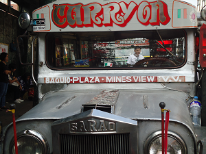 The sign of jeepneys going to Mines View Park is "Baguio Plaza-Mines View VV". Their terminal is along Mabini (lower) Street near corner Session Road,
 opposite McDonald's (now gone). Your new landmark is the City Center Hotel which is located at the other side of Session Rd corner Upper Mabini St. To get to the terminal from upper Session Road, e.g. SM City Baguio, Prime Hotel, Victory Liner, Baguio Cathedral, walk along the left hand side of Session Road until you get to Lower Mabini St which is the last street before the end tip of Session Rd and it is downhill from the corner of Session Rd. Turn left onto (Lower) Mabini Street. Located at the right hand side of Mabini is the terminal of "Baguio Plaza-Mines View VV" jeepneys.
From Burnham Park, walk across Lake Drive, the road between Burnham Park and Football Field. Then go to Harrison Road, the road where interconnecting overpasses are located. Don't cross Harrison Road via overpass. Instead, from the stair of the overpass, walk along Harrison Road and get across the other side where a BPI Bank is located. That street is Mabini. And the terminal of jeepneys going to Mines View is located near opposite end, which is corner Session Road.
Alternatively, walk across the football field toward Melvin Jones Grandstand, go up the grandstand and exit at Harrison Rd where you can easily walk across toward Mabini St. Then, just walk your way up the uphill Mabini Street from the corner of Harrison Rd until you get to the terminal of jeepneys bound for Mines View, to the left of Mabini Street. Click here to view map of walking direction from Burnham Park to this terminal.

Addional information: If you're going to Good Shepherd Convent aside from Mines View Park, ask the dispatcher if the jeepneys you're going to ride is via Gibraltar Road. There's also different route going to Mines View Park but most of the time the jeepneys pass through Gibraltar. Still, you need to make sure.
How to get to Mansion House and Wright Park

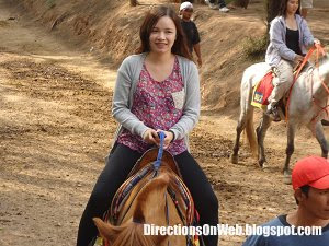
If you're fond of horseback riding, you will like it there at Wright Park. Mansion House, the official summer of Philippine President, is located next to it. You can get to Mansion House from Wright Park via stairs that goes directly to the landscaped walkway with a distance of approximately 330 meters from the stair to the gate of the Mansion House.


Ride a jeepney going to Mines View Park and get off at Wright Park.
If you want to go directly to the gate of Mansion House, ask the dispatcher if the jeepney he's filling up is via Gibraltar. If it does, don't ride it because it won't pass by the Mansion House. Try the next jeepney.
How to get to Botanical Garden, Panagbenga Park and Sunshine Park

These three parks are located near to Baguio Plaza. Just ride a jeepney going to PMA or Mines View Park and ask driver to drop you off at any of these spots.
Location Map of Terminals of Jeepneys bound for Baguio City's Tourist Spots
Walking direction from Burnham Lake to terminal of jeepneys bound for PMA and Camp John Hay
Go back
Walk from Burnham Park to terminal of jeepneys bound for Mines View and Good Shepherd Convent
Go back
Walking direction from Burnham Park to terminal of jeepneys bound for Lourdes Grotto
Go back
Walking direction from Burnham Park to terminal of jeepneys bound for Crystal Cave
Go back
Read more...
Botanical Garden
Burnham Park
Camp John Hay
Crystal Cave
Good Shepherd Convent
Lourdes Grotto
Mansion House
Mines View Park
Panagbenga Park
Philippine Military Academy
Session Road
Sunshine Park
Wright Park
For Dinosaur Island and Holy Land, go to:
How to get to Dinosaur Island & Holy Land
Read these separate directional articles:
How To Commute To Tam-Awan Village From Baguio City
Strawberry Picking: A What To Do In La Trinidad
Baguio City Visita Iglesia Route Guide

How to get to Camp John Hay
The jeepneys that ply the route passing by Camp John Hay is located at Burnham Park. In the map this terminal is called Bakakeng Jeepney Station. Now, I think Bakakeng Station is just one of the many

Additional information: Next to jeepneys with "Baguio Plaza-Scout Barrio" sign are few L-300 vans with the same sign, Baguio Plaza-Scout Barrio. According to the driver of one of the van that I talked to, their route is different from the jeepneys as they pass through exact location of Camp John Hay. At any rate, you can talk to driver of either jeepney or van to find out which one pass through the excellent spot of Camp John Hay.
How to get to Philippine Military Academy

Reminder: All visitors entering PMA must have individual valid IDs. A person without a valid ID can't enter PMA. If you're in a group and you don't have ID, you will be instructed to get off the jeepney at the gate and wait for your companions with IDs while they're enjoying the tour.

In the same terminal of Bakakeng Jeepney Station is the station of jeepneys with "Baguio Plaza-KIAS-PMA-Springhills-Apugan" sign. This is the only jeepney at this terminal going directly inside PMA. From loading area of "Baguio Plaza-Scout Barrio" jeepneys, walk further up ahead until you see the sign board that read: "LOADING AREA: PMA-KIAS-SITEL-EPZA". Ride the jeep being filled up with passengers by a dispatcher.


There's also a souvenir shops near the drop off point. To maximize your tour of the PMA, after you take photos at this area, you can walk your way from the PMA building downhil towards the gate to see other attraction inside the camp. There are other important landmarks you get to see along the way. Then after getting your ID, you can wait for a jeepney outside the gate to get back to Burnham Park Bakakeng Jeepney Station. But if you're contented with attractions around the PMA main building, then you can just wait for a jeepney with the same sign at the loading and unloading area waiting shed. Jeepney fare to PMA from Burnham Park is 18.50 pesos per passenger.
How to get to Crystal Cave


You're now at Shanum Street. The building at the corner of Shanum Street and Harrison Road is Hotel Veniz. Walk along Shanum street until you get to the next intersection which is Otek Street. At the opposite corner of Otek and Shanum, you will see the sign board that read "Loading Area: Crystal Cave".
From Burnham Park. Let's say you're in the lagoon area also known as Burnham Lake. Go towards Lake Drive. Lake Drive is the road between Burnham Park and the football field. Walk along Lake Drive past Ganza Restaurant until you get to corner of Lake Drive and Shanum Street. Turn right on Shanum until you get to the next street intersecting Shanum. That is Otek Street and in the corner is the terminal of jeepneys bound for Crystal Cave. Click here to view map of walking direction from Burnham Park to terminal of jeepneys bound for Crystal Cave.

Additional information: Talk to the dispatcher of the jeepney. Tell him that you're going to cave itself. Crystal Cave at the sign of the jeepney doesn't refer specifically at the cave itself. It refers to Crystal Cave Road. And majority of the passengers are residence living in different areas along Crystal Cave Road. It's important the driver knows he has passengers going to the cave so that he can drop them off at the street leading to the site of Crystal Cave. As of this time, jeepney fare to Crystal Cave is 8.50 pesos.
How to get to Lourdes Grotto

From Session Road, walk downhill from SM towards the end of the road where DBP Bank Building is located at the corner. Turn after you get past DBP Bank Building. There's a KFC Restaurant at the ground floor of DBP and opposite DBP Bank Building at the other side of Magsaysay Avenue, the road where Session Road ends, is Maharlika Livelihood Complex.


How to get to Good Shepherd Convent and Mines View Park


Addional information: If you're going to Good Shepherd Convent aside from Mines View Park, ask the dispatcher if the jeepneys you're going to ride is via Gibraltar Road. There's also different route going to Mines View Park but most of the time the jeepneys pass through Gibraltar. Still, you need to make sure.
How to get to Mansion House and Wright Park


If you're fond of horseback riding, you will like it there at Wright Park. Mansion House, the official summer of Philippine President, is located next to it. You can get to Mansion House from Wright Park via stairs that goes directly to the landscaped walkway with a distance of approximately 330 meters from the stair to the gate of the Mansion House.


Ride a jeepney going to Mines View Park and get off at Wright Park.
How to get to Botanical Garden, Panagbenga Park and Sunshine Park

These three parks are located near to Baguio Plaza. Just ride a jeepney going to PMA or Mines View Park and ask driver to drop you off at any of these spots.
Location Map of Terminals of Jeepneys bound for Baguio City's Tourist Spots
Walking direction from Burnham Lake to terminal of jeepneys bound for PMA and Camp John Hay
Go back
Walk from Burnham Park to terminal of jeepneys bound for Mines View and Good Shepherd Convent
Go back
Walking direction from Burnham Park to terminal of jeepneys bound for Lourdes Grotto
Go back
Walking direction from Burnham Park to terminal of jeepneys bound for Crystal Cave
Go back
27 Apr 2011
Direction Bytes: How To Get To POEA From NAIA-3
POEA or Philippine Overseas Employment Administration is situated at the corner of EDSA's southbound lane and Ortigas Avenue. To get there from NAIA-3, you need to get to either MRT-3 or a bus bay along EDSA depending on what mode of transportation you prefer - bus or train.
First ride from NAIA-3
 Ride a NAIA Shuttle Bus at the Bus Station which is located in front of Arrival Exit. After you exit the NAIA-3 building via Arrival Exit, walk across the access road. Go to the area under the 'NAIA Bus Station Route 2' sign and wait for a bus to arrive. Get in the bus and wait for a conductor to collect payment of 20 pesos.
There are three major locations where passengers can get off the shuttle bus - Unloading Area near Redemptorist Church in Baclaran, Heritage Hotel which is located at the corner of EDSA and Roxas Boulevard, and the Bus Station inside Genesis Bus Terminal which is next to MRT and LRT Train Stations at Pasay Taft Rotonda.
Second ride from EDSA or Pasay Rotonda
By Train
If you prefer the fast travel to POEA, get off the NAIA Shuttle Bus at its station in Pasay Rotonda where MRT-3 Taft Station is also located. Ride a train bound for North Station and alight at Ortigas Station. You need to walk approximately 500 meters distance from Ortigas Station to POEA.
After you alight from the train at Ortigas Station, turn left from turnstile (exit machine) and go down the station via stair located to the north part of the station. If you turn right from turnstile, the stair will take you to the ground going to SM Mega Mall.
Walk along EDSA's north bound lane until you reach Robinson's Galleria mall which is located at the corner of EDSA and Ortigas Avenue. POEA is located at the opposite corner of EDSA and Ortigas. To get to POEA, use the footbridge that connects Robinson's Galleria and the walkway going to POEA.
By Bus
If you prefer the more convenient but slow travel to POEA where you don't need to walk far, get off the NAIA Shuttle Bus at Heritage Hotel.
The driver will announce the arrival to unloading area in Heritage Hotel. Get off right there and ride a bus with "Ortigas Ilalim POEA" sign. The sign of the bus may not contain POEA but it should display "Ortigas Ilalim". Don't ride a bus with "Ortigas Ibabaw" sign. Only "Ortigas Ilalim" buses stop at POEA. Get off the bus at the unloading area in Robinson's Galleria which is located at the corner of EDSA's northbound lane and Ortigas Avenue. If you choose this option, your travel to POEA is slower because of the traffic in EDSA and the long duration the bus spends in loading areas to pick up more passengers. But its more comfortable as you don't need to walk far. Instead, you will just walk across EDSA via footbridge to get to POEA which is just opposite Robinson's Galleria.
You can also alight from NAIA Shuttle Bus at Baclaran and take the bus to Ortigas there but it's more convenient at the loading area near Heritage Hotel.
Read more...
First ride from NAIA-3

There are three major locations where passengers can get off the shuttle bus - Unloading Area near Redemptorist Church in Baclaran, Heritage Hotel which is located at the corner of EDSA and Roxas Boulevard, and the Bus Station inside Genesis Bus Terminal which is next to MRT and LRT Train Stations at Pasay Taft Rotonda.
Second ride from EDSA or Pasay Rotonda
By Train
If you prefer the fast travel to POEA, get off the NAIA Shuttle Bus at its station in Pasay Rotonda where MRT-3 Taft Station is also located. Ride a train bound for North Station and alight at Ortigas Station. You need to walk approximately 500 meters distance from Ortigas Station to POEA.
After you alight from the train at Ortigas Station, turn left from turnstile (exit machine) and go down the station via stair located to the north part of the station. If you turn right from turnstile, the stair will take you to the ground going to SM Mega Mall.
Walk along EDSA's north bound lane until you reach Robinson's Galleria mall which is located at the corner of EDSA and Ortigas Avenue. POEA is located at the opposite corner of EDSA and Ortigas. To get to POEA, use the footbridge that connects Robinson's Galleria and the walkway going to POEA.
By Bus
If you prefer the more convenient but slow travel to POEA where you don't need to walk far, get off the NAIA Shuttle Bus at Heritage Hotel.
The driver will announce the arrival to unloading area in Heritage Hotel. Get off right there and ride a bus with "Ortigas Ilalim POEA" sign. The sign of the bus may not contain POEA but it should display "Ortigas Ilalim". Don't ride a bus with "Ortigas Ibabaw" sign. Only "Ortigas Ilalim" buses stop at POEA. Get off the bus at the unloading area in Robinson's Galleria which is located at the corner of EDSA's northbound lane and Ortigas Avenue. If you choose this option, your travel to POEA is slower because of the traffic in EDSA and the long duration the bus spends in loading areas to pick up more passengers. But its more comfortable as you don't need to walk far. Instead, you will just walk across EDSA via footbridge to get to POEA which is just opposite Robinson's Galleria.
You can also alight from NAIA Shuttle Bus at Baclaran and take the bus to Ortigas there but it's more convenient at the loading area near Heritage Hotel.
26 Apr 2011
Direction Bytes: From NAIA Terminal 2 To POEA Ortigas


Wait for a shuttle bus to arrive and get in. Pay 20 pesos. From NAIA-3, the bus will take Andrews Avenue on the way to Roxas Boulevard where it will turn right, then it will turn right again onto EDSA on its way to NAIA Shuttle Bus Station located at Pasay Taft Rotonda which is very near to LRT EDSA Station and MRT Taft Station.
You have 2 options in going to POEA:
Option 1
Get off the shuttle bus at its station in Pasay Rotonda and ride an MRT-3 Train bound for North Station and get off the train at Ortigas Station. If you choose this option, you will travel fast but you need to walk a little bit far from Ortigas Station to POEA, approximately 500 meters.
After you alight from the train at Ortigas Station, turn left from turnstile (exit machine) and go down the station via stair located to the north part of the station. If you turn right from turnstile, the stair will take you to the ground going to SM Mega Mall.
Walk along EDSA's north bound lane until you reach Robinson's Galleria mall which is located at the corner of EDSA and Ortigas Avenue. POEA is located at the opposite corner of EDSA and Ortigas. To get to POEA, use the footbridge that connects Robinson's Galleria and the walkway going to POEA.
Option 2
Ask the driver of NAIA Shuttle Bus to drop you off at Heritage Hotel. The driver will announce the arrival to unloading area in Heritage Hotel. Get off right there and ride a bus with "Ortigas Ilalim POEA" sign. The sign of the bus may not contain POEA but it should display "Ortigas Ilalim". Don't ride a bus with "Ortigas Ibabaw" sign. Only "Ortigas Ilalim" buses stop at POEA. Get off the bus at the unloading area at Robinson's Galleria which is located at the corner of EDSA and Ortigas Avenue. If you choose this option, your travel to POEA is slower because of the traffic in EDSA and the long duration the bus spends in loading areas to pick up more passengers. But its more comfortable as you don't need to walk far. Instead, you will just walk across EDSA via footbridge to get to POEA which is just opposite Robinson's Galleria.
20 Apr 2011
Two Visita Iglesia Routes
Filipino Catholic observance of the Holy Week would never be complete without the traditional Visita Iglesia. And so Lagalag recommends these seven churches to visit during Visita Iglesia. The churches' proximity to each other as well as the common route for both public and private vehicles from which they are situated make the "Church Visits" more solemn as the travel from one church to another is not complicated whether by foot or by car and jeepney.
Our Visita Iglesia involves the following Churches: Minor Basilica of the Black Nazarene also known as Quiapo Church, Manila Cathedral, San Agustin Church, Ermita Shrine, Our Lady Of Remedies Parish also known as Malate Church, Our Lady Of Sorrows, and Redemptorist Church also known as Our Mother of Perpetual Help Shrine.
Our Visita Iglesia has two routes - South to North and Vice Versa.
South to North route starts in Redemptorist Church in Baclaran and ends up in Minor Basilica of the Black Nazarene in Quiapo.
North to South route starts in Minor Basilica of the Black Nazarene in Quiapo and ends up in Our Lady of Perpetual Help Shrine also known as Redemptorist Church in Baclaran.
South to North
 First Church - Redemptorist Church
Redemptorist Church, most commontly known as Our Mother of Perpetual Help Shrine, is located at the corner of Roxas Boulevard and Redemptorist Road in Baclaran. You can get here by car via Roxas Boulevard. A lot of jeepneys and buses ply the route that pass by Redemptorist Church.
 Second Church - Our Lady of Sorrows
Located approximately 2 kilometers from Redemptorist Church. Situated along Harrison Street in Pasay City, between OWWA Building and TAILEE Building. This church is just opposite San Luis Street. By foot, you can get to Our Lady Of Sorrows from Redemptorist Church via north bound Roxas Boulevard. Walk along Roxas Boulevard northward, cross EDSA and Arnaiz Avenue formerly Libertad. Turn right on the fourth street from Arnaiz. That street is San Luis. At the opposite end is Our Lady of Sorrows.
By car, take Roxas Boulevard north bound lane, cross EDSA via flyover and Arnaiz Avenue aka Libertad Street. After crossing Arnaiz Avenue intersection, take the north bound service road and turn right onto the third street from Arnaiz which is Sta Escolastica Street. Then turn left on Harrison Street until you get to Our Lady of Sorrows to your right.
By jeepney, you can get there by riding a jeepney with any of these signs: "Mabini", "Quiapo", "Monumento", "Cubao" and "Divisoria". You need to get to Ortigas Street corner Roxas Boulevard to take a jeepney. Walk northward along Roxas Boulevard past McDonald's until you get to Ortigas Street.
 Third Church - Our Lady Of Remedies Parish
Located opposite Rajah Sulayman Park which is situated along Roxas Boulevard in Malate, approximately 2 kilometers from Our Lady of Sorrows. By foot, you can get there from Our Lady Of Sorrows by taking San Luis Street, turn right on Roxas Boulevard and walk along Roxas Boulevard northward. Cross Gil Puyat Avenue, P. Ocampo, and Quirino Avenue until you get to Aristocrat Restaurant. Turn right onto the road that borders Aristocrat until you get to Our Lady Of Remedies Parish.
By car, you can get to this church from Our Lady Of Sorrows by taking Roxas Boulevard northbound lane. You can get to Roxas Boulevard from Our Lady of Sorrows via San Luis Street, the road opposite the church. Cross Gil Puyat Avenue via the flyover, P. Ocampo and Quirino Avenue. After Quirino Avenue, watch out for Aristocrat Restaurant to your right. Turn right on the street that borders Aristocrat Restaurant until you see the church. Park your car at available space in the area.
By jeepney, you can get to this church by riding jeep with any of these signs: "Quiapo", "Divisoria", "Monumento" and "Cubao" in front of Our Lady Of Sorrows. Make sure the jeep passes through Mabini. Ask driver to drop you off at Remedios Street where Our Lady Of Remedies Parish is located.
 Fourth Church - Ermita Shrine
Approximately 1.2 kilometer from Our Lady Of Remedies Parish. Located at the corner of Del Pilar and Flores streets in Ermita. By foot, you can walk northward along Del Pilar, the road in front of Our Lady Of Remedies Parish, all the way until you get to Ermita Shrine. You will cross two intersections with traffic lights - Pedro Gil and Padre Faura.
By car, drive along north bound service road of Roxas Boulevard or you can take Roxas Boulevard if you want. Cross Pedro Gil and Padre Faura until you get to Plaza Nuestra Senora De Guia, a small park. You can park your car along the service road and go towards the opposite side of Plaza Nuestra Senora De Guia. Ermita Shrine is situated in the opposite side of Del Pilar facing Plaza Nuestra Senora De Guia.
By jeepney, you can take a ride at the back of Our Lady Of Remedies Parish. This street is Mabini. Get off at Flores Street and walk towards Roxas Boulevard until you get to Del Pilar where this church is located.
 Fifth Church - San Agustin Church
Approximately 1.5 kilometer from Ermita Shrine, San Agustin Church is located along General Luna Street in Intramuros. By foot, you can get there by taking Del Pilar northward, turn right onto T.M. Kalaw and turn left on Maria Orosa where a Jollibee is located at the right corner of Kalaw and Orosa. Walk along Orosa past Luneta Park and cross Burgos Street until you get to the entrance of Intramuros. Walk further along General Luna Street until you get to San Agustin Church, located to the left of General Luna.
By car, take Roxas Boulevard. Turn right onto T.M. Kalaw Street and left on Maria Orosa Street. Drive on Maria Orosa past Luneta Park and cross Padre Burgos Street until you get to Intramuros. Road name changes to General Luna. Drive further until you get to San Agustin Church located to the left of General Luna Street.
By jeepney, ride a "Monumento", "Quiapo" or "Divisoria" bound jeep and get off at Padre Burgos. Walk towards Intramuros and take General Luna Street to get to San Agustin Church located to your left.
 Sixth Church - Manila Cathedral
Located approximately 365 meters from San Agustin Church at the other end of General Luna Street. Walk along General Luna northward until you get to the church. By car, take General Luna Street and drive northward until you get to the church.
 Seventh Church - Minor Basilica of the Black Nazarene
Located at Quiapo approximately 1.6 kilometer from Manila Cathedral. By foot, you can get there by taking the main road in front of Manila Cathedral. This road is Andres Soriano Jr Avenue. Turn right from Manila Cathedral to Andres Soriano. Walk further until you exit Intramuros and get to Lawton. Take the road in front of Metropolitan Theater and cross Pasig River via Quezon Bridge until you get to Quiapo. Use Underpass to get to Quiapo Church.
By car, take the same route you took along General Luna Street from Luneta Park until you exit Intramuros. Turn right on Y-intersection next to Intramuros Exit to go with the flow of traffic. Turn left on Padre Burgos and drive all the way to Lawton. Take McArthur Bridge and get to Carriedo. Take Avenida, turn right onto Recto Avenue. Then, turn right again onto Quezon Avenue, drive further until you get to Quiapo Church where you can park your car near church.
By jeepney, you can take a ride in front of Manila Cathedral. Take a jeepney with "Retiro Blumentritt" or "Project 6" sign. Get off at Quiapo.
North to South
First Church - Minor Basilica of the Black Nazarene
Located along Quezon Avenue near Quezon Bridge. Most jeepney routes go to Quiapo including from Pasig, Novaliches, Fairview and other locations in Quezon City. Waking distance from Recto where jeepneys from Marikina pass through. There are parking areas designated for private cars located near church along Quezon Avenue. There are also Pay Parking near the church.
Second Church - Manila Cathedral
You can walk to Manila Cathedral from Minor Basilica of the Black Nazarene in Quiapo by taking Quezon Bridge, past Post Office until you get to Intramuros. In Intramuros, take Magallanes Drive until you get to Andres Soriano Jr Avenue. Walk along Andres Soriano Jr Avenue until you get to Manila Cathedral located to the left of Andres Soriano Jr Avenue.
By car, take Quezon Bridge and immediately turn right onto the road located at the foot of the bridge. This road is called Muelle Del Rio. Stay on this road and pass through two short tunnels under McArthur Bridge and Jones Bridge. Stay on Muelle Del Rio until you get to Andres Soriano Jr Avenue, the main thoroughfare that runs through Intramuros. Manila Cathedral is to the left of Andres Soriano near northern wall of Intramuros.
By jeepney, you can ride a jeep with "Pier" sign and get off in front of Manila Cathedral.
Third Church - San Agustin Church
Walk from Manila Cathedral to San Agustin Church via General Luna Street which is located to your right if you're facing Manila Cathedral. General Luna Street is between Palacio Del Governador and Manila Cathedral. Walk along General Luna southward until you get to San Agustin Church, to your right.
By car, you can get to San Agustin Church from Manila Cathedral by following the walking direction.
Fourth Church - Ermita Shrine
You can walk to Ermita Shrine by taking General Luna Exit of Intramuros. From San Agustin Church walk further southward along General Luna. Walk across Padre Burgos until you get to Luneta Park. Walk along Maria Orosa Street, the road that passes through Luneta. Turn right onto T.M. Kalaw Street and left on Del Pilar Street. Cross U.N. Avenue until you get to Ermita Shrine, located to the left of Del Pilar.
By car, take General Luna southward until you exit Intramuros. Turn right onto Padre Burgos and left on Roxas Boulevard. Turn left on Kalaw and immediately turn right onto the service road of Roxas Boulevard. Cross U.N. Avenue until you get to Plaza Nuestra Senora De Guia, a small park. You can park your car anywhere in along the service road and walk your way to Ermita Church, located along Del Pilar which is paralleled to Roxas Boulevard.
By jeepney, you can ride outside General Luna Exit of Intramuros. Take a jeepney with "Baclaran" or "Vito Cruz" sign and get off at Ermita Shrine.
Fifth Church - Our Lady Of Remedies Parish
Walk along Del Pilar southward. Cross two intersection with traffic lights - Padre Faura and Pedro Gil. Walk further until you get to Remedios Street where Our Lady Of Remedies Parish is located.
By car, you can get to Our Lady Of Remedies Parish from Plaza Nuestra Senora De Guia by taking the service road of Roxas Boulevard. Drive southward, cross Padre Faura and Pedro Gil until you get to Rajah Sulayman Park where the church is located next to it along Del Pilar Street.
You can get to Our Lady Of Remedies from Plaza Nuestra Senora De Guia by jeepney by riding one with "Baclaran" or "Vito Cruz" sign. Ask driver to drop you off at Malate Church or Remedios.
Sixth Church - Our Lady Of Sorrows
You can walk to Our Lady of Sorrows from Our Lady Of Remedies by taking Del Pilar all the way up to Quirino Avenue and then take Roxas Boulevard. Cross P. Ocampo aka Vito Cruz and take Gil Puyat. From Gil Puyat turn right onto Harrison Street. Walk along Harrison Street until you get to Our Lady Of Sorrows to your left opposite San Luis.
By car, take the service road, cross Padre Faura and Pedro Gil and take Roxas Boulevard from Quirino Avenue. Cross CCP Complex but immediately take the rightmost lane. Turn right onto Gil Puyat Avenue and make a U-Turn to get back to Roxas Boulevard. Cross Roxas Boulevard and turn right onto Harrison Street where Our Lady Of Sorrows is located to the left after OWWA but before the 5-storey building with "TAILEE" sign.
By jeep, you can get to Our Lady Of Sorrow from Malate Church by riding a "Baclaran" bound jeep and ask driver to drop you off at the church.
Seventh Church - Redemptorist Church
Walk along Harrison Street southward all the way to EDSA where you cross it via footbridge. Walk further along Harrison until you get to Baclaran where you turn right on Redemptorist Road (a McDonal's is located at the corner of Redemptorist Road and Harrison Street) until you get to Redemptoriest Church.
From Our Lady Of Sorrows, drive along Harrison Street southward and cross Arnaiz Avenue formerly Libertad. Turn right onto EDSA and make a U-Turn in front of Heritage Hotel. Turn right onto Harrison Street and right again onto Cuneta Avenue, the road next to EDSA. Turn left on service road of Roxas Boulevard to get nearer to Redemptorist Church. You can park your car at McDonald's and walk your way to Redemptorist.
From Our Lady Of Sorrows, you can ride a "Baclaran" bound jeepney and get off at McDonald's branch in Roxas Boulevard Baclaran. From there walk southward until you get to Redemptorist Church.
Read more...
Our Visita Iglesia involves the following Churches: Minor Basilica of the Black Nazarene also known as Quiapo Church, Manila Cathedral, San Agustin Church, Ermita Shrine, Our Lady Of Remedies Parish also known as Malate Church, Our Lady Of Sorrows, and Redemptorist Church also known as Our Mother of Perpetual Help Shrine.
Our Visita Iglesia has two routes - South to North and Vice Versa.
South to North route starts in Redemptorist Church in Baclaran and ends up in Minor Basilica of the Black Nazarene in Quiapo.
North to South route starts in Minor Basilica of the Black Nazarene in Quiapo and ends up in Our Lady of Perpetual Help Shrine also known as Redemptorist Church in Baclaran.
South to North

Redemptorist Church, most commontly known as Our Mother of Perpetual Help Shrine, is located at the corner of Roxas Boulevard and Redemptorist Road in Baclaran. You can get here by car via Roxas Boulevard. A lot of jeepneys and buses ply the route that pass by Redemptorist Church.

Located approximately 2 kilometers from Redemptorist Church. Situated along Harrison Street in Pasay City, between OWWA Building and TAILEE Building. This church is just opposite San Luis Street. By foot, you can get to Our Lady Of Sorrows from Redemptorist Church via north bound Roxas Boulevard. Walk along Roxas Boulevard northward, cross EDSA and Arnaiz Avenue formerly Libertad. Turn right on the fourth street from Arnaiz. That street is San Luis. At the opposite end is Our Lady of Sorrows.
By car, take Roxas Boulevard north bound lane, cross EDSA via flyover and Arnaiz Avenue aka Libertad Street. After crossing Arnaiz Avenue intersection, take the north bound service road and turn right onto the third street from Arnaiz which is Sta Escolastica Street. Then turn left on Harrison Street until you get to Our Lady of Sorrows to your right.
By jeepney, you can get there by riding a jeepney with any of these signs: "Mabini", "Quiapo", "Monumento", "Cubao" and "Divisoria". You need to get to Ortigas Street corner Roxas Boulevard to take a jeepney. Walk northward along Roxas Boulevard past McDonald's until you get to Ortigas Street.

Located opposite Rajah Sulayman Park which is situated along Roxas Boulevard in Malate, approximately 2 kilometers from Our Lady of Sorrows. By foot, you can get there from Our Lady Of Sorrows by taking San Luis Street, turn right on Roxas Boulevard and walk along Roxas Boulevard northward. Cross Gil Puyat Avenue, P. Ocampo, and Quirino Avenue until you get to Aristocrat Restaurant. Turn right onto the road that borders Aristocrat until you get to Our Lady Of Remedies Parish.
By car, you can get to this church from Our Lady Of Sorrows by taking Roxas Boulevard northbound lane. You can get to Roxas Boulevard from Our Lady of Sorrows via San Luis Street, the road opposite the church. Cross Gil Puyat Avenue via the flyover, P. Ocampo and Quirino Avenue. After Quirino Avenue, watch out for Aristocrat Restaurant to your right. Turn right on the street that borders Aristocrat Restaurant until you see the church. Park your car at available space in the area.
By jeepney, you can get to this church by riding jeep with any of these signs: "Quiapo", "Divisoria", "Monumento" and "Cubao" in front of Our Lady Of Sorrows. Make sure the jeep passes through Mabini. Ask driver to drop you off at Remedios Street where Our Lady Of Remedies Parish is located.

Approximately 1.2 kilometer from Our Lady Of Remedies Parish. Located at the corner of Del Pilar and Flores streets in Ermita. By foot, you can walk northward along Del Pilar, the road in front of Our Lady Of Remedies Parish, all the way until you get to Ermita Shrine. You will cross two intersections with traffic lights - Pedro Gil and Padre Faura.
By car, drive along north bound service road of Roxas Boulevard or you can take Roxas Boulevard if you want. Cross Pedro Gil and Padre Faura until you get to Plaza Nuestra Senora De Guia, a small park. You can park your car along the service road and go towards the opposite side of Plaza Nuestra Senora De Guia. Ermita Shrine is situated in the opposite side of Del Pilar facing Plaza Nuestra Senora De Guia.
By jeepney, you can take a ride at the back of Our Lady Of Remedies Parish. This street is Mabini. Get off at Flores Street and walk towards Roxas Boulevard until you get to Del Pilar where this church is located.

Approximately 1.5 kilometer from Ermita Shrine, San Agustin Church is located along General Luna Street in Intramuros. By foot, you can get there by taking Del Pilar northward, turn right onto T.M. Kalaw and turn left on Maria Orosa where a Jollibee is located at the right corner of Kalaw and Orosa. Walk along Orosa past Luneta Park and cross Burgos Street until you get to the entrance of Intramuros. Walk further along General Luna Street until you get to San Agustin Church, located to the left of General Luna.
By car, take Roxas Boulevard. Turn right onto T.M. Kalaw Street and left on Maria Orosa Street. Drive on Maria Orosa past Luneta Park and cross Padre Burgos Street until you get to Intramuros. Road name changes to General Luna. Drive further until you get to San Agustin Church located to the left of General Luna Street.
By jeepney, ride a "Monumento", "Quiapo" or "Divisoria" bound jeep and get off at Padre Burgos. Walk towards Intramuros and take General Luna Street to get to San Agustin Church located to your left.

Located approximately 365 meters from San Agustin Church at the other end of General Luna Street. Walk along General Luna northward until you get to the church. By car, take General Luna Street and drive northward until you get to the church.

Located at Quiapo approximately 1.6 kilometer from Manila Cathedral. By foot, you can get there by taking the main road in front of Manila Cathedral. This road is Andres Soriano Jr Avenue. Turn right from Manila Cathedral to Andres Soriano. Walk further until you exit Intramuros and get to Lawton. Take the road in front of Metropolitan Theater and cross Pasig River via Quezon Bridge until you get to Quiapo. Use Underpass to get to Quiapo Church.
By car, take the same route you took along General Luna Street from Luneta Park until you exit Intramuros. Turn right on Y-intersection next to Intramuros Exit to go with the flow of traffic. Turn left on Padre Burgos and drive all the way to Lawton. Take McArthur Bridge and get to Carriedo. Take Avenida, turn right onto Recto Avenue. Then, turn right again onto Quezon Avenue, drive further until you get to Quiapo Church where you can park your car near church.
By jeepney, you can take a ride in front of Manila Cathedral. Take a jeepney with "Retiro Blumentritt" or "Project 6" sign. Get off at Quiapo.
North to South
First Church - Minor Basilica of the Black Nazarene
Located along Quezon Avenue near Quezon Bridge. Most jeepney routes go to Quiapo including from Pasig, Novaliches, Fairview and other locations in Quezon City. Waking distance from Recto where jeepneys from Marikina pass through. There are parking areas designated for private cars located near church along Quezon Avenue. There are also Pay Parking near the church.
Second Church - Manila Cathedral
You can walk to Manila Cathedral from Minor Basilica of the Black Nazarene in Quiapo by taking Quezon Bridge, past Post Office until you get to Intramuros. In Intramuros, take Magallanes Drive until you get to Andres Soriano Jr Avenue. Walk along Andres Soriano Jr Avenue until you get to Manila Cathedral located to the left of Andres Soriano Jr Avenue.
By car, take Quezon Bridge and immediately turn right onto the road located at the foot of the bridge. This road is called Muelle Del Rio. Stay on this road and pass through two short tunnels under McArthur Bridge and Jones Bridge. Stay on Muelle Del Rio until you get to Andres Soriano Jr Avenue, the main thoroughfare that runs through Intramuros. Manila Cathedral is to the left of Andres Soriano near northern wall of Intramuros.
By jeepney, you can ride a jeep with "Pier" sign and get off in front of Manila Cathedral.
Third Church - San Agustin Church
Walk from Manila Cathedral to San Agustin Church via General Luna Street which is located to your right if you're facing Manila Cathedral. General Luna Street is between Palacio Del Governador and Manila Cathedral. Walk along General Luna southward until you get to San Agustin Church, to your right.
By car, you can get to San Agustin Church from Manila Cathedral by following the walking direction.
Fourth Church - Ermita Shrine
You can walk to Ermita Shrine by taking General Luna Exit of Intramuros. From San Agustin Church walk further southward along General Luna. Walk across Padre Burgos until you get to Luneta Park. Walk along Maria Orosa Street, the road that passes through Luneta. Turn right onto T.M. Kalaw Street and left on Del Pilar Street. Cross U.N. Avenue until you get to Ermita Shrine, located to the left of Del Pilar.
By car, take General Luna southward until you exit Intramuros. Turn right onto Padre Burgos and left on Roxas Boulevard. Turn left on Kalaw and immediately turn right onto the service road of Roxas Boulevard. Cross U.N. Avenue until you get to Plaza Nuestra Senora De Guia, a small park. You can park your car anywhere in along the service road and walk your way to Ermita Church, located along Del Pilar which is paralleled to Roxas Boulevard.
By jeepney, you can ride outside General Luna Exit of Intramuros. Take a jeepney with "Baclaran" or "Vito Cruz" sign and get off at Ermita Shrine.
Fifth Church - Our Lady Of Remedies Parish
Walk along Del Pilar southward. Cross two intersection with traffic lights - Padre Faura and Pedro Gil. Walk further until you get to Remedios Street where Our Lady Of Remedies Parish is located.
By car, you can get to Our Lady Of Remedies Parish from Plaza Nuestra Senora De Guia by taking the service road of Roxas Boulevard. Drive southward, cross Padre Faura and Pedro Gil until you get to Rajah Sulayman Park where the church is located next to it along Del Pilar Street.
You can get to Our Lady Of Remedies from Plaza Nuestra Senora De Guia by jeepney by riding one with "Baclaran" or "Vito Cruz" sign. Ask driver to drop you off at Malate Church or Remedios.
Sixth Church - Our Lady Of Sorrows
You can walk to Our Lady of Sorrows from Our Lady Of Remedies by taking Del Pilar all the way up to Quirino Avenue and then take Roxas Boulevard. Cross P. Ocampo aka Vito Cruz and take Gil Puyat. From Gil Puyat turn right onto Harrison Street. Walk along Harrison Street until you get to Our Lady Of Sorrows to your left opposite San Luis.
By car, take the service road, cross Padre Faura and Pedro Gil and take Roxas Boulevard from Quirino Avenue. Cross CCP Complex but immediately take the rightmost lane. Turn right onto Gil Puyat Avenue and make a U-Turn to get back to Roxas Boulevard. Cross Roxas Boulevard and turn right onto Harrison Street where Our Lady Of Sorrows is located to the left after OWWA but before the 5-storey building with "TAILEE" sign.
By jeep, you can get to Our Lady Of Sorrow from Malate Church by riding a "Baclaran" bound jeep and ask driver to drop you off at the church.
Seventh Church - Redemptorist Church
Walk along Harrison Street southward all the way to EDSA where you cross it via footbridge. Walk further along Harrison until you get to Baclaran where you turn right on Redemptorist Road (a McDonal's is located at the corner of Redemptorist Road and Harrison Street) until you get to Redemptoriest Church.
From Our Lady Of Sorrows, drive along Harrison Street southward and cross Arnaiz Avenue formerly Libertad. Turn right onto EDSA and make a U-Turn in front of Heritage Hotel. Turn right onto Harrison Street and right again onto Cuneta Avenue, the road next to EDSA. Turn left on service road of Roxas Boulevard to get nearer to Redemptorist Church. You can park your car at McDonald's and walk your way to Redemptorist.
From Our Lady Of Sorrows, you can ride a "Baclaran" bound jeepney and get off at McDonald's branch in Roxas Boulevard Baclaran. From there walk southward until you get to Redemptorist Church.
19 Apr 2011
NAIA 1-2-3 Shuttle Bus: Easy Way To Get To & From NAIA Terminals
Going to three terminals of Ninoy Aquino International Airport or NAIA presents problems for most of the commuters especially if they don't know what route of jeepneys or buses to take. Good for the old terminal 1 that its location is along the route of Metro Manila buses. One can get off the bus exactly at the old airport. In NAIA-2, you need to walk a little bit far to get to its ground. NAIA-3 is the most hard to reach by commuting among the three terminals because of its location.
FLASH! City buses from north of Metro Manila now go direct to NAIA 3 and 4. Read the latest article on how to go to terminal 4 and 3 in one bus ride from your location, go to City Buses Route Direct to NAIA-3 & 4 from North of Metro Manila
Thanks to NAIA Shuttle Bus, going to and from two terminals of our premier airport, NAIA-2 and NAIA-3, has never been this convenient for commuters. You can get in and out of these terminals even if you're not an arriving passenger. In Terminal 1, only arriving passengers can ride the shuttle bus but commuters going to the old airport can still get there by riding the shuttle bus.
IMPORTANT UPDATE (Sep 12, 2015): NAIA Shuttle is now called Airport Loop. The bus in the photo below no longer exists. They are replaced by Airport Loop buses. Also the location of new Airport Loop inside Pasay Bus Terminal has moved. The unloading spot in Terminal 3 is moved, too. So, I have created a new article that will guide you in locating and identifying the Airport Loop buses. In the new article, added are complete list of unloading areas and their locations along the entire route of the loop. Two unloading areas are now designated inside Newport City. You have to read the new article as it is fresh. Nevertheless, directions in this article are still usable in general so my recommendation is to read this and the new published article. Here's the link: Airport Loop: Where to Ride & Alight to and from NAIA Terminals.
If you're going to a NAIA Terminal to catch your flight, make sure you have enough time allowance. In addition to 3 hours requirement for international flight and 2 hours for local flight for a flying passenger to be at the airport before the time of the flight, an added 2 hours allowance is needed if you're going to NAIA-1 via Shuttle Bus to make up for the waiting time both in Bus Station at Pasay Rotonda and NAIA-3.
HOW TO GET TO EACH TERMINAL OF NAIA FROM SHUTTLE BUS STATION
For Commute Guide to Manila Domestic Airport aka Terminal 4, read
How To Commute To Manila Domestic Airport Terminal 4.
 Flash: Read new post published July 29, 2012 for NAIA 1-2-3-4 Shuttle Bus Updates.
NAIA Shuttle Bus Station is located inside the terminal of provincial bus Genesis Transport Services with exact location at EDSA corner Taft, Pasay Rotunda - at the back of Sogo Pasay Rotonda Branch.
 From LRT-1 EDSA Station, turn left after your exit at turnstile (exit machine), then use the footbridge to get across EDSA. Go towards Sogo until you get to the building of MRT-3 Taft Station. Use the stair and get to the ground where a McDonald's is situated next to MRT Station. McDonald (under major renovation as of July 2015) is located alongside Dunkin Donut, Chow King and Sogo. Between McDonald's and Dunkin Donut is an exit driveway of all buses and jeepneys coming from the terminal. Use this driveway to enter the bus terminal where NAIA shuttle buses stand waiting for passengers. Get in the bus and wait for conductor to collect payments of 20 pesos per passenger.
 From MRT-3 Taft Station, after your exit at the turnstile (exit machine where you insert ticket) located to the right of station, go towards the hallway where pedestrians walk to get to either side of EDSA. Walk towards the opposide of EDSA. At this point Sogo Hotel is already visible. Use the stair to get to the ground where you will immediately see McDonald's alongside Dunkin Donut, Chow King and Sogo itself. Between McDonald's and Dunkin Donut is a exit driveway of all buses and jeepneys coming from the terminal. Use this driveway to enter the bus terminal where NAIA shuttle buses stand waiting for passengers. Get in the bus and wait for conductor to collect payments of 20 pesos per passenger.
Direction #1
 From Genesis Bus Terminal at Pasay Rotunda to NAIA-3. Passengers going to NAIA-1 and NAIA-2 must also board at Genesis Bus Terminal at Pasay Rotonda. They will transfer to another NAIA Shuttle Bus at NAIA-3.
The bus will turn right onto EDSA from the terminal in Pasay Rotunda. Then it will turn right again onto Aurora Boulevard also known as Tramo. The bus will take the whole stretch of Aurora Boulevard up to its opposite end where the bus will turn left on Andrews Avenue. The bus will turn right on a large rotunda where it will take the dedicated lane going to NAIA-3. All passengers will alight at NAIA-3 Bus Station.
Direction #2
 From NAIA-3 to NAIA-1 and NAIA-2. If you're going to either NAIA-1 or NAIA-2, go to 'NAIA Bus Station Route 1' which is located alongside 'NAIA Bus Station Route 2' where you get off the shuttle bus from Pasay Taft Rotonda. If there's no bus yet, wait for one to arrive. Ride a bus and wait for a conductor to collect payment. The bus will wait for more passengers to fill up the bus before it leaves.
From NAIA-3, the bus will take Andrews Avenue again. It go towards Domestic Road past Aurora Boulevard via Airport Road which is the extension of Andrews Avenue. From Airport Road, the bus will turn left on Domestic Road, stay there up to the opposite end where it will turn left on NAIA Road. Then the bus will turn right onto Ninoy Aquino Avenue on its way to NAIA-1. All passengers going to NAIA-1 will get off the bus the moment it stops at the designated area. Passengers going to NAIA-2 will stay on board. No need for transfer.
Direction #3
 From NAIA-1, the bus will go directly and immediately to NAIA-2 without any waiting. The bus will take Ninoy Aquino Avenue again, then it will turn right onto NAIA Road on its way to NAIA-2, the last stop of the shuttle from NAIA-3. The shuttle bus will stop in front of 'International Arrivals'. It will wait for passengers going to NAIA-3 where they will transfer to another NAIA Shuttle Bus that will take them outside the airport area and into any point along the route going to its terminal in Pasay Rotunda where MRT and LRT Lines will bring them to any point in Metro Manila.
HOW TO GET FROM EACH TERMINAL OF NAIA TO MRT AND LRT LINES LOCATED IN PASAY ROTUNDA
Direction #4
 From NAIA-3 to Pasay Rotunda Bus Terminal, LRT EDSA Station and MRT Taft Station.
If you're an arriving passenger, you can immediately see the NAIA Bus Station. It is located in front of Arrival Exit. After you exit the NAIA-3 building via the Arrival Exit, walk across the access road. Go to the area under the 'NAIA Bus Station Route 2' sign and wait for a bus to arrive.
Direction #5
 From NAIA-2 to NAIA-3, Pasay Rotunda Terminal and LRT/MRT Stations.
Outside 'International Arrivals', between Bay 14 and Bay 15, an 'AIRPORT SHUTTLE' sign hangs conspicuously. There are benches just below it where passengers can wait for the bus. Go to that area and wait for NAIA Shuttle Bus. The bus will take you to NAIA-3 where you will transfer to another NAIA Shuttle Bus that will bring you to Baclaran, Heritage Hotel or LRT/MRT Stations in Taft Pasay Rotunda where the bus station is located. Please read Direction #4 for the information on how to ride NAIA Shuttle Bus at NAIA-3.
Direction #6
 From NAIA-1 to Baclaran, MRT/LRT Stations EDSA Taft Pasay Rotonda and other locations in Metro Manila.
If you're an arriving passengers, after your exit from Arrival Area, go towards the right of the NAIA-1 building where you will see 'SHUTTLE SERVICE Loading Area' sign along the access road of Arrival. Opposite the shuttle service loading area are hotel lounges.
 If you're a non-arriving passengers, go to the main road where public jeepneys and buses pass through. This road is located to the right of the building of NAIA-1. If you're going to Baclaran, you can just ride a jeepney with "Baclaran" sign. If you're going to LRT-1 EDSA Station or MRT-3 Taft Station, wait for a public bus that plies the route of NAIA-1 to Fairview or other areas in north Metro Manila and vice versa. This bus will also pass by Baclaran via Roxas Boulevard, Heritage Hotel in EDSA corner Roxas Boulevard and other important locations along EDSA such as Magallanes, Buendia EDSA where CyberTwo is located, Guadalupe, Boni EDSA, Shaw EDSA Crossing, Ortigas Center where SM Megamall is located, Ortigas Avenue corner EDSA where POEA is located, Santolan, Araneta Center Cubao, GMA Kamuning, etc.
Location Map Of NAIA Shuttle Bus Station At Pasay Taft Rotonda
Read more...
Thanks to NAIA Shuttle Bus, going to and from two terminals of our premier airport, NAIA-2 and NAIA-3, has never been this convenient for commuters. You can get in and out of these terminals even if you're not an arriving passenger. In Terminal 1, only arriving passengers can ride the shuttle bus but commuters going to the old airport can still get there by riding the shuttle bus.
If you're going to a NAIA Terminal to catch your flight, make sure you have enough time allowance. In addition to 3 hours requirement for international flight and 2 hours for local flight for a flying passenger to be at the airport before the time of the flight, an added 2 hours allowance is needed if you're going to NAIA-1 via Shuttle Bus to make up for the waiting time both in Bus Station at Pasay Rotonda and NAIA-3.
For Commute Guide to Manila Domestic Airport aka Terminal 4, read
How To Commute To Manila Domestic Airport Terminal 4.

NAIA Shuttle Bus Station is located inside the terminal of provincial bus Genesis Transport Services with exact location at EDSA corner Taft, Pasay Rotunda - at the back of Sogo Pasay Rotonda Branch.


Direction #1

The bus will turn right onto EDSA from the terminal in Pasay Rotunda. Then it will turn right again onto Aurora Boulevard also known as Tramo. The bus will take the whole stretch of Aurora Boulevard up to its opposite end where the bus will turn left on Andrews Avenue. The bus will turn right on a large rotunda where it will take the dedicated lane going to NAIA-3. All passengers will alight at NAIA-3 Bus Station.
Direction #2

From NAIA-3, the bus will take Andrews Avenue again. It go towards Domestic Road past Aurora Boulevard via Airport Road which is the extension of Andrews Avenue. From Airport Road, the bus will turn left on Domestic Road, stay there up to the opposite end where it will turn left on NAIA Road. Then the bus will turn right onto Ninoy Aquino Avenue on its way to NAIA-1. All passengers going to NAIA-1 will get off the bus the moment it stops at the designated area. Passengers going to NAIA-2 will stay on board. No need for transfer.
Direction #3

HOW TO GET FROM EACH TERMINAL OF NAIA TO MRT AND LRT LINES LOCATED IN PASAY ROTUNDA
Direction #4

If you're an arriving passenger, you can immediately see the NAIA Bus Station. It is located in front of Arrival Exit. After you exit the NAIA-3 building via the Arrival Exit, walk across the access road. Go to the area under the 'NAIA Bus Station Route 2' sign and wait for a bus to arrive.
Warning: Direction #4 has been changed since Jan 2013. For your convenience upon arrival at T3 commuting to MRT/LRT Taft, read NAIA Shuttle Bus Still OperationalThere are three major locations where passengers can get off the shuttle bus - Unloading Area near Redemptorist Church in Baclaran, Heritage Hotel which is located at the corner of EDSA and Roxas Boulevard, and the Bus Station inside Genesis Bus Terminal which is next to MRT and LRT Train Stations at Pasay Taft Rotonda.
Direction #5

Outside 'International Arrivals', between Bay 14 and Bay 15, an 'AIRPORT SHUTTLE' sign hangs conspicuously. There are benches just below it where passengers can wait for the bus. Go to that area and wait for NAIA Shuttle Bus. The bus will take you to NAIA-3 where you will transfer to another NAIA Shuttle Bus that will bring you to Baclaran, Heritage Hotel or LRT/MRT Stations in Taft Pasay Rotunda where the bus station is located. Please read Direction #4 for the information on how to ride NAIA Shuttle Bus at NAIA-3.
Direction #6

If you're an arriving passengers, after your exit from Arrival Area, go towards the right of the NAIA-1 building where you will see 'SHUTTLE SERVICE Loading Area' sign along the access road of Arrival. Opposite the shuttle service loading area are hotel lounges.

Location Map Of NAIA Shuttle Bus Station At Pasay Taft Rotonda
16 Apr 2011
Jeepney Route Along Chino Roces Ave Or Pasong Tamo From MRT
The nearest MRT-3 station to Chino Roces Avenue formerly Pasong Tamo in Makati City is Magallanes Station. If you're going to any buildings and establishments along Chino Roces Avenue or Pasong Tamo from MRT-3 Magallanes Station, all you need to do is to ride a jeepney with "PRC" sign. In map of Makati City below this post is the whole stretch of Chino Roces Ave from end to end. PRC in Makati City is Philippine Racing Club which is located next to the terminal of these jeepneys at the northern end of Chino Roces Avenue.
Where to ride?
From MRT-3 Magallanes Station south exit (south bound lane which is going to Taft), walk along EDSA past San Lorenzo Place Construction Site towards Chino Roces where a SM Save More is located at the opposite side. Exactly at that corner of Chino Roces and EDSA Service Road, these jeepneys stop to pick up passengers.
From MRT-3 Magallanes Station north exit (north bound lane which is going to North Station), go inside Alphaland Southgate Mall and exit the mall to the front facing Chino Roces Avenue Extension. In front of Southgate Mall along Chino Roces Extension, these jeepneys stop to pick up passengers. They pass through a small tunnel across EDSA Magallanes Bridge on their way to PRC via Chino Roces aka Pasong Tamo.
Below are Makati City buildings and offices located along Chino Roces Avenue. They are arranged in order of their locations with the first as the nearest to EDSA, e.g. SM Save More, and the last as the farthest, e.g. ShopWise.
The buildings are given directions from the corner of EDSA to the next and so on.
Left side of Chino Roces from EDSA to J.P. Rizal:
Right side of Chino Roces from EDSA to J.P. Rizal:
Chino Roces Avenue and MRT-3 Magallanes Map
Map of Makati City
In this Makati City map green line is the entire stretch of Chino Roces aka Pasong Tamo from north to south.
Read more...
From MRT-3 Magallanes Station south exit (south bound lane which is going to Taft), walk along EDSA past San Lorenzo Place Construction Site towards Chino Roces where a SM Save More is located at the opposite side. Exactly at that corner of Chino Roces and EDSA Service Road, these jeepneys stop to pick up passengers.
From MRT-3 Magallanes Station north exit (north bound lane which is going to North Station), go inside Alphaland Southgate Mall and exit the mall to the front facing Chino Roces Avenue Extension. In front of Southgate Mall along Chino Roces Extension, these jeepneys stop to pick up passengers. They pass through a small tunnel across EDSA Magallanes Bridge on their way to PRC via Chino Roces aka Pasong Tamo.
The buildings are given directions from the corner of EDSA to the next and so on.
Left side of Chino Roces from EDSA to J.P. Rizal:
| To make it easy for you to go to a building or establishment along Chino Roces or Pasong Tamo by jeepney, use intersections as your guide. For example, Miracle Building 1 is listed here under 'Javier Street to Dela Rosa Street'. That means Miracle Building 1 is at the corner of Chino Roces and Javier Reyes. Blu Racket Badminton Place is next to Miracle Building I, next to it is Matrinco and so on. Knowing what's the nearest intersection to your destination will help you to 'not miss' it. IMPORTANT: You must turn your phone to landscape view to see photos of buildings opposite named buildings below. EDSA to Don Bosco Street Save More BHAGI'S iNT'L TRADING CORP, NEWTRENDS INT'L, PARADIGM retailers, Inc. Roche (Philippines) Inc. Federal Hardware PC EXPRESS Home Depot Makati Under one roof - Living 'n Style, mobelhaus, Roca Philippine Industrial Engineering Company, Inc. Under one roof - UR Home, CANCIO CADI, Bike Town Cyclery Bike Town Coca Cola Makati Sales Office Pfizer Wyeth Universal Motors Corporation Anthony p. Lee Center CAR & R.V., INC. NISSAN UPRC I - Seatrade Tile Depot PDIC or Philippine Deposit Insurance Corporation Don Bosco Street to Arnaiz Avenue Citimotors, Inc. - Mitsubishi Motors Ssangyong (along Don Bosco Drive back of Citimotors) Laureano di Trevi - Trevi Wilcon Depot Citiland Pasong Tamo Tower Avida Towers San Lorenzo Walter Mart Makati Arnaiz Avenue(formerly Pasay Rd) to Javier St (opposite Herrera Street) Eurotel Andok's Restaurant The Generic Pharmacy Tower of David Car Aircon Slims Fashion & Arts School M&CO Direct Sale Wedding Connections Bacolod Chicken House Copylandia PC Express Leelin Building Catipon Dental Center Mercury Drug Felicity's Skin Care ALVA Computer Around the World Manpower Motolite Goodyear Carmen Building Stargate Spa Saika Japanese Restaurant Franchise One Hotel - located at the back of Stargate Spa, along Santillan Street corner Fernando Street Herald Suites Pizza Hut Reyes Hair Cutters Touch N' Wellness Massage and Spa Dat Express Courier Inc. Botak Soliman Corporate Center BPI Pasong Tamo SAGA MJMM Music Jam Theater Bar & Restaurant Money Changer Parungao Singzon Sangalang Lawyers Jobsite Grill The Oriental Place Miracle Building I Blu Racket Badminton Place Matrinco Regal Travel Service, Inc Fuji-Hava AIMCOOP Metro Motorbikes Corporation Kawasaki Authorized Service Shop Pares Point 2168 Bruce Hardwood Floors Motolite Obeertime Makati International Inn - located at the back of Obeertime, along Dela Rosa Street Dela Rosa Street to Gil Puyat Avenue Dela Rosa Square Oriental Garden Makati Exportbank Plaza Gil Puyat Avenue to Bagtikan Street Petron Station Malugay Street Cafe Puro High Pointe Building formerly N&M Bagtikan Street to Estrella Street GMA LOU BEL PLAZA Piedra Building Copyer M.G.T. Guerra Bldg VECA Building Estrella Street to Kamagong Street CF Pablo & Sons NYS Bldg A Cue Stick Carland Heartland Prudence Kamagong Street to P. Ocampo (formerly Vito Cruz) Raman Condo KFC Kingswood - located along P. Ocampo near corner Chino Roces Avenue |
|


Right side of Chino Roces from EDSA to J.P. Rizal:
| There are open spaces along Chino Roces Avenue. There are also Abandoned buildings. Next to Under Construction San Lorenzo Place is a deserted building. Next to this empty structure is the Tokyo Health Link. A big gap between Marvin Plaza and American Wire & Cables Co., Inc. is an open sprawling land. You need to be aware of these empty spaces to avoid getting confused when you see nothing is next to a building mentioned here. If you encounter such areas, try to look at the next building to find out if it's the building you're going to. EDSA to Don Bosco Street San Lorenzo Place (under construction) An abondoned building Tokyo Health Link Kodak Artemis Mazda Sabio La Fuerza 2 - TUV Rheinland, Factory Sales, RATS, Design Square, Pietro, Choir link Office Gallery La Fuerza Plaza - FINALE ART FILE WAREHOUSE 17, The Soup Kitchen, Aspac/Law, Puma, Black Station, BORDERS, Tomato Outlet, Republ1c, Cirrus GLOBAL, Synchronizity Authentic Reflexology Center Cafe Breton, SABAK Bike Shop, Country Style, Tile Express Shop Allied Bank Marsman Drysdale, Bulb Studios Molave Building Alegra Building - SGS, SKF, CROMA Medic Philscan Travel, BCD Travel, SCANMAR Crewing Specialists ZIEBART AUTOMALL Makati Executive Suites (back of Ziebart along Don Bosco Street) Don Bosco Street to Arnaiz Avenue(formerly Pasay Road) Don Bosco Technical Institute Meriam Bookstore Arnaiz Avenue to Rufino Street(formerly Herrera) Beacon Makati Square Shinjuku Ramen Little Tokyo Cactus PPC Laser Catipon Clinic JTKC Centre Shell Gas Station Rufino Street aka Herrera to Dela Rosa Street Marvin Plaza American Wire & Cables Co., Inc. Kings Court II Kings Court Dela Rosa Street to Gil Puyat Avenue Dominga Bldg - Fortune Insurance Group, Business Mirror, Eternal Gardens, 97.9 Home Radio, Isuzu Gencars Makati, Asian Security & Investigation Agency, Cook, Key Finance JAKA Center Centrepoint Building McDonald's COMFOODS First Homes Makati Pryce Center Building Bagtikan to Dao Street Trans-Phil House MJL Building Ambers Best Phil Tek Kool King Aircon CLF I Building - Alpha Machinery & Engineering HCG Dao to Kamagong ISLA HJR Auto Enhancer Yokohama Benedicto Steel Corporation Firewolf Motors Kamagong to Metropolitan Avenue Logicall (C. Roces corner Metropolitan Avenue) Chowking P. Ocampo Street ShopWise |
|


Chino Roces Avenue and MRT-3 Magallanes Map
Map of Makati City
In this Makati City map green line is the entire stretch of Chino Roces aka Pasong Tamo from north to south.
Subscribe to:
Posts (Atom)


