
28 Aug 2011
How To Get To The Buildings Along Gil Puyat From MRT Buendia 2
This is the second part of our topic on how to commute to the buildings located along Gil Puyat Avenue from EDSA where MRT Buendia Station is located to Chino Roces Avenue. Gil Puyat Avenue is formerly known as Buendia Avenue and Chino Roces Avenue is formerly known as Pasong Tamo. In this article, the buildings to the left side of Gil Puyat are our subjects. The buildings to the right are given directions in the first part of this topic, you can get direction to the location of those buildings in the first article, go to How To Get To The Buildings Along Gil Puyat From MRT Buendia.
Check if your building destination is listed below then patiently read this direction guide to locate the building and get the commuting direction from MRT Buendia Staion.
For complete guide please refer to the building maps at the bottom of this article. Some buildings have photos which you can also view below this post.
How to get to a building along the left side of Gil Puyat Avenue from MRT Buendia Station?
From the MRT turnstile (exit machine), go left and then go right to take the footbridge and stairs that goes to Gil Puyat Avenue. Walk across Gil Puyat Avenue under Gil Puyat-EDSA flyover.
There's a terminal of jeepney with "Bel-Air Washington Buendia MRT" wordings in both sides of the body and "Washington" sign in its front near the entrance of McDonald's branch located at the ground floor of SM CyberTwo, the first office building from EDSA next to Shell Gasoline Station. Ride one of these jeepneys. Pay Minimum.
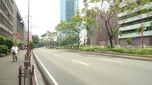
Get off the jeep at Paseo de Roxas, the first intersection with traffic lights from EDSA if your destination is Medicard Lifestyle Center and Metrobank Plaza. Walk across Gil Puyat to get to the other corner where Medicard Lifestyle Center is located at the left corner of Gil Puyat and Paseo de Roxas. Metrobank Plaza is located at the middle of Paseo de Roxas and Makati Avenue, the next main intersection (with traffic lights). It's just a little bit walk from Medicard Lifestyle Center. If you are a typical Filipino who doesn't follow traffic law, you can get off the jeep at SM CyberOne, the building to the right opposite Metrobank Plaza, then like the two men in this photo, take the risk of crossing Gil Puyat and tread on the well-landscaped center island.
Next main intersection is Makati Avenue. Buildings near the corner are: DBP or Development Bank of the Philippines, located at the first left corner of Gil Puyat and Makati Avenue. Pacific Star, located at the second left corner of Gil Puyat and Makati Avenue. BPI Buendia Center, next to Pacific Star. Petron Mega Plaza, third building from Pacific Star. The Church of Christ of Latter Day Saints, next to Petron Mega Plaza. Get off the jeep at Makati Avenue and just walk towards those buildings. They're just stone's throw away from where you would alight.
Next to The Church of Christ is a vacant lot and next to it is Salcedo Park Twin Towers, but it's more nearer to the next intersection which is Nicanor Garcia. There's a lot of pedestrians getting off the jeep infront of Ajinomoto Building, the building located to the right of Gil Puyat exactly opposite Salcedo Park Twin Towers, and they just cross the road right there as if it's legal to do it. Can't blame them, the center island don't have any barrier at all and it's quite fast to just walk across in that part of the road. It's your call, but if it's you're first time here, just follow the law and use pedestrian crossing.
Get off the jeep at Nicanor Garcia Street. And follow this guide. Use the pedestrian crossing to get to the left side of Gil Puyat Avenue. Grand Soho Makati is just a few meters from pedestrian crossing. It's next to vacant lot that followed Salcedo Park Twin Towers. Next to Grand Soho is Country Space and as you step the sidewalk of left side of Gil Puyat from corner of Nicanor Garcia, ACT Tower is in the front, facing you.
Next to ACT Tower is a parking lot. GF & Partners is next to the parking area, and a vacant lot followed it.
Next corner is Malugay Street. Get off the jeepney at Malugay Street. Walk across the road to get to the other corner. Road name opposite Malugay Street left of Gil Puyat is different, it is called Tordesillas Street. So Tordesillas is the one to the left of Gil Puyat while Malugay is to the right. Go left as soon as you crossed from Malugay. The World Centre is the tall building next to the parking lot that followed GF Partners. Next to The World Centre is Show Room of One Pacific Place, then Elizabeth Place and at the corner of Gil Puyat Avenue and Tordesillas Street is an under construction building.
Located at the second left corner of Tordesillas and Gil Puyat is Le Metropole, followed by Mondragon House. Third building from the second corner of Tordesillas and Gil Puyat is Le Triomphe and next to it is Telecom Plaza also known as Eastern Telecom Plaza. The building to the right of Gil Puyat Avenue opposite Telecom Plaza is PAG-IBIG Fund. The barriers or metal fence in front of these two building have openings, and I noticed lots of pedestrians crossing this part of Gil Puyat Avenue from one side to another. Next to Eastern Telecom is Plantersbank, followed by Trident. Under construction One Central is next to Trident. Located at the first left corner of Ayala Avenue and Gil Puyat Avenue is RCBC Plaza. By law, you are requred to get off the jeep near Ayala Avenue, if you're going to Plantersbank, Trident, One Central. But if you're like those people who keep on crossing streets in wrong places, then you can get off at PAG-IBIG and cross the road right there. Eastern Telecom is nearer to Malugay than Ayala Avenue.
Located opposite RCBC Plaza, at the second left corner of Ayala Avenue and Gil Puyat Avenue is Aegis People Support. Just get off the jeep near corner Ayala Avenue and walk across the road to get to this building, there's a large sign that read Aegis People Support above the building. You also must get off the jeep at Ayala Avenue if you're going to the Mercury Drug and Tropical Hut branches located next to Aegis People Support, respectively.
Last intersection along Gil Puyat Avenue is Chino Roces Avenue formerly known as Pasong Tamo. The buildings you can walk to from the corner of Chino Roces Avenue and Gil Puyat Avenue are the following: Burgundy Corporate Tower, West of Ayala, STI College, Bank of Commerce, McDonald's Gil Puyat Roces and Export Bank Plaza. These buildings lined up after Tropical Hut in that order. But an under construction building owned by Greenfield Development Corporation comes first before Burgundy Corporate Tower. Walk across Gil Puyat Avenue to get to the other corner of Chino Roces. Go left to proceed to Burgundy and West of Ayala. They are tall buildings with building names on their facades. McDonald's is just across the corner. Bank of Commerce is next to West of Ayala and Export Bank Plaza is the skyscrpaer located at the second left corner of Gil Puyat Avenue and Chino Roces Avenue.
Discover few simple ways not to miss new and upcoming articles on commuting and driving directions to lots of places in Metro Manila. Click HERE
Building Map from Paseo de Roxas to Makati Avenue. Click the red pin to see building name.
Building Map from Makati Avenue to Ayala Avenue. Click each marker or red pin to see building name.
Building Map from Ayala Avenue to Chino Roces aka Pasong Tamo. Click each marker or pin to see building name.
Read more...
 |
| From left: Pacific Star, BPI Buendia Center and Petron Mega Plaza |
Check if your building destination is listed below then patiently read this direction guide to locate the building and get the commuting direction from MRT Buendia Staion.
ACT Tower Aegis People Support Bank of Commerce Buendia Pasong Tamo Branch BPI Buendia Center Burgundy Corporate Tower Country Space 1 DBP Building Elizabeth Place Exportbank Plaza GF & Partners Building Grand Soho Makati Le Metropole Le Triomphe McDonalds Gil Puyat Chino Roces Medicard Lifestyle Center Mercury Drug Branch | Metrobank Plaza Mondragon House One Central One Pacific Place Show Room Pacific Star Petron Mega Plaza Planters Bank RCBC Plaza Salcedo Park Twin Towers STI College Telecom Plaza The Church of Christ of Latter Day Saints The World Centre Trident Gil Puyat Tropical Hut Humberger Gil Puyat West of Ayala |
How to get to a building along the left side of Gil Puyat Avenue from MRT Buendia Station?
From the MRT turnstile (exit machine), go left and then go right to take the footbridge and stairs that goes to Gil Puyat Avenue. Walk across Gil Puyat Avenue under Gil Puyat-EDSA flyover.
 |
| Two men crossing Gil Puyat from Metrobank Plaza to CybertOne |
Next main intersection is Makati Avenue. Buildings near the corner are: DBP or Development Bank of the Philippines, located at the first left corner of Gil Puyat and Makati Avenue. Pacific Star, located at the second left corner of Gil Puyat and Makati Avenue. BPI Buendia Center, next to Pacific Star. Petron Mega Plaza, third building from Pacific Star. The Church of Christ of Latter Day Saints, next to Petron Mega Plaza. Get off the jeep at Makati Avenue and just walk towards those buildings. They're just stone's throw away from where you would alight.
Next to The Church of Christ is a vacant lot and next to it is Salcedo Park Twin Towers, but it's more nearer to the next intersection which is Nicanor Garcia. There's a lot of pedestrians getting off the jeep infront of Ajinomoto Building, the building located to the right of Gil Puyat exactly opposite Salcedo Park Twin Towers, and they just cross the road right there as if it's legal to do it. Can't blame them, the center island don't have any barrier at all and it's quite fast to just walk across in that part of the road. It's your call, but if it's you're first time here, just follow the law and use pedestrian crossing.
Get off the jeep at Nicanor Garcia Street. And follow this guide. Use the pedestrian crossing to get to the left side of Gil Puyat Avenue. Grand Soho Makati is just a few meters from pedestrian crossing. It's next to vacant lot that followed Salcedo Park Twin Towers. Next to Grand Soho is Country Space and as you step the sidewalk of left side of Gil Puyat from corner of Nicanor Garcia, ACT Tower is in the front, facing you.
Next to ACT Tower is a parking lot. GF & Partners is next to the parking area, and a vacant lot followed it.
Next corner is Malugay Street. Get off the jeepney at Malugay Street. Walk across the road to get to the other corner. Road name opposite Malugay Street left of Gil Puyat is different, it is called Tordesillas Street. So Tordesillas is the one to the left of Gil Puyat while Malugay is to the right. Go left as soon as you crossed from Malugay. The World Centre is the tall building next to the parking lot that followed GF Partners. Next to The World Centre is Show Room of One Pacific Place, then Elizabeth Place and at the corner of Gil Puyat Avenue and Tordesillas Street is an under construction building.
Located at the second left corner of Tordesillas and Gil Puyat is Le Metropole, followed by Mondragon House. Third building from the second corner of Tordesillas and Gil Puyat is Le Triomphe and next to it is Telecom Plaza also known as Eastern Telecom Plaza. The building to the right of Gil Puyat Avenue opposite Telecom Plaza is PAG-IBIG Fund. The barriers or metal fence in front of these two building have openings, and I noticed lots of pedestrians crossing this part of Gil Puyat Avenue from one side to another. Next to Eastern Telecom is Plantersbank, followed by Trident. Under construction One Central is next to Trident. Located at the first left corner of Ayala Avenue and Gil Puyat Avenue is RCBC Plaza. By law, you are requred to get off the jeep near Ayala Avenue, if you're going to Plantersbank, Trident, One Central. But if you're like those people who keep on crossing streets in wrong places, then you can get off at PAG-IBIG and cross the road right there. Eastern Telecom is nearer to Malugay than Ayala Avenue.
Located opposite RCBC Plaza, at the second left corner of Ayala Avenue and Gil Puyat Avenue is Aegis People Support. Just get off the jeep near corner Ayala Avenue and walk across the road to get to this building, there's a large sign that read Aegis People Support above the building. You also must get off the jeep at Ayala Avenue if you're going to the Mercury Drug and Tropical Hut branches located next to Aegis People Support, respectively.
Last intersection along Gil Puyat Avenue is Chino Roces Avenue formerly known as Pasong Tamo. The buildings you can walk to from the corner of Chino Roces Avenue and Gil Puyat Avenue are the following: Burgundy Corporate Tower, West of Ayala, STI College, Bank of Commerce, McDonald's Gil Puyat Roces and Export Bank Plaza. These buildings lined up after Tropical Hut in that order. But an under construction building owned by Greenfield Development Corporation comes first before Burgundy Corporate Tower. Walk across Gil Puyat Avenue to get to the other corner of Chino Roces. Go left to proceed to Burgundy and West of Ayala. They are tall buildings with building names on their facades. McDonald's is just across the corner. Bank of Commerce is next to West of Ayala and Export Bank Plaza is the skyscrpaer located at the second left corner of Gil Puyat Avenue and Chino Roces Avenue.
 |
| DBP Building |
 |
| BPI Buendia Center |
 |
| Petron Mega Plaza |
 |
| Salcedo Park |
 |
| ACT Tower |
 |
| Gil Puyat Avenue with its metal fence |
 |
| Pedestrians wrongfully crossing Gil Puyat Avenue |
Discover few simple ways not to miss new and upcoming articles on commuting and driving directions to lots of places in Metro Manila. Click HERE
Building Map from Paseo de Roxas to Makati Avenue. Click the red pin to see building name.
Building Map from Makati Avenue to Ayala Avenue. Click each marker or red pin to see building name.
Building Map from Ayala Avenue to Chino Roces aka Pasong Tamo. Click each marker or pin to see building name.
20 Aug 2011
How To Get To The Buildings Along Gil Puyat From MRT Buendia
If you're from LRT Gil Puyat, please go to How To Get To The Buildings Along Buendia From LRT Gil Puyat Station. In this article, I will guide you to the buildings located along Gil Puyat Avenue (formerly known as Buendia) from EDSA where MRT-3 Buendia Station is located up to Chino Roces Avenue (formerly known as Pasong Tamo). This post helps you not only to locate a building along the stretch of Gil Puyat Avenue but also tells you where to get off the jeepney. You need to remember that Gil Puyat Avenue, like Ayala Avenue, has these metal fences and barriers along the whole stretch of the road from EDSA to Mayapis Street. Of course, these barriers stop in intersections and gasoline stations. In creating this directional guide, I put these metal fences into the whole route so that you get the right spot in which you must get off the jeepney to quickly arrive to your building destination.

Also, all buildings and institutions in this article are located to the right of Gil Puyat Avenue, that is if you're coming from MRT Buendia Station in EDSA. That means you just need to walk a little bit from drop off point to your destination located in the same side of Gil Puyat as where you get off the jeep. The commuting direction to the buildings located to the left of Gil Puyat Avenue from EDSA is explained in second part of this topic, go to How To Get To The Buildings Along Gil Puyat From MRT Buendia 2. We do this in parts for quick reference.
Please check if your building destination is listed below, then patiently read the rest of this direction to know where to get off the jeep from MRT, or if you can just walk your way to the building, if it's near to EDSA.
How to get to a building along the right side of Gil Puyat Avenue from MRT Buendia Station?
 From the MRT turnstile (exit machine), go left and then go right to take the footbridge and stairs that goes to Gil Puyat Avenue. From the footbridge which is extended from MRT station, just before you go down the stairs, SM CyberTwo Building is visible. This photo is taken from the footbridge right at the top of the stairs. Get to the ground, walk across Gil Puyat Avenue under the flyover to get to SM CyberTwo.
Once in SM CyberTwo, you get to see the terminal of jeepneys with "Bel-Air Washington Buendia MRT" wordings in both sides of the body and "Washington" sign in its front. The terminal is located near the entrance of McDonal's which is located at the ground floor of SM CyberTwo. Ride one of these jeepneys, pay minimum fare.
Since there are metal fences along the sidewalk of Gil Puyat, you can't alight infront of a building located before the next main intersection of Paseo de Roxas. So, the following buildings can be accessed just by walking from CyberTwo Building:
Next building to SM CyberTwo is PDAF Building. It's followed by Urban Building. Fouth Building from CyberTwo is Midland Buendia, followed by ENZO Building, and next to it is Buendia Car Exchange. Next to Buendia Car Exchange is Accelerando Building, followed by Goodwill Building. The ninth building from SM CyberTwo including Buendia Car Exchange is ALCO Building where Chevrolet Philippines is located in the fifth floor. Tara Building is next to ALCO Building. The last three buildings before Paseo de Roxas intersection can be quickly reached by riding the "Washington" jeepney because they are nearer to the corner of Paseo de Roxas. These buildings are: 387 Used Auto Center, a used car sales company, which is next to Tara Building; Department of Trade & Industry - Board of Investments, next to Auto Center; and Saville Building, exactly located at the corner of Paseo de Roxas and Gil Puyat Avenue. See location map of these buildings below, click HERE.
After Paseo de Roxas, the next main intersection is Makati Avenue. There are only six buildings located between Paseo de Roxas and Makati Avenue. Get off the jeepney at Paseo de Roxas if your destination is one of these three buildings: EBC Building - BDO Paseo-Gil Puyat, the first building from the corner of Paseo de Roxas and Gil Puyat Avenue. Goodland Building - Herbalife / ICSEC-KAPLAN, next to EBC Building. And DTI International Building, third building from Paseo de Roxas. Get off the jeepney at Makati Avenue if your building destination is one of these buildings: SM CyberOne Building, fourth building from Paseo de Roxas. NAPOLCOM Building, fifth building and very near to Makati Avenue. Executive Building, sixth building from Paseo de Roxas and exactly located at the corner of Makati Avenue and Gil Puyat Avenue. See location map of these buildings, click HERE.
Have you located your building destination yet? If not, here are other sets of buildings to the right of Gil Puyat Avenue. These buildings are located to the right of Gil Puyat Avenue from Makati Avenue to Nicanor Garcia Street (formerly know as Reposo):
Located at the corner of Makati Avenue and Gil Puyat Avenue is Petron Gasoline Station. Next to it is the first building from Makati Avenue which is Department of Trade & Industry - DTI. Like other DTI buildings that precede this building, there's a big signage of DTI in this building. Second building is SSS Makati - ECC Building, there's also a big signage that read SSS outside the building. You can get off the jeepney right in front of DTI Building or when the jeepney stops at Petron, then walk right to DTI, SSS and the buildings that follow. Next to SSS Building is Employees Compensation Commission, there's also a big signage with its name above the entrance. Fourth building is New Solid Building, next to it is an abandoned building that formerly housed Intellectual Property Philippines which moved its office to Fort Bonifacio. Sixth building is OPPEN Building aka Welding Industries of the Philippines. Next to it is the Morning Star Center. There is an small opening in the metal fence near the front of Morning Star Center purportedly done illegally so that people regularly come to the buildings in the area can just get off the jeepney near the buildings. The eight building and of course the remaining four is near to Nicanor Garcia Street, the next intersection. So I recommend to get off the jeepney at the corner of Nicanor Reyes Street if your destination is one of these buildings. The eight building is Union Ajinomoto Building with BDO branch at the ground floor. It is followed by Metro House, the ninth building. Next to to it is another abandoned building formerly occupied by Home Guaranty Corporation. ITC Building is the eleventh building from Makati Avenue to Nicanor Reyes. And the last bulding which is located at the corner of Nicanor Reyes Street and Gil Puyat Avenue is Yupangco Building. Based on their locations, the right unloading area if you're going to any of the last five buildings is at Nicanor Reyes Street also known as Reposo. See location map of these buildings, click HERE.
Next intersection which is not far from Nicanor Garcia Street is Malugay Street. There's only one building located between Nicanor Reyes Street and Malugay Street, there's a vacant lot at the corner of Malugay and Gil Puyat. The only building here is Mapua Institute of Technology, located at the corner of Nicanor Reyes and Gil Puyat. Get off the jeepney at Nicanor Garcia also known as Reposo if you're going to Mapua Institute of Technology. The signage of Mapua is engraved in the facade of the building. See location map below, click HERE.
In the second corner of Malugay Street is a parking lot. The next intersecion to the right of Gil Puyat is Zuellig Loop. There are only seven building from the parking lot at the corner of Malugay Street to Zuellig Loop. Get off the jeepney at the corner of Malugay Street if your going to any of these buildings: Next to parking lot is Star Centrum Building, it is followed by an abondoned building. PAG-IBIG Fund Makati Branch - Justine Building is the third building from Malugay Street. Next to it is GNOSIS International Learning Center. You can get off the jeepney at the corner of Zuellig Loop if your destination is one of the three buildings near to the corner. These are: BIR Revenue Region 8 Makati, fifth building from Malugay Street. An abandoned building is next to BIR Region 8 building. FEU Makati is located at the corner of Gil Puyat Avenue and Zuellig Loop. Located in FEU Makati Building is Loop Creative Dining and The Institute of Culinary Arts and Food Service.
Next main intersection is Ayala Avenue which is very near to Zuellig Loop. The Columns Ayala Avenue is located between Zuellig Loop and Ayala Avenue. See location map of these buildings, click HERE.
After Ayala Avenue, the next major intersection is Chino Roces Avenue also known as Pasong Tamo. But there's an access road perpendicular to Gil Puyat Avenue called Tindalo Street which is between the tall Philippine AXA Life Centre building and the twin towered Sky Plaza building. The first building from Ayala Avenue to Chino Roces Avenue is Makati Central Post Office, and next to it is Philippine AXA Life Centre. You can get off the jeep in front of Makati Central Post Office or the next corner which is Tindalo Street, next to Philippine AXA Life Centre if your destination is either Sky Plaza or Philippine AXA Life Centre. Next to Sky Plaza is Centro Escolar University. Get off the jeepney at the corner Tindalo Street if you're going to Centro Escolar University. Comfoods Building is a building that occupies the long stretch of Gil Puyat Avenue from the corner of Chino Roces Avenue towards the building of Centro Escolar University. The right area to get off the jeepney if your destination is Comfoods is at the corner of Gil Puyat Avenue and Chino Roces Avenue since the metal fence is built from the corner of Tindalo Street all the way to the corner of Chino Roces.
Grepalife Building is the third institution between Chino Roces Avenue and Mayapis Street, the road just before the PNR rail track. A Petron station is situated at the second corner of Chino Roces Avenue and Gil Puyat Avenue. Next to it is Caltex. Then, Grepalife Building with its big sign visible from the corner of Chino Roces. See location map of these buildings, click HERE.
Discover few simple ways not to miss new and upcoming articles on commuting and driving directions to lots of places in Metro Manila. Click HERE
Building Map from EDSA to Paseo de Roxas. Click each red marker to display building name.
Building Map from EDSA to Paseo de Roxas. Click each red marker to display building name.
Building Map from EDSA to Paseo de Roxas. Click each red marker to display building name.
Building Map from EDSA to Paseo de Roxas. Click each red marker to display building name.
Building Map from EDSA to Paseo de Roxas. Click each red marker to display building name.
Building Map from EDSA to Paseo de Roxas. Click each red marker to display building name.
Read more...

Also, all buildings and institutions in this article are located to the right of Gil Puyat Avenue, that is if you're coming from MRT Buendia Station in EDSA. That means you just need to walk a little bit from drop off point to your destination located in the same side of Gil Puyat as where you get off the jeep. The commuting direction to the buildings located to the left of Gil Puyat Avenue from EDSA is explained in second part of this topic, go to How To Get To The Buildings Along Gil Puyat From MRT Buendia 2. We do this in parts for quick reference.
| Accelerando Building ALCO Building - Chevrolet Philippines Auto Center BIR Revenue Region 8 Makati Buendia Car Exchange Centro Escolar University Comfoods Building DTI DTI - Board of Investments DTI International Building EBC Building - BDO Paseo-Gil Puyat Employees Compensation Commission Enzo Building Executive Building FEU Makati - Loop Creative Dining / The Institute of Culinary Arts & Food Service GNOSIS International Learning Center Goodland Building - Herbalife / ICSEC-KAPLAN Goodwill Building Grepalife Building ITC Building Makati Central Post Office | Mapua Institute of Technology Metro House 345 Midland Buendia Morning Star Center NAPOLCOM Building New Solid Building OPPEN Building - Welding Industries of the Philippines PAG-IBIG FUND Makati Branch - Justine Building PDAF Building Philippine AXA Life Centre Saville Building Skyland Plaza SM CyberOne Building SM Cybertwo SSS Makati 355 ECC Building Star Centrum Tara Building The Columns Ayala Avenue Union Ajinomoto Building with BDO branch at G/F Urban Building Yupangco Building |
How to get to a building along the right side of Gil Puyat Avenue from MRT Buendia Station?

Once in SM CyberTwo, you get to see the terminal of jeepneys with "Bel-Air Washington Buendia MRT" wordings in both sides of the body and "Washington" sign in its front. The terminal is located near the entrance of McDonal's which is located at the ground floor of SM CyberTwo. Ride one of these jeepneys, pay minimum fare.
After Paseo de Roxas, the next main intersection is Makati Avenue. There are only six buildings located between Paseo de Roxas and Makati Avenue. Get off the jeepney at Paseo de Roxas if your destination is one of these three buildings: EBC Building - BDO Paseo-Gil Puyat, the first building from the corner of Paseo de Roxas and Gil Puyat Avenue. Goodland Building - Herbalife / ICSEC-KAPLAN, next to EBC Building. And DTI International Building, third building from Paseo de Roxas. Get off the jeepney at Makati Avenue if your building destination is one of these buildings: SM CyberOne Building, fourth building from Paseo de Roxas. NAPOLCOM Building, fifth building and very near to Makati Avenue. Executive Building, sixth building from Paseo de Roxas and exactly located at the corner of Makati Avenue and Gil Puyat Avenue. See location map of these buildings, click HERE.
Have you located your building destination yet? If not, here are other sets of buildings to the right of Gil Puyat Avenue. These buildings are located to the right of Gil Puyat Avenue from Makati Avenue to Nicanor Garcia Street (formerly know as Reposo):
Next intersection which is not far from Nicanor Garcia Street is Malugay Street. There's only one building located between Nicanor Reyes Street and Malugay Street, there's a vacant lot at the corner of Malugay and Gil Puyat. The only building here is Mapua Institute of Technology, located at the corner of Nicanor Reyes and Gil Puyat. Get off the jeepney at Nicanor Garcia also known as Reposo if you're going to Mapua Institute of Technology. The signage of Mapua is engraved in the facade of the building. See location map below, click HERE.
Next main intersection is Ayala Avenue which is very near to Zuellig Loop. The Columns Ayala Avenue is located between Zuellig Loop and Ayala Avenue. See location map of these buildings, click HERE.
After Ayala Avenue, the next major intersection is Chino Roces Avenue also known as Pasong Tamo. But there's an access road perpendicular to Gil Puyat Avenue called Tindalo Street which is between the tall Philippine AXA Life Centre building and the twin towered Sky Plaza building. The first building from Ayala Avenue to Chino Roces Avenue is Makati Central Post Office, and next to it is Philippine AXA Life Centre. You can get off the jeep in front of Makati Central Post Office or the next corner which is Tindalo Street, next to Philippine AXA Life Centre if your destination is either Sky Plaza or Philippine AXA Life Centre. Next to Sky Plaza is Centro Escolar University. Get off the jeepney at the corner Tindalo Street if you're going to Centro Escolar University. Comfoods Building is a building that occupies the long stretch of Gil Puyat Avenue from the corner of Chino Roces Avenue towards the building of Centro Escolar University. The right area to get off the jeepney if your destination is Comfoods is at the corner of Gil Puyat Avenue and Chino Roces Avenue since the metal fence is built from the corner of Tindalo Street all the way to the corner of Chino Roces.
 |
| NAPOLCOM Bldg |
 |
| FEU Makati |
 |
| SSS Makati Branch |
 |
| Goldland Bldg - Herbalife |
 |
| The Columns Ayala Avenue |
 |
| Morning Star Center |
 |
| New Solid Bldg |
Discover few simple ways not to miss new and upcoming articles on commuting and driving directions to lots of places in Metro Manila. Click HERE
Building Map from EDSA to Paseo de Roxas. Click each red marker to display building name.
Building Map from EDSA to Paseo de Roxas. Click each red marker to display building name.
Building Map from EDSA to Paseo de Roxas. Click each red marker to display building name.
Building Map from EDSA to Paseo de Roxas. Click each red marker to display building name.
Building Map from EDSA to Paseo de Roxas. Click each red marker to display building name.
Building Map from EDSA to Paseo de Roxas. Click each red marker to display building name.
17 Aug 2011
How To Commute To Ynares Sports Arena
For Ynares Center Antipolo direction,
go to How To Get To Ynares Center In Antipolo
The 3,000 capacity Ynares Sports Arena is situated in Shaw Boulevard, Pasig City approximately 1 kilometer and 250 meters away from EDSA corner Shaw Boulevard where MRT-3 Shaw Station is located. Heading off to this sports center from both north (Alabang, Sucat, Baclaran, FTI, Bicutan, NAIA) and south (Monumento, Caloocan, Malabon, Navotas, Valenzuela, Cubao, Fariview, Novaliches) of Metro Manila is relatively easy.

By bus, you need to ride one with "Crossing Ibabaw" sign in its front, e.g. "Monumento Crossing Ibabaw", "Baclaran Crossing Ibabaw", "Alabang Crossing Ibabaw" and "Fairview Crossing Ibabaw", and alight at Shaw Boulevard also known as Crossing. By train, from any station of MRT-3, alignt at Shaw Station.
From EDSA, you need to ride a jeepney with "Pasig Palengke" sign. I'm gonna give you guide and direction in such a way that you don't need to ask for driver's assistance. First, go to PARKLEA Jeppney Terminal located along Shaw Boulevard opposite Starmall.
How to get to the jeepney terminal from MRT Shaw Station?
If you're riding a train from Taft Avenue Station, go to escalator near to the rear of the train. If you're riding a train from North Avenue Station, go to escalator near to the front of the train. Go up the second level of the station. From the turnstile (exit machine), go right and enter a glass door, then go right again and use the stairs to get to the lower level of the station again. From the foot of the stairs, go to your left to exit the station towards the jeepney terminal. Once in the ground, walk along Shaw Boulevard away from the corner of EDSA until you get to the jeepney terminal next to Andok's Lechon.
How to get to jeepney terminal from the bus unloading areas?
If you're riding a bus from Monumento, Fairview, Cubao or Novaliches, and you get off the bus before the bus crosses Shaw Boulevard, walk across Shaw Boulevard, then walk along Shaw Boulevard from corner of EDSA until you get to the jeepney terminal next to Andok's. After the bus crossed Shaw, walk along Shaw Boulevard from the corner of EDSA to get to the jeepney terminal.
If you're riding a bus from Baclaran, Alabang or Sucat, and you gets off the bus before the bus crosses Shaw Boulevard, cross EDSA and walk further along Shaw Boulevard until you see the jeepney terminal next to Andok's Lechon. If the bus has already crossed Shaw Boulevard before you got off, walk across Shaw to get back to the other corner, then cross EDSA, and walk further along Shaw Boulevard to get the jeepney terminal next to Andok's.
Ride a jeepney with "Pasig Palengke" sign.
In the terminal entrance, jeepneys of different destinations are parked in a row. The jeepneys with "Pasig Palengke" sign occupy the last two slots. Ride one of these jeepneys. Pay minimum fare.
Now, here's the simple guide along the jeepney route up to Ynares Sports Arena. If you pay attention here, there's no need to ask the jeepney driver to drop you off at the exact location of Ynares Sports Arena. It would be a big help if you're sitting beside the driver or if you're at the back, make sure you're sitting in the left side of the jeep. You can easily do that because you're going to ride the jeep at the terminal.
 Ynares Sports Arena is located to the left of Shaw Boulevard. See map below this post. The first main intersection from EDSA with traffic lights is One San Miguel Avenue, where a very tall building called One San Miguel Avenue is located at the corner of Shaw Boulevard and San Miguel Avenue, to your left. Next main road to the left of Shaw is Meralco Avenue, there's no traffic light but a pedestrian overpass is erected across Shaw from corner of Meralco Avenue. Before Meralco Avenue, the jeepney will pass by a main intersection to the right of Shaw Boulevard called Pioneer Street and there's a big Caltex Gasoline Station right at the corner of Shaw and Pioneer. Ynares Sports Arena is approximately 200 meters away from Meralco Avenueu. There's an oval rotunda with some trees inside it along Shaw Boulevard just before Ynares Sports Arena.
 Once the jeepney pass through the oval rotunda, you'll surely see to your left from afar the big logo of Ynares Sports Arena engraved outside the indoor arena. The sports center is located just before the tall building called Citystate Centre. You can get off the jeepney at the unloading zone in the oval rotunda. Your other landmark to the right of Shaw Boulevard exactly opposite the oval rotunda and at the corner of Shaw Boulevard and West Capitol Drive is a Shell Gasoline Station. Use the pedestrian lane to get to the other side of Shaw Boulevard and head towards the the building of Ynares Sports Center.
How do you get to Ymares Sports Arena from other parts of Metro Manila?
From Quiapo
In Quezon Boulevard north lane opposite Quiapo Church, ride a jeepney with "Pasig Palengke" sign. Once the jeep crossed EDSA via flyover, or it passed through MRT Shaw Station, observe the landmarks along the route. The first main intersection from EDSA with traffic lights is One San Miguel Avenue, where a very tall building called One San Miguel Avenue is located at the corner of Shaw Boulevard and San Miguel Avenue, to your left. Next main road to the left of Shaw is Meralco Avenue, there's no traffic light but a pedestrian overpass is erected across Shaw from corner of Meralco Avenue. Before Meralco Avenue, the jeepney will pass by a main intersection to the right of Shaw Boulevard called Pioneer Street and there's a big Caltex Gasoline Station right at the corner of Shaw and Pioneer. Ynares Sports Center is approximately 200 meters away from Meralco Avenue. There's an oval rotunda with some trees inside it along Shaw Boulevard just before Ynares Sports Arena.
Once the jeep passed through the oval rotunda, you'll surely see to your left from afar the big logo of Ynares Sports Arena engraved outside the indoor arena. It's located before the tall building called Citystate Centre. You can get off at the unloading zone in the oval rotunda. Your other landmark to the right of Shaw Boulevard exactly opposite the oval rotunda is a Shell Station. Use the pedestrian lane to get to the other side of Shaw Boulevard and head towards the stadium.
From SM Marikina, Sta. Lucia East, Robinson's Metro East and nearby areas
By jeep and bus
You can ride a jeepney bound for Divisoria or Stop&Shop and then get off the jeep at EDSA. Ride a bus bound for south of Metro Manila, e.g. "Baclaran Crossing Ibabaw", "Alabang Crossing Ibabaw", "Sucat Crossing Ibabaw", etc. Get off the bus and ride a "Pasig Palengke" bound jeepney. Please read how to get to jeepney terminal, click HERE, and where to get off the jeepney, click HERE.
By train
Ride a train bound for "Recto" at LRT-2 Santolan Station. Alight at Araneta Center Cubao Station. Ride another train bound for Taft at MRT-3 Araneta Center Cubao Station. LRT-2 and MRT-3 Araneta Center Cubao stations are interconnected by walkways from Gateway Mall to Farmers Plaza mall via Areneta Coliseum. Just follow directions inside the malls. Get off the train at Shaw Station. Ride a jeep with "Pasig Palengke" sign, click HERE to know how to get to the jeepney terminal from MRT Shaw. Follow the guide on where to get off the jeepney at the vicinity of Ynares Sports Center, click HERE.
From Cavite
By bus
Ride a bus or jeepney bound for Baclaran. In Baclaran, take a bus bound for south of Metro Manila with any of these signs: "Monumento Crossing Ibabaw", "Fairview Crossing Ibabaw" or "Novaliches Crossing Ibabaw". Get off the bus at Shaw Boulevard most popularly known as Crossing. Ride a jeepney with "Pasig Palengke" sign. Click HERE for walking direction to the jeepney terminal. Follow my guide on how to get off the jeep at Ynares Sports Center even without asking driver's assistance, click HERE.
By train
From Baclaran, get off the bus at Pasay Taft Rotunda where MRT Taft Station is located. Ride a train bound for North Station and alight at Shaw Station. Ride a jeepney with "Pasig Palengke" sign. Click HERE if you don't know how to get to the jeepney terminal from MRT Shaw Station. Follow my guide on where to get off the jeepney at the location of Ynares Sports Arena even if you don't ask driver's assistance, click HERE.
From Batangas, Laguna and Quezon Province
Ride a bus bound for Manila or Pasay and alight at Magallanes. Use pedestrian overpasses and walkways to get to MRT-3 Magallanes Station. Ride a train bound for "North Avenue Station". Alight at Shaw Station. Ride a jeepney with "Pasig Palengke" sign. Click HERE to know how to get to the jeepney terminal from MRT Shaw Station. Follow the guide on how and where to get off the jeep at the vicinity of Ynares Sports Arena, click HERE.
From Pampanga and other areas in North Luzon
Ride a bus bound for Manila or Quezon City with terminal located in EDSA, In EDSA, you can either take a bus or train.
By bus
Just ride a bus with any of these signs: "Baclaran Crossing Ibabaw", "Alabang Crossing Ibabaw", "Sucat Crossing Ibabaw" or "FTI Crossing Ibabaw". Get off the bus at Crossing or Shaw Boulevard. Ride a jeepney with "Pasig Palengke" sign. Click HERE to know how to get to the jeepney terminal from where you alight from the bus. Follow the guide on how and where to get off the jeepney very near to Ynares Sports Arena, click HERE.
By train
You must get off the provincial bus at the unloading area near any MRT Station, e.g. North Avenue Station, GMA Kamuning Station or Araneta Center Cubao Station. Ride a train bound for Taft Station and alight at Shaw Station. Ride a jeepney with "Pasig Palengke" sign. Click HERE to know how to get to the jeepney terminal from MRT Shaw real quick. Follow the guide on how to get off the jeepney at the exact location of Ynares Sports Arena without the driver's assistance, click HERE.
Discover few simple ways not to miss new and upcoming articles on commuting and driving directions to lots of places in Metro Manila. Click HERE
Ynares Sports Arena Vicinity Map
Read more...
go to How To Get To Ynares Center In Antipolo
The 3,000 capacity Ynares Sports Arena is situated in Shaw Boulevard, Pasig City approximately 1 kilometer and 250 meters away from EDSA corner Shaw Boulevard where MRT-3 Shaw Station is located. Heading off to this sports center from both north (Alabang, Sucat, Baclaran, FTI, Bicutan, NAIA) and south (Monumento, Caloocan, Malabon, Navotas, Valenzuela, Cubao, Fariview, Novaliches) of Metro Manila is relatively easy.

By bus, you need to ride one with "Crossing Ibabaw" sign in its front, e.g. "Monumento Crossing Ibabaw", "Baclaran Crossing Ibabaw", "Alabang Crossing Ibabaw" and "Fairview Crossing Ibabaw", and alight at Shaw Boulevard also known as Crossing. By train, from any station of MRT-3, alignt at Shaw Station.
From EDSA, you need to ride a jeepney with "Pasig Palengke" sign. I'm gonna give you guide and direction in such a way that you don't need to ask for driver's assistance. First, go to PARKLEA Jeppney Terminal located along Shaw Boulevard opposite Starmall.
How to get to the jeepney terminal from MRT Shaw Station?
If you're riding a train from Taft Avenue Station, go to escalator near to the rear of the train. If you're riding a train from North Avenue Station, go to escalator near to the front of the train. Go up the second level of the station. From the turnstile (exit machine), go right and enter a glass door, then go right again and use the stairs to get to the lower level of the station again. From the foot of the stairs, go to your left to exit the station towards the jeepney terminal. Once in the ground, walk along Shaw Boulevard away from the corner of EDSA until you get to the jeepney terminal next to Andok's Lechon.
How to get to jeepney terminal from the bus unloading areas?
If you're riding a bus from Monumento, Fairview, Cubao or Novaliches, and you get off the bus before the bus crosses Shaw Boulevard, walk across Shaw Boulevard, then walk along Shaw Boulevard from corner of EDSA until you get to the jeepney terminal next to Andok's. After the bus crossed Shaw, walk along Shaw Boulevard from the corner of EDSA to get to the jeepney terminal.
If you're riding a bus from Baclaran, Alabang or Sucat, and you gets off the bus before the bus crosses Shaw Boulevard, cross EDSA and walk further along Shaw Boulevard until you see the jeepney terminal next to Andok's Lechon. If the bus has already crossed Shaw Boulevard before you got off, walk across Shaw to get back to the other corner, then cross EDSA, and walk further along Shaw Boulevard to get the jeepney terminal next to Andok's.
Ride a jeepney with "Pasig Palengke" sign.
In the terminal entrance, jeepneys of different destinations are parked in a row. The jeepneys with "Pasig Palengke" sign occupy the last two slots. Ride one of these jeepneys. Pay minimum fare.
Now, here's the simple guide along the jeepney route up to Ynares Sports Arena. If you pay attention here, there's no need to ask the jeepney driver to drop you off at the exact location of Ynares Sports Arena. It would be a big help if you're sitting beside the driver or if you're at the back, make sure you're sitting in the left side of the jeep. You can easily do that because you're going to ride the jeep at the terminal.


How do you get to Ymares Sports Arena from other parts of Metro Manila?
From Quiapo
In Quezon Boulevard north lane opposite Quiapo Church, ride a jeepney with "Pasig Palengke" sign. Once the jeep crossed EDSA via flyover, or it passed through MRT Shaw Station, observe the landmarks along the route. The first main intersection from EDSA with traffic lights is One San Miguel Avenue, where a very tall building called One San Miguel Avenue is located at the corner of Shaw Boulevard and San Miguel Avenue, to your left. Next main road to the left of Shaw is Meralco Avenue, there's no traffic light but a pedestrian overpass is erected across Shaw from corner of Meralco Avenue. Before Meralco Avenue, the jeepney will pass by a main intersection to the right of Shaw Boulevard called Pioneer Street and there's a big Caltex Gasoline Station right at the corner of Shaw and Pioneer. Ynares Sports Center is approximately 200 meters away from Meralco Avenue. There's an oval rotunda with some trees inside it along Shaw Boulevard just before Ynares Sports Arena.
Once the jeep passed through the oval rotunda, you'll surely see to your left from afar the big logo of Ynares Sports Arena engraved outside the indoor arena. It's located before the tall building called Citystate Centre. You can get off at the unloading zone in the oval rotunda. Your other landmark to the right of Shaw Boulevard exactly opposite the oval rotunda is a Shell Station. Use the pedestrian lane to get to the other side of Shaw Boulevard and head towards the stadium.
From SM Marikina, Sta. Lucia East, Robinson's Metro East and nearby areas
By jeep and bus
You can ride a jeepney bound for Divisoria or Stop&Shop and then get off the jeep at EDSA. Ride a bus bound for south of Metro Manila, e.g. "Baclaran Crossing Ibabaw", "Alabang Crossing Ibabaw", "Sucat Crossing Ibabaw", etc. Get off the bus and ride a "Pasig Palengke" bound jeepney. Please read how to get to jeepney terminal, click HERE, and where to get off the jeepney, click HERE.
By train
Ride a train bound for "Recto" at LRT-2 Santolan Station. Alight at Araneta Center Cubao Station. Ride another train bound for Taft at MRT-3 Araneta Center Cubao Station. LRT-2 and MRT-3 Araneta Center Cubao stations are interconnected by walkways from Gateway Mall to Farmers Plaza mall via Areneta Coliseum. Just follow directions inside the malls. Get off the train at Shaw Station. Ride a jeep with "Pasig Palengke" sign, click HERE to know how to get to the jeepney terminal from MRT Shaw. Follow the guide on where to get off the jeepney at the vicinity of Ynares Sports Center, click HERE.
From Cavite
By bus
Ride a bus or jeepney bound for Baclaran. In Baclaran, take a bus bound for south of Metro Manila with any of these signs: "Monumento Crossing Ibabaw", "Fairview Crossing Ibabaw" or "Novaliches Crossing Ibabaw". Get off the bus at Shaw Boulevard most popularly known as Crossing. Ride a jeepney with "Pasig Palengke" sign. Click HERE for walking direction to the jeepney terminal. Follow my guide on how to get off the jeep at Ynares Sports Center even without asking driver's assistance, click HERE.
By train
From Baclaran, get off the bus at Pasay Taft Rotunda where MRT Taft Station is located. Ride a train bound for North Station and alight at Shaw Station. Ride a jeepney with "Pasig Palengke" sign. Click HERE if you don't know how to get to the jeepney terminal from MRT Shaw Station. Follow my guide on where to get off the jeepney at the location of Ynares Sports Arena even if you don't ask driver's assistance, click HERE.
From Batangas, Laguna and Quezon Province
Ride a bus bound for Manila or Pasay and alight at Magallanes. Use pedestrian overpasses and walkways to get to MRT-3 Magallanes Station. Ride a train bound for "North Avenue Station". Alight at Shaw Station. Ride a jeepney with "Pasig Palengke" sign. Click HERE to know how to get to the jeepney terminal from MRT Shaw Station. Follow the guide on how and where to get off the jeep at the vicinity of Ynares Sports Arena, click HERE.
From Pampanga and other areas in North Luzon
Ride a bus bound for Manila or Quezon City with terminal located in EDSA, In EDSA, you can either take a bus or train.
By bus
Just ride a bus with any of these signs: "Baclaran Crossing Ibabaw", "Alabang Crossing Ibabaw", "Sucat Crossing Ibabaw" or "FTI Crossing Ibabaw". Get off the bus at Crossing or Shaw Boulevard. Ride a jeepney with "Pasig Palengke" sign. Click HERE to know how to get to the jeepney terminal from where you alight from the bus. Follow the guide on how and where to get off the jeepney very near to Ynares Sports Arena, click HERE.
By train
You must get off the provincial bus at the unloading area near any MRT Station, e.g. North Avenue Station, GMA Kamuning Station or Araneta Center Cubao Station. Ride a train bound for Taft Station and alight at Shaw Station. Ride a jeepney with "Pasig Palengke" sign. Click HERE to know how to get to the jeepney terminal from MRT Shaw real quick. Follow the guide on how to get off the jeepney at the exact location of Ynares Sports Arena without the driver's assistance, click HERE.
Discover few simple ways not to miss new and upcoming articles on commuting and driving directions to lots of places in Metro Manila. Click HERE
Ynares Sports Arena Vicinity Map
14 Aug 2011
How To Commute To Makati Coliseum
In this article, I'll show you how to get to the Makati Coliseum in a very simple way. First off, Makati Coliseum is accessible from both MRT-3 and LRT-1 lines. The nearest MRT Station, commute wise, is Magallanes Station, while the nearest LRT is Gil Puyat Station. You can also get off the train at Vito Cruz Station and ride a jeepney at a terminal which is way too far, then ride a tricylce, but for first timer, it's not easy so Gil Puyat Station is more convenient. The roads and landmarks are familiar. But if you're from the vicinity of La Salle Taft, then follow direction at Route #11 below.
 A jeepney ride from the train stations is needed to get to the vicinity of the coliseum and the sign of the jeepney you must take from both Magallanes and Gil Puyat stations is "PRC". Makati Coliseum is situated approximately 430 meters from the jeepney drop off point at the corner of Chino Roces Avenue (formerly Pasong Tamo) and Mascardo Street. There's a terminal of motorized tricycle at the corner of Mascardo and Chino Roces Avenue. You can walk your way to Makati Coliseum which is located to the left of Maskardo Street or ride one of these tricycles.
Now, here's how you head off to the sport center from MRT-3 and LRT-1:
How to get to Makati Coliseum from MRT Magallanes Station?
Direction #1 - From MRT Magallanes Station, go to Chino Roces Avenue formerly known as Pasong Tamo. It's the main thoroughfare that intersects EDSA underneath EDSA-Magallanes flyover where lots of passenger jeepneys pass through, and its a short walk away from the train station. If you're riding a train from Taft Station, enter Alphaland Southgate Mall which is connected to MRT, go down to the ground floor and exit the mall to the west side that leads to Chino Roces Avenue.
Along Chino Roces Avenue, you get to see jeepneys of either "Ayala" or "PRC" signs in their front. Ride a jeepney with "PRC" sign. Pay minimum. PRC here means Philippine Racing Club which is situated near the northern end of Chino Roces, specifically A.P. Reyes Avenue, 1207 Makati City. It is also known as Santa Ana Park.
The jeepney will traverse the north bound lane of Chino Roces. The first main intersection the jeepney will cross is Arnaiz Avenue formerly Pasay Road where Walter Mart is located to the first left corner. Mascardo Street is approximately 3.2 km from EDSA. Next intersection with traffic lights is Herrera Street now known as Rufino Street, followed by Dela Rosa Street, then the wide intersection of Gil Puyat Avenue formerly known as Buendia. There's a McDonald's branch to the right first corner of Gil Puyat and Chino Roces, and opposite it to the left first corner is an skyscraper called Export Bank Plaza.
After crossing Gil Puyat Avenue, there are two other intersections with traffic lights that the jeep will pass through - Kamagong Street and Pablo Ocampo Sr Ext., respectively. There's a big Rustan's Shopwise branch to the right second corner of Pablo Ocampo and Chino Roces. At this point Mascardo Street is approximately 200 meters away. A large road sign with "Mascardo St" words written on it hangs conspicuously from a post at the corner. It's noticeable from the distance. You get to see it from afar. Davila Street comes first before Mascardo. Get off the jeep at Mascardo Street, walk across the road to get to the other side of Chino Roces and then decide if you walk or take one of the tricycles at the corner.
If you decide to walk, all you need to remember is you will cross three streets before you get to see Makati Coliseum to the left of Mascardo Street. First street is Metropolitan Avenue, followed by Pasong Tirad, then Primo de Riveria Street. That's it, you're looking now at Makati Coliseum, next to the building with "WTJ Sports & Amusement Center" signage to the left second corner of Primo Riveria and Mascardo streets. See map below.
How do you get to Makati Coliseum from LRT Gil Puyat Station?
Direction #2 - From Gil Puyat Station, go to the area of Gil Puyat Avenue where you can conveniently ride a jeepney. Don't wait for a jeepeny at the corner. There are lots of traffic enforcers and jeepneys won't stop there. Walk a little bit far from the corner, then wait for a jeepney with "PRC" sign in its front, flag it down, ride in and pay minimum fare.
No need to ask the driver to drop you off at Mascardo Street. Some of them forget because of the nature of their job. Just follow this simple guide. Normally, the jeepney traverses Gil Puyat Avenue and crosses Osmena Highway underneath Osmena Flyover before turning right onto Washington Street, then left on Dela Rosa Street and then left on Chino Roces once again, its last turn. Remember, your drop off point is at the corner of Chino Roces Avenue and Mascardo Street. See map below. Now, there are times, especially during the days when traffic in Gil Puyat is so heavy, that some of jeepneys take the side road paralleled to Gil Puyat which is called Finlandia. In that case, the jeep goes straight, crosses Osmena Highway underneath Osmena Flyover, takes Dela Rosa Street, then turns left on Chino Roces Avenue from Dela Rosa Street.
After the left turn at Dela Rosa and Chino Roces intersecion, the jeepney will cross Gil Puyat Avenue on its way to PRC. You should see a McDonald's to the right first corner of Gil Puyat and Chino Roces. To the left first corner opposite McDonald's is an skyscraper called Export Bank Plaza.
After crossing Gil Puyat Avenue, there are two other intersections with traffic lights that the jeep will pass through - Kamagong Street and Pablo Ocampo Sr Ext., respectively. There's a big Rustan's Shopwise branch to the right second corner of Pablo Ocampo and Chino Roces. At this point Mascardo Street is approximately 200 meters away. A large road sign with "Mascardo St" words on it hangs conspicuously from a post at the corner. It's noticeable from the distance. You get to see it from afar. Davila Street comes first before Mascardo. Get off the jeep at Mascardo, walk across the road to get to the other side of Chino Roces and then decide if you walk or take one of the tricycles at the corner.
If you decide to walk, all you need to remember is you will cross three streets before you get to see Makati Coliseum to the left of Mascardo. First street is Metropolitan Avenue, followed by Pasong Tirad, then Primo de Riveria Street. That's it, you're looking now at Makati Coliseum, next to the building with "WTJ Sports & Amusement Center" signage to the left second corner of Primo Riveria and Mascardo streets.
How do you get to Makati Coliseum from different parts of Metro Manila?
Route #1
From Caloocan, Malabon, Navotas, Valenzuela, Monumento, Balintawak, Bagong Barrio, Roosevelt, Munoz, Congressional, Project 7 and 8 and areas nearby.
The fastest way is by train, of course. If you live far such as in Malanday, Navotas and Malabon, just ride a jeep or bus bound for Monumento and take a Baclaran bound train at Monumento Station. You can also take Baclaran bound train at Roosevelt Station or Balintawak Station. Get off the train at Gil Puyat Station and follow the guide at Direction #2, click HERE.
Route #2
From Project 6, SM City North EDSA, Trinoma, West Avenue and nearby areas.
Use the MRT-3 North Station. Ride a train bound for Taft Station. Get off the train at Magallanes Station. Follow the guide at Direction #1, click HERE.
Route #3
From Alabang, Metropolis Starmall, Festival Mall, Ayala Town Center, Filinvest City and other areas nearby.
Take a bus bound for north of Metro Manila with any of these signs: "Fairview", "Monumento", "Novaliches", "Cubao", "Malanday", "Navotas", etc. These buses pick up passengers near Metropolis Starmall. Get off the bus at the unloading area near to Magallanes MRT Station. Then walk along EDSA towards Alphaland Southgate Mall. It's the big mall connected to MRT Magallanes Station and there's tall building above it. Chino Roces Avenue bordered the west frontage of the mall. Wait for a jeepney with "PRC" sign in its front right at Chino Roces Avenue formerly Pasong Tamo. Follow my guide at Direction #1, click click HERE.
Route #4
From Pasig, Ortigas Center, SM Mega Mall, Shangri-La Plaza, EDSA Crossing, Kalentong and other areas nearby.
From Pasig, ride a jeep with "Quiapo Crossing Ilalim" sign. From Kalentong, ride a jeep with "Pasig Palengke Crossing Ilalim" sign. Get off at EDSA-Shaw. Ride an MRT train bound for Taft. From Ortigas Center and SM Mega Mall, take a train bound for Taft at Ortigas Station. Get off the train at Magallanes Station. Follow the guide at Direction #1, click HERE.
Route #5
From Sta. Lucia East, Robinson's Metro East, SM City Marikina and places nearby.
Take an LRT-2 train bound for Recto at Santolan Station. Get off the train at Araneta Center Cubao Station. Ride another train bound for Taft at MRT-3 Araneta Center Cubao Station. LRT-2 Araneta Cubao Station and MRT-3 Araneta Center Cubao Station are interconnected by a series of walkway from Gateway Mall to Farmers Plaza via Araneta Coliseum. Follow directions inside the malls. Alight at Magallanes Station. Follow our guide at Direction #1, click HERE.
Route #6
From Fairview, UP Diliman, UP-Ayala Technohub, Quezon City Hall, Elliptical Road, Quezon Memorial Circle, East Avenue, GMA-Kamuning and areas around these vicinities.
You can have a one bus ride to Magallanes. Take a bus with any of these signs: "Baclaran", "Alabang", or "Sucat". Get off the bus at the unloading area near MRT Magallanes. Walk past MRT Magallanes Station towards Chino Roces. Follow the guide at Direction #1, click HERE.
Alternatively, you can get off the bus and take a train bound for Taft at MRT GMA Kamuning Station and alight at Magallanes Station, then follow guide at Direction #1.
Route #7
From Robinson's Place Manila, Mabini Street and Del Pilar Street in Malate and Ermita area.
This one doesn't need a train ride. Take a jeepney with "Paco" sign. These jeepneys pass through around Robinson's Place Mall via Padre Faura Street, Del Pilar Street and Pedro Gil Street, The jeepney will cross Taft Avenue. Get off the jeep at Agoncillo Street, the third street from Taft Avenue, with Taft Avenue as the first in your count. Along Pedro Gil Street at the corner of Agoncillo Street is the terminal of jeepneys with "Guadalupe Herran Ilalim" sign. Ride one of these jeepneys. Ask the driver to drop you off at Chino Roces Avenue. In Chino Roces Avenue, take a jeep with "Mantrade" sign and alight at Mascardo Street. It's very near so please be alert. Watch for "Mascardo St" road sign. Also, Philippine Daily Inquirer or PDI Building is situated at the first corner of Mascardo and Chino Roces, to your right.
Or, if you want a simple route, get off the "Paco" bound jeep at Taft Avenue, ride a train bound for Baclaran at LRT Pedro Gil Station located at Taft Avenue-Pedro Gil intersection, alight at Gil Puyat Station and follow the guide at Direction #2, click HERE.
Route #8
From Espana, UST, FEU, Lerma, Nicanor Reyes Street formerly Morayta and other places in University Belt area.
If you're near Nicanor Reyes, Lerma and FEU area, ride a "Divisoria" bound jeepney at the terminal located at the corner of Nicanor Reyes and Paredes Street where Professional Regulation Commission is situated. Get off the jeep at Avenida, walk to LRT-1 Doroteo Jose Station, ride a "Baclaran" bound train and alight at Gil Puyat Avenue Station. Follow guide at Direction #2, click HERE.
If you're in UST or somewhere in Espana far from Lerma, ride a jeep bound for "Baclaran", "Pasay" or "Quiapo Ilalim". Get off the jeepeny at Quiapo, walk to LRT Carriedo Station, ride a train bound for "Baclaran" and alight at Gil Puyat Station. Follow our guide at Direction #2, click click HERE.
Route #9
From Quirino Highway in Novaliches.
You can have just one bus ride to Chino Roces Avenue by taking a bus bound for either "Baclaran" or "Alabang", lots of them in Novaliches Bayan and along Quirino Highway. It'g going to be a long journey. Get off the bus at the unloading area near MRT Magallanes Station. Quite a lot of passengers alight at this area. The conductor usually yells "Mantrade", "Magallanes MRT" or "Pasong Tamo" and "Chino Roces" once the bus gets to that location. It's next to Ayala Station. Walk towards Chino Roces, and follow the guide at Direction #1, click HERE.
If you want fast travel, get off the bus at Munoz-EDSA and ride a "Baclaran" bound train at LRT-1 Roosevelt Station. Get off the train at Gil Puyat Station and follow the guide at Direction #2, click HERE.
Route #10
From any station of LRT-2.
LRT Line 2 is the train that runs from Recto Station to Santolan Station. You can transfer to either LRT-1 or MRT-3 to get to the location of Makati Coliseum. Which one takes you faster depends on which one is nearer to your location.
Location wise LRT-2 stations nearer to MRT-3 are the following: Santolan Station, Katipunan Station, Anonas Station, Araneta Center Cubao Station, Betty Go Belmonte Station and Gilmore Station. If you're in either Betty Go Belmonte Station or Gilmore Station, take a train bound for Santolan and alight at Araneta Center Cubao. If you're in either Katipunan or Anonas stations, ride a train bound for Recto and alight at Araneta Center Cubao Station. Take another train bound for "Taft" at MRT-3 Araneta Center Cubao Station. LRT-2 and MRT-3 stations in Araneta Center are interconnected by walkway from Gateway Mall to Farmers Plaza via Araneta Coliseum, just follow directions inside the malls. Get off the train at Magallanes Station and follow the guide at Direction #1, click HERE.
LRT-2 stations nearer to LRT-1 are the following: J Ruiz Station, V Mapa Station, Pureza Station, Legarda Station and Recto Station. We have to take into the consideration the distance from LRT-2 Recto Station to LRT-1 Doroteo Station and the distance from LRT-2 Araneta Center Cubao Station to MRT-3 Araneta Center Cubao Station and so, according to me, J Ruiz Station is physically nearer to LRT-1. From these stations, ride a train bound for Recto Station, alight at Recto Station and take another train bound for Baclaran at LRT-1 Doroteo Jose Station. LRT-2 Recto Station and LRT-1 Doroteo Jose Station are interconnected by a footbridge, just follow direction inside Recto Station. You need to get to the other side of Doroteo Jose Station to ride a Baclaran bound train. There's an escalator and elevator available in Doroteo Jose Station. Get off the train at Gil Puyat Station and follow the guide in Direction #2, click click HERE.
Route #11
From La Salle Taft, Rizal Memorial Sports Complex, Torre Lorenzo, Pablo Ocampo corner Taft and St Scholastica's College.
Take a jeepney with "Dulo" sign at its terminal in Pablo Ocampo (formerly Vito Cruz) corner Leon Guinto Street. It's where St. Scholastica's College is located. Pay minimum fare. Get off the jeep at the other end of the Zobel Roxas Street, the last stop of the jeepney before it goes back to Taft. Take a tricycle and tell the driver to take you to Makati Coliseum.
Makati Coliseum capacity is 3,000.
Discover few simple ways not to miss new and upcoming articles on commuting and driving directions to lots of places in Metro Manila. Click HERE
Location and Route Map of Makati Coliseum
Read more...

Now, here's how you head off to the sport center from MRT-3 and LRT-1:
How to get to Makati Coliseum from MRT Magallanes Station?
Direction #1 - From MRT Magallanes Station, go to Chino Roces Avenue formerly known as Pasong Tamo. It's the main thoroughfare that intersects EDSA underneath EDSA-Magallanes flyover where lots of passenger jeepneys pass through, and its a short walk away from the train station. If you're riding a train from Taft Station, enter Alphaland Southgate Mall which is connected to MRT, go down to the ground floor and exit the mall to the west side that leads to Chino Roces Avenue.
Along Chino Roces Avenue, you get to see jeepneys of either "Ayala" or "PRC" signs in their front. Ride a jeepney with "PRC" sign. Pay minimum. PRC here means Philippine Racing Club which is situated near the northern end of Chino Roces, specifically A.P. Reyes Avenue, 1207 Makati City. It is also known as Santa Ana Park.
The jeepney will traverse the north bound lane of Chino Roces. The first main intersection the jeepney will cross is Arnaiz Avenue formerly Pasay Road where Walter Mart is located to the first left corner. Mascardo Street is approximately 3.2 km from EDSA. Next intersection with traffic lights is Herrera Street now known as Rufino Street, followed by Dela Rosa Street, then the wide intersection of Gil Puyat Avenue formerly known as Buendia. There's a McDonald's branch to the right first corner of Gil Puyat and Chino Roces, and opposite it to the left first corner is an skyscraper called Export Bank Plaza.
After crossing Gil Puyat Avenue, there are two other intersections with traffic lights that the jeep will pass through - Kamagong Street and Pablo Ocampo Sr Ext., respectively. There's a big Rustan's Shopwise branch to the right second corner of Pablo Ocampo and Chino Roces. At this point Mascardo Street is approximately 200 meters away. A large road sign with "Mascardo St" words written on it hangs conspicuously from a post at the corner. It's noticeable from the distance. You get to see it from afar. Davila Street comes first before Mascardo. Get off the jeep at Mascardo Street, walk across the road to get to the other side of Chino Roces and then decide if you walk or take one of the tricycles at the corner.
If you decide to walk, all you need to remember is you will cross three streets before you get to see Makati Coliseum to the left of Mascardo Street. First street is Metropolitan Avenue, followed by Pasong Tirad, then Primo de Riveria Street. That's it, you're looking now at Makati Coliseum, next to the building with "WTJ Sports & Amusement Center" signage to the left second corner of Primo Riveria and Mascardo streets. See map below.
How do you get to Makati Coliseum from LRT Gil Puyat Station?
Direction #2 - From Gil Puyat Station, go to the area of Gil Puyat Avenue where you can conveniently ride a jeepney. Don't wait for a jeepeny at the corner. There are lots of traffic enforcers and jeepneys won't stop there. Walk a little bit far from the corner, then wait for a jeepney with "PRC" sign in its front, flag it down, ride in and pay minimum fare.
No need to ask the driver to drop you off at Mascardo Street. Some of them forget because of the nature of their job. Just follow this simple guide. Normally, the jeepney traverses Gil Puyat Avenue and crosses Osmena Highway underneath Osmena Flyover before turning right onto Washington Street, then left on Dela Rosa Street and then left on Chino Roces once again, its last turn. Remember, your drop off point is at the corner of Chino Roces Avenue and Mascardo Street. See map below. Now, there are times, especially during the days when traffic in Gil Puyat is so heavy, that some of jeepneys take the side road paralleled to Gil Puyat which is called Finlandia. In that case, the jeep goes straight, crosses Osmena Highway underneath Osmena Flyover, takes Dela Rosa Street, then turns left on Chino Roces Avenue from Dela Rosa Street.
After the left turn at Dela Rosa and Chino Roces intersecion, the jeepney will cross Gil Puyat Avenue on its way to PRC. You should see a McDonald's to the right first corner of Gil Puyat and Chino Roces. To the left first corner opposite McDonald's is an skyscraper called Export Bank Plaza.
After crossing Gil Puyat Avenue, there are two other intersections with traffic lights that the jeep will pass through - Kamagong Street and Pablo Ocampo Sr Ext., respectively. There's a big Rustan's Shopwise branch to the right second corner of Pablo Ocampo and Chino Roces. At this point Mascardo Street is approximately 200 meters away. A large road sign with "Mascardo St" words on it hangs conspicuously from a post at the corner. It's noticeable from the distance. You get to see it from afar. Davila Street comes first before Mascardo. Get off the jeep at Mascardo, walk across the road to get to the other side of Chino Roces and then decide if you walk or take one of the tricycles at the corner.
If you decide to walk, all you need to remember is you will cross three streets before you get to see Makati Coliseum to the left of Mascardo. First street is Metropolitan Avenue, followed by Pasong Tirad, then Primo de Riveria Street. That's it, you're looking now at Makati Coliseum, next to the building with "WTJ Sports & Amusement Center" signage to the left second corner of Primo Riveria and Mascardo streets.
How do you get to Makati Coliseum from different parts of Metro Manila?
Route #1
From Caloocan, Malabon, Navotas, Valenzuela, Monumento, Balintawak, Bagong Barrio, Roosevelt, Munoz, Congressional, Project 7 and 8 and areas nearby.
The fastest way is by train, of course. If you live far such as in Malanday, Navotas and Malabon, just ride a jeep or bus bound for Monumento and take a Baclaran bound train at Monumento Station. You can also take Baclaran bound train at Roosevelt Station or Balintawak Station. Get off the train at Gil Puyat Station and follow the guide at Direction #2, click HERE.
Route #2
From Project 6, SM City North EDSA, Trinoma, West Avenue and nearby areas.
Use the MRT-3 North Station. Ride a train bound for Taft Station. Get off the train at Magallanes Station. Follow the guide at Direction #1, click HERE.
Route #3
From Alabang, Metropolis Starmall, Festival Mall, Ayala Town Center, Filinvest City and other areas nearby.
Take a bus bound for north of Metro Manila with any of these signs: "Fairview", "Monumento", "Novaliches", "Cubao", "Malanday", "Navotas", etc. These buses pick up passengers near Metropolis Starmall. Get off the bus at the unloading area near to Magallanes MRT Station. Then walk along EDSA towards Alphaland Southgate Mall. It's the big mall connected to MRT Magallanes Station and there's tall building above it. Chino Roces Avenue bordered the west frontage of the mall. Wait for a jeepney with "PRC" sign in its front right at Chino Roces Avenue formerly Pasong Tamo. Follow my guide at Direction #1, click click HERE.
Route #4
From Pasig, Ortigas Center, SM Mega Mall, Shangri-La Plaza, EDSA Crossing, Kalentong and other areas nearby.
From Pasig, ride a jeep with "Quiapo Crossing Ilalim" sign. From Kalentong, ride a jeep with "Pasig Palengke Crossing Ilalim" sign. Get off at EDSA-Shaw. Ride an MRT train bound for Taft. From Ortigas Center and SM Mega Mall, take a train bound for Taft at Ortigas Station. Get off the train at Magallanes Station. Follow the guide at Direction #1, click HERE.
Route #5
From Sta. Lucia East, Robinson's Metro East, SM City Marikina and places nearby.
Take an LRT-2 train bound for Recto at Santolan Station. Get off the train at Araneta Center Cubao Station. Ride another train bound for Taft at MRT-3 Araneta Center Cubao Station. LRT-2 Araneta Cubao Station and MRT-3 Araneta Center Cubao Station are interconnected by a series of walkway from Gateway Mall to Farmers Plaza via Araneta Coliseum. Follow directions inside the malls. Alight at Magallanes Station. Follow our guide at Direction #1, click HERE.
Route #6
From Fairview, UP Diliman, UP-Ayala Technohub, Quezon City Hall, Elliptical Road, Quezon Memorial Circle, East Avenue, GMA-Kamuning and areas around these vicinities.
You can have a one bus ride to Magallanes. Take a bus with any of these signs: "Baclaran", "Alabang", or "Sucat". Get off the bus at the unloading area near MRT Magallanes. Walk past MRT Magallanes Station towards Chino Roces. Follow the guide at Direction #1, click HERE.
Alternatively, you can get off the bus and take a train bound for Taft at MRT GMA Kamuning Station and alight at Magallanes Station, then follow guide at Direction #1.
Route #7
From Robinson's Place Manila, Mabini Street and Del Pilar Street in Malate and Ermita area.
This one doesn't need a train ride. Take a jeepney with "Paco" sign. These jeepneys pass through around Robinson's Place Mall via Padre Faura Street, Del Pilar Street and Pedro Gil Street, The jeepney will cross Taft Avenue. Get off the jeep at Agoncillo Street, the third street from Taft Avenue, with Taft Avenue as the first in your count. Along Pedro Gil Street at the corner of Agoncillo Street is the terminal of jeepneys with "Guadalupe Herran Ilalim" sign. Ride one of these jeepneys. Ask the driver to drop you off at Chino Roces Avenue. In Chino Roces Avenue, take a jeep with "Mantrade" sign and alight at Mascardo Street. It's very near so please be alert. Watch for "Mascardo St" road sign. Also, Philippine Daily Inquirer or PDI Building is situated at the first corner of Mascardo and Chino Roces, to your right.
Or, if you want a simple route, get off the "Paco" bound jeep at Taft Avenue, ride a train bound for Baclaran at LRT Pedro Gil Station located at Taft Avenue-Pedro Gil intersection, alight at Gil Puyat Station and follow the guide at Direction #2, click HERE.
Route #8
From Espana, UST, FEU, Lerma, Nicanor Reyes Street formerly Morayta and other places in University Belt area.
If you're near Nicanor Reyes, Lerma and FEU area, ride a "Divisoria" bound jeepney at the terminal located at the corner of Nicanor Reyes and Paredes Street where Professional Regulation Commission is situated. Get off the jeep at Avenida, walk to LRT-1 Doroteo Jose Station, ride a "Baclaran" bound train and alight at Gil Puyat Avenue Station. Follow guide at Direction #2, click HERE.
If you're in UST or somewhere in Espana far from Lerma, ride a jeep bound for "Baclaran", "Pasay" or "Quiapo Ilalim". Get off the jeepeny at Quiapo, walk to LRT Carriedo Station, ride a train bound for "Baclaran" and alight at Gil Puyat Station. Follow our guide at Direction #2, click click HERE.
Route #9
From Quirino Highway in Novaliches.
You can have just one bus ride to Chino Roces Avenue by taking a bus bound for either "Baclaran" or "Alabang", lots of them in Novaliches Bayan and along Quirino Highway. It'g going to be a long journey. Get off the bus at the unloading area near MRT Magallanes Station. Quite a lot of passengers alight at this area. The conductor usually yells "Mantrade", "Magallanes MRT" or "Pasong Tamo" and "Chino Roces" once the bus gets to that location. It's next to Ayala Station. Walk towards Chino Roces, and follow the guide at Direction #1, click HERE.
If you want fast travel, get off the bus at Munoz-EDSA and ride a "Baclaran" bound train at LRT-1 Roosevelt Station. Get off the train at Gil Puyat Station and follow the guide at Direction #2, click HERE.
Route #10
From any station of LRT-2.
LRT Line 2 is the train that runs from Recto Station to Santolan Station. You can transfer to either LRT-1 or MRT-3 to get to the location of Makati Coliseum. Which one takes you faster depends on which one is nearer to your location.
Location wise LRT-2 stations nearer to MRT-3 are the following: Santolan Station, Katipunan Station, Anonas Station, Araneta Center Cubao Station, Betty Go Belmonte Station and Gilmore Station. If you're in either Betty Go Belmonte Station or Gilmore Station, take a train bound for Santolan and alight at Araneta Center Cubao. If you're in either Katipunan or Anonas stations, ride a train bound for Recto and alight at Araneta Center Cubao Station. Take another train bound for "Taft" at MRT-3 Araneta Center Cubao Station. LRT-2 and MRT-3 stations in Araneta Center are interconnected by walkway from Gateway Mall to Farmers Plaza via Araneta Coliseum, just follow directions inside the malls. Get off the train at Magallanes Station and follow the guide at Direction #1, click HERE.
LRT-2 stations nearer to LRT-1 are the following: J Ruiz Station, V Mapa Station, Pureza Station, Legarda Station and Recto Station. We have to take into the consideration the distance from LRT-2 Recto Station to LRT-1 Doroteo Station and the distance from LRT-2 Araneta Center Cubao Station to MRT-3 Araneta Center Cubao Station and so, according to me, J Ruiz Station is physically nearer to LRT-1. From these stations, ride a train bound for Recto Station, alight at Recto Station and take another train bound for Baclaran at LRT-1 Doroteo Jose Station. LRT-2 Recto Station and LRT-1 Doroteo Jose Station are interconnected by a footbridge, just follow direction inside Recto Station. You need to get to the other side of Doroteo Jose Station to ride a Baclaran bound train. There's an escalator and elevator available in Doroteo Jose Station. Get off the train at Gil Puyat Station and follow the guide in Direction #2, click click HERE.
Route #11
From La Salle Taft, Rizal Memorial Sports Complex, Torre Lorenzo, Pablo Ocampo corner Taft and St Scholastica's College.
Take a jeepney with "Dulo" sign at its terminal in Pablo Ocampo (formerly Vito Cruz) corner Leon Guinto Street. It's where St. Scholastica's College is located. Pay minimum fare. Get off the jeep at the other end of the Zobel Roxas Street, the last stop of the jeepney before it goes back to Taft. Take a tricycle and tell the driver to take you to Makati Coliseum.
Makati Coliseum capacity is 3,000.
Discover few simple ways not to miss new and upcoming articles on commuting and driving directions to lots of places in Metro Manila. Click HERE
Location and Route Map of Makati Coliseum
12 Aug 2011
How To Commute To The Filoil Flying V Arena In San Juan
Formerly known as The Arena in San Juan, The Filoil Flying V Arena is an indoor sporting stadium with 5,000 capacity and is situated along west side of Santolan Road near corner P. Guevara Street in San Juan City, Metro Manila. It is under jurisdiction of Barangay Corazon De Jesus. There are important landmarks located near the arena that make commuting to the coliseum relatively easy.

 If you're coming from EDSA, the first important landmark you should watch for to the right of Santolan Road very close to the bowl is the Fountain International School. Once you see the school institution, get off the jeepney. Next to the school is San Juan Police Station. Between the school and police station is the access road that leads to Filoil Flying V Arena. See Map below this article.
 If you're coming from Quiapo, Morayta, Legarda, LRT-2 V. Mapa Station, Magsaysay Boulevard, Araneta Avenue and SM City Sta Mesa, watch for P. Guevara Street where Caltex and Seaoil gas stations are located on two corners to your right. There's also road sign that read P Guevarra St attached above the traffic light post at the corner of Santolan Road and P. Guevarra Street. Get off the bus or jeep at P. Guevarra Street.
One important thing, if you're riding a jeep or bus from SM City Sta Mesa or Quiapo, please remember that Santolan Road is the extension of Pinaglabanan Street. That means Pinaglabanan Street changes its name to Santolan Road in P. Guevarra Street. See map below this article.
Below are detailed commuting directions from different places in Metro Manila to the exact location of The FILOIL Flying V Arena. For your convenience, I created a link on each route to the part of this article that details how you can observe places along the ride as you get nearer. In this way, you are assured that you don't exceed to its location without you knowing it, even if it's your first time to head out to San Juan arena. This is important because there are bus conductors and jeepney drivers that forget to tell passengers that they've already arrived to their destination even though the passengers requested to drop them off at the location. In this guide, there's no need for you to depend on the driver and conductor to get to the exact location of this arena. Just follow the clear-cut direction. The links are placed at the end of each route.
Here's how to get to The Filoil Flying V Arena:
Route #1
From SM North, Trinoma, West Avenue, Project 6 and nearby areas.
Ride an MRT train bound for Taft. Get off the train at Santolan Station. Ride a bus along EDSA with "Ortigas Ilalim" on its sign in the front. Get off the bus at Ortigas Avenue. Along Ortigas Avenue near corner EDSA is the terminal of jeepneys with "ROSARIO - SAN JUAN" sign on both sides and "San Juan" sign in the front. Ride one of these jeepneys and pay minimum fare. If you don't see any jeep, just wait for one to arrive. Click HERE for complete guide.
Route #2
From Monumento, Malanday, Caloocan, Malabon, Navotas, Valenzuela, 5th Avenue and areas nearby.
Ride a bus of any destination down south, e.g. Baclaran, Alabang, FTI, Sucat but must also diplays "Ortigas Ilalim" sign in front. Get off the bus at Ortigas Avenue and walk your way to the jeepney terminal along Ortigas Avenue near EDSA. Follow direction at Route #1.
If you want to take an MRT train, then get off the bus at North Avenue Station and follow direction at Route #1.
Click HERE for complete guide after reading Route #1.
Route #3
From Novaliches, Congressional, Project 7-8, Munoz, Roosevelt, UP Diliman, Fairview, Philcoa, UP Ayala Technopark, Quezon Memorial Circle, East Avenue, Central, Tandang Sora and nearby areas.
Ride a bus of any destination south of Metro Manila but make sure it has "Ortigas Ilalim" sign in front as well. Get off the bus at Ortigas Avenue and go to the terminal of jeepney with "Rosario - San Juan" sign located along Ortigas Avenue near corner of EDSA. If you don't see any jeep, just wait for one to arrive.
Alternatively, you can ride Taft bound train at MRT North Station. Follow direction in Route #1.
Click HERE for complete guide.
Route #4
From Baclaran, Paranaque, NAIA Terminal 1 & 2, Coastal Mall, NAIA Road and nearby areas.
Just ride a bus of any destination north of Metro Manila, e.g. "Fairview", "Monumento", "Malanday", "Novaliches" etc., but with "Ortigas Ilalim" sign in front as well. Get off the bus at Robinsons Galleria. Use the pedestrian overpass and go to the other side of Ortigas Avenue. Ride a jeepney with "San Juan" sign in front. Pay minimum and tell the driver either P. Guevarra or San Juan Arena. Click HERE for complete guide.
Alternatively, if you want to get to the arena quickly, you can get off the bus at Taft, ride a North bound train, alight at Ortigas Station, ride another bus with "Ortigas Ilalim" on its sign and get off the bus at Robinson's Galleria which is located at Ortigas Avenue.
Route #5
From Alabang, Sucat, Bicutan, Festival Mall, Metropolis Star Mall, and other nearby areas.
Just ride a bus bound for north of Metro Manila, e.g. "Monumento" and "Fairview" but must also displays "Ortigas Ilalim" sign in front.
Follow direction at Route #4. After reading route #4, click HERE for complete guide.
If traffic in EDSA is heavy, you can ride an MRT train at Magallanes Station and alight at Ortigas Station, then walk your way to Ortigas Avenue or take another bus if its too far for you.
Route #6
From SM Mall of Asia or MOA, Blue Wave Macapagal, Harrizon Plaza, Libertad Pasay now known as Arnaiz Avenue and nearby areas.
Just ride a jeepney that passes by MRT Taft Station. In MOA, ride a jeep with "Malibay" sign. There's a multi cab turned jeepney bound for Pasay Taft but you need to walk far to get to MRT Taft so I recommend to ride the Malibay bound jeepney which is situated at the FX and jeepney terminal opposite SM MOA Department Store in South Parking building and near to the under construction SM Arena. From Harrizon Plaza, ride a jeep bound for Baclaran, alight at EDSA and ride a Malibay bound jeepney. From Arnaiz aka Libertad just ride a Malibay bound jeepney if your near corner Harrizon Street and Libertad, i.e. you're in Cuneta Astrodome. If you're near Taft corner Arnaiz aka Libertad, either ride a jeep bound for Baclaran/Pasay Rotunda or take a Baclaran bound train at LRT Libertad Station.
Alight at MRT Taft Station, situated at EDSA-Taft Avenue intersection also known as Pasay Rotunda.
Ride an MRT train bound for North Station, get off the train at Ortigas Station, walk to Ortigas Avenue or ride a bus with "Ortigas Ilalim" sign in front and alight at Robinson's Galleria. Use the pedestrian overpass to get to the other side of Ortigas Avenue. Take a jeepney with "San Juan" sign in front, pay minimum and tell the driver you're alighting at P. Guevarra or San Juan Arena. Click HERE for complete guide.
Route #7
From Pasig Palengke, Pasig Boulevard, Pasig Cathedral and nearby areas.
Ride a jeepney or FX with "Quiapo Ilalim Crossing" sign and alight at EDSA or Shangri-La Plaza. Take a bus with "Ortigas Ilalim" on its sign in front. Get off the bus at Robinson's Galleria. Use the pedestrian overpass to get to the other side of Ortigas Avenue and ride a jeepney with "San Juan" sign in front. Pay munumum. Your destination - P. Guevarra or San Juan Arena. Click HERE for complete guide.
Route #8
From Bonifacio Global City or BGC aka Fort Bonifacio, Market Market and nearby areas.
Ride a bus or jeepney bound for Ayala-EDSA or a jeepney bound for Guadalupe. You can ride a train bound for North Station at either MRT Ayala Station or Guadalupe Station, alight at Ortigas Station, then walk to Ortigas Avenue or ride a bus with "Ortigas Ilalim" sign and get off the bus at Robinson's Galleria.
Use the pedetrian overpass to get to the other side of Ortigas Avenue, and ride a jeepney with "San Juan" sign in front. Pay minumum fare. Click HERE for complete guide.
Route #9
From Ayala Avenue, Glorietta 1-2-3-4-5, Greenbelt 1-2-3-4-5, Paseo Center and other places in Makati CBD.
Just take a walk to MRT Ayala Station or if you're way too in Ayala Avenue, ride a jeepney with "Ayala EDSA-MRT" sign. Take a train bound for NOrth Station at MRT Ayala Station and alight at Ortigas Station. Walk or ride a bus with "Ortigas Ilalim" sign in front and get off the bus at Robinson's Galleria. Use pedestrian overpass to get to the other side of Ortigas Avenue. Ride a jeepney with "San Juan" sign in front, pay minimum fare and tell the driver your destination as P. Guevarra or San Juan Arena. Click HERE for complete guide.
Route #10
From Robinson's Place Manila, SM City Manila, Mabini, M.H. Del Pilar, UN Avenue, and other places in Malate-Ermita Area.
Head out to Quiapo. Ride a jeepney with "Quiapo" sign in Mabini, Taft Avenue or in P. Burgos - the road near to SM City Manila and Manila City Hall where public jeepneys pass through. Pay minimum fare and get off the jeep at Quiapo unloading area. Ride an RRCG or G-Liner bus with either "Cainta" or "Taytay" sign in front. These buses pick up passengers along Quezon Boulevard in Quiapo near the only pedestrian overpass in the area. If you don't see any bus, just wait for one to arrive. Tell the conductor your destination as P. Guevarra, that's the most prominent drop off point. Click HERE for complete guide.
Route #11
From Lerma, Espana, Nicanor Reyes formerly Morayta, Recto Avenue, Legarda, FEU, UST, Manila Plaza and other places in University belt area.
RRCG and G-Liner buses bound for Taytay and Cainta pass through Lerma and Nicanor Reyes Street formerly known as Morayta to pick up passengers.
It's just a walking distance from UST and just outside FEU. The bus also passes by Legarda. Ride one of these buses and alight at P. Guevarra Street. Click HERE for complete guide.
Route #12
From Binondo, Divisoria, Chinatown aka Ongpin, 999 Mall, Tutuban Mall, Isettan Recto, Avenida, Doroteo Jose LRT, Recto Station LRT, and other areas nearby. This route is via LRT-2 train.
Ride an LRT-2 train in Recto Station bound for Santolan. If you're in Divisoria area, ride a jeep bound for Nicanor Reyes also known as Morayta or jeepney bound for Cubao or Quiapo.
From Doroteo Jose LRT Station, walk inside the footbridge that connects it to Recto Station. Ongpin and Avenida is walking distance from Recto Station which is just outside Isettan Recto.
Get off the train at V. Mapa Station, then ride an RRCG or G-Liner bus along Magsaysay Boulevard, the road where LRT V. Mapa Station is situated. You can ride just beneath the station or walk your way to Araneta Avenue, the road that intersects Magsaysay Boulevard and bordered SM City Sta Mesa, and ride right there at the designated loading and unloading zones. Get off the bus at P. Guevarra Street. Click HERE for complete guide.
Route #13
From LRT-2 Santolan Station, Sta Lucia East, SM City Marikina, Robinson's Metro East and places nearby.
Ride a train bound for Recto at LRT-2 Santolan Station. Get off the train at V. Mapa Station, then ride an RRCG or G-Liner bus along Magsaysay Boulevard, the road where LRT V. Mapa Station is situated. You can ride just beneath the station or walk your way to Araneta Avenue, the road that intersects Magsaysay Boulevard and bordered SM City Sta Mesa, and ride right there at the designated loading and unloading zones. Get off the bus at P. Guevarra Street. Click HERE for complete guide.
Route #14
From provinces of Cavite, Batangas, Laguna and Quezon.
If you're from Cavite, just take a bus or jeepney bound for Baclaran and follow direction at route #4. If you're from Batangas, Laguna and Quezon, take a bus bound for Manila and make sure you alight at the unloading zone near Magallanes. Walk your way to MRT-3 Magallanes Station, ride a train bound for North Station and get off the train at Ortigas Station. You can walk to Ortigas Avenue but it's a little bit far so you might just as well ride a bus with "Ortigas Ilalim" on its sign in the front and alight at Robinson's Galleria. Use the pedestrian overpass to get to the other side of Ortigas Avenue and ride a jeepney with "San Juan" sign in its front. Pay minimum. Click HERE for complete guide.
How do you notice that you're already in the location of The Filoil Flying V Arena if you're riding a jeep from EDSA?
 The jeepney will traverse the whole stretch of Ortigas Avenue from EDSA. A lot of passengers will alight at Greenhills Shopping Center, which is located along Ortigas Avenue approximately 1.2 km from EDSA. There are a few intersections with traffic lights along Ortigas, but don't mind them. You can tell that you're nearing San Juan Arena once the jeep turn left from Ortigas Avenue to a little bit busy street called Santolan Road. It's only once that the jeep turns to another road. Ortigas then left on Santolan, that's it.
In Santolan Road, watch for a street that runs diagonal from road to your right. After that, Santolan Road bends to the right in a slowly curving direction. At this point you're less than 300 meters to the access way of The Filoil Flying V Arena. Watch for Fountain International School big sign to you're right. The school is located at the part of Santolan Road that bends back to the left in a little bit sharp curve. The signage of the school is massive so it's a perfect landmark. Get off the jeep right there. The Filoil Flying V Arena is visible from the access road next to Fountain International School. The access road is between the school and the San Juah Police Precint which located at the corner of Santolan and P. Guevarra Street. See map below.
How do you notice you're already in the location of The Filoil Flying V Arena if you're riding a bus from Quiapo, Nicanor Reyes or Morayta, SM City Sta Mesa, V. Mapa Station, Araneta Avenue and N. Domingo?
 Okay, the important thing to remember is you'll be passing by SM City Sta Mesa. The bus turns right onto Araneta Avenue from the frontage of SM City Sta Mesa. Araneta Avenue ends in N. Domingo. The bus turns left on N. Domingo. In N. Domnigo, you will pass by a large Puregold branch to your right. Then the bus turns right onto the main road perpendicular to the right of N. Domingo. This road is Pinaglabanan, the road in which The Filoil Flying V Arena is situated to the left approximately 960 meters from the corner of N. Domingo. It just changes its name to Santolan Road in P. Guevarra Street. There are important institutions you should see before you reach P. Guevarra. A church called Holy Child Parish is to your right, followed by Pinaglabanan Elementary School, to the right as well.
And then there's the monument built to commemorate 1896 Philippine Revouliton called Pinaglabanan Shrine located to the left of Pinaglabanan Street as the road bends to the left. P. Guevarra Strret intersection is up ahead. Watch for Caltex to your right. Once you see it, you're also looking at P. Guevarra intersection, marked by traffic lights with "P. Guevarra" road sign attached to it. You can get off the bus if the traffic light is red. You can also alight at Seaoil Station. I don't recommend heading to Filoil Flying V Arena via P. Guevarra because it's more nearer and convenient via the access road between San Juan Police Station and Fountain International School.
The police headquarters is located to the left of Santolan Road corner P. Guevarra Street. Next to it is the international school. Between them is the entryway to Filoil Flying V Arena which is just a few meters from the sidewalk.
For visual guide, please see maps below.
Discover few simple ways not to miss new and upcoming articles on commuting and driving directions to lots of places in Metro Manila. Click HERE
Jeepney route from EDSA to the location of Filoil Flying V Arena in San Juan. Red pins represent Fountain International School and San Juan Police Station, respectively.
Bus route map from Quiapo, Morayta, V. Mapa, SM City Sta Mesa and N. Domingo to Filoil Flying V Arena in San Junan. Red pins represent San Juan Polic Station and Fountain International School.
Read more...


One important thing, if you're riding a jeep or bus from SM City Sta Mesa or Quiapo, please remember that Santolan Road is the extension of Pinaglabanan Street. That means Pinaglabanan Street changes its name to Santolan Road in P. Guevarra Street. See map below this article.
Below are detailed commuting directions from different places in Metro Manila to the exact location of The FILOIL Flying V Arena. For your convenience, I created a link on each route to the part of this article that details how you can observe places along the ride as you get nearer. In this way, you are assured that you don't exceed to its location without you knowing it, even if it's your first time to head out to San Juan arena. This is important because there are bus conductors and jeepney drivers that forget to tell passengers that they've already arrived to their destination even though the passengers requested to drop them off at the location. In this guide, there's no need for you to depend on the driver and conductor to get to the exact location of this arena. Just follow the clear-cut direction. The links are placed at the end of each route.
Here's how to get to The Filoil Flying V Arena:
From SM North, Trinoma, West Avenue, Project 6 and nearby areas.
Ride an MRT train bound for Taft. Get off the train at Santolan Station. Ride a bus along EDSA with "Ortigas Ilalim" on its sign in the front. Get off the bus at Ortigas Avenue. Along Ortigas Avenue near corner EDSA is the terminal of jeepneys with "ROSARIO - SAN JUAN" sign on both sides and "San Juan" sign in the front. Ride one of these jeepneys and pay minimum fare. If you don't see any jeep, just wait for one to arrive. Click HERE for complete guide.
Route #2
From Monumento, Malanday, Caloocan, Malabon, Navotas, Valenzuela, 5th Avenue and areas nearby.
Ride a bus of any destination down south, e.g. Baclaran, Alabang, FTI, Sucat but must also diplays "Ortigas Ilalim" sign in front. Get off the bus at Ortigas Avenue and walk your way to the jeepney terminal along Ortigas Avenue near EDSA. Follow direction at Route #1.
If you want to take an MRT train, then get off the bus at North Avenue Station and follow direction at Route #1.
Click HERE for complete guide after reading Route #1.
Route #3
From Novaliches, Congressional, Project 7-8, Munoz, Roosevelt, UP Diliman, Fairview, Philcoa, UP Ayala Technopark, Quezon Memorial Circle, East Avenue, Central, Tandang Sora and nearby areas.
Ride a bus of any destination south of Metro Manila but make sure it has "Ortigas Ilalim" sign in front as well. Get off the bus at Ortigas Avenue and go to the terminal of jeepney with "Rosario - San Juan" sign located along Ortigas Avenue near corner of EDSA. If you don't see any jeep, just wait for one to arrive.
Alternatively, you can ride Taft bound train at MRT North Station. Follow direction in Route #1.
Click HERE for complete guide.
Route #4
From Baclaran, Paranaque, NAIA Terminal 1 & 2, Coastal Mall, NAIA Road and nearby areas.
Just ride a bus of any destination north of Metro Manila, e.g. "Fairview", "Monumento", "Malanday", "Novaliches" etc., but with "Ortigas Ilalim" sign in front as well. Get off the bus at Robinsons Galleria. Use the pedestrian overpass and go to the other side of Ortigas Avenue. Ride a jeepney with "San Juan" sign in front. Pay minimum and tell the driver either P. Guevarra or San Juan Arena. Click HERE for complete guide.
Alternatively, if you want to get to the arena quickly, you can get off the bus at Taft, ride a North bound train, alight at Ortigas Station, ride another bus with "Ortigas Ilalim" on its sign and get off the bus at Robinson's Galleria which is located at Ortigas Avenue.
Route #5
From Alabang, Sucat, Bicutan, Festival Mall, Metropolis Star Mall, and other nearby areas.
Just ride a bus bound for north of Metro Manila, e.g. "Monumento" and "Fairview" but must also displays "Ortigas Ilalim" sign in front.
If traffic in EDSA is heavy, you can ride an MRT train at Magallanes Station and alight at Ortigas Station, then walk your way to Ortigas Avenue or take another bus if its too far for you.
Route #6
From SM Mall of Asia or MOA, Blue Wave Macapagal, Harrizon Plaza, Libertad Pasay now known as Arnaiz Avenue and nearby areas.
Alight at MRT Taft Station, situated at EDSA-Taft Avenue intersection also known as Pasay Rotunda.
Ride an MRT train bound for North Station, get off the train at Ortigas Station, walk to Ortigas Avenue or ride a bus with "Ortigas Ilalim" sign in front and alight at Robinson's Galleria. Use the pedestrian overpass to get to the other side of Ortigas Avenue. Take a jeepney with "San Juan" sign in front, pay minimum and tell the driver you're alighting at P. Guevarra or San Juan Arena. Click HERE for complete guide.
Route #7
From Pasig Palengke, Pasig Boulevard, Pasig Cathedral and nearby areas.
Ride a jeepney or FX with "Quiapo Ilalim Crossing" sign and alight at EDSA or Shangri-La Plaza. Take a bus with "Ortigas Ilalim" on its sign in front. Get off the bus at Robinson's Galleria. Use the pedestrian overpass to get to the other side of Ortigas Avenue and ride a jeepney with "San Juan" sign in front. Pay munumum. Your destination - P. Guevarra or San Juan Arena. Click HERE for complete guide.
Route #8
From Bonifacio Global City or BGC aka Fort Bonifacio, Market Market and nearby areas.
Ride a bus or jeepney bound for Ayala-EDSA or a jeepney bound for Guadalupe. You can ride a train bound for North Station at either MRT Ayala Station or Guadalupe Station, alight at Ortigas Station, then walk to Ortigas Avenue or ride a bus with "Ortigas Ilalim" sign and get off the bus at Robinson's Galleria.
Route #9
From Ayala Avenue, Glorietta 1-2-3-4-5, Greenbelt 1-2-3-4-5, Paseo Center and other places in Makati CBD.
Just take a walk to MRT Ayala Station or if you're way too in Ayala Avenue, ride a jeepney with "Ayala EDSA-MRT" sign. Take a train bound for NOrth Station at MRT Ayala Station and alight at Ortigas Station. Walk or ride a bus with "Ortigas Ilalim" sign in front and get off the bus at Robinson's Galleria. Use pedestrian overpass to get to the other side of Ortigas Avenue. Ride a jeepney with "San Juan" sign in front, pay minimum fare and tell the driver your destination as P. Guevarra or San Juan Arena. Click HERE for complete guide.
Route #10
From Robinson's Place Manila, SM City Manila, Mabini, M.H. Del Pilar, UN Avenue, and other places in Malate-Ermita Area.
Head out to Quiapo. Ride a jeepney with "Quiapo" sign in Mabini, Taft Avenue or in P. Burgos - the road near to SM City Manila and Manila City Hall where public jeepneys pass through. Pay minimum fare and get off the jeep at Quiapo unloading area. Ride an RRCG or G-Liner bus with either "Cainta" or "Taytay" sign in front. These buses pick up passengers along Quezon Boulevard in Quiapo near the only pedestrian overpass in the area. If you don't see any bus, just wait for one to arrive. Tell the conductor your destination as P. Guevarra, that's the most prominent drop off point. Click HERE for complete guide.
Route #11
From Lerma, Espana, Nicanor Reyes formerly Morayta, Recto Avenue, Legarda, FEU, UST, Manila Plaza and other places in University belt area.
RRCG and G-Liner buses bound for Taytay and Cainta pass through Lerma and Nicanor Reyes Street formerly known as Morayta to pick up passengers.
Route #12
From Binondo, Divisoria, Chinatown aka Ongpin, 999 Mall, Tutuban Mall, Isettan Recto, Avenida, Doroteo Jose LRT, Recto Station LRT, and other areas nearby. This route is via LRT-2 train.
Ride an LRT-2 train in Recto Station bound for Santolan. If you're in Divisoria area, ride a jeep bound for Nicanor Reyes also known as Morayta or jeepney bound for Cubao or Quiapo.
Get off the train at V. Mapa Station, then ride an RRCG or G-Liner bus along Magsaysay Boulevard, the road where LRT V. Mapa Station is situated. You can ride just beneath the station or walk your way to Araneta Avenue, the road that intersects Magsaysay Boulevard and bordered SM City Sta Mesa, and ride right there at the designated loading and unloading zones. Get off the bus at P. Guevarra Street. Click HERE for complete guide.
Route #13
From LRT-2 Santolan Station, Sta Lucia East, SM City Marikina, Robinson's Metro East and places nearby.
Ride a train bound for Recto at LRT-2 Santolan Station. Get off the train at V. Mapa Station, then ride an RRCG or G-Liner bus along Magsaysay Boulevard, the road where LRT V. Mapa Station is situated. You can ride just beneath the station or walk your way to Araneta Avenue, the road that intersects Magsaysay Boulevard and bordered SM City Sta Mesa, and ride right there at the designated loading and unloading zones. Get off the bus at P. Guevarra Street. Click HERE for complete guide.
Route #14
From provinces of Cavite, Batangas, Laguna and Quezon.
If you're from Cavite, just take a bus or jeepney bound for Baclaran and follow direction at route #4. If you're from Batangas, Laguna and Quezon, take a bus bound for Manila and make sure you alight at the unloading zone near Magallanes. Walk your way to MRT-3 Magallanes Station, ride a train bound for North Station and get off the train at Ortigas Station. You can walk to Ortigas Avenue but it's a little bit far so you might just as well ride a bus with "Ortigas Ilalim" on its sign in the front and alight at Robinson's Galleria. Use the pedestrian overpass to get to the other side of Ortigas Avenue and ride a jeepney with "San Juan" sign in its front. Pay minimum. Click HERE for complete guide.
How do you notice that you're already in the location of The Filoil Flying V Arena if you're riding a jeep from EDSA?

How do you notice you're already in the location of The Filoil Flying V Arena if you're riding a bus from Quiapo, Nicanor Reyes or Morayta, SM City Sta Mesa, V. Mapa Station, Araneta Avenue and N. Domingo?

For visual guide, please see maps below.
Discover few simple ways not to miss new and upcoming articles on commuting and driving directions to lots of places in Metro Manila. Click HERE
Jeepney route from EDSA to the location of Filoil Flying V Arena in San Juan. Red pins represent Fountain International School and San Juan Police Station, respectively.
Bus route map from Quiapo, Morayta, V. Mapa, SM City Sta Mesa and N. Domingo to Filoil Flying V Arena in San Junan. Red pins represent San Juan Polic Station and Fountain International School.
Subscribe to:
Posts (Atom)


