
28 Feb 2012
Good Eats And Good Rides From Manila To Cebu
 |
| 7-11 at NAIA-3 |
 |
| Ministop at NAIA-3 |
Ministop has increased their prices 3 pesos more of their regular pricing. Ala Carte meals which cost only 49 pesos in their other branches are sold for 52 pesos in their branch inside NAIA 3. Nevertheless, they're still in our budget, aren't they?
On Feb 26, I headed to NAIA-3 at 2 am for my flight to Cebu scheduled at 5:50 am. I had my meal at 7-11 before proceeding to the boarding gate. It was a very relaxing trip. I didn't rush. I just grabbed my backpack, plugged down a taxi and 35 minutes after, I was passing the time at the lounge near the Viewing Deck, after which I walked a little bit to 7-11 and ordered my favorite Beef Caldereta and a bottle of water.
 |
| Jollibee inside NAIA-3 |
The flight to Cebu only takes 1 hour and 5 minutes. At 6:55 am, the Air Philippines plane I boarded was already at full stop in Mactan Cebu International Airport. And my first step on the Queen City of the south which is also the second important city of the Philippines next to Metro Manila has begun.
The first siginificant thing I've noticed in this major destination not only for Filipinos but for numerous foreign tourists as well (seen them everywhere), is the good manner of taxi drivers that serve arriving passengers and the ease of going to downtown Cebu without any hassles - very organized, fast and reliable. (Unlike in Metro Manila) When I say taxi, I am referring to the white ones not the yellow. Two types of taxi take passengers from Mactan International Airport to the downtown and anywhere in Cebu. And you should know which one to take and how to locate their terminal, for your convenience and security. For that, I need to open this topic in a new post which will give you more tips especially where to stay in Cebu City, practically.
Please read it here: Cebu: Taking Taxi From Mactan Airport To Colon
22 Feb 2012
World-Class Airport With The Most Reasonably Priced Food
It's a fact of life that airport is the most expensive place to buy food. And you might say "Hey, why do you need to buy meal in the airport when you're a shoestring traveler?" Well, actually, I could live with that and even before, I didn't give so much attention. Until I discovered this international airport with world class stature but so sensitive to Pinoys economic status that they literally put up a Food Court inside their terminal.
When I flew to Laoag City this past January, I came to this airport way too early. Boarding time was 4 pm, so as per airline policy I could have arrived at the airport at 2 pm, but because of my excitement I got there at 11 am. Things like this happen and we have our own whims. I needed to pass the time and the temptation to eat kicked in. So, I decided to roam around this airport terminal with its interior comparable to Hong Kong International Airport and Suvarnabhumi International Airport. It's so modern, clean, spacious, inviting, invigorating and comfortable. If a need for me to be here at 3 am like for example I would be catching an earlier flight, then I wouldn't care sleeping at this airport as I had noticed a lot of outbound passengers slumbering in different sides, corners and benches. Hope www.sleepinginairports.net looks into it.
Anyways, I took an escalator to the mezzanine and "WOW!". A sign that reads Food Court hangs conspicuously. I was taken aback. I didn't expect the eloquent airport terminal has food court. What's behind my mind then was expensiveness of everything sold here. I'd just tried my luck. My plan was to buy a sandwich which I thought would cost me Php 150.00 and then maybe a bottled water could go for 60 pesos. As it is, I found myself enjoying the gastronomically delightful meal of Beef Caldereta served with freshly cooked rice in styro box that came with a glass of ice tea that only costed me 90 pesos. Now that's travelling in budget. A full meal - rice, pinoy favorite dish and a drink for the price of US$ 2 dollars at an international airport. Amazing!
So, what is the name of this airport? Ladies and Gentlemen, welcome to Terminal 3 of Ninoy Aquino International Airport, the most modern and expensive airport in the country. As of late, it's one of the airport scenes in the upcoming sequel of Bourne film entitled Bourne Legacy which stars Jeremy Renner, Rachel Weisz and Edward Norton. Their production team shot the NAIA-3 scenes this January. Now, people from around the world get to see our premier airport terminal 3. That's something to watch for.
 |
| A restaurant inside NAIA-3 Food Court |
Now that I had discovered Ministop in NAIA 3, I will never be stress-out whenever my flight departs from this terminal. I just grab my backpack and take a cab to the terminal hours before my flight, have my heavy meal at the Food Court, relax in any lounges before heading to boarding lounges nearest to designated gate, open my smartphone or notebook and browse blogs of my favorite bloggers like EDMARATION etc, Just Sharing - WEBNATIN, Lakad Pilipinas, Promdi/City Girl Diaries, Batang Lakwatsero, ruthilicious, MICAMYX, The Backpack Man, Pinoy Adventurista, Lakbay Philippines and Arnel Pineda | Official Site. Thanks to the airport's free wifi.
On Feb 26, my flight to Cebu City will depart at 4 am. Right from NAIA Terminal 3. Now, I get to eat my favorite meal from Ministop inside my favorite airport terminal. Hope they don't jack up the price just because they are inside a world class airport. I'll let you know. "Because it just feels good to eat in an airport!" :)
19 Feb 2012
One Night In Tiendesitas
 |
| SK8s performing live at Tiendesitas |
After filling up the tank at Petron in Boy Scout Circle, we headed out to our destination. I was the one who suggested the route. We took the driving direction I posted in my blog entry entitled Driving Directions To Tiendesitas And Frontera Verde. We took Kamuning Road, crossed EDSA, took Kamias Road all the way to Langka Street where we turned right. Then, we turned left on Xavierville Ave and drove all the way to Esteban Abada St, the last road before Katipunan Ave. We turned left on Abada to get around so that we could pass through Katipunan Aurora flyover. This is the route to take to avoid the traffic in Aurora Blvd intersection. To get the details of this route, go to Driving Directions To Tiendesitas And Frontera Verde. Once we're in Katipunan Ave, the drive was smooth all the way to Tiendesitas with a bit of traffic in Libis caused by the U-turn to Eastwood City. We left Petron at 7:40 pm and parked at Tiendesitas at 8:25 pm.
 |
| Tiendesitas nightlife experience |
We had a ball all through out the night. The band named SK8s performed well. The food was great as well. We bought our food from Sinugba stall. A group meal served in circular basket and called "Bilao Meal" which contains different assortment of Filipino favorite dishes, namely: Nilasing na Hipon, Crispy Calamares, Pork Liempo, Boneless Bangus, Chicken Teriyaki, Garlic Chicken, Chop suey, Sinigang na Baboy, Manggang Binagoongan, and of course rice (6 cups). It costs Php 1,200 and served with free two towers of ice tea, each tower measures 1 liter. Now, with the sumptuous finger foods and meals in front of us and a live band playing great rock and pop songs, we ordered enough quantity of light beer to enjoy the night in Tiendesitas.
 |
| A night in Tiendesitas |
We took different route on our way back to Boy Scout Circle. I had quickly drawn up in my mind a map in which Tiendesitas and Boy Scout Circle are connected by different roads and I came out with this direction: from Tiendesitas take Julia Vargas, turn right onto EDSA, left on Ortigas Ave via flyover, turn right onto N. Domingo, left at Dona Hemedy, right onto E. Rodriguez Sr Ave and finally, turn left on Tomeas Morato. And so I instructed our designated driver along our way. Not bad, because we've reached Boy Scout Circle in no time. We left Tiendesitas parking area at 11:55 pm and at 12:20 am we're already encircling Boy Scout Roundabout.
15 Feb 2012
Commute Guide To Buildings & Attractions Inside BGC From MRT Ayala Station
Even if you're from the farthest part of Metro Manila, going to a location inside the Bonifacio Global City is relatively easy. First, you need to get to the exact location of MRT Ayala Station. You can get there either by bus or by train. Second, go down to northbound lane of EDSA which is the lane "opposite" SM Makati. There's only one stair there. Get inside BGC Bus Terminal and buy ticket, depending on what BGC bus route passes your destination.
There are two routes the buses take in going to Bonifacio Global City from BGC Bus Terminal in EDSA:
BGC Bus Routes are:
| WEST ROUTE | EAST ROUTE |
|---|---|
The bus that plies this route is:
The bus loops through the west part of BGC and unloads/loads passengers at Bus Stops located along the route and goes back to its EDSA terminal. | Buses that ply this route:
The buses take passengers to buildings and places located within the east part of BGC and then the bus parks at its other terminal in Market Market parking ground. All passengers who haven't alighted in Bus Stops at which the bus had stopped earlier must alight at Market Market. |
| Buy ticket Get inside the terminal. Proceed to ticket seller window with signage that reads West. | Buy ticket Get inside the terminal. Proceed to ticket seller window with signage that reads East. |
How to get to BGC Bus Terminal in EDSA from different locations?
If you're in Glorietta or SM Makati, get across EDSA via MRT Ayala Station. If you're from any point along Ayala Avenue, take a "Washington-Ayala" jeepney to get to EDSA and use the pedestrian overpass to get to the BGC Bus Terminal. Some jeepneys cross EDSA, just ask driver. If you're riding a bus from north e.g. Caloocan, Cubao, Monumento, Fairview or Novaliches, alight at SM Makati and get across EDSA via MRT Station. If you're riding a bus from south e.g. Alabang, Sucat, Baclaran, NAIA, SM MOA or Pasay, alight at MRT Ayala Station. From any station of MRT-3, get off at Ayala Station. From any station of LRT-2, transfer at MRT-3 in Araneta Center Cubao Station. From a station of LRT-1, transfer to MRT-3 at Taft Station Important: The bus to ride in going to MRT Ayala Station/SM Makati must have a secondary sign that reads "Ayala Ibabaw."
Buildings & Destinations in BGC listed in Alphabetical order
But first, go see the Route Map of each bus. So that you get bird's eye view of how the buses get around their respective routes. After you examine the maps, just click the Back button to get back here. For West Route Map, click here. For East Route Map, click here.
For fast direction, just click the name of your building or place of destination. All buildings and spots are listed in alphabetical order. You will land to Bus Stop near it and with detailed map and walk guide from bus stop. Use Back button to return.
Important: You're using mobile now. To maximize help that this guide gives, please make sure to drag maps by touching a map with TWO fingers and move to desired direction. Pinch to zoom out. 'Pinch-out' gesture to zoom in.
Tip: Tap your thumb in each of red pins in the maps to show building names and quickly get directions.
| Destination | Bus Route | Bus Stop Name | Bus Stop Number |
|---|---|---|---|
| 32&Fifth | East Route | Globe Tower/HSBC | 1st Bus Stop from EDSA by HM Bus |
| Accralaw Tower | West Route | Crescent Park West | 5th Bus Stop from EDSA |
| Active Fun Children's Play & Party Centre | East Route | Nutriasia | 2nd Bus Stop from EDSA by HM Bus |
| Agave | East Route | Nutriasia | 2nd Bus Stop from EDSA by HM Bus |
| American Cemetery | West Route | McKinley Parkway | 1st Bus Stop from EDSA |
| Amphitheater of High Street | West Route | RCBC | 2nd Bus Stop from EDSA |
| Ascott BGC Manila | West Route | RCBC | 2nd Bus Stop from EDSA |
| Autohub | West Route | Net One | 3rd Bus Stop from EDSA |
| Autostrada | East Route | Globe Tower/HSBC | 1st Bus Stop from EDSA by HM Bus |
| Avant The Fort | West Route | Net One | 3rd Bus Stop from EDSA |
| Bench Tower | West Route | BGC Stopover | 4th Bus Stop from EDSA |
| BGC Arts Center | West Route | RCBC | 2nd Bus Stop from EDSA |
| Blue Sapphire Residences | West Route[ | Crescent Park West | 5th Bus Stop from EDSA |
| Bo Concept | East Route | Nutriasia | 2nd Bus Stop from EDSA by HM Bus |
| Bonifacio Civic Center | East Route | Market Market Terminal | 4th Bus Stop from EDSA by HM Bus |
| Bonifacio High Street | East Route | Nutriasia | 2nd Bus Stop from EDSA by HM Bus |
| Bonifacio One Technology Tower | West Route | BGC Stopover | 4th Bus Stop from EDSA |
| Bonifacio Ridge | West Route | Crescent Park West | 5th Bus Stop from EDSA |
| Bonifacio Stopover Center | West Route | BGC Stopover | 4th Bus Stop from EDSA |
| Bonifacio Stopover Pavilion | West Route | BGC Stopover | 4th Bus Stop from EDSA |
| Bonifacio Technology Center | West Route | Crescent Park West | 5th Bus Stop from EDSA |
| British School Manila | East Route | University Parkway | 3rd Bus Stop from EDSA by HM Bus |
| Brothers Burger | East Route | Nutriasia | 2nd Bus Stop from EDSA by HM Bus |
| Burgos Circle | West Route | Crescent Park West | 5th Bus Stop from EDSA |
| Central Square | West Route | RCBC | 2nd Bus Stop from EDSA |
| Citibank Plaza/Citi Plaza | East Route | Nutriasia | 2nd Bus Stop from EDSA by HM Bus |
| Commerce Center | West Route | BGC Stopover | 4th Bus Stop from EDSA |
| Crescent Park Residences | West Route | Crescent Park West | 5th Bus Stop from EDSA |
| Department of Energy | East Route | University Parkway | 3rd Bus Stop from EDSA by HM Bus |
| Dimension | East Route | Nutriasia | 2nd Bus Stop from EDSA by HM Bus |
| ECO Tower | East Route | Nutriasia | 2nd Bus Stop from EDSA by HM Bus |
| Embassy of Singapore | West Route | McKinley Parkway | 1st Bust Stop from EDSA |
| Energy Development Corp | East Route | University Parkway | 3rd Bus Stop from EDSA by HM Bus |
| Essensa East Forbes | West Route | McKinley Parkway | 1st Bus Stop from EDSA |
| Every Nation | East Route | University Parkway | 3rd Bus Stop from EDSA by HM Bus |
| F1 City Center Hotel | East Route | Globe Tower/HSBC | 1st Bus Stop from EDSA by HM Bus |
| Fairways Tower | West Route | McKinley Parkway | 1st Bus Stop from EDSA |
| Fiesta Market | East Route | Market Market Terminal | 4th Bus Stop from EDSA by HM Bus |
| Fifth Avenue Place | West Route | McKinley Parkway | 1st Bus Stop from EDSA |
| Forbes Town Center | West Route | Net One | 3rd Bus Stop from EDSA |
| Forbeswood Heights | West Route | Net One | 3rd Bus Stop from EDSA |
| Forbeswood Parklane | West Route | Net One | 3rd Bus Stop from EDSA |
| Ford Global City | West Route | BGC Stopover | 4th Bus Stop from EDSA |
| Fort Legend Tower | West Route | BGC Stopover | 4th Bus Stop from EDSA |
| Fort Palm Spring Condo | West Route | Crescent Park West | 5th Bus Stop from EDSA |
| Fort Victoria U/C | West Route | McKinley Parkway | 1st Bus Stop from EDSA |
| Forum South Global | West Route | RCBC | 2nd Bus Stop from EDSA |
| Fully Booked | East Route | Nutriasia | 2nd Bus Stop from EDSA by HM Bus |
| Furnitalia | West Route | BGC Stopover | 4th Bus Stop from EDSA |
| GAP High Street | East Route | Nutriasia | 2nd Bus Stop from EDSA by HM Bus |
| Globe Telecom Tower | East Route | Globe Tower/HSBC | 1st Bus Stop from EDSA by HM Bus |
| Honda Cars Global City | East Route | Nutriasia | 2nd Bus Stop from EDSA by HM Bus |
| HSBC Centre | East Route | Globe Tower/HSBC | 1st Bus Stop from EDSA by HM Bus |
| Hyundai Global City | West Route | Net One | 3rd Bus Stop from EDSA |
| Icon Plaza | West Route | RCBC | 2nd Bust Stop from EDSA |
| Icon Plaza Showroom | West Route | McKinley Parkway | 1st Bus Stop from EDSA |
| Icon Residences | West Route | Net One | 3rd Bus Stop from EDSA |
| International School Manila | East Route | University Parkway | 3rd Bus Stop from EDSA by HM Bus |
| Jeco Prime Building | West Route | McKinley Parkway | 1st Bus Stop from EDSA |
| Jollibee | West Route | BGC Stopover | 4th Bus Stop from EDSA |
| JP Morgan Chase | West Route | Crescent Park West | 5th Bus Stop from EDSA |
| Karport | West Route | BGC Stopover | 4th Bus Stop from EDSA |
| Kensington Place | West Route | Crescent Park West | 5th Bus Stop from EDSA |
| Kia Motors Global City | West Route | BGC Stopover | 4th Bus Stop from EDSA |
| Kidzania Manila | East Route | University Parkway | 3rd Bus Stop from EDSA by HM Bus |
| Korean Cultural Center | West Route | BGC Stopover | 4th Bus Stop from EDSA |
| LR Phils Motors | East Route | Globe Tower/HSBC | 1st Bus Stop from EDSA by HM Bus |
| Mancor Corporate Center | West Route | BGC Stopover | 4th Bus Stop from EDSA |
| Manila Japanese School | East Route | University Parkway | 3rd Bus Stop from EDSA by HM Bus |
| Marajo Tower | West Route | Net One | 3rd Bus Stop from EDSA |
| Market Market | East Route | Market Market Terminal | 4th Bus Stop from EDSA by HM Bus |
| Maybank Performing Arts Theater | West Route | RCBC | 2nd Bus Stop from EDSA |
| MC Home Depot | East Route | Globe Tower/HSBC | 1st Bus Stop from EDSA by HM Bus |
| McDonald's Burgos Circle | West Route | Net One | 3rd Bus Stop from EDSA |
| McKinley Park Residences | West Route | BGC Stopover | 4th Bus Stop from EDSA |
| Meguiar's VIP Auto Salon | West Route | BGC Stopover | 4th Bus Stop from EDSA |
| Metro Market Market | East Route | University Parkway | 3rd Bus Stop from EDSA by HM Bus |
| Mini Global City | West Route | RCBC | 2nd Bus Stop from EDSA |
| MOs Design | East Route | Nutriasia | 2nd Bus Stop from EDSA by HM Bus |
| MUJI High Street | East Route | Nutriasia | 2nd Bus Stop from EDSA by HM Bus |
| NAC Tower | East Route | Nutriasia | 2nd Bus Stop from EDSA by HM Bus |
| West Route | RCBC | 2nd Bus Stop from EDSA | |
| Net Cube | West Route | Net Cube | 4th Bus Stop from EDSA |
| Net Lima | West Route | The Fort Bus Stop | 2nd Bus Stop from EDSA |
| Net One Center | West Route | Net One | 3rd Bus Stop from EDSA |
| Net Park | West Route | RCBC | 2nd Bus Stop from EDSA |
| Net Plaza | West Route | Crescent Park West | 5th Bus Stop from EDSA |
| Net Quad | West Route | BGC Stopover | 4th Bus Stop from EDSA |
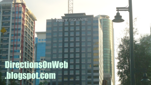
| Net Square | West Route | Net One | 3rd Bus Stop from EDSA |
| Nuffnang Philippines | East Route | Nutriasia | 2nd Bus Stop from EDSA by HM Bus |
| One Global Place | West Route | McKinley Parkway | 1st Bus Stop from EDSA |
| One McKinley Place | West Route | Net One | 3rd Bus Stop from EDSA |
| One Parkade | West Route | The Fort Bus Stop | 2nd Bus Stop from EDSA |
| One World Place | East Route | Nutriasia | 2nd Bus Stop from EDSA by HM Bus |
| Pacific Plaza Towers | West Route | McKinley Parkway | 1st Bus Stop from EDSA |
| Penhurst Park Place | West Route | Crescent Park West | 5th Bus Stop from EDSA |
| PGA Cars Audi | East Route | Nutriasia | 2nd Bus Stop from EDSA by HM Bus |
| Philam Life | West Route | RCBC | 2nd Bus Stop from EDSA |
| Picadilly Star | West Route | Net One | 3rd Bus Stop from EDSA |
| PNOC | East Route | University Parkway | 3rd Bus Stop from EDSA by HM Bus |
| PS Bank | West Route | Crescent Park West | 5th Bus Stop from EDSA |
| RCBC Corporate Tower | West Route | RCBC | 2nd Bus Stop from EDSA |
| Red Ribbon | West Route | BGC Stopover | 4th Bus Stop from EDSA |
| Regent Parkway | West Route | McKinley Parkway | 1st Bus Stop from EDSA |
| S&R | East Route | Globe Tower/HSBC | 1st Bus Stop from EDSA by HM Bus |
| Seattle's Best Coffee | East Route | Nutriasia | 2nd Bus Stop from EDSA by HM Bus |
| Seattle Best Coffee 4th Ave | West Route | Net One | 3rd Bus Stop from EDSA |
| Seda | East Route | Nutriasia | 2nd Bus Stop from EDSA by HM Bus |
| Seibu Tower | West Route | McKinley Parkway | 1st Bus Stop from EDSA |
| Serendra | East Route | Market Market Terminal | 4th Bus Stop from EDSA by HM Bus |
| Shangri-La at The Fort | West Route | BGC Stopover | 4th Bus Stop from EDSA |
| Shell Gasoline Station | West Route | Crescent Park West | 5th Bus Stop from EDSA |
| Slice | East Route | Nutriasia | 2nd Bus Stop from EDSA by HM Bus |
| SM Aura Premier | East Route | Market Market Terminal | 4th Bus Stop from EDSA by HM Bus |
| South of Market | East Route | Market Market Terminal | 4th Bus Stop from EDSA by HM Bus |
| Space 2000 | West Route | BGC Stopover | 4th Bus Stop from EDSA |
| St Luke Medical Center | West Route | BGC Stopover | 4th Bus Stop from EDSA |
| St Michael Parish | West Route | RCBC | 2nd Bus Stop from EDSA |
| Starbucks Coffee 32 Ave | West Route | BGC Stopover | 4th Bus Stop from EDSA |
| STI Academy | East Route | University Parkway | 3rd Bus Stop from EDSA by HM Bus |
| Sun Life Amphitheater | West Route | RCBC | 2nd Bus Stop from EDSA |
| Sun Life Centre | West Route | McKinley Parkway | 1st Bus Stop from EDSA |
| The Beaufort | West Route | McKinley Parkway | 1st Bus Stop from EDSA |
| The Beaufort Showroom | West Route | Net One | 3rd Bus Stop from EDSA |
| The Bellagio | West Route | Crescent Park West | 5th Bus Stop from EDSA |
| The Curve (U/C) | West Route | BGC Stopover | 4th Bus Stop from EDSA |
| The Fort | West Route | RCBC | 2nd Bus Stop from EDSA |
| The Fort Residences | West Route | Crescent Park West | 5th Bus Stop from EDSA |
| The Fort Strip | West Route | RCBC | 2nd Bus Stop from EDSA |
| The Grand Hamptons 1 & 2 | West Route | Crescent Park West | 5th Bus Stop from EDSA |
| The Luxe Residences | West Route | Net One | 3rd Bus Stop from EDSA |
| The Mind Museum | West Route | Net One | 3rd Bus Stop from EDSA |
| The Sapphire Residences | West Route | Crescent Park West | 5th Bus Stop from EDSA |
| The Spa Wellness | East Route | Nutriasia | 2nd Bus Stop from EDSA by HM Bus |
| Trade And Financial Tower | East Route | Globe Tower/HSBC | 1st Bus Stop from EDSA by HM Bus |
| Uptown Mall | West Route | RCBC | 2nd Bus Stop from EDSA |
| W City Center | East Route | Globe Tower/HSBC | 1st Bus Stop from EDSA by HM Bus |
| W Fifth Ave Bldg | East Route | Globe Tower/HSBC | 1st Bus Stop from EDSA by HM Bus |
| W Global Center | East Route | Nutriasia | 2nd Bus Stop from EDSA by HM Bus |
| W Office Building | East Route | Nutriasia | 2nd Bus Stop from EDSA by HM Bus |
How to get to the buildings located around BGC Bus Stops
Direction of BGC Bus West Route from BGC Bus Terminal in EDSA to West BGC
Important: Use TWO fingers to drag map from left to right to see the whole route. Pinch the map to zoom out. To zoom in, 'pinch-out' gesture. Tap each bus icon to get its name and to know which bus stop is available for boarding bus to return to EDSA.
How To Get To Buildings & Spots From A Bus Stop In West BGC
First Bus Stop From EDSA - McKinley Parkway

Location Map of buildings around McKinley Pkway Bus Stop. Click red pins for building names.
 |
| Gate of American Cemetery BGC |
 |
| Jeco Prime Bldg Bonifacio Global City |
 |
| Jeco Prime Fifth Avenue Place Essensa East of Forbes Regent Parkway |
 |
| Fairways Tower BGC |
 |
| One Global Place BGC |
 |
| Pacific Plaza Towers BGC |
 |
| Seibu Tower BGC |
 |
| Singapore Embassy BGC |
 |
| Sun Life Centre Bonifacio Global City |
Second Bus Stop From EDSA - RCBC aka The Fort Station
Next to RCBC toward 7th Ave is Icon Plaza. Located adjacent to the parking area by the bus stop is The Fort. The Maybank Performing Arts Theater is located at the corner of 26th Street and 9th Ave. From this bus stop, walk back along 26th St past 7th St and you will immediately see the signage of the arts theater on its facade, right hand side of 26th St. BGC Arts Center is the entire complex in which the Maybank Performing Arts Theater is founded. Sun Life Amphitheater - you would have seen it to your right after the bus turned left onto 7th Ave from 25th St. Sun Life Amphitheater is located at the same location of Maybank Performing Arts, only much nearer, so you'll pass by it on the way to Maybank Performing Arts. Where is BHS Amphitheater? If you're going to Bonifacio High Street Amphitheater and Central Square, walk to 5th Ave, turn right there and walk past the next intersection of 28th St. Turn right onto High Street for the Amphitheater. Central Square is the building to your left. If your destination is the
Location map around RCBC bus stop. Click each red pin to read the name.
 |
| The Fort at Bonifacio Global City |
 |
| NBC Tent Bonifacio Global City |
 |
| The Fort Strip |
Third Bus Stop From EDSA - Net One
How to commute to Forbes Town Center from EDSA? Alight from the BGC Bus at this bus stop. Walk across 3rd Ave toward McDonald's Forbes Town which is very visible from this bus stop. It's just a short walk away. McDonald's Forbes Town is exactly located at the corner of 26 St and Rizal Dr. Walk a little bit from the corner of 26th St and Rizal Dr along 26th St until you get to Forbestown Road which is already the Forbes Town Center. Forbestown Road also leads to the Burgos Circle.
Along Rizal Dr, next to McDonald's Forbes Town toward 28th St is Forbeswood Parklane, followed by Forbeswood Heights.
Entrances of Icon Residences and Avant The Fort are located at small roundabout at the end of 3rd Ave past Net One Center and One McKinley Place. See photos of these buildings below this map.
Location Map around NetOne Bus Stop. Click red pins to read building names.
 |
| Marajo Tower Bonifacio Global City |
 |
| Net One Center Global City |
 |
| Net Square BGC |
 |
| Picadilly Star BGC |
 |
| Forbes Town Center |
 |
| Forbeswood Heights |
 |
| Forbeswood Parklane |
 |
| The Luxe Residences BGC |
 |
| Toro Restaurant & Bar Global City |
 |
| Burgos Circle Bonifacio Global City |
 |
| Avant The Fort & Icon Residences |
 |
| One McKinley Place BGC |
Fourth Bus Stop From EDSA - Bonifacio Stopover
Bonifacio Stopover Bus Stop is located in front of the building of Bonifacio Stopover Pavilion, hence, the eponym. From Net One which is the third bus stop from EDSA, the bus takes the one way 3rd Ave all the way past The Mind Museum and then it will take the turnaround road to take Rizal Drive, which goes in the opposite direction. The bus will turn right immediately onto the first T-intersection which is 31st St cor Rizal Drive where Bonifacio Stopover Pavilion is situated. The bus stops right there in that station.
If your destination is any of the following: CATS Motors Inc's Mercedes Benz, St Luke Medical Center, Ford Global City, Korean Cultural Center, Mancor Corporate Center, Meguiar's VIP Auto Salon, Kia Motors Global City and Karport, walk back to Rizal Dr from bus stop. Walk along Rizal drive from Bonifacio Stopover Pavilion past the turnaround road that bus has taken. Cross the main intersection of Rizal Dr and 32nd St. CATS Mercedes Benz and St Luke Medical Center are located at opposite corners of 32nd St and Rizal Dr, respectively. You'll see them immediately. Ford Global is next to Mercedes Benz along Rizal Dr. Next to Mercedes Benz along 32nd St are: Korean Cultural Center, Mancor Corporate Center, Meguiar's VIP Auto Salon, Kia Motors Global City and Karport, in that order. Stand-alone restaurants of Chowking, Red Ribbon and Jollibee are located in that tip of Rizal Dr before the intersection of 32nd St.
Location Map of buildings around Bonifacio Stopover. Click red pins for building names.
Important: Please drag the map to all directions to see all pins of all buildings.
 |
| Net Cube |
 |
| Fort Legend Tower |
 |
| Net Quad Transnational Diversified Group (TDG) |
 |
| Fort Legend Tower McKinley Park Residences Net Cube |
 |
| Commerce Center BGC |
 |
| St Luke Medical Center BGC Taguig City |
Fifth Bus Stop From EDSA - Crescent Park West
As you can see in the map, the bus takes Rizal Drive from 3rd Ave via turaround lane. Then it turns right onto the next street perpendicular to Rizal Drive which is 31st St. The bus crosses 2nd Ave and turns left onto 1st Ave where the fifth Bus Stop from EDSA is located. Both Upper Route - rush hour and West Route - off-peak hour take the same direction.
Here are the buildings nearer to this bus stop:
If your destination is JP Morgan Chase which is located at Net Plaza bldg, walk back to 31st St, turn left onto 31st St and you will immediately see the building from afar, right side of 31st St. Bonifacio Technology Centre is just opposite 1st Ave along 31st St. It's the elongated building that stretches from the corner of 2nd Ave to the next building which is the Net Plaza itself.
The Grand Hamptons Tower 2 is just opposite the Bus Stop. It is located at the corner of 1st Ave and 31st St. Just cross the road to get there. Turn right onto 31st St to get to The Grand Hamptons Tower 1 which is next to The Grand Hamptons Tower 2 along 31st St. Cross 2nd Ave to ge to The Sapphire Residences which is at the corner of 2nd Ave and 31st St. Fort Palm Spring Condominium is next to The Grand Hamptons Tower 2 along 1st Ave. It is located at the corner of 30th St. Penhurst Park Place is at the other corner of 1st Ave and 30th St. Next to Penhurst Park Place along 1st Ave is Kensington Place. Still, along 1st Ave opposite Kensington Place is Bonifacio Ridge which is to the right of side of 1st Ave if you're walking from the Bus Stop which is also at the right side of 1st Ave. Turn left onto 30th St if you're going to Crescent Park Residences which is next to Penhurst Park Place. Blue Sapphire Residences is next to Fort Palm Spring Condominium. Blue Sapphire is at the left corner of 30th St and 2nd Ave. Lastly, cross 2nd Ave to get to Accralaw and The Fort Residences which are located at the left and right corners of 2nd Ave and 30th St, respectively.
Location map: Buildings near Crescent Park bus stop. Click red pins to get building names.
 |
| Bonifacio One Technology Tower |
 |
| Bonifacio Technology Center |
 |
| Net Plaza BGC |
 |
| The Grand Hamptons 1&2 BGC |
 |
| Bonifacio Ridge Bonifacio Global City |
 |
| The Sapphire Residences BGC |
Sixth Bus Stop From EDSA - Fort Victoria
Location Map of buildings around Fort Victoria Bus Stop. Click red pins for names.
Direction of HM Bus (East Route) from The Fort Bus Terminal in EDSA to Market Market
IMPORTANT: Please click each red bus icon to see bus stop name and if you can use it to return to EDSA. Not all bus stops are available for boarding a bus back to MRT Ayala Station/BGC Terminal EDSA.
Important: Please tap each red bus icon to see bus stop name and see if you can use it to return to EDSA. Not all bus stops are available for boarding a bus back to MRT Ayala/BGC EDSA Terminal.
How To Get To Buildings & Destinations From A Bus Stop Along East Route Of BGC Bus
The difference between BGC Bus East Route and HM Bus East Route aside from the roads they take from EDSA is that the former stops at McKinley Pkway Bus Stop before heading to The Fort Bus Stop which is the first Bus Stop of HM Bus. So, you must remember this: If the bus you take East Route is HM Bus, it will not pass by Mckinley Pkway. It's first Bus Stop from EDSA is The Fort. If the bus you take East Route is BGC Bus, it will stop in McKinley Pkway Bus Stop if there are passengers alighting there. And the second Bus Stop of BGC Bus is The Fort. Directions explain below is based on HM Bus routes and bus stops.
First Bus Stop From EDSA: 7TH Ave Globe Tower
Located along 7th Ave immediately after the bus turns right from 32nd St. This is where to get off the bus if your destination is Globe Tower which the bus has passed by at the corner of 32nd St and 7th Ave. Walk back to 32nd St, turn left to get to the entrance. W City Center is right at this bus stop, you will quickly see it. Because this bus stop is exactly located at the frontage of W City Center. The Trade and Financial Tower is located at the other corner of 32nd and 7th Ave. F1 City Center Hotel is next to Globe Tower.
Cross 32nd from the corner of 5th Ave to get to 32nd & Fifth which is very visible from the bus stop. Autostrade and LR Phils are next to 32nd & Fifth, exactly located at the corner of 32nd and 4th Ave. See map below.
Location Map of buildings around MC Bus Stop. Click red pins to read building names.
 |
| Autostrada Bonifacio Global City |
 |
| 32nd and Fifth Bonifacio Global City |
 |
| HSBC Centre Bonifacio Global City |
 |
| Trade And Financial Tower BGC |
 |
| F1 City Center Hotel BGC |
Second Bus Stop From EDSA: Nutriasia
Located along 30th St few meters before the main intersection of 9th Ave. Exactly at that corner of 9th Ave and 30th St is a under construction building. Opposite that building, located at the other corner or the opposite corner of 9th Ave and 30th St is W Global Center building. To get to Seda building, walk from bus stop, cross 9th Ave, walk further along 30th St until you see the building with the word "Seda" above it. It is located at the end tip of 30th St. If your destination is either ECO Tower or NAC Tower, here's what to do. From bus stop, walk forward to 9th Ave and turn left on 9th Ave. Walk along 9th Ave which is northward past 31st St until you get to the main intersection of 32nd St where the ECO Tower is situated. Turn left on 32nd St to get to NAC Tower which is next to ECO Tower.
If your destination is either One World Place or Citibank Plaza aka Citi Plaza, cross 32nd St. You must see by now the logo of Citi Plaza up ahead. To get to Citi Plaza, walk further along 9th Ave past Lane R and Lane S and turn right onto the next intersection which is 34th St, walk until you get to the exact location of the Citi Plaza. To get to One World Place, walk along 32nd St, turn right on 32nd St from 9th Ave after you cross 32nd. Walk further and you'll see the tall building in the middle of 9th Ave and 11th Ave.
From bus stop, walk to 9th Ave. Turn right onto 9th Ave. Walk along 9th Ave from 30th St to get to High Street. Nuffnang Philippines is along 9th Ave, at the corner of Lane P and 9th Ave in Bonifacio High Street. Agave is located at the same building where Nuffnang is. To get to Slice, walk past Agave until you get to the corner of High Street where Nike is located, turn right. Walk past Seattle's Best Coffee, IStudio, Nokia, The Stock Market, Geox, Runnr, Speedo and Starbucks Coffee. Walk across the road (7th Ave) towards C2 Building (visible from Starbucks) which is to your left. Slice is at the ground floor of C2 Building alongside Mango and Jamba Juice. For fast commute directions to different establishments in High Street, go to Commute Fast To Restaurants & Establishments In Bonifacio High Street. Dimension is to the left of 9th Ave in High Street. Brothers Burger is also located near 9th Ave. Walk past High Street and to your right is Bo Concept, then MOs Design and Active Fun Children's Play and Party Center to the right of 9th Ave corner of 28th St. Opposite Active Fun, to the left corner is Honda Cars Global City. Now walk along 28th St from Honda eastward and you will get to PGA Cars Audi, located at the corner of 28th and 11th Ave which is W Office Building. If your destination is MUJI or Fully Booked, then, from Nuffnang, walk inside Bonifacio High Street eastward until you get to 11th Ave where they are located opposite each other. GAP is at the same building of MUJI.
Buildings and spots near 30th Street Bus Stop. Click red pins to get their names. Note: Please move the map downward to see pins of Citibank Plaza, One World Place, Eco Tower, etc.
 |
| MUJI Bonifacio High Street |
 |
| Fully Booked Bonifacio High Street |
 |
| PGA Cars Audi at W Office Bldg in BGC |
 |
| Bonifacio High Street |
Third Bus Stop From EDSA: University Parkway
Located right before C-5 and Metro Market Market where terminal of jeepneys and FXs bound for different directions is located. The tall building of STI is just across 32nd St, situated at the corner of 32nd and 38th St. Kidzania Manila is located past STI building, walk past STI, turn right at that corner, 34th St, and the building next to open space at left is the Kidzania. The frontage is at the other street that bordered it, 11th Ave. From STI building cross 34th St and turn right onto the next street which is 11th Ave, immediately you will see the big signage of Kidzania at the right of 11th Ave, next to vacant space of 11th Ave cor 32nd St. Also visible even before the bus stops is Every Nation, located at the right corner of 32nd and 38 streets opposite STI. You just cross 32nd to get to them. Walk to the right of 38th Street from Every Nation to get to International School Manila which is next to Every Nation. Walk to the left of 38th St from STI to get to Energy Development Corporation and Department of Energy which are next to STI. PNOC is next. Then British School Manila followed by Manila Japanese School which you might find too far for a walk, so you might consider taking a taxi from Market Market. But you can actually ride a jeepney that passes through 38th St. The sign of the jeepney is "Guadalupe" and you can ride this jeep at the loading area along McKinley Pkwy between Market Market and Serendra. 38th St continues McKinley Pkway to the other side of 32nd St.
Location map of buildings around STI Bus Stop. Click red pins to read building names.
 |
| Metro Market Market BGC |
 |
| Every Nation Bonifacio Global City |
 |
| Energy Development Corporation BGC |
 |
| STI Academy Global City |
Fourth Bus Stop From EDSA: Market Market BGC Terminal
Located at the front of Market Market. The bus just gets around the mall and stops at its terminal located at 26th St. SM Aura Premier is located just across 26th St. To get there, use the pedestrian crossing nearby. See map below. Bonifacio Civic Center is the tall building attached to SM Aura. If you're destination is South of Market and Serendra, then walk along 26th Street westward. The tall twin tower building you see to the left up ahead is South of Market. Entrances of Serendra are situated along 11th Ave. Most of the passengers bound for Market Market and SM Aura alight at this Bus Terminal which also known as BGC Central.
 |
| Fiesta Market |
 |
| South of Market BGC |
 |
| Serendra |
Bonifacio Global City map


