
15 Feb 2012
Commute Guide To Buildings & Attractions Inside BGC From MRT Ayala Station
Even if you're from the farthest part of Metro Manila, going to a location inside the Bonifacio Global City is relatively easy. First, you need to get to the exact location of MRT Ayala Station. You can get there either by bus or by train. Second, go down to northbound lane of EDSA which is the lane "opposite" SM Makati. There's only one stair there. Get inside BGC Bus Terminal and buy ticket, depending on what BGC bus route passes your destination.
There are two routes the buses take in going to Bonifacio Global City from BGC Bus Terminal in EDSA:
BGC Bus Routes are:
| WEST ROUTE | EAST ROUTE |
|---|---|
The bus that plies this route is:
The bus loops through the west part of BGC and unloads/loads passengers at Bus Stops located along the route and goes back to its EDSA terminal. | Buses that ply this route:
The buses take passengers to buildings and places located within the east part of BGC and then the bus parks at its other terminal in Market Market parking ground. All passengers who haven't alighted in Bus Stops at which the bus had stopped earlier must alight at Market Market. |
| Buy ticket Get inside the terminal. Proceed to ticket seller window with signage that reads West. | Buy ticket Get inside the terminal. Proceed to ticket seller window with signage that reads East. |
How to get to BGC Bus Terminal in EDSA from different locations?
If you're in Glorietta or SM Makati, get across EDSA via MRT Ayala Station. If you're from any point along Ayala Avenue, take a "Washington-Ayala" jeepney to get to EDSA and use the pedestrian overpass to get to the BGC Bus Terminal. Some jeepneys cross EDSA, just ask driver. If you're riding a bus from north e.g. Caloocan, Cubao, Monumento, Fairview or Novaliches, alight at SM Makati and get across EDSA via MRT Station. If you're riding a bus from south e.g. Alabang, Sucat, Baclaran, NAIA, SM MOA or Pasay, alight at MRT Ayala Station. From any station of MRT-3, get off at Ayala Station. From any station of LRT-2, transfer at MRT-3 in Araneta Center Cubao Station. From a station of LRT-1, transfer to MRT-3 at Taft Station Important: The bus to ride in going to MRT Ayala Station/SM Makati must have a secondary sign that reads "Ayala Ibabaw."
Buildings & Destinations in BGC listed in Alphabetical order
But first, go see the Route Map of each bus. So that you get bird's eye view of how the buses get around their respective routes. After you examine the maps, just click the Back button to get back here. For West Route Map, click here. For East Route Map, click here.
For fast direction, just click the name of your building or place of destination. All buildings and spots are listed in alphabetical order. You will land to Bus Stop near it and with detailed map and walk guide from bus stop. Use Back button to return.
Important: You're using mobile now. To maximize help that this guide gives, please make sure to drag maps by touching a map with TWO fingers and move to desired direction. Pinch to zoom out. 'Pinch-out' gesture to zoom in.
Tip: Tap your thumb in each of red pins in the maps to show building names and quickly get directions.
| Destination | Bus Route | Bus Stop Name | Bus Stop Number |
|---|---|---|---|
| 32&Fifth | East Route | Globe Tower/HSBC | 1st Bus Stop from EDSA by HM Bus |
| Accralaw Tower | West Route | Crescent Park West | 5th Bus Stop from EDSA |
| Active Fun Children's Play & Party Centre | East Route | Nutriasia | 2nd Bus Stop from EDSA by HM Bus |
| Agave | East Route | Nutriasia | 2nd Bus Stop from EDSA by HM Bus |
| American Cemetery | West Route | McKinley Parkway | 1st Bus Stop from EDSA |
| Amphitheater of High Street | West Route | RCBC | 2nd Bus Stop from EDSA |
| Ascott BGC Manila | West Route | RCBC | 2nd Bus Stop from EDSA |
| Autohub | West Route | Net One | 3rd Bus Stop from EDSA |
| Autostrada | East Route | Globe Tower/HSBC | 1st Bus Stop from EDSA by HM Bus |
| Avant The Fort | West Route | Net One | 3rd Bus Stop from EDSA |
| Bench Tower | West Route | BGC Stopover | 4th Bus Stop from EDSA |
| BGC Arts Center | West Route | RCBC | 2nd Bus Stop from EDSA |
| Blue Sapphire Residences | West Route[ | Crescent Park West | 5th Bus Stop from EDSA |
| Bo Concept | East Route | Nutriasia | 2nd Bus Stop from EDSA by HM Bus |
| Bonifacio Civic Center | East Route | Market Market Terminal | 4th Bus Stop from EDSA by HM Bus |
| Bonifacio High Street | East Route | Nutriasia | 2nd Bus Stop from EDSA by HM Bus |
| Bonifacio One Technology Tower | West Route | BGC Stopover | 4th Bus Stop from EDSA |
| Bonifacio Ridge | West Route | Crescent Park West | 5th Bus Stop from EDSA |
| Bonifacio Stopover Center | West Route | BGC Stopover | 4th Bus Stop from EDSA |
| Bonifacio Stopover Pavilion | West Route | BGC Stopover | 4th Bus Stop from EDSA |
| Bonifacio Technology Center | West Route | Crescent Park West | 5th Bus Stop from EDSA |
| British School Manila | East Route | University Parkway | 3rd Bus Stop from EDSA by HM Bus |
| Brothers Burger | East Route | Nutriasia | 2nd Bus Stop from EDSA by HM Bus |
| Burgos Circle | West Route | Crescent Park West | 5th Bus Stop from EDSA |
| Central Square | West Route | RCBC | 2nd Bus Stop from EDSA |
| Citibank Plaza/Citi Plaza | East Route | Nutriasia | 2nd Bus Stop from EDSA by HM Bus |
| Commerce Center | West Route | BGC Stopover | 4th Bus Stop from EDSA |
| Crescent Park Residences | West Route | Crescent Park West | 5th Bus Stop from EDSA |
| Department of Energy | East Route | University Parkway | 3rd Bus Stop from EDSA by HM Bus |
| Dimension | East Route | Nutriasia | 2nd Bus Stop from EDSA by HM Bus |
| ECO Tower | East Route | Nutriasia | 2nd Bus Stop from EDSA by HM Bus |
| Embassy of Singapore | West Route | McKinley Parkway | 1st Bust Stop from EDSA |
| Energy Development Corp | East Route | University Parkway | 3rd Bus Stop from EDSA by HM Bus |
| Essensa East Forbes | West Route | McKinley Parkway | 1st Bus Stop from EDSA |
| Every Nation | East Route | University Parkway | 3rd Bus Stop from EDSA by HM Bus |
| F1 City Center Hotel | East Route | Globe Tower/HSBC | 1st Bus Stop from EDSA by HM Bus |
| Fairways Tower | West Route | McKinley Parkway | 1st Bus Stop from EDSA |
| Fiesta Market | East Route | Market Market Terminal | 4th Bus Stop from EDSA by HM Bus |
| Fifth Avenue Place | West Route | McKinley Parkway | 1st Bus Stop from EDSA |
| Forbes Town Center | West Route | Net One | 3rd Bus Stop from EDSA |
| Forbeswood Heights | West Route | Net One | 3rd Bus Stop from EDSA |
| Forbeswood Parklane | West Route | Net One | 3rd Bus Stop from EDSA |
| Ford Global City | West Route | BGC Stopover | 4th Bus Stop from EDSA |
| Fort Legend Tower | West Route | BGC Stopover | 4th Bus Stop from EDSA |
| Fort Palm Spring Condo | West Route | Crescent Park West | 5th Bus Stop from EDSA |
| Fort Victoria U/C | West Route | McKinley Parkway | 1st Bus Stop from EDSA |
| Forum South Global | West Route | RCBC | 2nd Bus Stop from EDSA |
| Fully Booked | East Route | Nutriasia | 2nd Bus Stop from EDSA by HM Bus |
| Furnitalia | West Route | BGC Stopover | 4th Bus Stop from EDSA |
| GAP High Street | East Route | Nutriasia | 2nd Bus Stop from EDSA by HM Bus |
| Globe Telecom Tower | East Route | Globe Tower/HSBC | 1st Bus Stop from EDSA by HM Bus |
| Honda Cars Global City | East Route | Nutriasia | 2nd Bus Stop from EDSA by HM Bus |
| HSBC Centre | East Route | Globe Tower/HSBC | 1st Bus Stop from EDSA by HM Bus |
| Hyundai Global City | West Route | Net One | 3rd Bus Stop from EDSA |
| Icon Plaza | West Route | RCBC | 2nd Bust Stop from EDSA |
| Icon Plaza Showroom | West Route | McKinley Parkway | 1st Bus Stop from EDSA |
| Icon Residences | West Route | Net One | 3rd Bus Stop from EDSA |
| International School Manila | East Route | University Parkway | 3rd Bus Stop from EDSA by HM Bus |
| Jeco Prime Building | West Route | McKinley Parkway | 1st Bus Stop from EDSA |
| Jollibee | West Route | BGC Stopover | 4th Bus Stop from EDSA |
| JP Morgan Chase | West Route | Crescent Park West | 5th Bus Stop from EDSA |
| Karport | West Route | BGC Stopover | 4th Bus Stop from EDSA |
| Kensington Place | West Route | Crescent Park West | 5th Bus Stop from EDSA |
| Kia Motors Global City | West Route | BGC Stopover | 4th Bus Stop from EDSA |
| Kidzania Manila | East Route | University Parkway | 3rd Bus Stop from EDSA by HM Bus |
| Korean Cultural Center | West Route | BGC Stopover | 4th Bus Stop from EDSA |
| LR Phils Motors | East Route | Globe Tower/HSBC | 1st Bus Stop from EDSA by HM Bus |
| Mancor Corporate Center | West Route | BGC Stopover | 4th Bus Stop from EDSA |
| Manila Japanese School | East Route | University Parkway | 3rd Bus Stop from EDSA by HM Bus |
| Marajo Tower | West Route | Net One | 3rd Bus Stop from EDSA |
| Market Market | East Route | Market Market Terminal | 4th Bus Stop from EDSA by HM Bus |
| Maybank Performing Arts Theater | West Route | RCBC | 2nd Bus Stop from EDSA |
| MC Home Depot | East Route | Globe Tower/HSBC | 1st Bus Stop from EDSA by HM Bus |
| McDonald's Burgos Circle | West Route | Net One | 3rd Bus Stop from EDSA |
| McKinley Park Residences | West Route | BGC Stopover | 4th Bus Stop from EDSA |
| Meguiar's VIP Auto Salon | West Route | BGC Stopover | 4th Bus Stop from EDSA |
| Metro Market Market | East Route | University Parkway | 3rd Bus Stop from EDSA by HM Bus |
| Mini Global City | West Route | RCBC | 2nd Bus Stop from EDSA |
| MOs Design | East Route | Nutriasia | 2nd Bus Stop from EDSA by HM Bus |
| MUJI High Street | East Route | Nutriasia | 2nd Bus Stop from EDSA by HM Bus |
| NAC Tower | East Route | Nutriasia | 2nd Bus Stop from EDSA by HM Bus |
| West Route | RCBC | 2nd Bus Stop from EDSA | |
| Net Cube | West Route | Net Cube | 4th Bus Stop from EDSA |
| Net Lima | West Route | The Fort Bus Stop | 2nd Bus Stop from EDSA |
| Net One Center | West Route | Net One | 3rd Bus Stop from EDSA |
| Net Park | West Route | RCBC | 2nd Bus Stop from EDSA |
| Net Plaza | West Route | Crescent Park West | 5th Bus Stop from EDSA |
| Net Quad | West Route | BGC Stopover | 4th Bus Stop from EDSA |
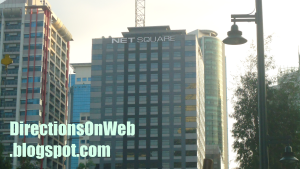
| Net Square | West Route | Net One | 3rd Bus Stop from EDSA |
| Nuffnang Philippines | East Route | Nutriasia | 2nd Bus Stop from EDSA by HM Bus |
| One Global Place | West Route | McKinley Parkway | 1st Bus Stop from EDSA |
| One McKinley Place | West Route | Net One | 3rd Bus Stop from EDSA |
| One Parkade | West Route | The Fort Bus Stop | 2nd Bus Stop from EDSA |
| One World Place | East Route | Nutriasia | 2nd Bus Stop from EDSA by HM Bus |
| Pacific Plaza Towers | West Route | McKinley Parkway | 1st Bus Stop from EDSA |
| Penhurst Park Place | West Route | Crescent Park West | 5th Bus Stop from EDSA |
| PGA Cars Audi | East Route | Nutriasia | 2nd Bus Stop from EDSA by HM Bus |
| Philam Life | West Route | RCBC | 2nd Bus Stop from EDSA |
| Picadilly Star | West Route | Net One | 3rd Bus Stop from EDSA |
| PNOC | East Route | University Parkway | 3rd Bus Stop from EDSA by HM Bus |
| PS Bank | West Route | Crescent Park West | 5th Bus Stop from EDSA |
| RCBC Corporate Tower | West Route | RCBC | 2nd Bus Stop from EDSA |
| Red Ribbon | West Route | BGC Stopover | 4th Bus Stop from EDSA |
| Regent Parkway | West Route | McKinley Parkway | 1st Bus Stop from EDSA |
| S&R | East Route | Globe Tower/HSBC | 1st Bus Stop from EDSA by HM Bus |
| Seattle's Best Coffee | East Route | Nutriasia | 2nd Bus Stop from EDSA by HM Bus |
| Seattle Best Coffee 4th Ave | West Route | Net One | 3rd Bus Stop from EDSA |
| Seda | East Route | Nutriasia | 2nd Bus Stop from EDSA by HM Bus |
| Seibu Tower | West Route | McKinley Parkway | 1st Bus Stop from EDSA |
| Serendra | East Route | Market Market Terminal | 4th Bus Stop from EDSA by HM Bus |
| Shangri-La at The Fort | West Route | BGC Stopover | 4th Bus Stop from EDSA |
| Shell Gasoline Station | West Route | Crescent Park West | 5th Bus Stop from EDSA |
| Slice | East Route | Nutriasia | 2nd Bus Stop from EDSA by HM Bus |
| SM Aura Premier | East Route | Market Market Terminal | 4th Bus Stop from EDSA by HM Bus |
| South of Market | East Route | Market Market Terminal | 4th Bus Stop from EDSA by HM Bus |
| Space 2000 | West Route | BGC Stopover | 4th Bus Stop from EDSA |
| St Luke Medical Center | West Route | BGC Stopover | 4th Bus Stop from EDSA |
| St Michael Parish | West Route | RCBC | 2nd Bus Stop from EDSA |
| Starbucks Coffee 32 Ave | West Route | BGC Stopover | 4th Bus Stop from EDSA |
| STI Academy | East Route | University Parkway | 3rd Bus Stop from EDSA by HM Bus |
| Sun Life Amphitheater | West Route | RCBC | 2nd Bus Stop from EDSA |
| Sun Life Centre | West Route | McKinley Parkway | 1st Bus Stop from EDSA |
| The Beaufort | West Route | McKinley Parkway | 1st Bus Stop from EDSA |
| The Beaufort Showroom | West Route | Net One | 3rd Bus Stop from EDSA |
| The Bellagio | West Route | Crescent Park West | 5th Bus Stop from EDSA |
| The Curve (U/C) | West Route | BGC Stopover | 4th Bus Stop from EDSA |
| The Fort | West Route | RCBC | 2nd Bus Stop from EDSA |
| The Fort Residences | West Route | Crescent Park West | 5th Bus Stop from EDSA |
| The Fort Strip | West Route | RCBC | 2nd Bus Stop from EDSA |
| The Grand Hamptons 1 & 2 | West Route | Crescent Park West | 5th Bus Stop from EDSA |
| The Luxe Residences | West Route | Net One | 3rd Bus Stop from EDSA |
| The Mind Museum | West Route | Net One | 3rd Bus Stop from EDSA |
| The Sapphire Residences | West Route | Crescent Park West | 5th Bus Stop from EDSA |
| The Spa Wellness | East Route | Nutriasia | 2nd Bus Stop from EDSA by HM Bus |
| Trade And Financial Tower | East Route | Globe Tower/HSBC | 1st Bus Stop from EDSA by HM Bus |
| Uptown Mall | West Route | RCBC | 2nd Bus Stop from EDSA |
| W City Center | East Route | Globe Tower/HSBC | 1st Bus Stop from EDSA by HM Bus |
| W Fifth Ave Bldg | East Route | Globe Tower/HSBC | 1st Bus Stop from EDSA by HM Bus |
| W Global Center | East Route | Nutriasia | 2nd Bus Stop from EDSA by HM Bus |
| W Office Building | East Route | Nutriasia | 2nd Bus Stop from EDSA by HM Bus |
How to get to the buildings located around BGC Bus Stops
Direction of BGC Bus West Route from BGC Bus Terminal in EDSA to West BGC
Important: Use TWO fingers to drag map from left to right to see the whole route. Pinch the map to zoom out. To zoom in, 'pinch-out' gesture. Tap each bus icon to get its name and to know which bus stop is available for boarding bus to return to EDSA.
How To Get To Buildings & Spots From A Bus Stop In West BGC
First Bus Stop From EDSA - McKinley Parkway

Location Map of buildings around McKinley Pkway Bus Stop. Click red pins for building names.
 |
| Gate of American Cemetery BGC |
 |
| Jeco Prime Bldg Bonifacio Global City |
 |
| Jeco Prime Fifth Avenue Place Essensa East of Forbes Regent Parkway |
 |
| Fairways Tower BGC |
 |
| One Global Place BGC |
 |
| Pacific Plaza Towers BGC |
 |
| Seibu Tower BGC |
 |
| Singapore Embassy BGC |
 |
| Sun Life Centre Bonifacio Global City |
Second Bus Stop From EDSA - RCBC aka The Fort Station
Next to RCBC toward 7th Ave is Icon Plaza. Located adjacent to the parking area by the bus stop is The Fort. The Maybank Performing Arts Theater is located at the corner of 26th Street and 9th Ave. From this bus stop, walk back along 26th St past 7th St and you will immediately see the signage of the arts theater on its facade, right hand side of 26th St. BGC Arts Center is the entire complex in which the Maybank Performing Arts Theater is founded. Sun Life Amphitheater - you would have seen it to your right after the bus turned left onto 7th Ave from 25th St. Sun Life Amphitheater is located at the same location of Maybank Performing Arts, only much nearer, so you'll pass by it on the way to Maybank Performing Arts. Where is BHS Amphitheater? If you're going to Bonifacio High Street Amphitheater and Central Square, walk to 5th Ave, turn right there and walk past the next intersection of 28th St. Turn right onto High Street for the Amphitheater. Central Square is the building to your left. If your destination is the
Location map around RCBC bus stop. Click each red pin to read the name.
 |
| The Fort at Bonifacio Global City |
 |
| NBC Tent Bonifacio Global City |
 |
| The Fort Strip |
Third Bus Stop From EDSA - Net One
How to commute to Forbes Town Center from EDSA? Alight from the BGC Bus at this bus stop. Walk across 3rd Ave toward McDonald's Forbes Town which is very visible from this bus stop. It's just a short walk away. McDonald's Forbes Town is exactly located at the corner of 26 St and Rizal Dr. Walk a little bit from the corner of 26th St and Rizal Dr along 26th St until you get to Forbestown Road which is already the Forbes Town Center. Forbestown Road also leads to the Burgos Circle.
Along Rizal Dr, next to McDonald's Forbes Town toward 28th St is Forbeswood Parklane, followed by Forbeswood Heights.
Entrances of Icon Residences and Avant The Fort are located at small roundabout at the end of 3rd Ave past Net One Center and One McKinley Place. See photos of these buildings below this map.
Location Map around NetOne Bus Stop. Click red pins to read building names.
 |
| Marajo Tower Bonifacio Global City |
 |
| Net One Center Global City |
 |
| Net Square BGC |
 |
| Picadilly Star BGC |
 |
| Forbes Town Center |
 |
| Forbeswood Heights |
 |
| Forbeswood Parklane |
 |
| The Luxe Residences BGC |
 |
| Toro Restaurant & Bar Global City |
 |
| Burgos Circle Bonifacio Global City |
 |
| Avant The Fort & Icon Residences |
 |
| One McKinley Place BGC |
Fourth Bus Stop From EDSA - Bonifacio Stopover
Bonifacio Stopover Bus Stop is located in front of the building of Bonifacio Stopover Pavilion, hence, the eponym. From Net One which is the third bus stop from EDSA, the bus takes the one way 3rd Ave all the way past The Mind Museum and then it will take the turnaround road to take Rizal Drive, which goes in the opposite direction. The bus will turn right immediately onto the first T-intersection which is 31st St cor Rizal Drive where Bonifacio Stopover Pavilion is situated. The bus stops right there in that station.
If your destination is any of the following: CATS Motors Inc's Mercedes Benz, St Luke Medical Center, Ford Global City, Korean Cultural Center, Mancor Corporate Center, Meguiar's VIP Auto Salon, Kia Motors Global City and Karport, walk back to Rizal Dr from bus stop. Walk along Rizal drive from Bonifacio Stopover Pavilion past the turnaround road that bus has taken. Cross the main intersection of Rizal Dr and 32nd St. CATS Mercedes Benz and St Luke Medical Center are located at opposite corners of 32nd St and Rizal Dr, respectively. You'll see them immediately. Ford Global is next to Mercedes Benz along Rizal Dr. Next to Mercedes Benz along 32nd St are: Korean Cultural Center, Mancor Corporate Center, Meguiar's VIP Auto Salon, Kia Motors Global City and Karport, in that order. Stand-alone restaurants of Chowking, Red Ribbon and Jollibee are located in that tip of Rizal Dr before the intersection of 32nd St.
Location Map of buildings around Bonifacio Stopover. Click red pins for building names.
Important: Please drag the map to all directions to see all pins of all buildings.
 |
| Net Cube |
 |
| Fort Legend Tower |
 |
| Net Quad Transnational Diversified Group (TDG) |
 |
| Fort Legend Tower McKinley Park Residences Net Cube |
 |
| Commerce Center BGC |
 |
| St Luke Medical Center BGC Taguig City |
Fifth Bus Stop From EDSA - Crescent Park West
As you can see in the map, the bus takes Rizal Drive from 3rd Ave via turaround lane. Then it turns right onto the next street perpendicular to Rizal Drive which is 31st St. The bus crosses 2nd Ave and turns left onto 1st Ave where the fifth Bus Stop from EDSA is located. Both Upper Route - rush hour and West Route - off-peak hour take the same direction.
Here are the buildings nearer to this bus stop:
If your destination is JP Morgan Chase which is located at Net Plaza bldg, walk back to 31st St, turn left onto 31st St and you will immediately see the building from afar, right side of 31st St. Bonifacio Technology Centre is just opposite 1st Ave along 31st St. It's the elongated building that stretches from the corner of 2nd Ave to the next building which is the Net Plaza itself.
The Grand Hamptons Tower 2 is just opposite the Bus Stop. It is located at the corner of 1st Ave and 31st St. Just cross the road to get there. Turn right onto 31st St to get to The Grand Hamptons Tower 1 which is next to The Grand Hamptons Tower 2 along 31st St. Cross 2nd Ave to ge to The Sapphire Residences which is at the corner of 2nd Ave and 31st St. Fort Palm Spring Condominium is next to The Grand Hamptons Tower 2 along 1st Ave. It is located at the corner of 30th St. Penhurst Park Place is at the other corner of 1st Ave and 30th St. Next to Penhurst Park Place along 1st Ave is Kensington Place. Still, along 1st Ave opposite Kensington Place is Bonifacio Ridge which is to the right of side of 1st Ave if you're walking from the Bus Stop which is also at the right side of 1st Ave. Turn left onto 30th St if you're going to Crescent Park Residences which is next to Penhurst Park Place. Blue Sapphire Residences is next to Fort Palm Spring Condominium. Blue Sapphire is at the left corner of 30th St and 2nd Ave. Lastly, cross 2nd Ave to get to Accralaw and The Fort Residences which are located at the left and right corners of 2nd Ave and 30th St, respectively.
Location map: Buildings near Crescent Park bus stop. Click red pins to get building names.
 |
| Bonifacio One Technology Tower |
 |
| Bonifacio Technology Center |
 |
| Net Plaza BGC |
 |
| The Grand Hamptons 1&2 BGC |
 |
| Bonifacio Ridge Bonifacio Global City |
 |
| The Sapphire Residences BGC |
Sixth Bus Stop From EDSA - Fort Victoria
Location Map of buildings around Fort Victoria Bus Stop. Click red pins for names.
Direction of HM Bus (East Route) from The Fort Bus Terminal in EDSA to Market Market
IMPORTANT: Please click each red bus icon to see bus stop name and if you can use it to return to EDSA. Not all bus stops are available for boarding a bus back to MRT Ayala Station/BGC Terminal EDSA.
Important: Please tap each red bus icon to see bus stop name and see if you can use it to return to EDSA. Not all bus stops are available for boarding a bus back to MRT Ayala/BGC EDSA Terminal.
How To Get To Buildings & Destinations From A Bus Stop Along East Route Of BGC Bus
The difference between BGC Bus East Route and HM Bus East Route aside from the roads they take from EDSA is that the former stops at McKinley Pkway Bus Stop before heading to The Fort Bus Stop which is the first Bus Stop of HM Bus. So, you must remember this: If the bus you take East Route is HM Bus, it will not pass by Mckinley Pkway. It's first Bus Stop from EDSA is The Fort. If the bus you take East Route is BGC Bus, it will stop in McKinley Pkway Bus Stop if there are passengers alighting there. And the second Bus Stop of BGC Bus is The Fort. Directions explain below is based on HM Bus routes and bus stops.
First Bus Stop From EDSA: 7TH Ave Globe Tower
Located along 7th Ave immediately after the bus turns right from 32nd St. This is where to get off the bus if your destination is Globe Tower which the bus has passed by at the corner of 32nd St and 7th Ave. Walk back to 32nd St, turn left to get to the entrance. W City Center is right at this bus stop, you will quickly see it. Because this bus stop is exactly located at the frontage of W City Center. The Trade and Financial Tower is located at the other corner of 32nd and 7th Ave. F1 City Center Hotel is next to Globe Tower.
Cross 32nd from the corner of 5th Ave to get to 32nd & Fifth which is very visible from the bus stop. Autostrade and LR Phils are next to 32nd & Fifth, exactly located at the corner of 32nd and 4th Ave. See map below.
Location Map of buildings around MC Bus Stop. Click red pins to read building names.
 |
| Autostrada Bonifacio Global City |
 |
| 32nd and Fifth Bonifacio Global City |
 |
| HSBC Centre Bonifacio Global City |
 |
| Trade And Financial Tower BGC |
 |
| F1 City Center Hotel BGC |
Second Bus Stop From EDSA: Nutriasia
Located along 30th St few meters before the main intersection of 9th Ave. Exactly at that corner of 9th Ave and 30th St is a under construction building. Opposite that building, located at the other corner or the opposite corner of 9th Ave and 30th St is W Global Center building. To get to Seda building, walk from bus stop, cross 9th Ave, walk further along 30th St until you see the building with the word "Seda" above it. It is located at the end tip of 30th St. If your destination is either ECO Tower or NAC Tower, here's what to do. From bus stop, walk forward to 9th Ave and turn left on 9th Ave. Walk along 9th Ave which is northward past 31st St until you get to the main intersection of 32nd St where the ECO Tower is situated. Turn left on 32nd St to get to NAC Tower which is next to ECO Tower.
If your destination is either One World Place or Citibank Plaza aka Citi Plaza, cross 32nd St. You must see by now the logo of Citi Plaza up ahead. To get to Citi Plaza, walk further along 9th Ave past Lane R and Lane S and turn right onto the next intersection which is 34th St, walk until you get to the exact location of the Citi Plaza. To get to One World Place, walk along 32nd St, turn right on 32nd St from 9th Ave after you cross 32nd. Walk further and you'll see the tall building in the middle of 9th Ave and 11th Ave.
From bus stop, walk to 9th Ave. Turn right onto 9th Ave. Walk along 9th Ave from 30th St to get to High Street. Nuffnang Philippines is along 9th Ave, at the corner of Lane P and 9th Ave in Bonifacio High Street. Agave is located at the same building where Nuffnang is. To get to Slice, walk past Agave until you get to the corner of High Street where Nike is located, turn right. Walk past Seattle's Best Coffee, IStudio, Nokia, The Stock Market, Geox, Runnr, Speedo and Starbucks Coffee. Walk across the road (7th Ave) towards C2 Building (visible from Starbucks) which is to your left. Slice is at the ground floor of C2 Building alongside Mango and Jamba Juice. For fast commute directions to different establishments in High Street, go to Commute Fast To Restaurants & Establishments In Bonifacio High Street. Dimension is to the left of 9th Ave in High Street. Brothers Burger is also located near 9th Ave. Walk past High Street and to your right is Bo Concept, then MOs Design and Active Fun Children's Play and Party Center to the right of 9th Ave corner of 28th St. Opposite Active Fun, to the left corner is Honda Cars Global City. Now walk along 28th St from Honda eastward and you will get to PGA Cars Audi, located at the corner of 28th and 11th Ave which is W Office Building. If your destination is MUJI or Fully Booked, then, from Nuffnang, walk inside Bonifacio High Street eastward until you get to 11th Ave where they are located opposite each other. GAP is at the same building of MUJI.
Buildings and spots near 30th Street Bus Stop. Click red pins to get their names. Note: Please move the map downward to see pins of Citibank Plaza, One World Place, Eco Tower, etc.
 |
| MUJI Bonifacio High Street |
 |
| Fully Booked Bonifacio High Street |
 |
| PGA Cars Audi at W Office Bldg in BGC |
 |
| Bonifacio High Street |
Third Bus Stop From EDSA: University Parkway
Located right before C-5 and Metro Market Market where terminal of jeepneys and FXs bound for different directions is located. The tall building of STI is just across 32nd St, situated at the corner of 32nd and 38th St. Kidzania Manila is located past STI building, walk past STI, turn right at that corner, 34th St, and the building next to open space at left is the Kidzania. The frontage is at the other street that bordered it, 11th Ave. From STI building cross 34th St and turn right onto the next street which is 11th Ave, immediately you will see the big signage of Kidzania at the right of 11th Ave, next to vacant space of 11th Ave cor 32nd St. Also visible even before the bus stops is Every Nation, located at the right corner of 32nd and 38 streets opposite STI. You just cross 32nd to get to them. Walk to the right of 38th Street from Every Nation to get to International School Manila which is next to Every Nation. Walk to the left of 38th St from STI to get to Energy Development Corporation and Department of Energy which are next to STI. PNOC is next. Then British School Manila followed by Manila Japanese School which you might find too far for a walk, so you might consider taking a taxi from Market Market. But you can actually ride a jeepney that passes through 38th St. The sign of the jeepney is "Guadalupe" and you can ride this jeep at the loading area along McKinley Pkwy between Market Market and Serendra. 38th St continues McKinley Pkway to the other side of 32nd St.
Location map of buildings around STI Bus Stop. Click red pins to read building names.
 |
| Metro Market Market BGC |
 |
| Every Nation Bonifacio Global City |
 |
| Energy Development Corporation BGC |
 |
| STI Academy Global City |
Fourth Bus Stop From EDSA: Market Market BGC Terminal
Located at the front of Market Market. The bus just gets around the mall and stops at its terminal located at 26th St. SM Aura Premier is located just across 26th St. To get there, use the pedestrian crossing nearby. See map below. Bonifacio Civic Center is the tall building attached to SM Aura. If you're destination is South of Market and Serendra, then walk along 26th Street westward. The tall twin tower building you see to the left up ahead is South of Market. Entrances of Serendra are situated along 11th Ave. Most of the passengers bound for Market Market and SM Aura alight at this Bus Terminal which also known as BGC Central.
 |
| Fiesta Market |
 |
| South of Market BGC |
 |
| Serendra |
Bonifacio Global City map


holy mother! kumpleto ah! kampay!
ReplyDeleteHello sir, thank you ha. Ilang araw din nasa draft yan bago ko na-published eh. Salamat sa pag-suri hehe.
ReplyDeletewOW THIS SHOULD BE MADE INTO A MINI HANDBOOK DIRECTIONS TO bgc
ReplyDeleteWow. I'm dumbfounded. This should be made to a Directions Guide to BGC Map booklet and provided to any local or foreign tourist. Calling the attention of INTELLECTUALLY savvy Taguig City Town managers---This is the perfect guide to YOUR TAX RICH CITY PROPERTY. I can't say enough but again kudos to the blogger for the detailed and meticulously crafted directional guide to BONIFACIO GLOBAL CITY.
Thank you so much, sir Amado. Your nice words inspire me to publish more directions in this level. Marami po salamat.
ReplyDeleteHoly Moly! Pwede ka nang gumawa ng book para may bayad!!!! Publish na yan, libre lang kasi sa blog eh. The scope is extensive. Ikaw na!
ReplyDeleteMagandang ideya. Pero wala akong knowledge sa ganyan e. Gusto mo ikaw ang mag-publish ng book then hati tyo sa royalty... Ganun ba yun? Hehe!
ReplyDeleteYay! Wala rin akong alam, pero wait, itweet ko siya at i-share sa mga twitter and Fb followers ko na mangilan-ngilan baka may publisher sa kanila. HAha.
ReplyDeleteHaha, sige raket tyo!
ReplyDeleteThis was indeed a breather for those planning to work or simply visit the place..Mind you I had to learn my directions the hard way last year plying to this unknown route. Since majority of the marathons have been organized @BGC being familiar with the directions is a must.. This would really be a handy dandy.
ReplyDeleteYou bet it's gonna be a big help for health conscious individuals who would come here for upcoming marathons the first time. Being on time is essential I think so that stress is eliminated and being familiar with how to get to the starting line would definitely add up to sense of preparedness. Thanks for your appreciation. :)
ReplyDeleteThanks a lot. I'm amazed how you perfectly laid out the directions. Really helpful!
ReplyDelete@ Pamcakessss. You are welcome. Maybe because I am passionate about it. I enjoy doing this :)
ReplyDeleteHi, from Manila Japanese School, is there a bus or a jeep that would take you directly to Net Quad inside BGC? or do you need to go to Market Market to ride the bus or get a taxi? TIA
ReplyDelete@ VanityOrNot Pre-order Shop. First, ride a jeepney bound for "Gate 3". Alight at Market Market The Fort Bus Terminal. Ride "The Fort Bus" and ask the driver to drop you off at "Net Cube" bus stop. Net Quad is the building at the back of Net Cube.
ReplyDeletethanks for this, we are offering bedspaces and this is a perfect 101 guide :-)
ReplyDelete@ jpeddler. Thanks for the positive feedback. Will be publishing more directions to BGC buildings and institutions from the other side of the city. Kindly watch for it. :)
ReplyDeletewhat route then, shall i take if i'm going to upper mckinley hill (the venice piazza) ?
ReplyDelete@ our group. Sir/Madam, can you please tell where you will be coming from? So that I ca give you accurate info. Are you driving?
ReplyDeleteThis is very very useful! Thank you so much! Now I'm more confident in commuting to my BGC destination!
ReplyDelete@ grace. You are welcome. You might like to "plus 1" me on Google+. I will be very thankful. Just click the Google Plus button below the title of this post. Thanks.
ReplyDeleteHelp,
ReplyDeleteHow to commute coming from Buendia going to the Fort? Is there a jeep on Buendia that goes to the Fort?
@ Moët♥. You did not specify the exact spot in Buendia, it's very long. So I will now assume you are near Taft of Buendia. From there take bus bound for Cubao with "Ayala" on its sign. You must alight at unloading area in Glorietta, then walk towards EDSA and cross to the other side. You can now go to The Fort Bus Terminal in EDSA and take the appropriate bus to get to The Fort. Please read my article above as I mentioned clearly the right Bus Stop to get off the bus which is adjacent to The Fort. Hope my directions helps you. Cheers.
ReplyDeleteThanks. I heard there's an Ayala-Fort jeep at the Osmena Hiway x Buendia intersection that passes over Kalayaan and passes by Market Market, is there such a thing?
ReplyDeleteAlso I was told there's an Ayala-Washington jeep that they say passes through Buendia then Ayala and will take you across EDSA to the Fort Bus terminal, is there such a thing, too?
@ Moët♥. Yes there are jeepneys from Buendia corner Washington that go across EDSA and some of them pass by The Fort Bus Terminal. Take note that these jeeps have "Ayala-Washington" wordings on their both sides. You can take one of these jeepneys as well if you are in that vicinity.
ReplyDeleteWith regards to your first question, I will go check it.
Hi I'm a bit lost :) I don't know which bus stop is closest to the Maybank Corporate Center. The address is 7th Avenue corner 30th Street, hope you can help me out.. thanks!
ReplyDeleteHi, hope you can help me out :) I don't know which bus stop is closest to Maybank Corporate Center, the address is 7th Ave corner 30th Street. Thanks!
ReplyDelete@ Lei Madarang. Hello, the nearest Bus Stop to your destination is either "High Street 30th St" or "32nd St MC Depot". From there walk towards the corner of 7th Ave and 30th St. Just follow the road signs and you will not get lost. Hope my direction helps you.
ReplyDeleteWhich bus stop is better to off? the 1st or the last. I'm going to The Beaufort. thanks
ReplyDelete@ Angelo Casiding. If you want to get there quickly, the first bus stop is better. Just walk a little bit along 5th Ave towards 23rd St which is the exact location of your destination. Hope this direction helps you.
ReplyDeleteThank You. Sure, It really help
ReplyDeleteHi, is there any jeepneys from mckinley pkway to stopover 31st street? my route is from Two world square mckinly hill to Jp morgan.. hope you could help me..
ReplyDelete@ lenny. You need two rides. There are jeepneys there bound for "Market Market", ride one of them. In Market Market, go to the terminal of The Fort Bus, and take any of the two buses, they both stop at "Stopover 31st St", from there Morgan is a short walk away. Hope this direction helps you :)
ReplyDeleteHi, this is really helpful but i'd just like to ask how i'd be able to go back to MRT ayala station from the korean cultural center? :)
ReplyDelete@ Ana Roces. Hello, Ana. Just walk back to the corner of Rizal Drive and cross towards the opposite corner where Jollibee is situated. Walk along Rizal Dr until you get to the corner of 31st St, there's a Chowking there. Turn right and you will see the nearest Fort Bus Stop which is "31st St Stop Over". Fall in line under the sign that reads "Ayala MRT" because the other queue is for Bus bound for "Market Market". That's the nearest bus stop you can take to get back to MRT Ayala Station. Hope my direction helps you.
ReplyDeleteThank you so much!! you've been so helpful t everybody :D
ReplyDelete@ Ana Roces. Hi, you are very much welcome :)
ReplyDeleteThank you very much for these very detailed directions! Super helpful. I've been using this to get to my meetings in BGC!
ReplyDelete@ Lady May Martinez. The pleasure is mine. I am glad that you find my blog helpful. Thanks for the compliment :)
ReplyDeleteThis is very useful and comprehensive. My question is, how do I get back to MRT Ayala from Bonifacio Global City? Last time I was there, I had to take two bus rides (which means double the fare)--I got off at Market Market then got on a BGC bus going to Ayala.
ReplyDelete@ Aviva. Hello po. I think you have ridden a wrong bus. If you are in either Net Cube Bus Stop or 31st St Bus Stop, please remember that two bus routes use them. One is the bus bound for Market Market and with sign that reads "BGC Central" or "Market Market". The other one is bound for MRT Ayala EDSA with sign that reads "WEST" or "McKinley Stopover" or "MRT Ayala". Please don't use 30th St High St Bus Stop as it only serves bus bound for Market Market. If you can give me your location, I will be very happy to assist you by giving you right direction to the nearest bus stop where you can ride a bus that goes directly to EDSA/MRT Ayala.
ReplyDeleteLet's say I'm in Muji High Street, how do I get back to MRT Ayala?
ReplyDelete@ Aviva. Walk towards 9th Ave. Turn left on 9th Ave. Turn right on 28th St. Wait for a bus at BGC Bus Stop located along 28th St between 9th Ave and 7th Ave. Make sure its headed to MRT Ayala by asking the driver. You can ride any of these buses: BGC Bus, HM Bus or Worthy Bus. Hope my direction helps you.
ReplyDelete24/7 ba operation ng mga bus dito? thanks
ReplyDelete@ Dave Cortiguerra. Hindi po, kung hindi ako nagkakamali hanggang 10pm lang. Wala po anuman.
ReplyDeleteHi Lag alag thank you so much for the directions. Can I ask you to do an update and give permission for me to use your materials on this topic on my site? I am willing to pay a fee.
ReplyDelete@ venturer. You don't need to pay. Just copy and paste this to your topic:
ReplyDelete< a href="http://directionsonweb.blogspot.com/2012/02/commute-guide-to-buildings-attractions.html" >Your own words here< /a >
NOTE: There is no space between < and a, no space between html" and >, no space between < and /a
I only added spaces between them on this reply because comments interpreted the codes in another way. I need to illustrate to you html coding to be used so I need to put the spaces. At your end, please don't use spaces otherwise errors will occur.
If you have more questions or help regarding this, just let me know. Thanks.
Another thing: This is much better because if I update this post which I must considering the changes in bus routes that I came to learn, you don't need to worry about updating your own topic. As you we are linked. This is the ethically acceptable way of using other articles from other authors. Thanks again.
Great blog! Very helpful for a first time commuter like me :) Could I also ask for some assistance? If I'm coming from Upper Mckinley Hill, I know there's a jeep that can bring me back to BGC, what Bus stop would you recommend I walk to/be dropped off at so I can ride the Bus going back to Ayala MRT? Appreciate your help! Thank you very much!
ReplyDelete@ kriskadph. Thanks for the appreciation. The best bus stop to alight from the jeepney that will be coming from Upper McKinley is the Market Market Terminal itself. It is located between Market Market mall and SM Aura. Ride the bus bound for EDSA Ayala there, just make sure to ask the driver if he is indeed headed to EDSA because there are two routes of buses there. Hope this direction helps you.
ReplyDeleteHi! do you know how to get there at 26th street global city (net one) coming from masinag, antipolo terminal? masinag-ayala route via c5. thanks
ReplyDelete@ Andhie Garcia. If you're riding "Masinag-Ayala via C-5" vehicle, alight at Market Market, ride a BGC bus with "Central" sign and alight at "Net One". It will be announced by the driver.
ReplyDeleteGaling! Salamat! Aprub to lalo na pag job hunting din. Keep it up! :)
ReplyDelete@ Tef. Salamat din sa iyong aprobal. Yes, I will.
ReplyDeleteHi! Can you help me? I would like to know the best route to take from 7th Avenue going back to Ayala MRT/Shell.
ReplyDelete@ Novembershowers. Just go to the nearest bus stop there, you won't miss it. Then take the bus with "West Route" sign. It's headed back to its terminal in EDSA/MRT-Ayala.
ReplyDeleteThank you!
ReplyDelete@ Novembershowers. You are welcome.
ReplyDeleteHi Lagalag,
ReplyDeleteWell this is an off-topic question but still it's within Taguig.
Do you know how to get to One World Square Bldg. in Upper McKinley Road from Eastwood Ave in Quezon City ( or within the C-5 area). Many thanks.
Hi...can you please advise which bus to take from Ayala and the nearest bus stop to get to W Tower on 39th Street
ReplyDelete@ SHENY. Jeepney to Cubao, MRT to Ayala, BGC bus to Market Market, "Gate 3" jeepney to your destination. Alternative: "Gate 3" jeepney from Guadalupe..
ReplyDelete@ C Garcia. Take an East Route BGC bus and alight at STI 32nd St bus stop, Walk back to McKinley Pkway street and take a jeepney bound for "Guadalupe" there. Ask driver to drop you off to 39th St.
ReplyDeleteHello Lag alag, I know this is too much to ask but I would like to know if what's the most convenient time & place for me to wait for the bus if I need to get to MRT Ayala at 8:00 in the morning, coming from 1st Ave Burgos Circle...and what route (i really don't know anything about sa bus eh hehe)
ReplyDelete@ Giovenna Bianca. You can use the bus stop located along 1st Ave near cor 31st St. The bus must be headed to MRT/EDSA.
ReplyDeletehow to get to picadilly star building? pag hindi rush hour. and how to go back to edsa ayala? thanks.
ReplyDelete@ Rose Ann Velasco. Take the West Route BGC bus, and alight at 3rd Ave Net One bus stop, walk from bus stop forward along 3rd Ave and turn right onto 27th St. Picadilly Star is situated at the corner of 27th St and 4th Ave
ReplyDeleteThanks for the swift response! Oh, another thing, how can i go back to Edsa-Ayala from Picadilly star building? Will I go back to Net One bus stop and wait for a west route sign? Sorry, just a first time commuter in bcg. Many thanks and God Bless!
ReplyDelete@ Rose Ann Velasco. Yes. Wait for the same bus (West Route) and on the same lane because the bus gets around the West part of BGC continuously until it reaches EDSA/McKinley terminal again.
ReplyDeleteHi! how do i commute back to Ayala/shell from net cube 1 bus stop? :-)
ReplyDeleteTake the same bus at the same bus stop. Just wait for the bus to arrive.
DeleteHi. I'm planning to go to Net Cube Center E-Square Crescent Park West from Cainta Rizal. I will be riding a UV Express with a sign of Ayala C-5. this goes in ortigas ext then C-5 then kalayaan ave. I would like to know where i could get off and ride a BGC bus going to Net Cube Center. I've never been to BGC. Thanks.
ReplyDeletemy travel would be around 8am-11am.
DeleteYou can alight at Kalayaan/32nd St, walk along 32nd all the way to 3rd Ave, make right, walk along 3rd Ave until you get to Net Cube (left side) or alight at Ayala terminal and take the BGC bus to Net Cube.
DeleteHi! I am from taft going to S&R. I was wondering if I could take the ayala bus from buendia and drop off at glorietta (i'm not sure if they drop off passengers there) to go to the bus station. Is this right? If so, how many hours would it take me considering my work starts at rush hours. Thanks!
ReplyDeleteYes, you can get off the bus at Glorietta and walk your way to BGC bus terminal via EDSA/Ayala pedestrian overpass. I can't give estimate as to how long it would take you to get to S&R.
DeleteHi! I really find this very comprehensive. Kudos to that! :) I understand that this guide is for people from EDSA going towards BGC. How about the other way around? Say, I'm at One Global Place, how can I reach say EDSA/MRT Ayala Station again? Thanks much! :D
ReplyDeleteThanks for appreciation. You only need to get back to the bus stop where you got off. Wait for a BGC bus with WEST ROUTE sign. It goes back to EDSA Terminal/MRT Ayala Station.
DeleteI can't seem to find how to get to TwentyFour Seven McKinley, 24th st. corner 7th ave., bgc?
ReplyDeleteAfter the bus turns left at 5th Ave, get off as it stops there, walk forward to the next corner (Rizal Dr). Immediately next to it is 24th Ave. Turn right on 24th Ave, walk past 6th Ave and the next corner of course is 7th Ave where Twenty-Four Seven McKinley is situated (left hand side.)
DeleteMay I have a permission to post This Site! Hi I'am Christine from Berkwil Construction Inc. I'm here to propose about The Berkwil Construction Inc. In Berkwil Construction Inc. We have a Contractor , Interior Designer, Construction Service & Supply.
ReplyDeleteJust visit our website www.facebook.com/Berkwilconstruction
or contact us 455-16-21
I hope you are interested Thank you.
Hi Sir! How can I get to 38th North (Everest Academy Manila) from Alabang? Thank you in advance.
ReplyDeleteComplete address is needed, thanks.
DeleteVery informative. Thank you!
ReplyDeleteThank you as well.
DeleteHi I would like to ask if this is still updated? or it does not need any update because BGC commute route did not change?
ReplyDeleteThis is regularly updated. Last update - 22 June 17. To see all updates done, please go to our Updates page. Thank you.
DeleteHello sir ask ko lng kung tama papuntang Fort Legend Tower 3rd Avenue taguig . galing ako ng alabang sasakay ako pa ayala tapos ppunta ako bgc bus tapos sa west route ako sasakay tama ba? Tsaka saan ako sasakay pabalik thank you po dpo kasi mgaling sa directiins hehe
ReplyDeleteWait for the same BGC bus at the same bus stop you would have alighted. Make sure you have ticket. There's ticket seller in the area.
DeleteGood day po..panu po papuntang Wells Fargo coming from bgc bus sa ayala..thanks po
ReplyDeletePanu din po pag punta sa JP Morgan Chase coming from bgc bus terminal sa ayala po..many thanks:)
ReplyDeleteAnong bldg ang punta mo maam?2 yun e
DeleteDirection to JP Morgan Chase is clearly written in the post.
DeletePerfect! Good job
ReplyDeleteThanks.
DeleteHi! Sorry I don't know where to post this question. I'm planning to got to Five E-Com Center in MOA complex by commute. However, I'm not familiar with the area. I'm coming from Alabang. Wish you could help me on this one. TIA!
ReplyDeleteWe have separate post on how to get to MOA.
DeleteHmm... I do not see "Venice Grand Canal Mall" in the list... :/
ReplyDeleteI keep on updating this guide. Last update - June 22, '17. I will try to include that spot on next update.
DeleteWow! thank you for this guide. I want to see the updated list -Ayala Properties
ReplyDelete