
30 Apr 2012
Driving Directions To NAIA Terminal 1
UPDATE: Driving directions to NAIA-1 from different locations has changed for the better via new Airport Expressway. For fast route from your location to Terminal 1, read our new post, go to Drive Directions to NAIA-1-2-3 Via NAIA Expressway. Update date: 2 Sep 16
NAIA Terminal 1 is simply known as NAIA. By car, it's relatively easy to get to the main terminal of our premier airport which also serves as the gateway to our country. The driving directions to NAIA are the same as the ones bound for NAIA 2. You only just need to turn right onto Ninoy Aquino Ave aka Imelda Ave from NAIA Road instead of crossing Ninoy Aquino Ave which will take you to NAIA 2. Please look at the map below and see NAIA 2 direction (blue arrow) in relation to direction to NAIA (red arrow), then read the directions below the map.
Once you're traversing NAIA Rd either from Domestic Rd or Roxas Blvd and Macapagal Blvd, just stay to the right lane and drive under road signs that read "NAIA 1 Paranaque". That lane will turn right onto Ninoy Aquino Ave and will take you to the ramp that goes to NAIA 1. Once inside NAIA 1 complex, just follow either "Departure" or "Arrival" sign depending on where you're actually going.
Route #1
Via NLEX, A. Bonifacio Ave and Roxas Blvd from Malolos, Bulacan, Subic, Clark, Tarlac, SCTEX, Pampanga, Olongapo and other areas of North Luzon.
Take NLEX and cross EDSA below EDSA Balintawak/Cloverleaf Bridge to traverse A. Bonifacio Ave. Drive all the way to the other end of Bonifacio and turn right onto Blumentritt, left on Aurora Blvd then right onto Dimasalang. Cross Lacson and take Laong Laan all the way to the wide Alfonso Mendoza (Quezon Blvd). Turn left on Alfonzo Mendoza. Drive to the middle and take Quezon Underpass to get to Quiapo. Cross Pasig River via Quezon Bridge and drive to the middle, avoid Lagusnilad Underpass by driving to the right of Padre Burgos after Lawton area. Cross four intersections with traffic lights - first in Manila City Hall, second is Finance Road, third is Juan Luna and fourth is Palacio St. Turn left on Roxas Blvd and drive all the way to NAIA Road. Follow directions in Route #2 of Driving Directions To NAIA Terminal 2, click here. Just remember, drive under road signs of "NAIA-1 Paranaque" instead of road signs of "NAIA-2".

Route #2
Via SLEX aka Osmena Highway or Skyway from Alabang, Muntinlupa, Sucat, Sta Rosa, and places in Laguna, Batangas, Tagaytay, Quezon and some parts of Cavite nearer to Sta Rosa which form the CALABARZON.
Exit SLEX via Sucat Exit. Cross SLEX via bridge above Osmena Highway that becomes Sucat Road aka Dr A. Santos Ave. Stay to this road without any turn, passing under C-5 Extension Flyover which is situated past SM City Sucat. Road name becomes Ninoy Aquino Ave. Watch for Duty Free Philippines Fiesta Mall to your right. After passing by Duty Free complex, take the lane going to NAIA-1.
Route #3
Via southbound lane of Osmena Highway aka SLEX or the Skyway above it from Nagtahan, Ramon Magsaysay Blvd, N. Domingo, Paco, San Andres Bukid and other areas nearby.
Follow directions in Route #2 of Driving Directions To NAIA Terminal 2, click here. After turning left from Domestic Road to NAIA Road, change lane and choose the one under the road sign that reads "NAIA 1 Paranaque". It will take you directly to the ramp of Ninoy Aquino International Airport. Once inside NAIA complex, follow direction to either "Departure" or "Arrival".
Route #4
Via EDSA's southbound lane from Ayala Center, Rockwell Center, A Venue, Century City, Greenfield District, Pioneer Boni in Mandaluyong, Ortigas Center, Greenhills, EDSA Shaw, Megamall, Shangri-La Plaza, POEA and other places nearby.
Drive all the way to Pasay past Magallanes MRT Station and Magallanes Bridge. Up ahead a left turning flyover with "NAIA" sign appears. Take that flyover that goes down to Aurora Blvd formerly Tramo. Drive all the way to its other end and turn right onto Airport Road. Turn left on Domestic Road, drive all the way to the other end and make left. After turning left from Domestic Road to NAIA Road, change lane and choose the one under the road sign that reads "NAIA 1 Paranaque". It will take you directly to the ramp of Ninoy Aquino International Airport. Once inside NAIA complex, follow direction to either "Departure" or "Arrival".
Route #5
Via Skyway's northbound lane and Andrews Ave taking NAIA-3 Exit from Alabang, Festival Mall, Muntinlupa, Metropolis Starmall, Sta Rosa, Laguna, Batangas, Tagaytay and other towns and places nearby. This is driving directions from NAIA-3 and Resorts World Manila Newport City to NAIA-1.
Traversing Skyway, drive all the way past Bicutan exit. Next to Bicutan Exit is NAIA-3 Exit. Change lane to the right. From the distance, after Bicutan Exit, you will see another flyover crossing above the skyway. It's the NAIA-3 Exit running from your lane. Take the lane going to NAIA-3 Exit. The ramp goes down to Andrews Ave, the road between Resorts World Manila and NAIA-3. Drive all the way past the gigantic sculpture which looks like an skeletal giant egg. Andrews Ave becomes Airport Road past Aurora Blvd, an intersection to the right. Turn left on Domestic Road and drive all the way to the other end which is in NAIA Road. Turn left on NAIA Rd and immediately drive on the lane below road sign that reads "NAIA 1 Paranaque". It will take you directly to the ramp of Ninoy Aquino International Airport. Once inside NAIA complex, follow direction to either "Departure" or "Arrival".
Route #6
Via Lawton Ave from Bonifacio Global City aka BGC and Global City.
Take Lawton Ave all the way from BGC (Bonifacio Global City) and cross Osmena Highway aka South Super Highway via Sales Bridge. Continue onto Sales Road, the main road that continues Sales Bridge. Drive all the way until Sales Road turns right and becomes Andrews Ave. Drive all the way past NAIA Terminal 3 (located to the left of Andrew Ave). Follow traffic direction that takesCirculo del Mundo Rotunda Andrews Ave roundabout, the rotunda past NAIA-3 frontage. If your destination is NAIA Terminal 3, you must take this roundabout past the extension of Andrews Ave and then take the dedicated lane that goes to NAIA-3. Just follow road signs there. To continue to Terminal 1 or Terminal 2, take take the extension of Andrews Ave which you get to see immediately up ahead while traversing the roundabout. Drive all the way past Aurora Blvd (the main intersection perpendicular to the right of Andrews Ave). Road name becomes Airport Road. Next intersection is Domestic Road (this one is perpendicular to the left of Airport Rd). Turn left onto Domestic Road. Drive all the way past Manila Domestic Airport (Terminal 4). Turn left onto NAIA Road where Domestic Road ends. In NAIA Rd, there are road signs that read either "NAIA Terminal 2" or "NAIA Terminal 1". You will immediately see the signs. If your destination is Terminal 2, drive under the sign "Terminal 2". Now since your destination is Terminal 1, drive under those road signs that read "NAIA Terminal 1" as the lane turns right onto Ninoy Aquino Ave aka Imelda Ave. Now follow the dedicated lane to Ninoy Aquino International Airport and take the lane under "Departure" sign or "Arrival", depending on your situation.
Read more...
NAIA Terminal 1 is simply known as NAIA. By car, it's relatively easy to get to the main terminal of our premier airport which also serves as the gateway to our country. The driving directions to NAIA are the same as the ones bound for NAIA 2. You only just need to turn right onto Ninoy Aquino Ave aka Imelda Ave from NAIA Road instead of crossing Ninoy Aquino Ave which will take you to NAIA 2. Please look at the map below and see NAIA 2 direction (blue arrow) in relation to direction to NAIA (red arrow), then read the directions below the map.
You're on mobile. Drag and zoom out the map. Just tap your finger inside the map and 1) to drag, just move to left, right, up, down, etc; 2) to zoom out, pinch in; and to zoom in, pinch out.
Location and direction map of NAIA Terminal 1Once you're traversing NAIA Rd either from Domestic Rd or Roxas Blvd and Macapagal Blvd, just stay to the right lane and drive under road signs that read "NAIA 1 Paranaque". That lane will turn right onto Ninoy Aquino Ave and will take you to the ramp that goes to NAIA 1. Once inside NAIA 1 complex, just follow either "Departure" or "Arrival" sign depending on where you're actually going.
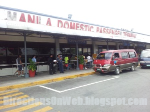
How To Get To NAIA-1 By Car
 |
| You must drive under NAIA-1 road sign |
Via NLEX, A. Bonifacio Ave and Roxas Blvd from Malolos, Bulacan, Subic, Clark, Tarlac, SCTEX, Pampanga, Olongapo and other areas of North Luzon.
Take NLEX and cross EDSA below EDSA Balintawak/Cloverleaf Bridge to traverse A. Bonifacio Ave. Drive all the way to the other end of Bonifacio and turn right onto Blumentritt, left on Aurora Blvd then right onto Dimasalang. Cross Lacson and take Laong Laan all the way to the wide Alfonso Mendoza (Quezon Blvd). Turn left on Alfonzo Mendoza. Drive to the middle and take Quezon Underpass to get to Quiapo. Cross Pasig River via Quezon Bridge and drive to the middle, avoid Lagusnilad Underpass by driving to the right of Padre Burgos after Lawton area. Cross four intersections with traffic lights - first in Manila City Hall, second is Finance Road, third is Juan Luna and fourth is Palacio St. Turn left on Roxas Blvd and drive all the way to NAIA Road. Follow directions in Route #2 of Driving Directions To NAIA Terminal 2, click here. Just remember, drive under road signs of "NAIA-1 Paranaque" instead of road signs of "NAIA-2".
Route #2
Via SLEX aka Osmena Highway or Skyway from Alabang, Muntinlupa, Sucat, Sta Rosa, and places in Laguna, Batangas, Tagaytay, Quezon and some parts of Cavite nearer to Sta Rosa which form the CALABARZON.
Exit SLEX via Sucat Exit. Cross SLEX via bridge above Osmena Highway that becomes Sucat Road aka Dr A. Santos Ave. Stay to this road without any turn, passing under C-5 Extension Flyover which is situated past SM City Sucat. Road name becomes Ninoy Aquino Ave. Watch for Duty Free Philippines Fiesta Mall to your right. After passing by Duty Free complex, take the lane going to NAIA-1.
Route #3
Via southbound lane of Osmena Highway aka SLEX or the Skyway above it from Nagtahan, Ramon Magsaysay Blvd, N. Domingo, Paco, San Andres Bukid and other areas nearby.
Follow directions in Route #2 of Driving Directions To NAIA Terminal 2, click here. After turning left from Domestic Road to NAIA Road, change lane and choose the one under the road sign that reads "NAIA 1 Paranaque". It will take you directly to the ramp of Ninoy Aquino International Airport. Once inside NAIA complex, follow direction to either "Departure" or "Arrival".
Route #4
Via EDSA's southbound lane from Ayala Center, Rockwell Center, A Venue, Century City, Greenfield District, Pioneer Boni in Mandaluyong, Ortigas Center, Greenhills, EDSA Shaw, Megamall, Shangri-La Plaza, POEA and other places nearby.
Drive all the way to Pasay past Magallanes MRT Station and Magallanes Bridge. Up ahead a left turning flyover with "NAIA" sign appears. Take that flyover that goes down to Aurora Blvd formerly Tramo. Drive all the way to its other end and turn right onto Airport Road. Turn left on Domestic Road, drive all the way to the other end and make left. After turning left from Domestic Road to NAIA Road, change lane and choose the one under the road sign that reads "NAIA 1 Paranaque". It will take you directly to the ramp of Ninoy Aquino International Airport. Once inside NAIA complex, follow direction to either "Departure" or "Arrival".
Route #5
Via Skyway's northbound lane and Andrews Ave taking NAIA-3 Exit from Alabang, Festival Mall, Muntinlupa, Metropolis Starmall, Sta Rosa, Laguna, Batangas, Tagaytay and other towns and places nearby. This is driving directions from NAIA-3 and Resorts World Manila Newport City to NAIA-1.
Traversing Skyway, drive all the way past Bicutan exit. Next to Bicutan Exit is NAIA-3 Exit. Change lane to the right. From the distance, after Bicutan Exit, you will see another flyover crossing above the skyway. It's the NAIA-3 Exit running from your lane. Take the lane going to NAIA-3 Exit. The ramp goes down to Andrews Ave, the road between Resorts World Manila and NAIA-3. Drive all the way past the gigantic sculpture which looks like an skeletal giant egg. Andrews Ave becomes Airport Road past Aurora Blvd, an intersection to the right. Turn left on Domestic Road and drive all the way to the other end which is in NAIA Road. Turn left on NAIA Rd and immediately drive on the lane below road sign that reads "NAIA 1 Paranaque". It will take you directly to the ramp of Ninoy Aquino International Airport. Once inside NAIA complex, follow direction to either "Departure" or "Arrival".
Route #6
Via Lawton Ave from Bonifacio Global City aka BGC and Global City.
Take Lawton Ave all the way from BGC (Bonifacio Global City) and cross Osmena Highway aka South Super Highway via Sales Bridge. Continue onto Sales Road, the main road that continues Sales Bridge. Drive all the way until Sales Road turns right and becomes Andrews Ave. Drive all the way past NAIA Terminal 3 (located to the left of Andrew Ave). Follow traffic direction that takes
Driving Directions To SM City North EDSA
As you can see in the map below, SM City North EDSA is situated at the north end of West Ave, south end of North Avenue and along EDSA's northbound lane. Based on these facts, you can get to to SM City North EDSA by:
One - take West Ave from Quezon Ave.
Two - take North Ave's westbound lane from Quezon Memorial Circle or Elliptical Road.
Three - take EDSA's southbound lane from Balintawak, Monumento and Roosevelt-Munoz.
Four - take EDSA's northbound lane from Cubao, Makati, Mandaluyong and Pasay.
Parking
Entrance to Parking is situated in the following:
EDSA - Annex Building which is the north end of the SM City North EDSA complex. From EDSA northbound lane, drive straight, all the way past North Ave, change lane to the right and take the driveway past Buses' Terminal.
North Ave - Carpark Buidling and Open Parking. From EDSA northbound turn right onto North Ave, change lane to the left and turn left to SM complex, follow directions to parking. Taking North Ave, turn right onto the driveway to SM North which is after Mindanao Ave.
Vicinity Map of SM City North EDSA showing road directions from different locations.
Route #1
Via NLEX and Mindanao Exit rom Malolos, Bulacan, Pampanga, Valenzuela, Olongapo, Subic, SCTEX, Clark, Tarlac and other nearby areas.
Take the Mindanao Exit from NLEX. Traverse Mindanao Ave all the way passing through Quirino Highway-Mindanao Ave Underpass and crossing Congressional Ave (main intersection with traffic lights) and then turn right onto North Ave (main intersection with traffic lights). See map above for more clear direction. There's a McDonald's branch at the corner of North Ave. Read "Parking" above.
Route #2
Via SLEX (Osmena Highway) and C-5 from Alabang, Sucat, Muntinlupa, Taguig, Paranaque, Sta Rosa, Tagaytay and other areas in the vicinity and southern Tagalog provinces of CALABARZON.
Take the Exit to C-5. Drive all the way on C-5 past Bonifacio Global City, Tiendesitas and Eastwood City. Stay under the road sign that reads NLEX. After Eastwood, you will pass through a flyover and then Katipunan Tunnel. Take Aurora flyover. Katipunan becomes Tandang Sora past Manila Water that you get to see to the right. Road narrows and then you will be approaching the widest road in the Philippines called Commonwealth Ave where Tandang Sora Flyover runs above it. Turn left on Commonwealth below the flyover and drive all the way to its end which is in Quezon Memorial Circle. Turn right onto Elliptical Road which encircles QMC. Drive past Visayas Ave, a main road perpendicular to the right then change lane to the rightmost and turn right onto North Ave. That's it, traverse North Ave, cross Mindanao and take the driveway which leads to parking areas. Read "Parking" above.
Route #3
Via Quezon Ave from Espana, UST, Lerma, Morayta aka Nicanor Reyes, Quiapo, Recto, Sto Domingo Church, Welcome Rotunda, Lacson, Nagtahan and areas nearby.
Take Espana and Quezon Ave lane bound for Quezon Memorial Circle. After taking Araneta-Quezon Ave Underpass (under construction click here for alternate routes), stay to the middle lane and drive past Roces Ave, the road where big Sogo Hotel is situated. After passing by a Y-intersection to the right which is Timog Ave, change lane to the left and make a U-Turn and then make a sharp right-turn onto West Ave. Drive all the way to EDSA where you must turn right but immediately make a U-Turn on the first U-Turn Slot. That's it, you're in SM City EDSA vicinity. Make your choice on where to park - Annex Bldg or Carpark Bldg located at the back of SM City North main building. Read "Parking" above.
Route #4
Via EDSA's northbound lane from Makati, Pasay, Baclaran, Mandaluyong, MOA, Ortigas Center, Mega Mall, Shangri-La Plaza, EDSA Shaw and other areas along the route.
Traverse EDSA, stay to the middle and drive under road signs of Monumento passing through all flyovers, tunnels and underpasses. Next to Quezon Ave-EDSA flyover is North Ave where SM City North EDSA is located at the other corner. See map above. Follow directions to parking entrance. Read "Parking" above.
Route #5
Via EDSA's southbound lane from Monumento, Balintawak, Roosevelt, Munoz and areas nearby.
Stay to the middle lane of EDSA until you see the huge complex of SM City North EDSA to your left. Make a U-turn at the first U-Turn slot after the busy West Ave which runs to the right of EDSA. Head to parking areas. Read "Parking" above.
Route #6
From Blumentritt, Chinese Medical Center, Retiro and other areas nearby areas.
Take A. Bonifacio Ave northbound and then turn right onto EDSA. Drive all the way to North Ave and make a U-Turn. Read "Parking" above.
Route #7
Via C-5 from Bonifacio Global City, Tiendesitas and Eastwood City.
Take C-5 northbound. After Eastwood, you will pass through a flyover and then Katipunan Tunnel. Take Aurora flyover. Katipunan becomes Tandang Sora past Manila Water that you get to see to the right. Road narrows and then you will be approaching the widest road in the Philippines called Commonwealth Ave where Tandang Sora Flyover runs above it. Turn left on Commonwealth below the flyover and drive all the way to its end which is in Quezon Memorial Circle. Turn right onto Elliptical Road which encircles QMC. Drive past Visayas Ave, a main road perpendicular to the right then change lane to the rightmost and turn right onto North Ave. That's it, traverse North Ave, cross Mindanao and take the driveway which leads to parking areas. Read "Parking" above.
Route #8
Via Ortigas Ave from Tiendesitas, Eastwood City, Ortigas Center, Mega Mall, Robinson's Galleria and other areas nearby.
From Eastwood, take C-5 northbound and avoid the Katipunan Tunnel to take Bonny Serrano Ave. Cross EDSA and drive all the way to Ortigas Ave. Make right. From Tiendesitas and Robinson's Galleria, take Ortigas Ave lane bound for EDSA. Cross EDSA. From Mega Mall and Origas Center, take Julia Vargas and turn right onto EDSA. Drive to the left and take the flyover that turns left to Ortigas Ave. Drive all the way past Greenhills Shopping Center. Follow directions given in How To Get To SM City North EDSA From Greenhills, click here.
Read more...
One - take West Ave from Quezon Ave.
Two - take North Ave's westbound lane from Quezon Memorial Circle or Elliptical Road.
Three - take EDSA's southbound lane from Balintawak, Monumento and Roosevelt-Munoz.
Four - take EDSA's northbound lane from Cubao, Makati, Mandaluyong and Pasay.
Parking
Entrance to Parking is situated in the following:
EDSA - Annex Building which is the north end of the SM City North EDSA complex. From EDSA northbound lane, drive straight, all the way past North Ave, change lane to the right and take the driveway past Buses' Terminal.
North Ave - Carpark Buidling and Open Parking. From EDSA northbound turn right onto North Ave, change lane to the left and turn left to SM complex, follow directions to parking. Taking North Ave, turn right onto the driveway to SM North which is after Mindanao Ave.
Vicinity Map of SM City North EDSA showing road directions from different locations.
How To Get To SM City North EDSA From Different Directions
 |
| SM City North EDSA |
Via NLEX and Mindanao Exit rom Malolos, Bulacan, Pampanga, Valenzuela, Olongapo, Subic, SCTEX, Clark, Tarlac and other nearby areas.
Take the Mindanao Exit from NLEX. Traverse Mindanao Ave all the way passing through Quirino Highway-Mindanao Ave Underpass and crossing Congressional Ave (main intersection with traffic lights) and then turn right onto North Ave (main intersection with traffic lights). See map above for more clear direction. There's a McDonald's branch at the corner of North Ave. Read "Parking" above.
Route #2
Via SLEX (Osmena Highway) and C-5 from Alabang, Sucat, Muntinlupa, Taguig, Paranaque, Sta Rosa, Tagaytay and other areas in the vicinity and southern Tagalog provinces of CALABARZON.
Take the Exit to C-5. Drive all the way on C-5 past Bonifacio Global City, Tiendesitas and Eastwood City. Stay under the road sign that reads NLEX. After Eastwood, you will pass through a flyover and then Katipunan Tunnel. Take Aurora flyover. Katipunan becomes Tandang Sora past Manila Water that you get to see to the right. Road narrows and then you will be approaching the widest road in the Philippines called Commonwealth Ave where Tandang Sora Flyover runs above it. Turn left on Commonwealth below the flyover and drive all the way to its end which is in Quezon Memorial Circle. Turn right onto Elliptical Road which encircles QMC. Drive past Visayas Ave, a main road perpendicular to the right then change lane to the rightmost and turn right onto North Ave. That's it, traverse North Ave, cross Mindanao and take the driveway which leads to parking areas. Read "Parking" above.
Route #3
Via Quezon Ave from Espana, UST, Lerma, Morayta aka Nicanor Reyes, Quiapo, Recto, Sto Domingo Church, Welcome Rotunda, Lacson, Nagtahan and areas nearby.
Take Espana and Quezon Ave lane bound for Quezon Memorial Circle. After taking Araneta-Quezon Ave Underpass (under construction click here for alternate routes), stay to the middle lane and drive past Roces Ave, the road where big Sogo Hotel is situated. After passing by a Y-intersection to the right which is Timog Ave, change lane to the left and make a U-Turn and then make a sharp right-turn onto West Ave. Drive all the way to EDSA where you must turn right but immediately make a U-Turn on the first U-Turn Slot. That's it, you're in SM City EDSA vicinity. Make your choice on where to park - Annex Bldg or Carpark Bldg located at the back of SM City North main building. Read "Parking" above.
Route #4
Via EDSA's northbound lane from Makati, Pasay, Baclaran, Mandaluyong, MOA, Ortigas Center, Mega Mall, Shangri-La Plaza, EDSA Shaw and other areas along the route.
Traverse EDSA, stay to the middle and drive under road signs of Monumento passing through all flyovers, tunnels and underpasses. Next to Quezon Ave-EDSA flyover is North Ave where SM City North EDSA is located at the other corner. See map above. Follow directions to parking entrance. Read "Parking" above.
Route #5
Via EDSA's southbound lane from Monumento, Balintawak, Roosevelt, Munoz and areas nearby.
Stay to the middle lane of EDSA until you see the huge complex of SM City North EDSA to your left. Make a U-turn at the first U-Turn slot after the busy West Ave which runs to the right of EDSA. Head to parking areas. Read "Parking" above.
Route #6
From Blumentritt, Chinese Medical Center, Retiro and other areas nearby areas.
Take A. Bonifacio Ave northbound and then turn right onto EDSA. Drive all the way to North Ave and make a U-Turn. Read "Parking" above.
Route #7
Via C-5 from Bonifacio Global City, Tiendesitas and Eastwood City.
Take C-5 northbound. After Eastwood, you will pass through a flyover and then Katipunan Tunnel. Take Aurora flyover. Katipunan becomes Tandang Sora past Manila Water that you get to see to the right. Road narrows and then you will be approaching the widest road in the Philippines called Commonwealth Ave where Tandang Sora Flyover runs above it. Turn left on Commonwealth below the flyover and drive all the way to its end which is in Quezon Memorial Circle. Turn right onto Elliptical Road which encircles QMC. Drive past Visayas Ave, a main road perpendicular to the right then change lane to the rightmost and turn right onto North Ave. That's it, traverse North Ave, cross Mindanao and take the driveway which leads to parking areas. Read "Parking" above.
Route #8
Via Ortigas Ave from Tiendesitas, Eastwood City, Ortigas Center, Mega Mall, Robinson's Galleria and other areas nearby.
From Eastwood, take C-5 northbound and avoid the Katipunan Tunnel to take Bonny Serrano Ave. Cross EDSA and drive all the way to Ortigas Ave. Make right. From Tiendesitas and Robinson's Galleria, take Ortigas Ave lane bound for EDSA. Cross EDSA. From Mega Mall and Origas Center, take Julia Vargas and turn right onto EDSA. Drive to the left and take the flyover that turns left to Ortigas Ave. Drive all the way past Greenhills Shopping Center. Follow directions given in How To Get To SM City North EDSA From Greenhills, click here.
27 Apr 2012
UV & GT Express Van & FX Terminal At Lucky Chinatown Mall
There is a public transport terminal of air-conditioned vans and FXs owned by UV Express and GT Express at Lucky Chinatown Mall. These vans and FXs take passengers to remote areas of Metro Manila directly from the posh shopping mall. So, if you're wondering if there's a direct commute route to your vicinity from Lucky Chinatown, you may want to take a look at destination list of these public passenger vehicles.
According to the Public Transport Terminal bulletin board at Lucky Chinatown, their public transport vehicles currently serve passengers going to the following locations:
Ayala-Makati
Baclaran
Buendia (Gil Puyat Ave)
Cavite
Fairview
Las Pinas
Macapagal
Malolos - Bulacan
MCU - Monumento
Montalban
North EDSA
Sucat - Paranaque
Note: Please be informed that as of this early, one thing noticeable is the scarcity of van and FX on the terminal which is located right in front of Lucky Chinatown Mall along Reina Regente. When I got there, I only saw three vehicles waiting for passengers. Two of the air-conditioned public passenger vehicles are bound for Sucat while the other one is bound for North EDSA. So, please don't expect that all destinations listed above are available when you need them.
For directions on how to commute to Lucky Chinatown Mall, go to How To Commute To Lucky Chinatown Mall or click here.
For other jeepney and FX terminals, browse our Table of Contents and scroll down to "FX and Jeepney Terminals".
Read more...
 |
| Lucky Chinatown Public Transport Terminal is served by UV Express |
According to the Public Transport Terminal bulletin board at Lucky Chinatown, their public transport vehicles currently serve passengers going to the following locations:
 |
| A Mitsubishi Adventure bound for Sucat at Lucky Chinatown Terminal |
Baclaran
Buendia (Gil Puyat Ave)
Cavite
Fairview
Las Pinas
Macapagal
Malolos - Bulacan
MCU - Monumento
Montalban
North EDSA
Sucat - Paranaque
Note: Please be informed that as of this early, one thing noticeable is the scarcity of van and FX on the terminal which is located right in front of Lucky Chinatown Mall along Reina Regente. When I got there, I only saw three vehicles waiting for passengers. Two of the air-conditioned public passenger vehicles are bound for Sucat while the other one is bound for North EDSA. So, please don't expect that all destinations listed above are available when you need them.
For directions on how to commute to Lucky Chinatown Mall, go to How To Commute To Lucky Chinatown Mall or click here.
For other jeepney and FX terminals, browse our Table of Contents and scroll down to "FX and Jeepney Terminals".
25 Apr 2012
Driving Directions To Lucky Chinatown Mall
Lucky Chinatown is a new mall in Binondo-Divisoria area that seems to become the final stroke on ultimate transformation of Metro Manila's popular retail and wholesale destination into a classy complete shopping, dining and entertainment attraction. It's a little Eastwood right in the heart of Binondo.
Location:
Along Reina Regente between Claro M. Recto Ave and Plaza Lorenzo Ruiz, a park opposite Binondo Church. Once parked inside Lucky Chinatown, you can walk to Binondo Church, then back for shopping. You can also do wholesale shopping in adjacent 999 Mall, 168 Mall and the CityPlace Square which is connected to Lucky Chinatown by a footbridge. See location map below this post.
Parking:
Entrance to the parking is located at the south end of the mall along Reina Regente. Parking Rates: Monday to Thursday - Php 60 (6am to 12mn). Overnight charge - Php 150. Motorcycle flat rate - Php 30. Regular Rate (Friday to Sunday and holidays) - Php 60 first 3 hours and Php 15 succeeding hour or fraction thereof.
Driving Access Roads:
One. From South of Metro Manila - take Padre Burgos, cross Pasig River via Jones Bridge. Road becomes Quintin Paredes after Jones Bridge. Drive past Binondo Church and Plaza L. Ruis. Drive straight ahead. Road name becomes Reina Regente after Lorenzo Ruiz Plaza. Lucky Chinatown is to the left and can be seen from the small bridge over the creek. Drive to the left of Reina Regente's northbound lane and turn on your left signal as both traffic enforcers and Lucky Chinatown's security officers managing the traffic are watching for motorists bound for the shopping mall.
Two. From North of Metro Manila - Take Jose Abad Santos Ave, cross C.M. Recto Ave, the main intersection with pedestrian bridges. Cross Soler St, drive to the right, turn on your signal and follow "Parking" signage.
Three. From East of Metro Manila - Take C.M. Recto Ave, turn left on Masangkay St, turn right onto Soler St. Drive all the way to Reina Regente where you will turn left. Follow direction to the "Parking" of Lucky Chinatown Mall.
Refer to the map below.
Depending on your location, take any of these directions: Roxas Blvd northbound lane, Taft northbound lane, and from Osmena take Quirino Ave turning right onto Taft Ave. Drive all the way along Taft Ave until it becomes Padre Burgos past Manila City Hall. Follow Access Road One.
Take Espana Blvd. Turn right onto P. Campa Street, the street between McDonald's and KFC before Lerma. Drive all the way to the other end of the road, turn left on Quezon Blvd but immediately turn right onto dedicated lane that goes to Fugoso Street. Drive all the way past LRT Line 1 and then turn left on Tomas Mapua Street. Continuosly drive until you cross Recto Avenue. Finally, turn right onto Soler Street and follow direction in Access Road Three.
Drive all the way to Jose Abad Santos. Turn right onto Jose Abad Santos from Rizal Ave's southbound lane. Follow direction given in Access Road Two.
Take C.M. Recto Ave all the way past LRT-1 elevated track. Turn left onto Masangkay. Follow direction given in Access Road Three.
Lucky Chinatown Location Map
Read more...
 |
| Lucky Chinatown Mall |
Location:
Along Reina Regente between Claro M. Recto Ave and Plaza Lorenzo Ruiz, a park opposite Binondo Church. Once parked inside Lucky Chinatown, you can walk to Binondo Church, then back for shopping. You can also do wholesale shopping in adjacent 999 Mall, 168 Mall and the CityPlace Square which is connected to Lucky Chinatown by a footbridge. See location map below this post.
 |
| Lucky Chinatown |
Parking:
Entrance to the parking is located at the south end of the mall along Reina Regente. Parking Rates: Monday to Thursday - Php 60 (6am to 12mn). Overnight charge - Php 150. Motorcycle flat rate - Php 30. Regular Rate (Friday to Sunday and holidays) - Php 60 first 3 hours and Php 15 succeeding hour or fraction thereof.
 |
| Lucky Chinatown Cinemas |
Driving Access Roads:
One. From South of Metro Manila - take Padre Burgos, cross Pasig River via Jones Bridge. Road becomes Quintin Paredes after Jones Bridge. Drive past Binondo Church and Plaza L. Ruis. Drive straight ahead. Road name becomes Reina Regente after Lorenzo Ruiz Plaza. Lucky Chinatown is to the left and can be seen from the small bridge over the creek. Drive to the left of Reina Regente's northbound lane and turn on your left signal as both traffic enforcers and Lucky Chinatown's security officers managing the traffic are watching for motorists bound for the shopping mall.
Two. From North of Metro Manila - Take Jose Abad Santos Ave, cross C.M. Recto Ave, the main intersection with pedestrian bridges. Cross Soler St, drive to the right, turn on your signal and follow "Parking" signage.
Three. From East of Metro Manila - Take C.M. Recto Ave, turn left on Masangkay St, turn right onto Soler St. Drive all the way to Reina Regente where you will turn left. Follow direction to the "Parking" of Lucky Chinatown Mall.
Refer to the map below.
How To Get To Lucky Chinatown From....
Malate, Ermita, Pasay, Baclaran, Paranaque, Osmena Highway aka SLEX and places nearby.
Depending on your location, take any of these directions: Roxas Blvd northbound lane, Taft northbound lane, and from Osmena take Quirino Ave turning right onto Taft Ave. Drive all the way along Taft Ave until it becomes Padre Burgos past Manila City Hall. Follow Access Road One.
Espana, Welcome Rotunda, Quezon Ave and areas nearby.
Take Espana Blvd. Turn right onto P. Campa Street, the street between McDonald's and KFC before Lerma. Drive all the way to the other end of the road, turn left on Quezon Blvd but immediately turn right onto dedicated lane that goes to Fugoso Street. Drive all the way past LRT Line 1 and then turn left on Tomas Mapua Street. Continuosly drive until you cross Recto Avenue. Finally, turn right onto Soler Street and follow direction in Access Road Three.
Caloocan, Malabon, Navotas, Valenzuela and nearby areas.
Drive all the way to Jose Abad Santos. Turn right onto Jose Abad Santos from Rizal Ave's southbound lane. Follow direction given in Access Road Two.
Legarda, Nicanor Reyes aka Morayta and areas nearby.
Take C.M. Recto Ave all the way past LRT-1 elevated track. Turn left onto Masangkay. Follow direction given in Access Road Three.
Lucky Chinatown Location Map
How To Commute To Lucky Chinatown Mall
This quick guide will tell you how to get to the posh shopping mall in Binondo-Divisoria area that will change the way you perceive the premier wholesale and retail destination of Metro Manila. Lucky Chinatown is a little Eastwood in my opinion and a bit of crossover between Newport Mall and Eastwood Mall. Are you a mall hopper? Go get down there and see it for yourself. Everything you expect of a classy mall is in there. But above all, bargain centers such as 999 Mall, 168 Malls and CityPlace Square are all connected to the new hub via walkways and footbridges.
Location:
Along Reina Regente between Claro M. Recto Ave and Plaza Lorenzo Ruiz, the park across Binondo Church. See map below this post.
Where to alight from the jeepney:
Unloading area one. C.M Recto Ave corner Jose Abad Santos - an intersection with pedestrian bridges.
Unloading area two. Soler cor Reina Regente - jeepneys from Recto turn right here if they take Masangkay St.
Unloading area three. Plaza Lorenzo Ruiz Metrobank Downtown Center - jeepneys from Pedro Gil, Baclaran, Pasay Rotunda, Manila City Hall and Mabini pass by here.
Refer to the map below this post.
Route #1
From LRT-2 Recto Station, the nearest LRT-2 station.
Ride a jeepney with "Divisoria" sign. If the jeepney crosses Masangkay St, alight at Jose Abad Santos (Unloading area one). Use the footbridge to get to the other corner of Recto which is Reina Regente, the road that continues Abad Santos.
Walk along Reina Regente past Soler St towards the mall which you will easily see from the corner. If the jeepney turns left to Masangkay, it will turn right onto Soler St. Alight at Reina Regente corner Soler (Unloading area two) and walk towards the mall. See map below.
Route #2
From LRT-1 Doroteo Jose Station, the nearest LRT-1 station.
Get to the corner of Avenida and Recto. Ride a jeepney with "Divisoria" sign. If the jeepney crosses Masangkay St, alight at Jose Abad Santos (Unloading area one). Use the footbridge to get to the other corner of Recto which is Reina Regente, the road that continues Abad Santos. Walk along Reina Regente past Soler St towards the mall which you will easily see from the corner. If the jeepney turns left to Masangkay, it will turn right onto Soler St. Alight at Reina Regente corner Soler (Unloading area two) and walk towards the mall. See map below.
Route #3
Via MRT-3 from all stations.
Alight at MRT-3 Taft Station. Use the footbridge and get to the connected LRT-1 EDSA Station. Take a LRT-1 train bound for Roosevelt. Alight at Doroteo Jose Station. Follow direction at Route #2.
Route #4
Jeepneys from Baclaran, Pasay Rotunda, Harrison Plaza, Taft and Mabini. Jeepney sign reads "Divisoria". After the jeep crosses Pasig River via Jones Bridge, it will take Quintin Paredes which ends up in Plaza Lorenzo Ruiz. Get off the jeep after it passes by Binondo Church and reaches the tall building of Metrobank Downtown Center, opposite Plaza Lorenzo Ruiz Park (Unloading area three). Walk along the road that continues Quintin Paredes, that's Reina Regente. Lucky Chinatown is to the left past the small bridge over the creek. You can easily see it from afar. See map below.
Route #5
Jeepneys from Monumento, Caloocan, Malabon and Navotas. The jeep takes Abad Santos Ave all the way to Recto. Alight at Recto or before Recto (Unloading area one), use the pedestrian overpass to get to the other corner which is Reina Regente, the road that continues Abad Santos.
Walk along Reina Regente past Soler until you get to Lucky Chinatown, to your right. You will easily see the mall even if you are still at Soler, the road next to Recto. See map below.
Route #6
Jeepneys from Marikina, Cubao, Araneta Center, Magsaysay Blvd, SM City Sta Mesa, V. Mapa, Legarda, Broadway Centrum and places nearby. The sign of jeepney that you must ride is "Divisoria". You can ride this jeep along the road where LRT-2 runs - Aurora Blvd which becomes Magsaysay Blvd and Recto Ave. If you don't want to take train, this is the best one-ride commute by jeepney to Lucky Chinatown Mall. It will turn right onto Recto Ave from Legarda and Nagtahan. After the jeepney crosses Avenida with LRT-1 above it, it will either go straight to Abad Santos or turn left on Masangkay St then right to Soler. If the jeepney crosses Masangkay St, alight at Jose Abad Santos (Unloading area one). Use the footbridge to get to the other corner of Recto which is Reina Regente, the road that continues Abad Santos. Walk along Reina Regente past Soler St towards the mall which you will easily see from the corner.
If the jeepney turns left to Masangkay, it will turn right onto Soler St. Alight at Reina Regente corner Soler (Unloading area two) and walk towards the mall. Refer to the map below.
Route #7
From Escolta River Ferry Station. Ride a jeepney with "Divisoria" sign at the loading/unloading near the foot of Jones Bridge. These jeepneys pass through Jones Bridge from its origin in Baclara, Pasay, Pedro Gil, etc. Follow the direction given at Route #4 above.
Location Map of Lucky Chinatown with the jeepney unloading areas.
Read more...
 |
| Lucky Chinatown |
Location:
Along Reina Regente between Claro M. Recto Ave and Plaza Lorenzo Ruiz, the park across Binondo Church. See map below this post.
Where to alight from the jeepney:
Unloading area one. C.M Recto Ave corner Jose Abad Santos - an intersection with pedestrian bridges.
Unloading area two. Soler cor Reina Regente - jeepneys from Recto turn right here if they take Masangkay St.
Unloading area three. Plaza Lorenzo Ruiz Metrobank Downtown Center - jeepneys from Pedro Gil, Baclaran, Pasay Rotunda, Manila City Hall and Mabini pass by here.
Refer to the map below this post.
How To Quickly Get To Lucky Chinatown Mall
Route #1
From LRT-2 Recto Station, the nearest LRT-2 station.
Ride a jeepney with "Divisoria" sign. If the jeepney crosses Masangkay St, alight at Jose Abad Santos (Unloading area one). Use the footbridge to get to the other corner of Recto which is Reina Regente, the road that continues Abad Santos.
Route #2
From LRT-1 Doroteo Jose Station, the nearest LRT-1 station.
Get to the corner of Avenida and Recto. Ride a jeepney with "Divisoria" sign. If the jeepney crosses Masangkay St, alight at Jose Abad Santos (Unloading area one). Use the footbridge to get to the other corner of Recto which is Reina Regente, the road that continues Abad Santos. Walk along Reina Regente past Soler St towards the mall which you will easily see from the corner. If the jeepney turns left to Masangkay, it will turn right onto Soler St. Alight at Reina Regente corner Soler (Unloading area two) and walk towards the mall. See map below.
Route #3
Via MRT-3 from all stations.
Alight at MRT-3 Taft Station. Use the footbridge and get to the connected LRT-1 EDSA Station. Take a LRT-1 train bound for Roosevelt. Alight at Doroteo Jose Station. Follow direction at Route #2.
Route #4
Jeepneys from Baclaran, Pasay Rotunda, Harrison Plaza, Taft and Mabini. Jeepney sign reads "Divisoria". After the jeep crosses Pasig River via Jones Bridge, it will take Quintin Paredes which ends up in Plaza Lorenzo Ruiz. Get off the jeep after it passes by Binondo Church and reaches the tall building of Metrobank Downtown Center, opposite Plaza Lorenzo Ruiz Park (Unloading area three). Walk along the road that continues Quintin Paredes, that's Reina Regente. Lucky Chinatown is to the left past the small bridge over the creek. You can easily see it from afar. See map below.
Route #5
Jeepneys from Monumento, Caloocan, Malabon and Navotas. The jeep takes Abad Santos Ave all the way to Recto. Alight at Recto or before Recto (Unloading area one), use the pedestrian overpass to get to the other corner which is Reina Regente, the road that continues Abad Santos.
Route #6
Jeepneys from Marikina, Cubao, Araneta Center, Magsaysay Blvd, SM City Sta Mesa, V. Mapa, Legarda, Broadway Centrum and places nearby. The sign of jeepney that you must ride is "Divisoria". You can ride this jeep along the road where LRT-2 runs - Aurora Blvd which becomes Magsaysay Blvd and Recto Ave. If you don't want to take train, this is the best one-ride commute by jeepney to Lucky Chinatown Mall. It will turn right onto Recto Ave from Legarda and Nagtahan. After the jeepney crosses Avenida with LRT-1 above it, it will either go straight to Abad Santos or turn left on Masangkay St then right to Soler. If the jeepney crosses Masangkay St, alight at Jose Abad Santos (Unloading area one). Use the footbridge to get to the other corner of Recto which is Reina Regente, the road that continues Abad Santos. Walk along Reina Regente past Soler St towards the mall which you will easily see from the corner.
Route #7
From Escolta River Ferry Station. Ride a jeepney with "Divisoria" sign at the loading/unloading near the foot of Jones Bridge. These jeepneys pass through Jones Bridge from its origin in Baclara, Pasay, Pedro Gil, etc. Follow the direction given at Route #4 above.
Location Map of Lucky Chinatown with the jeepney unloading areas.
How To Get To Cityplace Square in Divisoria
Cityplace Square is a new mall just across 999 Mall and 168 Mall along Felipe II St, the road paralleled to Soler St and a short walk away from C.M. Recto corner Abad Santos Ave. It is next to 11/68 Mall which is situated right at the corner of Reina Regente and Felipe.
If you're driving, park your car at Lucky Chinatown Mall and use the footbridge that connects it to the Cityplace Square.
Follow or use the commute directions in How To Commute To Lucky Chinatown Mall, click here. From unloading area in Abad Santos-Recto intersection, use the pedestrian footbridges and walk along Reina Regente, the road that continues Abad Santos to the other side of Recto. Cross Soler St. From the corner of Soler and Reina Regente, you will see these tall twin towers which is just next to 11/68 Mall along Felipe St. Walk towards the two buildings. Cityplace Square is located right at the ground level of those buildings.
Vicinity Map of Cityplace Square
Read more...
 |
| Cityplace Square |
If you're driving, park your car at Lucky Chinatown Mall and use the footbridge that connects it to the Cityplace Square.
How To Commute To Cityplace Square
 |
| Cityplace Square |
Follow or use the commute directions in How To Commute To Lucky Chinatown Mall, click here. From unloading area in Abad Santos-Recto intersection, use the pedestrian footbridges and walk along Reina Regente, the road that continues Abad Santos to the other side of Recto. Cross Soler St. From the corner of Soler and Reina Regente, you will see these tall twin towers which is just next to 11/68 Mall along Felipe St. Walk towards the two buildings. Cityplace Square is located right at the ground level of those buildings.
Vicinity Map of Cityplace Square
Wilson - Greenhills Jeepney Route
This multi-cab turned jeepney that plies the route of McDonald's Wilson - Unimart Greenhills Shopping Center and Vice versa has been a great help for me in going home via Resort World Manila free shuttle service which is exclusive for members of Resort World Manila by virtue of a membership card that you can avail from their concierge at Newport City. You see RWM shuttle vans have fixed schedule of departure from Newport to specific destinations.
I wanted to leave Resort World at past 4 pm. But the available shuttle van scheduled to leave at 4:30 pm was headed to McDonald's Wilson, an area I've been passing through on wheels but haven't set my foot into. Still I decided to board the air-conditioned van from Newport City. As soon as I alighted at Wilson I saw the terminal of these multi-cabs with their routes painted on the vehicles' side.

The public transport takes the whole stretch of Wilson all the way to Ortigas Ave where it makes left then turns right onto Club Filipino Ave and offloads passengers inside Greenhills Shopping Center Complex where passengers headed to McDonald's Wilson in turn will board the jeepney.
The unloading area is near to the terminal of another jeepney bound for EDSA MRT-3 Santolan Station in which I boarded the train bound for North. It was a breeze for me. The shuttle left Newport exactly at 4:30 pm and at 5:15 pm I was already in Greenhills.
I recommended this route to other members of Resort World Manila who might need to leave Newport City at 4:30 pm.
Read more...
I wanted to leave Resort World at past 4 pm. But the available shuttle van scheduled to leave at 4:30 pm was headed to McDonald's Wilson, an area I've been passing through on wheels but haven't set my foot into. Still I decided to board the air-conditioned van from Newport City. As soon as I alighted at Wilson I saw the terminal of these multi-cabs with their routes painted on the vehicles' side.

The public transport takes the whole stretch of Wilson all the way to Ortigas Ave where it makes left then turns right onto Club Filipino Ave and offloads passengers inside Greenhills Shopping Center Complex where passengers headed to McDonald's Wilson in turn will board the jeepney.
The unloading area is near to the terminal of another jeepney bound for EDSA MRT-3 Santolan Station in which I boarded the train bound for North. It was a breeze for me. The shuttle left Newport exactly at 4:30 pm and at 5:15 pm I was already in Greenhills.
I recommended this route to other members of Resort World Manila who might need to leave Newport City at 4:30 pm.
Driving Directions To NAIA Terminal 2
UPDATE: Driving directions to NAIA-2 from different locations has changed for the better via new Airport Expressway. For fast route from your location to Terminal 2, read our new post, go to Drive Directions to NAIA-1-2-3 Via NAIA Expressway. Update date: 2 Sep 16 End of UPDATE:
Here are driving directions from different parts of Metro Manila including nearby provinces to Ninoy Aquino International Airport Terminal 2 which is also known as the Centennial Airport.

How To Get To NAIA Terminal 2 By Car
Route #1
Via Sucat Road from Paranaque City, BF Homes, EVACOM, SM Sucat and areas nearby.
Take Dr A Santos Ave that becomes Sucat Road and drive all the way until road name becomes Ninoy Aquino Ave. Drive past Duty Free Philippines Fiesta Mall and NAIA Terminal 1 access road towards where it ends which is NAIA Road. Upon approach to NAIA Road, change lane to the right and turn right onto NAIA Road. Drive to the middle, you are now headed to Terminal 2. Follow road signs that read "Terminal 2" and depending on whether you're going to "Arrival" or "Departure" area, follow the corresponding sign.
Route #2
Via Roxas Blvd from Ermita, Malate, Quiapo, Binondo, Tondo and some parts of CAMANAVA.
Drive along Roxas Blvd southbound lane all the way to NAIA Road. Turn left on NAIA Road. Alternatively, you can take Macapagal Blvd which is paralleled to Roxas Blvd then turn left on NAIA Road and cross Roxas Blvd. In NAIA Road, cross Quirino Ave, a main intersection with traffic lights, then drive under road signs that read "Terminal 2" and cross main intersection of Ninoy Aquino Ave. You're now headed to Terminal 2. Follow directions to either "Arrival" or "Departure".
Route #3
Via southbound lane of Osmena Highway aka SLEX or the Skyway above it from Nagtahan, Ramon Magsaysay Blvd, N. Domingo, Paco, San Andres Bukid and other areas nearby.
Take Quirino Ave and turn left on Osmena aka SLEX. Drive all the way past Magallanes Interchange in EDSA. Skyway entry is located past Gil Puyat-Osmena flyover. In Skyway, drive to the rightmost lane after EDSA and take the "Terminal 3 Exit". Down in Osmena Highway, drive to the rightmost lane after EDSA and turn right onto dedicated lane before the Skyway crossover flyovers that you see up ahead. Follow the road to Sales and eventually to Andrews Ave, the road between NAIA Terminal 3 and Resort World Newport City. Drive all the way on Andrews Ave past the gigantic sculpture which looks like an skeletal giant egg. Andrews Ave becomes Airport Road past Aurora Blvd, an intersection to the right. Turn left on Domestic Road and drive all the way to the other end and make left. Now drive under road signs that read "Terminal 2" and cross main intersection of Ninoy Aquino Ave. You're now headed to Terminal 2. Follow directions to either "Arrival" or "Departure".
Route #4
Via EDSA's southbound lane from Ayala Center, Rockwell Center, A Venue, Century City, Greenfield District, Pioneer Boni in Mandaluyong, Ortigas Center, Greenhills, EDSA Shaw, Megamall, Shangri-La Plaza, POEA and other places nearby.
Drive all the way to Pasay past Magallanes MRT Station and Magallanes Bridge. Up ahead a left turning flyover with "NAIA" sign appears. Take that flyover that goes down to Aurora Blvd formerly Tramo. Drive all the way to its other end and turn right onto Airport Road. Turn left on Domestic Road, drive all the way to the other end and make left. Now drive under road signs that read "Terminal 2" and cross main intersection of Ninoy Aquino Ave. You're now headed to Terminal 2. Follow directions to either "Arrival" or "Departure".
Route #5
Via Skyway's northbound lane from Alabang, Festival Mall, Muntinlupa, Metropolis Starmall, Sta Rosa, Laguna, Batangas, Tagaytay and other towns and places nearby.
Drive all the way past Bicutan exit. Next to Bicutan Exit is NAIA-3 Exit. Change lane to the right. From the distance, after Bicutan Exit, you will see another flyover crossing above the skyway. It's the NAIA-3 Exit running from your lane. Take the lane going to NAIA-3 Exit. The ramp goes down to Andrews Ave. Drive all the way on Andrews Ave past the gigantic sculpture which looks like an skeletal giant egg. Andrews Ave becomes Airport Road past Aurora Blvd, an intersection to the right. Turn left on Domestic Road and drive all the way to the other end and make left. Now drive under road signs that read "Terminal 2" and cross main intersection of Ninoy Aquino Ave. You're now headed to Terminal 2. Follow directions to either "Arrival" or "Departure".
Route #6
Via Lawton Ave from Bonifacio Global City aka BGC and Global City.
Please follow direction given in Route #6 of driving directions to NAIA-1. Go to Driving Directions To NAIA Terminal 1 and scroll down to Route #6.
Vicinity Map - NAIA Terminal 2 aka Centennial Airport
Read more...
Here are driving directions from different parts of Metro Manila including nearby provinces to Ninoy Aquino International Airport Terminal 2 which is also known as the Centennial Airport.

How To Get To NAIA Terminal 2 By Car
Route #1
Via Sucat Road from Paranaque City, BF Homes, EVACOM, SM Sucat and areas nearby.
Take Dr A Santos Ave that becomes Sucat Road and drive all the way until road name becomes Ninoy Aquino Ave. Drive past Duty Free Philippines Fiesta Mall and NAIA Terminal 1 access road towards where it ends which is NAIA Road. Upon approach to NAIA Road, change lane to the right and turn right onto NAIA Road. Drive to the middle, you are now headed to Terminal 2. Follow road signs that read "Terminal 2" and depending on whether you're going to "Arrival" or "Departure" area, follow the corresponding sign.
Route #2
Via Roxas Blvd from Ermita, Malate, Quiapo, Binondo, Tondo and some parts of CAMANAVA.
Drive along Roxas Blvd southbound lane all the way to NAIA Road. Turn left on NAIA Road. Alternatively, you can take Macapagal Blvd which is paralleled to Roxas Blvd then turn left on NAIA Road and cross Roxas Blvd. In NAIA Road, cross Quirino Ave, a main intersection with traffic lights, then drive under road signs that read "Terminal 2" and cross main intersection of Ninoy Aquino Ave. You're now headed to Terminal 2. Follow directions to either "Arrival" or "Departure".
Route #3
Via southbound lane of Osmena Highway aka SLEX or the Skyway above it from Nagtahan, Ramon Magsaysay Blvd, N. Domingo, Paco, San Andres Bukid and other areas nearby.
Take Quirino Ave and turn left on Osmena aka SLEX. Drive all the way past Magallanes Interchange in EDSA. Skyway entry is located past Gil Puyat-Osmena flyover. In Skyway, drive to the rightmost lane after EDSA and take the "Terminal 3 Exit". Down in Osmena Highway, drive to the rightmost lane after EDSA and turn right onto dedicated lane before the Skyway crossover flyovers that you see up ahead. Follow the road to Sales and eventually to Andrews Ave, the road between NAIA Terminal 3 and Resort World Newport City. Drive all the way on Andrews Ave past the gigantic sculpture which looks like an skeletal giant egg. Andrews Ave becomes Airport Road past Aurora Blvd, an intersection to the right. Turn left on Domestic Road and drive all the way to the other end and make left. Now drive under road signs that read "Terminal 2" and cross main intersection of Ninoy Aquino Ave. You're now headed to Terminal 2. Follow directions to either "Arrival" or "Departure".
Route #4
Via EDSA's southbound lane from Ayala Center, Rockwell Center, A Venue, Century City, Greenfield District, Pioneer Boni in Mandaluyong, Ortigas Center, Greenhills, EDSA Shaw, Megamall, Shangri-La Plaza, POEA and other places nearby.
Drive all the way to Pasay past Magallanes MRT Station and Magallanes Bridge. Up ahead a left turning flyover with "NAIA" sign appears. Take that flyover that goes down to Aurora Blvd formerly Tramo. Drive all the way to its other end and turn right onto Airport Road. Turn left on Domestic Road, drive all the way to the other end and make left. Now drive under road signs that read "Terminal 2" and cross main intersection of Ninoy Aquino Ave. You're now headed to Terminal 2. Follow directions to either "Arrival" or "Departure".
Route #5
Via Skyway's northbound lane from Alabang, Festival Mall, Muntinlupa, Metropolis Starmall, Sta Rosa, Laguna, Batangas, Tagaytay and other towns and places nearby.
Drive all the way past Bicutan exit. Next to Bicutan Exit is NAIA-3 Exit. Change lane to the right. From the distance, after Bicutan Exit, you will see another flyover crossing above the skyway. It's the NAIA-3 Exit running from your lane. Take the lane going to NAIA-3 Exit. The ramp goes down to Andrews Ave. Drive all the way on Andrews Ave past the gigantic sculpture which looks like an skeletal giant egg. Andrews Ave becomes Airport Road past Aurora Blvd, an intersection to the right. Turn left on Domestic Road and drive all the way to the other end and make left. Now drive under road signs that read "Terminal 2" and cross main intersection of Ninoy Aquino Ave. You're now headed to Terminal 2. Follow directions to either "Arrival" or "Departure".
Route #6
Via Lawton Ave from Bonifacio Global City aka BGC and Global City.
Please follow direction given in Route #6 of driving directions to NAIA-1. Go to Driving Directions To NAIA Terminal 1 and scroll down to Route #6.
Vicinity Map - NAIA Terminal 2 aka Centennial Airport
Tip: Connecting Flight At NAIA-1 From NAIA-2
Let's say you're from any point of the Philippines and flying out of the country with connecting flight at NAIA-1 and you just landed at NAIA Terminal 2 also known as Centennial Airport. What would you do?
Immediately get to the Airport Shuttle waiting area outside 'International Arrivals', between Bay 14 and Bay 15, an 'AIRPORT SHUTTLE' sign hangs conspicuously. There are benches just below it where passengers can wait for the shuttles. Go to that area and wait for a van with sign that reads "NAIA 1-2-3 Manila Domestic". The driver will load luggage of waiting passengers.
Now, you must ask the driver if he's headed to NAIA-1. The shuttle van that arrives has no specific planned destination. The shuttle that you would be boarding might headed to NAIA-3. So, it's important to "ASK THE DRIVER" if he is indeed taking the passengers directly to Terminal 1. I need to write this because there's a lot of confusions happening in riding airport shuttles at NAIA-2. And I know how crucial the time for a flying passenger is.
Read more...
Immediately get to the Airport Shuttle waiting area outside 'International Arrivals', between Bay 14 and Bay 15, an 'AIRPORT SHUTTLE' sign hangs conspicuously. There are benches just below it where passengers can wait for the shuttles. Go to that area and wait for a van with sign that reads "NAIA 1-2-3 Manila Domestic". The driver will load luggage of waiting passengers.
Now, you must ask the driver if he's headed to NAIA-1. The shuttle van that arrives has no specific planned destination. The shuttle that you would be boarding might headed to NAIA-3. So, it's important to "ASK THE DRIVER" if he is indeed taking the passengers directly to Terminal 1. I need to write this because there's a lot of confusions happening in riding airport shuttles at NAIA-2. And I know how crucial the time for a flying passenger is.
 |
| NAIA-2 shuttle van |
24 Apr 2012
How To Commute To Manila Domestic Airport Terminal 4
Manila Domestic Airport also known as Terminal 4 is located along Domestic Road through which NAIA Shuttle buses and vans pass on its way to Terminal 1 and 2 from Terminal 3. The terminal of this shuttle service for both departing and arriving passengers of our premier airport is located at Pasay Rotunda, adjacent to MRT-3 and a pedestrian bridge away from LRT-1. Please read the complete information and detailed guide on how you can get to any of the three terminals from your location via NAIA Shuttle bus in our entry entitled NAIA 1-2-3 Shuttle Bus: Easy Way To Get To & From NAIA Terminals.
Important Update: New bus route direct to Terminal-4 from EDSA's northern part, e.g., Caloocan and QC, opens. Read newly published article here -> City Buses Route Direct to NAIA 3&4 from North of Metro Manila
In comments' section of NAIA Shuttle Bus article, some passengers had asked how to get to Terminal 4. I hadn't written about it on that post because when I took NAIA Shuttle Bus prior to my posting of the first article, the bus didn't stop at Manila Domestic Airport to unload passenger.
Today, I've ridden the NAIA Shuttle Bus for the second time from its terminal in Pasay Rotunda to get an accurate direction to Terminal 4. And I found out that you can get to Terminal 4 aka Manila Domestic Terminal from both MRT-3 Taft Station and LRT-1 EDSA Station by riding NAIA Shuttle Bus at its terminal in EDSA-Pasay Rotunda.
From NAIA-3 and MRT-3 & LRT-1 in EDSA-Taft - Ride NAIA Shuttle Bus at its terminal in Pasay Rotunda. Alight at Terminal-3. Ride another bus/van bound for Terminal 2 and 1 at Terminal-3. Once inside the shuttle bus or van bound for NAIA-1 or 2, tell the driver that your destination is "Manila Domestic Airport" while he makes round of collecting the fare which, up to now, is only Php 20.
If there's no passenger that tells him Terminal 4 as destination, the driver won't bother to announce that the shuttle is already passing by the Domestic Airport. And unlike in Terminals 1,2 and 3, there's no shuttle bay on Manila Domestic Airport. You will just alight on the road. So, it's important that you mention your destination and make sure that he remembers.
The shuttle bus will take Andrews Ave all the way until its name becomes Airport Road and then it turns left on Domestic Road. You shall be dropped off at either pedestrian overpass or a pedestrian lane opposite the Domestic Terminal. Go cross the road and head towards departure entrance.
 From NAIA Terminal 1 and Terminal 2 - Ride a Shuttle Bus or a van bound for Terminal 3. Alight at Terminal 4. Important: You must inform the driver that your destination is Terminal 4, because he will not stop there if no one tells him to drop them at Terminal 4. You will be late for your flight if that happens. So, make sure to remind the driver and be alert. If you don't know the location of NAIA Shuttles at Terminal 1 & 2, please go to NAIA 1-2-3 Shuttle Bus: Easy Way To Get To & From NAIA Terminals
Reminder: NAIA Shuttles are convenient and economical way to get to all terminals of Ninoy Aquino International Airport and Manila Domestic Airport. But you need to leave home very early. Think about the traffic along Aurora Blvd, the main road from EDSA which the shuttle takes. And then there's the waiting time on your transfer to another shuttle at NAIA-3. You can't be late on Check-In Time. So, have ample allowance.
If you're reading this without having read the first post, read it now to get the complete directions from MRT-3 Taft Station and LRT-1 EDSA Station. Click here.
Take a jeep from Sucat bound for Baclaran via Sucat Road. Ask the driver to drop you off at Domestic Road. Along Domestic Road from corner of NAIA Road, ride a jeepney with "Baclaran" sign. Don't ride a jeepney along NAIA Road even if it's sign is "Baclaran" because there are jeepneys bound for Baclaran that don't take Domestic Road. Ask the driver to drop you off at Manila Domestic Airport.
Read more...
Important Update: New bus route direct to Terminal-4 from EDSA's northern part, e.g., Caloocan and QC, opens. Read newly published article here -> City Buses Route Direct to NAIA 3&4 from North of Metro Manila
In comments' section of NAIA Shuttle Bus article, some passengers had asked how to get to Terminal 4. I hadn't written about it on that post because when I took NAIA Shuttle Bus prior to my posting of the first article, the bus didn't stop at Manila Domestic Airport to unload passenger.
Today, I've ridden the NAIA Shuttle Bus for the second time from its terminal in Pasay Rotunda to get an accurate direction to Terminal 4. And I found out that you can get to Terminal 4 aka Manila Domestic Terminal from both MRT-3 Taft Station and LRT-1 EDSA Station by riding NAIA Shuttle Bus at its terminal in EDSA-Pasay Rotunda.
How to get to Terminal 4?
From NAIA-3 and MRT-3 & LRT-1 in EDSA-Taft - Ride NAIA Shuttle Bus at its terminal in Pasay Rotunda. Alight at Terminal-3. Ride another bus/van bound for Terminal 2 and 1 at Terminal-3. Once inside the shuttle bus or van bound for NAIA-1 or 2, tell the driver that your destination is "Manila Domestic Airport" while he makes round of collecting the fare which, up to now, is only Php 20.
If there's no passenger that tells him Terminal 4 as destination, the driver won't bother to announce that the shuttle is already passing by the Domestic Airport. And unlike in Terminals 1,2 and 3, there's no shuttle bay on Manila Domestic Airport. You will just alight on the road. So, it's important that you mention your destination and make sure that he remembers.
The shuttle bus will take Andrews Ave all the way until its name becomes Airport Road and then it turns left on Domestic Road. You shall be dropped off at either pedestrian overpass or a pedestrian lane opposite the Domestic Terminal. Go cross the road and head towards departure entrance.
Reminder: NAIA Shuttles are convenient and economical way to get to all terminals of Ninoy Aquino International Airport and Manila Domestic Airport. But you need to leave home very early. Think about the traffic along Aurora Blvd, the main road from EDSA which the shuttle takes. And then there's the waiting time on your transfer to another shuttle at NAIA-3. You can't be late on Check-In Time. So, have ample allowance.
If you're reading this without having read the first post, read it now to get the complete directions from MRT-3 Taft Station and LRT-1 EDSA Station. Click here.
How To Commute To Terminal 4 From Sucat, Muntinlupa, Alabang And Nearby Areas
Take a jeep from Sucat bound for Baclaran via Sucat Road. Ask the driver to drop you off at Domestic Road. Along Domestic Road from corner of NAIA Road, ride a jeepney with "Baclaran" sign. Don't ride a jeepney along NAIA Road even if it's sign is "Baclaran" because there are jeepneys bound for Baclaran that don't take Domestic Road. Ask the driver to drop you off at Manila Domestic Airport.
20 Apr 2012
How To Commute To Zuellig Building
A new major office building has arisen in the Central Business District of Makati on the corner of Paseo de Roxas and Makati Ave next to Atrium Building. Surely, a lot of job applicants will be headed to this new office tower. Managers, clerks, newly graduates on OJT (on-the-jobs training), sales agents and building maintenance crews as well as janitorial and engineers are the common employments available once a high-rise building is newly built. To help these individuals, I created this article that guides you on how to go to Zuellig Building - by public jeepney, bus and train. You may want to see the location map which is located at the bottom of this post.
Route #1
From MRT-3 Buendia Station.
Commute wise, this is the nearest train station. Jeepney Terminal is located just across the corner of Gil Puyat Ave formerly Buendia, specifically situated by the edge of SM CyberTwo Building, just outside McDonald's. The sign of jeepney is "Bel-Air Washington Buendia". Get aboard this jeep and alight at the unloading area before or after the first intersection with traffic lights which is Paseo de Roxas. Walk across Gil Puyat aka Buendia towards the other corner and walk along Paseo de Roxaas until you get to the corner of Makati Ave in which Zuellig Building is situated to your left.
Route #2
From LRT-1 Gil Puyat Station.
The sign of jeepney that you must ride is "Bel-Air MRT Buendia" or "Bel-Air Guadalupe". The loading area for these jeepneys are located along Gil Puyat Ave aka Buendia near corner of Taft. There are so many jeepneys of these two routes. The jeep will traverse the whole stretch of Gil Puyat. Alight at Makati Ave. Walk along Makati Ave from Pacific Star building towards Paseo de Roxas.
If you get off the jeep after it crosses Makati Ave, walk from DBP or Development Bank of the Philippines building towards the corner of Paseo de Roxas. Note: You can ride an Aircon bus with Ayala sign but you need to walk way too far from bus unloading zone. It's more practical if you take the jeepney.
LRT Line 1 is the best train to ride if you're coming from these areas: Project 7-8, Munoz, Congressional Ave, Roosevelt Ave, Balintawak, Bagong Bario, Caloocan, Malabon, Navotas, Valenzuela, Tondo, SM City San Lazaro, UST, Carriedo, Binondo, Ongpin, Divisoria, Recto, FEU, Quiapo, Escolta, Intramuros, Ermita, Malate and areas nearby. Just take a train bound for Baclaran at any of these stations: Roosevelt, Balintawak, Monumento, R. Papa, 5th Ave, Jose Abad Santos, Blumentritt, Tayuman, Bambang, Doroteo Jose, Carriedo, Central Terminal Station, U.N. Ave. Pedro Gil, Quirino and Vito Cruz. Alight at Gil Puyat.
Route #3
Via LRT-2 from SM City Sta Mesa, N. Domingo, G. Araneta Ave, Legarda, Mendiola, Sampaloc and areas near to LRT-2 stations. Ride a train bound for Recto at any of these stations: V Mapa, Pureza and Legarda. Alight at Recto. Follow direction to LRT-1 Doroteo Jose Station. Take a train bound for Baclaran. Alight at Gil Puyat Station. Follow direction given at Route #2.
Route #4
Via LRT-2 from: Area A - Marikina, Katipunan, Ateneo, Riverbanks Center & Mall, Project 4 and areas neary. Area B - Broadway Centrum, New Manila, Saint Paul University QC, N Domingo Quezon City area, Robinson's Town Center, Our Lady of Mt Carmel Shrine and nearby areas.
Area A, take a train bound for Recto Station at any of these stations: Santolan, Katipunan and Anonas. Alight at Araneta Center Cubao Station. Area B, take a train bound for Santolan at any of these stations: J. Ruiz, Gilmore and Betty Go Belmonte. Alight at Araneta Center Cubao Station. Enter Gateway Mall and follow directions to MRT-3 Araneta Center Cubao Station. Take an MRT train bound for Taft and alight at Buendia Station. Follow direction given in Route #1.
Route #5
One bus ride from Quiapo, UST, Espana, Lacson and areas nearby.
Ride an aircon bus with Ayala sign at loading area by the Quiapo Church near 7-11. If you're in UST, Lacson, Lerma, Morayta aka Nicanor Reyes St and nearby areas, wait for an aircon bus with "Ayala Nagtahan" sign along Espana between Lerma and Lacson Ave. Take this bus. Alight at the unloading area nearest to Zuelling Building which is in Glorietta (Ayala Center), just after the bus crossed Makati Ave. Remember, in Makati you don't just alight from the bus as you wish. There's law in loading and unloading there. Walk across Ayala and walk back towards Makati Ave. Turn right onto Makati Ave, walk further past Makati Atruim Building until you get to Zuellig Building.
Route #6
One bus ride from Alabang, Sucat, FTI, Bicutan, Festival Mall, Metropolis Star Mall and areas nearby.
Just ride a bus with any of these signs: Monumento, Novaliches, Fairview, Malanday. Preferably, a secondary sign that reads "Ayala Ilalim" is much better if also attached on the bus windshield for fast arrival to your destination. Get off the bus at MRT Buendia. Walk across EDSA via the MRT Station and head towards Jeepney Terminal bound for Washington. Follow direction given in Route #1.
Route #7
One bus ride from Fairview, UP Diliman, UP Ayala Technohub, Quezon City Hall, East Ave, Kamuning, Timog-EDSA and areas nearby.
Just ride a bus with "Ayala LRT Leveriza" sign. Alight at the first unloading area in Ayala Avenue which is opposite Glorietta and Ayala Center. Walk along Ayala Ave towards next intersection with traffic lights which is Makati Avenue. Go right in Makati Ave. Walk further past Makati Atrium until you get to Zuellig Building.
Route #8
From Project 6, West Ave, SM City North EDSA, Trinoma, Greenhills, Pasig, Eastwood City, Mandaluyong, Ortigas Center, SM Mega Mall, Shangri-La Plaza, EDSA-Crossing, Kalentong, Boni and other areas nearby,
Ride a jeep to nearest MRT station, such as "Pier" or "Quiapo" jeep from Proj 6, jeep to "Quiapo" from Pasig, "Rosario-San Juan" jeep from Tiendesitas, jeepney to "EDSA Santolan MRT" from Greenhills, jeepney with "Cubao" sign from Eastwood, etc. Ride train bound for Taft at any of these MRT-3 stations: North, Quezon Ave, Kamuning, Araneta Center Cubao, Santolan, Ortigas, Shaw and Boni. Alight at Buendia. Follow direction given in Route #1.
Route #9
One bus ride from Baclaran, NAIA-1, Pasay Rotunda, Evengelista-EDSA, Malibay Aurora Blvd Pasay and areas neary.
Ride a bus bound for north of Metro Manila with secondary sign that reads "Ayala Ilalim". The main sign of the bus should read any of these: Monumento, Fairview, Novaliches and Malanday. Alight at MRT Buendia. Walk across EDSA via MRT Station and go to the jeepney terminal located at SM CyberTwo. Follow direciton in Route #1.
Location Map of Zuellig Building in Makati City
Read more...
 |
| Zuellig Building located at the corner of Paseo de Roxas and Makati Ave |
How To Get To Zuellig Building From Different Part Of Metro Manila
Route #1
From MRT-3 Buendia Station.
Commute wise, this is the nearest train station. Jeepney Terminal is located just across the corner of Gil Puyat Ave formerly Buendia, specifically situated by the edge of SM CyberTwo Building, just outside McDonald's. The sign of jeepney is "Bel-Air Washington Buendia". Get aboard this jeep and alight at the unloading area before or after the first intersection with traffic lights which is Paseo de Roxas. Walk across Gil Puyat aka Buendia towards the other corner and walk along Paseo de Roxaas until you get to the corner of Makati Ave in which Zuellig Building is situated to your left.
Route #2
From LRT-1 Gil Puyat Station.
The sign of jeepney that you must ride is "Bel-Air MRT Buendia" or "Bel-Air Guadalupe". The loading area for these jeepneys are located along Gil Puyat Ave aka Buendia near corner of Taft. There are so many jeepneys of these two routes. The jeep will traverse the whole stretch of Gil Puyat. Alight at Makati Ave. Walk along Makati Ave from Pacific Star building towards Paseo de Roxas.
LRT Line 1 is the best train to ride if you're coming from these areas: Project 7-8, Munoz, Congressional Ave, Roosevelt Ave, Balintawak, Bagong Bario, Caloocan, Malabon, Navotas, Valenzuela, Tondo, SM City San Lazaro, UST, Carriedo, Binondo, Ongpin, Divisoria, Recto, FEU, Quiapo, Escolta, Intramuros, Ermita, Malate and areas nearby. Just take a train bound for Baclaran at any of these stations: Roosevelt, Balintawak, Monumento, R. Papa, 5th Ave, Jose Abad Santos, Blumentritt, Tayuman, Bambang, Doroteo Jose, Carriedo, Central Terminal Station, U.N. Ave. Pedro Gil, Quirino and Vito Cruz. Alight at Gil Puyat.
Route #3
Via LRT-2 from SM City Sta Mesa, N. Domingo, G. Araneta Ave, Legarda, Mendiola, Sampaloc and areas near to LRT-2 stations. Ride a train bound for Recto at any of these stations: V Mapa, Pureza and Legarda. Alight at Recto. Follow direction to LRT-1 Doroteo Jose Station. Take a train bound for Baclaran. Alight at Gil Puyat Station. Follow direction given at Route #2.
Route #4
Via LRT-2 from: Area A - Marikina, Katipunan, Ateneo, Riverbanks Center & Mall, Project 4 and areas neary. Area B - Broadway Centrum, New Manila, Saint Paul University QC, N Domingo Quezon City area, Robinson's Town Center, Our Lady of Mt Carmel Shrine and nearby areas.
Area A, take a train bound for Recto Station at any of these stations: Santolan, Katipunan and Anonas. Alight at Araneta Center Cubao Station. Area B, take a train bound for Santolan at any of these stations: J. Ruiz, Gilmore and Betty Go Belmonte. Alight at Araneta Center Cubao Station. Enter Gateway Mall and follow directions to MRT-3 Araneta Center Cubao Station. Take an MRT train bound for Taft and alight at Buendia Station. Follow direction given in Route #1.
Route #5
One bus ride from Quiapo, UST, Espana, Lacson and areas nearby.
Ride an aircon bus with Ayala sign at loading area by the Quiapo Church near 7-11. If you're in UST, Lacson, Lerma, Morayta aka Nicanor Reyes St and nearby areas, wait for an aircon bus with "Ayala Nagtahan" sign along Espana between Lerma and Lacson Ave. Take this bus. Alight at the unloading area nearest to Zuelling Building which is in Glorietta (Ayala Center), just after the bus crossed Makati Ave. Remember, in Makati you don't just alight from the bus as you wish. There's law in loading and unloading there. Walk across Ayala and walk back towards Makati Ave. Turn right onto Makati Ave, walk further past Makati Atruim Building until you get to Zuellig Building.
Route #6
One bus ride from Alabang, Sucat, FTI, Bicutan, Festival Mall, Metropolis Star Mall and areas nearby.
Just ride a bus with any of these signs: Monumento, Novaliches, Fairview, Malanday. Preferably, a secondary sign that reads "Ayala Ilalim" is much better if also attached on the bus windshield for fast arrival to your destination. Get off the bus at MRT Buendia. Walk across EDSA via the MRT Station and head towards Jeepney Terminal bound for Washington. Follow direction given in Route #1.
Route #7
One bus ride from Fairview, UP Diliman, UP Ayala Technohub, Quezon City Hall, East Ave, Kamuning, Timog-EDSA and areas nearby.
Just ride a bus with "Ayala LRT Leveriza" sign. Alight at the first unloading area in Ayala Avenue which is opposite Glorietta and Ayala Center. Walk along Ayala Ave towards next intersection with traffic lights which is Makati Avenue. Go right in Makati Ave. Walk further past Makati Atrium until you get to Zuellig Building.
Route #8
From Project 6, West Ave, SM City North EDSA, Trinoma, Greenhills, Pasig, Eastwood City, Mandaluyong, Ortigas Center, SM Mega Mall, Shangri-La Plaza, EDSA-Crossing, Kalentong, Boni and other areas nearby,
Ride a jeep to nearest MRT station, such as "Pier" or "Quiapo" jeep from Proj 6, jeep to "Quiapo" from Pasig, "Rosario-San Juan" jeep from Tiendesitas, jeepney to "EDSA Santolan MRT" from Greenhills, jeepney with "Cubao" sign from Eastwood, etc. Ride train bound for Taft at any of these MRT-3 stations: North, Quezon Ave, Kamuning, Araneta Center Cubao, Santolan, Ortigas, Shaw and Boni. Alight at Buendia. Follow direction given in Route #1.
Route #9
One bus ride from Baclaran, NAIA-1, Pasay Rotunda, Evengelista-EDSA, Malibay Aurora Blvd Pasay and areas neary.
Ride a bus bound for north of Metro Manila with secondary sign that reads "Ayala Ilalim". The main sign of the bus should read any of these: Monumento, Fairview, Novaliches and Malanday. Alight at MRT Buendia. Walk across EDSA via MRT Station and go to the jeepney terminal located at SM CyberTwo. Follow direciton in Route #1.
Location Map of Zuellig Building in Makati City
18 Apr 2012
How To Commute Fast To SM Mall of Asia Arena Aka SM Arena
For Driving Directions To SM Arena, click here.
The 16,000-seat SM Mall of Asia Arena is located to the southern part of the entire MOA Complex alongside SMX Convention Center. There are two public transport terminals located at MOA, North Terminal which is in front of North Parking Bldg with Hypermart at Ground Level and South Terminal which is in front of South Parking Terminal with SM Department Store at Ground Level. In going to the exact location of SM Arena, you must know that the jeepney you're riding from train station is headed to the right direction - South Terminal which is adjacent to SM MOA Arena.
Obviously, the fastest way to commute to SM MOA Arena from any point of the metropolis is via train of our LRT and MRT Lines.
Warning: Riding train in Metro Manila is not safe for high-end gadget owners. That's the fact. I have experienced it and so did countless of others. A group of criminals who steal phones by playing noisy, happy, and talking to destruct attention of passengers away from their phones are always on the look out for easy prey. So, please make sure that your iphone, samsungs galaxy and other smartphones are secured in your pocket with your hand holding it. Believe me, it's not enough to put your phone on your pocket. Hold it with your hand inside your pocket. Here's a classic example of their modus operandi: click here.
Back to our topic.
By MRT-3, alight at Taft Station, then ride a jeepney from Malibay bound for MOA. You should see "SM MOA" wordings on its front. Look at one side of the jeepney and check if there's a "Malibay" wording on it. The loading area is along EDSA's southbound lane before MRT-3 EDSA Station.
By LRT-1, alight at EDSA Station and walk towards loading area along EDSA,s southbound lane. Confirm to driver if he's going to south terminal. Because there are some drivers that don't take passengers to the terminal. They just head back to Malibay after passing through Globe Rotunda at the middle of MOA frontage. If that happens, you need to walk a little bit far and you might be late.
Route #1
Marikina, Antipolo, Cainta, Katipunan, Anonas, Project 4 and other areas nearby.
Take LRT-2 bound for Recto. Nearest stations are: Santolan, Katipunan and Anonas. Alight at Recto Staion. Ride another train of LRT-1 bound for Baclaran at Doroteo Jose Station. Follow direction to LRT-1 inside LRT-2 Recto Station. Alight at EDSA.
Route #2
Araneta Center Cubao, Gateway Mall, Farmers Plaza, part of Project 4 near to Araneta Center, Eastwood City-Libis, Quezon Avenue-EDSA, Centris, Timog, Tomas Morato, Kamias, Kamuning, Project 2-3, Project 6, SM City North EDSA, Trinoma, East Ave, Philcoa, Fairview, Quezon City Memorial Circle, UP-Ayala Technohub and other areas nearby.
Ride a jeep or bus bound for EDSA and take train bound for Taft at any of these MRT-3 stations: North, Quezon, GMA Kamuning and Araneta Center Cubao. Alight at Taft Station. From Eastwood, ride a jeepney with "Cubao" sign. Read related post, go to Jeepney Route Bound For Eastwood City Libis
Route #3
Pasig, Ortigas Center, Greenhills, Mandaluyong, Robinsons's Galleria, SM Mega Mall, EDSA Shangri-la, Tiendesitas, Kalentong, Boni, Guadalupe, Bonifacio Global City Taguig, Power Plant Mall Rockwell Center, J.P. Rizal Makati, Ayala Ave, Glorietta, Greenbelt, Estrella-EDSA ang areas nearby.
Ride a jeep or bus that will pass by EDSA such as jeep to "Quiapo" from Pasig, "Rosario-San Juan" jeep from Tiendesitas, shuttle bus to EDSA from Market Market, jeep with "Guadalupe' sign from J.P. Rizal and Rockwell Center, jeepney to EDSA Santolan from Greenhills, etc. Ride train bound for Taft at any of these MRT-3 stations: Santolan, Ortigas, Shaw, Pioneer, Guadalupe, Buendia and Ayala. Alight at Taft Station.
Route #4
Project 7-8, Munoz, Roosevelt Ave, Congressional Ave, San Francisco del Monte, Bagong Barrio, Balong Bato, A. Bonifacio Ave, Novaliches, Caloocan, Malabon, Navotas, Valenzuela, Tondo, SM City Tayuman, UST, FEU, Legarda, Lacson Ave, Divisoria, Ongpin, Binondo, Escolta, Carriedo, Quiapo, Manila City Hall, SM City Manila, Intramuros, Robinson's Place Ermita, Paco, DLSU Taft, Rizal Memorial Sports Complex and other areas nearby.
Ride a jeepney bound for nearest LRT-1 station. Depending on your location, here are the LRT stations that dotted the whole stretch from Project 7-8 to Malate: Roosevelt, Balintawak, Monumento, R. Papa, 5th Ave, Jose Abad Santos, Blumentritt, Tayuman, Bambang, Doroteo Jose, Carriedo, Central Terminal Station, U.N. Ave. Pedro Gil, Quirino and Vito Cruz. Ride train bound for Baclaran and alight at EDSA Station.
For other locations going to SM Mall of Asia Arena, please read How To Get To Mall Of Asia Or MOA. Click here.
SM Mall of Asia Arena location map in MOA Complex.
Read more...
The 16,000-seat SM Mall of Asia Arena is located to the southern part of the entire MOA Complex alongside SMX Convention Center. There are two public transport terminals located at MOA, North Terminal which is in front of North Parking Bldg with Hypermart at Ground Level and South Terminal which is in front of South Parking Terminal with SM Department Store at Ground Level. In going to the exact location of SM Arena, you must know that the jeepney you're riding from train station is headed to the right direction - South Terminal which is adjacent to SM MOA Arena.
 |
| SM Mall of Asia Arena |
Obviously, the fastest way to commute to SM MOA Arena from any point of the metropolis is via train of our LRT and MRT Lines.
Warning: Riding train in Metro Manila is not safe for high-end gadget owners. That's the fact. I have experienced it and so did countless of others. A group of criminals who steal phones by playing noisy, happy, and talking to destruct attention of passengers away from their phones are always on the look out for easy prey. So, please make sure that your iphone, samsungs galaxy and other smartphones are secured in your pocket with your hand holding it. Believe me, it's not enough to put your phone on your pocket. Hold it with your hand inside your pocket. Here's a classic example of their modus operandi: click here.
Back to our topic.
By MRT-3, alight at Taft Station, then ride a jeepney from Malibay bound for MOA. You should see "SM MOA" wordings on its front. Look at one side of the jeepney and check if there's a "Malibay" wording on it. The loading area is along EDSA's southbound lane before MRT-3 EDSA Station.
By LRT-1, alight at EDSA Station and walk towards loading area along EDSA,s southbound lane. Confirm to driver if he's going to south terminal. Because there are some drivers that don't take passengers to the terminal. They just head back to Malibay after passing through Globe Rotunda at the middle of MOA frontage. If that happens, you need to walk a little bit far and you might be late.
How To Get To SM Mall of Asia Arena From Different Locations By Train?
Route #1
Marikina, Antipolo, Cainta, Katipunan, Anonas, Project 4 and other areas nearby.
Take LRT-2 bound for Recto. Nearest stations are: Santolan, Katipunan and Anonas. Alight at Recto Staion. Ride another train of LRT-1 bound for Baclaran at Doroteo Jose Station. Follow direction to LRT-1 inside LRT-2 Recto Station. Alight at EDSA.
Route #2
Araneta Center Cubao, Gateway Mall, Farmers Plaza, part of Project 4 near to Araneta Center, Eastwood City-Libis, Quezon Avenue-EDSA, Centris, Timog, Tomas Morato, Kamias, Kamuning, Project 2-3, Project 6, SM City North EDSA, Trinoma, East Ave, Philcoa, Fairview, Quezon City Memorial Circle, UP-Ayala Technohub and other areas nearby.
Ride a jeep or bus bound for EDSA and take train bound for Taft at any of these MRT-3 stations: North, Quezon, GMA Kamuning and Araneta Center Cubao. Alight at Taft Station. From Eastwood, ride a jeepney with "Cubao" sign. Read related post, go to Jeepney Route Bound For Eastwood City Libis
Route #3
Pasig, Ortigas Center, Greenhills, Mandaluyong, Robinsons's Galleria, SM Mega Mall, EDSA Shangri-la, Tiendesitas, Kalentong, Boni, Guadalupe, Bonifacio Global City Taguig, Power Plant Mall Rockwell Center, J.P. Rizal Makati, Ayala Ave, Glorietta, Greenbelt, Estrella-EDSA ang areas nearby.
Ride a jeep or bus that will pass by EDSA such as jeep to "Quiapo" from Pasig, "Rosario-San Juan" jeep from Tiendesitas, shuttle bus to EDSA from Market Market, jeep with "Guadalupe' sign from J.P. Rizal and Rockwell Center, jeepney to EDSA Santolan from Greenhills, etc. Ride train bound for Taft at any of these MRT-3 stations: Santolan, Ortigas, Shaw, Pioneer, Guadalupe, Buendia and Ayala. Alight at Taft Station.
Route #4
Project 7-8, Munoz, Roosevelt Ave, Congressional Ave, San Francisco del Monte, Bagong Barrio, Balong Bato, A. Bonifacio Ave, Novaliches, Caloocan, Malabon, Navotas, Valenzuela, Tondo, SM City Tayuman, UST, FEU, Legarda, Lacson Ave, Divisoria, Ongpin, Binondo, Escolta, Carriedo, Quiapo, Manila City Hall, SM City Manila, Intramuros, Robinson's Place Ermita, Paco, DLSU Taft, Rizal Memorial Sports Complex and other areas nearby.
Ride a jeepney bound for nearest LRT-1 station. Depending on your location, here are the LRT stations that dotted the whole stretch from Project 7-8 to Malate: Roosevelt, Balintawak, Monumento, R. Papa, 5th Ave, Jose Abad Santos, Blumentritt, Tayuman, Bambang, Doroteo Jose, Carriedo, Central Terminal Station, U.N. Ave. Pedro Gil, Quirino and Vito Cruz. Ride train bound for Baclaran and alight at EDSA Station.
For other locations going to SM Mall of Asia Arena, please read How To Get To Mall Of Asia Or MOA. Click here.
SM Mall of Asia Arena location map in MOA Complex.
15 Apr 2012
How To Commute To Tam-Awan Village From Baguio City
Tam-Awan Village is good for those who want to experience cultural travel with a bit of adventure on the side. Also known as Garden in the Sky, the model village is where you get to have a glimpse of traditional lives of Cordillera people. A major attraction outside the city proper of Baguio, this destination showcases Ifugao and Kalinga houses with an aim of promoting awareness for Ifugao Tribe's indigenous customs, traditions and their exquisite craftsmanship.
Ifugao and Kalinga houses as well as different native materials and instruments are perched apart from each other on various sides of the mountain. You need to climb stepped uphill trails and weedy paths that snake through dense forest to get to them.
In some areas, trail is precarious to take. Opposite the main entrance is an art gallery called Arko ni Apo. As you climb from the entrance, another gallery called Bugnay is perched on the landing adjacent to a craft and souvenir shop, and then there's the Sketching area where you can have yourself sketched by an artist. A cafe is conveniently located on a flat part of the mountain.
As you penetrate the wild uphill forest guided by common trails, you will be taken to these traditional houses that stationed in strategic locations. You get to see cottage accommodations that looked more like pigeon houses.
Yes, you heard me right. You can have an overnight stay here. It's quite an experience to live the life of our indigenous brothers and sisters, right? Well, here is your chance.
Up in the Viewing Deck, the magnificent sunset over tropical mountains can be seen. Another trail will take you to "Dream Catcher", "Gazebo 2", "Agape" and "Dukligan".
Back to the entrance, you have the option to take first the stepped path going to the "Spirit House", "Wishing Pond", "Kinakin" and "Gazebo 1" or the one which will take you to the "Bugnay Gallery", "Village Gallery", "Craft Shop" which are all connected to the "Cafe" and "Sketching" area. Restrooms are also located here.
Aside from cultural experience, the wild travelers' destination which is also aptly called Garden in the Sky exhibits a broad diversity of flora and fauna. So, if you are into plant and flower photography, you might like it here while enjoying cultural trip.
As of this writing, here's the costs of having an escapade in Tam-Awan Village. By that, I mean - to enjoy your time but make sure you're not doing things that would tarnish the highly revered cultural destination.
Entrance Fees: Children - Php 20. Students - Php 30. Adults - Php 50. You can get in even if you're not going to spend the night. But if you want to stay a little bit longer, here are the rates:
Lodging: 1 Person - Php 500. 2 Persons - Php 1000. Additional Person - Php 300 each. Group of 10 or more - Php 350/pax.
Picnic Fee: Available from 9am to 6pm. Php 200 for a group of 10. Additional pax - Php 20.
Use of a Hut w/o Bedding: Php 500 per day.
Big Events
Function Fee: Php 8,000. Maximum of 40 pax.
Cultural Show: Php 5,000.
Workshop: Php 450 per module per person.
The sign in front of jeepney that you must ride should read: "Baguio Long-Long Tacay Tam-Awan Vice Versa". The terminal of these jeepneys is located at Hilltop St in Market area. Here's the walking direction. To make it more comprehensible this direction starts from Burnham Park. I also created map which you can see below this post.
Walk towards the only interconnected pedestrian bridges of Baguio City which is right beside the tall building of Hotel Veniz. Climb the pedestrian overpass and walk towards Hotel Veniz. You should be seeing the big mall of Abanao Square located to the right of Abanao St which continued Harrison Rd, the street below the pedestrian bridge. Go down the other side of the road and head to Abanao Square.
Abanao Square is exactly located at the corner of Abanao St and Zandueta St. Turn right onto Zandueta St and walk all the way up the other corner which is Kayang St. Turn left onto Kayang St and walk to the right of the road past the small market street. Hilltop Street is the wide road to the right of Kayang Street in which to the other side of it jeepney terminal is located. Turn right onto Hilltop St and walk up to where it bends to the right. There you'll see a jeepney with "Baguio Long-Long Tacay Tam-Awan Vice Versa" wordings on its front and on its both sides. Get aboard the jeepney. See map at the end of this post.
You don't need to ask the driver to drop you off at Tam-Awan Village. You just need to look to the right of the uphill bending road until you see the mammoth concrete fencing on the steep side of the mountain with "TAM-AWAN VILLAGE" wordings engraved on it. Get off the jeep right there. Now I need to remind you that you wouldn't wait for the same jeepney at the opposite lane of that road in going back to the city proper. It will take you forever.
Once back outside Tam-Awan Village, walk back towards the direction of Baguio City Proper. The road bends to the left. Soon you'll reach the point in which a small sloping road runs to the right of this main road. A sari-sari store is situated right at that junction. Wait for a jeepney to arrive from city proper which will make a U-Turn right there to get back to the city. There are other passengers waiting because this is exactly a loading area. Now, go take a look of the map below for bird's eye view of the direction that I have mentioned. Scroll down to see the map.
Location Map of Terminal of jeepneys bound for Tam-Awan Village
Read more...
 |
| Luccong is an upper class Kalinga Hut in Tam-Awan Village |
Ifugao and Kalinga houses as well as different native materials and instruments are perched apart from each other on various sides of the mountain. You need to climb stepped uphill trails and weedy paths that snake through dense forest to get to them.
 |
| A Cafe located next to Sketching Area of Tam-Awan Village |
As you penetrate the wild uphill forest guided by common trails, you will be taken to these traditional houses that stationed in strategic locations. You get to see cottage accommodations that looked more like pigeon houses.
 |
| A typical lodging house in Tam-Awan Village |
Yes, you heard me right. You can have an overnight stay here. It's quite an experience to live the life of our indigenous brothers and sisters, right? Well, here is your chance.
 |
| Interior of Luccong Hut |
Up in the Viewing Deck, the magnificent sunset over tropical mountains can be seen. Another trail will take you to "Dream Catcher", "Gazebo 2", "Agape" and "Dukligan".
 |
| Sunset in Tam-Awan Village aka Garden in the Sky |
Back to the entrance, you have the option to take first the stepped path going to the "Spirit House", "Wishing Pond", "Kinakin" and "Gazebo 1" or the one which will take you to the "Bugnay Gallery", "Village Gallery", "Craft Shop" which are all connected to the "Cafe" and "Sketching" area. Restrooms are also located here.
 |
| Stepped access to different attractions inside Tam-Awan Village |
Aside from cultural experience, the wild travelers' destination which is also aptly called Garden in the Sky exhibits a broad diversity of flora and fauna. So, if you are into plant and flower photography, you might like it here while enjoying cultural trip.
 |
| Trail within forest of Tam-Awan Village |
As of this writing, here's the costs of having an escapade in Tam-Awan Village. By that, I mean - to enjoy your time but make sure you're not doing things that would tarnish the highly revered cultural destination.
Entrance Fees: Children - Php 20. Students - Php 30. Adults - Php 50. You can get in even if you're not going to spend the night. But if you want to stay a little bit longer, here are the rates:
Lodging: 1 Person - Php 500. 2 Persons - Php 1000. Additional Person - Php 300 each. Group of 10 or more - Php 350/pax.
Picnic Fee: Available from 9am to 6pm. Php 200 for a group of 10. Additional pax - Php 20.
Use of a Hut w/o Bedding: Php 500 per day.
Big Events
Function Fee: Php 8,000. Maximum of 40 pax.
Cultural Show: Php 5,000.
Workshop: Php 450 per module per person.
How To Get To Tam-Awan Village From Baguio City Proper?
The sign in front of jeepney that you must ride should read: "Baguio Long-Long Tacay Tam-Awan Vice Versa". The terminal of these jeepneys is located at Hilltop St in Market area. Here's the walking direction. To make it more comprehensible this direction starts from Burnham Park. I also created map which you can see below this post.
 |
| Jeepney bound for Tam-Awan Village |
 |
| Abanao Square |
 |
| Tam-Awan Village exterior |
How To Return To Baguio City Proper From Tam-Awan Village
Once back outside Tam-Awan Village, walk back towards the direction of Baguio City Proper. The road bends to the left. Soon you'll reach the point in which a small sloping road runs to the right of this main road. A sari-sari store is situated right at that junction. Wait for a jeepney to arrive from city proper which will make a U-Turn right there to get back to the city. There are other passengers waiting because this is exactly a loading area. Now, go take a look of the map below for bird's eye view of the direction that I have mentioned. Scroll down to see the map.
 |
| Arko ni Apo Art Gallery |
 |
| A traditional hut in the forest of Tam-Awan Village |
 |
| Some kind of music instrument used by Ifugao tribe |
 |
| A Bontoc rice granary in Tam-Awan Village |
 |
| Tam-Awan Village's trail are precarious to take in some areas |
Location Map of Terminal of jeepneys bound for Tam-Awan Village
9 Apr 2012
Strawberry Picking: A What To Do In La Trinidad
Easily become my favorite thing to do in La Trinidad, strawberry picking has gotten more popular among tourists and travelers from low land cities of our country. You will be amazed at the number of people who invade the Strawberry Farm situated in the capital municipality of Benguet during peak season which coincides with Holy Week.
Notwithstanding the cost of "Do-It-Yourself" picking which is higher than just buying fresh strawberries in the same size box taken to the farm, they prowl the farm and patiently select the freshest fruits and pick them up right from its vines.
There's something about picking strawberry in the farm for a Manileno like me. Firstly, you get to experience a noble routine of a farmer which somehow gives you a feeling of fulfillment even for a brief period of time.
As your hand gesture towards the vines after spotting a fresh yummy red heart-shape berry underneath green leaves and alongside a blossoming white flower, you carefully hold the fruit and twist it a little bit then slowly put it onto your box. And then you look again, for that piece of highly nutritious crop to fill up your box. The simple process is therapeutic and stress healing.
As of this day, you can pick your own strawberries right in the farm which is under the management of Benguet State University, for the price of Php 350 per box. Here's the guide on how to pick strawberries in La Trinidad Strawberry Farm. First. As you get to the farm, register your name in the logbook which is in the first stall to the right before you get down the farm. You see there's a market place located right before the farm. Second. Once already in the farm, you choose the best crops and then you approach its farmer saying you're in for strawberry picking. The farmer will give you a box made of bamboo strips. Third. Go for the Easter Egg Hunt! That's a joke! LOL. You proceed and do your strawberry picking along with picture taking of course. After that, you return to the farmer and pay the bill. That's it.
Ride a jeepney with "Buyagan" sign in its front at the terminal located at the foot of Baguio City Hall stairs. From Burnham Park, go toward Rizal Park. Walk uphill from the corner of Shanum St and Fernando Bautista Dr, the road to the right of Rizal Park towards City Hall until you get to the other end of Bautista Dr. Wait for a jeepney with "Buyagan" sign to arrive right at the corner. See location map below this post.
The jeepney will traverse Baguio-La Trinidad-Bontoc Rd and will pass by Chinese Temple, a tourist spot to the right, then La Trinidad Public Market which is to the left and then the Benguet State University. Get off the jeepney at Benguet State University's last gate. BSU is to the right of the road. Enter the road that runs perpendicular to the left of Baguio-La Trinidad-Bontoc Rd. Walk a little bit until you get to the entrance of the Strawberry Farm to your right. Before reaching Benguet State University, there's a Jollibee and McDonald's to the right of Baguio-La Trinidad-Bontoc Rd.
Location Map of loading area of jeepneys bound for Buyagan which passes by BSU Strawberry Farm
Read more...
 |
| Fresh strawberries sold at market located right in the farm |
Notwithstanding the cost of "Do-It-Yourself" picking which is higher than just buying fresh strawberries in the same size box taken to the farm, they prowl the farm and patiently select the freshest fruits and pick them up right from its vines.
 |
| You get to pick fresh strawberries like this right from its vines |
There's something about picking strawberry in the farm for a Manileno like me. Firstly, you get to experience a noble routine of a farmer which somehow gives you a feeling of fulfillment even for a brief period of time.
 |
| A farmer tending his crops |
 |
| Tourists flock to strawberry farm in La Trinidad Benguet |
As your hand gesture towards the vines after spotting a fresh yummy red heart-shape berry underneath green leaves and alongside a blossoming white flower, you carefully hold the fruit and twist it a little bit then slowly put it onto your box. And then you look again, for that piece of highly nutritious crop to fill up your box. The simple process is therapeutic and stress healing.
 |
| Strawberry Picking in La Trinidad |
As of this day, you can pick your own strawberries right in the farm which is under the management of Benguet State University, for the price of Php 350 per box. Here's the guide on how to pick strawberries in La Trinidad Strawberry Farm. First. As you get to the farm, register your name in the logbook which is in the first stall to the right before you get down the farm. You see there's a market place located right before the farm. Second. Once already in the farm, you choose the best crops and then you approach its farmer saying you're in for strawberry picking. The farmer will give you a box made of bamboo strips. Third. Go for the Easter Egg Hunt! That's a joke! LOL. You proceed and do your strawberry picking along with picture taking of course. After that, you return to the farmer and pay the bill. That's it.
 |
| This box of strawberries cost Php 350 if you're the one who picked them It costs only 250 in market outside the farm |
How To Get To BSU Strawberry Farm In La Trinidad Banguet
Ride a jeepney with "Buyagan" sign in its front at the terminal located at the foot of Baguio City Hall stairs. From Burnham Park, go toward Rizal Park. Walk uphill from the corner of Shanum St and Fernando Bautista Dr, the road to the right of Rizal Park towards City Hall until you get to the other end of Bautista Dr. Wait for a jeepney with "Buyagan" sign to arrive right at the corner. See location map below this post.
 |
| Jeepney bound for Buyagan |
 |
| Walk uphill from this signpost along Fernando Bautista to get to loading area of jeepney bound for Buyagan which passes by BSU Strawberry Farm |
The jeepney will traverse Baguio-La Trinidad-Bontoc Rd and will pass by Chinese Temple, a tourist spot to the right, then La Trinidad Public Market which is to the left and then the Benguet State University. Get off the jeepney at Benguet State University's last gate. BSU is to the right of the road. Enter the road that runs perpendicular to the left of Baguio-La Trinidad-Bontoc Rd. Walk a little bit until you get to the entrance of the Strawberry Farm to your right. Before reaching Benguet State University, there's a Jollibee and McDonald's to the right of Baguio-La Trinidad-Bontoc Rd.
 |
| BSU last gate before the road going to strawberry farm |
Location Map of loading area of jeepneys bound for Buyagan which passes by BSU Strawberry Farm
Subscribe to:
Posts (Atom)


