
Showing posts with label Jeepney Routes. Show all posts
Showing posts with label Jeepney Routes. Show all posts
27 Sept 2014
Comet E-Jeepney Routes and Faring System
Just today I have learned that Commet E-Jeepney is operational already in Quezon City. So I created this post so that commuters will be guided in riding Comet jeepneys.
What are the routes served by Comet E-Jeepney?
 As the e-jeepney is relatively new, the only available route now is in Quezon City which is from SM City North EDSA to Katipunan LRT-2 Station and vice versa. As they open new routes in the future, I will update this post so that other commuters from different areas of Metro Manila will also experience riding this amazing public transport which was introduced to the public by no other than US President Barack Obama in July.
How to ride a comet e-jeepney?
Here's the faring system of the comet jeepney. Say goodbye to loose coins and the hassles of not receiving a full change from traditional jeepney drivers. To ride a comet jeepney, you must first buy a reloadable GET pass card. Tap the card on a marked portion of the passengers' door, then ride. For the locations of where to buy GET cards, you can ask drivers once they stop at loading areas.
Why would I ride a comet?
Environment friendly because they don'r emit fumes, fast as their speed is 60 km per hour, and fan for its free wifi and television on-board. And the best part is the e-jeepney has camera installed at other end of the jeepney aimed at the door. The cameras take photos of each passengers getting on board and then transmit all photos taken to the command center. Now that's a one step forward for passenger safety, right?
Operating hours of Comet E-Jeepneys
Commets served passengers from 5am to 9pm.
How Comet E-Jeepneys are managed to serve the riding public?
All comets are being monitored by the command center for any problem, be it technical or human related, that might occurred while on the road. The command center has GPS tracking device that ensures all units are monitored wherever they are on their respective routes.
For our introductory post about COMET E-Jeepney, please go to Comet E-Jeepney Is The New King Of Philippine Roads
Read more...
What are the routes served by Comet E-Jeepney?
How to ride a comet e-jeepney?
Here's the faring system of the comet jeepney. Say goodbye to loose coins and the hassles of not receiving a full change from traditional jeepney drivers. To ride a comet jeepney, you must first buy a reloadable GET pass card. Tap the card on a marked portion of the passengers' door, then ride. For the locations of where to buy GET cards, you can ask drivers once they stop at loading areas.
Why would I ride a comet?
Environment friendly because they don'r emit fumes, fast as their speed is 60 km per hour, and fan for its free wifi and television on-board. And the best part is the e-jeepney has camera installed at other end of the jeepney aimed at the door. The cameras take photos of each passengers getting on board and then transmit all photos taken to the command center. Now that's a one step forward for passenger safety, right?
Operating hours of Comet E-Jeepneys
Commets served passengers from 5am to 9pm.
How Comet E-Jeepneys are managed to serve the riding public?
All comets are being monitored by the command center for any problem, be it technical or human related, that might occurred while on the road. The command center has GPS tracking device that ensures all units are monitored wherever they are on their respective routes.
For our introductory post about COMET E-Jeepney, please go to Comet E-Jeepney Is The New King Of Philippine Roads
11 Jan 2014
Comet E-Jeepney Is The New King Of Philippine Roads
Move over PUJ jeepney, COMET E-Jeepney is here. Yes! And it's taking your place as king of the road in Metro Manila. Packed with hi-tech features for the riding public, the new electrically powered public transportation vehicle for the masses hits the road this March.
Beginning of a new era
 The forthcoming start of operation of the City Optimized Managed Environmental Transport (COMET) E-Jeepneys marks the beginning of a modernized public transportation system in the Philippines similar to the ones already existed in our neighboring Southeast Asian countries for so many years now.
For starters, fare is charged and paid through card. No ticket booth lines, no fare collection on board. Next, there are designated loading and unloading areas at which boarding passengers should wait and alighting passengers should get off. Now that's civilized way of commuting. These coupled ways of commuting, card payment system and loading/unloading only in designated areas, has long been the rule enforced and observed in Singapore, Kuala Lumpur, Bangkok and Hong Kong. Among the contemporaries, the Philippines is the only country that is still primitive in the area of moving its people through reliable, efficient and fast public transportation.
Moving forward, the COMET E-Jeepney is environment friendly as it doesn't emit fumes which caused polution.
High-tech
Each unit of COMET E-Jeepneys has wifi connection, flat screen tv, built-in camera for passengers' security and above all it utilizes a technology called 'air suspension' which enables the vehicle to drop and load disabled persons fast, safe and conveniently by lowering the platform in the door area and automatically moving it back up again to floor level of the vehicle. Definitely a good news for persons with disabilities. Lastly, the hi-tech e-jeep is capable of passing through flooded areas. That's what I've heard. Just want to see as to what extent. Very interesting! Let's just see come rainy season.
More economical to the old PUJ jeepney
Compare to regular jeepney, comet e-jeepney is cost efficient as it only needs to be charged for 5 hours in 220 volts that would amount to Php 400 to 500. With the same distance both types of jeepney take, traditional PUJ consume diesel that costs drivers and operators money amount to the tune of Php 1,200. Even with the impending power hike, electric consumption needed to charge COMET jeepney is way too low.
Initial Route
The first batch of COMETS numbering to 30 units is scheduled to open officially this coming March. They will serve the riding public from North EDSA to EDSA Ortigas and vice versa. Existing jeepney fare rate applied and charged through the card.
Let's welcome the arrival of COMETs!
Read more...
Beginning of a new era
For starters, fare is charged and paid through card. No ticket booth lines, no fare collection on board. Next, there are designated loading and unloading areas at which boarding passengers should wait and alighting passengers should get off. Now that's civilized way of commuting. These coupled ways of commuting, card payment system and loading/unloading only in designated areas, has long been the rule enforced and observed in Singapore, Kuala Lumpur, Bangkok and Hong Kong. Among the contemporaries, the Philippines is the only country that is still primitive in the area of moving its people through reliable, efficient and fast public transportation.
Moving forward, the COMET E-Jeepney is environment friendly as it doesn't emit fumes which caused polution.
High-tech
More economical to the old PUJ jeepney
Compare to regular jeepney, comet e-jeepney is cost efficient as it only needs to be charged for 5 hours in 220 volts that would amount to Php 400 to 500. With the same distance both types of jeepney take, traditional PUJ consume diesel that costs drivers and operators money amount to the tune of Php 1,200. Even with the impending power hike, electric consumption needed to charge COMET jeepney is way too low.
Initial Route
The first batch of COMETS numbering to 30 units is scheduled to open officially this coming March. They will serve the riding public from North EDSA to EDSA Ortigas and vice versa. Existing jeepney fare rate applied and charged through the card.
Let's welcome the arrival of COMETs!
25 Apr 2012
Wilson - Greenhills Jeepney Route
This multi-cab turned jeepney that plies the route of McDonald's Wilson - Unimart Greenhills Shopping Center and Vice versa has been a great help for me in going home via Resort World Manila free shuttle service which is exclusive for members of Resort World Manila by virtue of a membership card that you can avail from their concierge at Newport City. You see RWM shuttle vans have fixed schedule of departure from Newport to specific destinations.
I wanted to leave Resort World at past 4 pm. But the available shuttle van scheduled to leave at 4:30 pm was headed to McDonald's Wilson, an area I've been passing through on wheels but haven't set my foot into. Still I decided to board the air-conditioned van from Newport City. As soon as I alighted at Wilson I saw the terminal of these multi-cabs with their routes painted on the vehicles' side.

The public transport takes the whole stretch of Wilson all the way to Ortigas Ave where it makes left then turns right onto Club Filipino Ave and offloads passengers inside Greenhills Shopping Center Complex where passengers headed to McDonald's Wilson in turn will board the jeepney.
The unloading area is near to the terminal of another jeepney bound for EDSA MRT-3 Santolan Station in which I boarded the train bound for North. It was a breeze for me. The shuttle left Newport exactly at 4:30 pm and at 5:15 pm I was already in Greenhills.
I recommended this route to other members of Resort World Manila who might need to leave Newport City at 4:30 pm.
Read more...
I wanted to leave Resort World at past 4 pm. But the available shuttle van scheduled to leave at 4:30 pm was headed to McDonald's Wilson, an area I've been passing through on wheels but haven't set my foot into. Still I decided to board the air-conditioned van from Newport City. As soon as I alighted at Wilson I saw the terminal of these multi-cabs with their routes painted on the vehicles' side.

The public transport takes the whole stretch of Wilson all the way to Ortigas Ave where it makes left then turns right onto Club Filipino Ave and offloads passengers inside Greenhills Shopping Center Complex where passengers headed to McDonald's Wilson in turn will board the jeepney.
The unloading area is near to the terminal of another jeepney bound for EDSA MRT-3 Santolan Station in which I boarded the train bound for North. It was a breeze for me. The shuttle left Newport exactly at 4:30 pm and at 5:15 pm I was already in Greenhills.
I recommended this route to other members of Resort World Manila who might need to leave Newport City at 4:30 pm.
6 Dec 2011
Jeepney Route Bound For Eastwood City Libis
 |
| Jeepney bound for Eastwood City |
The stopover or loading/unloading for commuters going to Eastwood City is along General Romulo Avenue near corner Aurora Boulevard in Cubao. You can also ride this jeepney along General Romulo Avenue opposite Ali Mall. So, by train, you can get to Eastwood City through the nearest MRT/LRT stations, commute wise,
How To Commute To Eastwood City From LRT-2 Araneta Center Cubao Station
This station is located at Aurora Blvd and connected to Gateway Mall. If you got off the train bound for Santolan Station, go down the station and walk along Aurora Boulevard's Santolan bound lane or towards the direction of the train you've ridden until you get to the corner of General Romulo Avenue. See map below. The purple arrow is the direction you take from the station.
There's a road sign at Aurora cor Gen Romulo as you can see in our second photo below. Also, a Mercury Drug branch is located at the corner of Aurora Boulevard and General Romulo Avenue. If you got off the train bound for Recto Station, walk back towards the origin of the train you've ridden. Walk across General Romulo (Mercury Drug side) and ride a jeepney with any of the aforementioned signs.
You can also ride a free shuttle bound for Ali Mall opposite loading area for this jeepney. Get inside Gateway Mall, walk towards the opposite end, go down the ground level, exit the mall, the shuttle terminal is right there as you exit. Ride the jeep. Pay minimum and alight at Eastwood City where a pedestrian overpass is located. You will easily know that you're nearing Eastwood City as its tall buildings are
 |
| Aurora Blvd cor Gen Romulo Ave Cubao |
In the map is the purple arrow towards the jeepney loading areas. You can see 4 jeepney markers.
Blue arrows are directions from MRT Station. Take either of the two directions.
How To Commute To Eastwood City From MRT-3 Araneta Center Cubao Station
This station is located at EDSA and connected to Farmers Plaza. After getting off the train, get inside Farmers Plaza and use the footbridge that links Farmers Plaza to Smart Araneta Coliseum. Follow the directional signs pointing to Araneta Coliseum and Gateway Mall. Exit to the other side of Smart Araneta Coliseum. Refer to the map above. The blue arrow is the walking direction you take from MRT and Farmers Plaza to get to the jeepney loading areas along Romulo. To get there, walk across General Aguinaldo Avenue towards ShopWise. Go to the back of ShopWise via General Roxas Avenue or General McArthur Avenue, the roads that bordered ShopWise to the north and south, respectively.
Walk further past Araneta Center Bus Terminal eastward until you get to General Romulo Avenue. Ride a jeepney with any of the aforementioned signs. Pay minimum and alight at Eastwood City where a pedestrian overpass is located. You will easily know that you're nearing Eastwood City as its tall buildings are visible from the distance. The jeepney unloading zone for Eastwood City goers is located just opposite MDC 100 and Citibank buildings with their names visible from the distance. Use the pedestrian overpass to get to Eastwood Avenue, the main road of Eastwood City perpendicular to C-5 where MDC 100 and Citibank Building are located at both corners. Click here to get walking directions from Eastwood Avenue corner C-5 to different destinations inside Eastwood City. You can also ride a free shuttle from Smart Araneta Coliseum to Ali Mall. Once you enter Gateway Mall from walkway inside Aranetea Coliseum, go down to the ground floor, exit the mall. The shuttle terminal is just in front of the Gateway Mall entrance.
How To Get To Eastwood City From Different Locations Of Metro Manila
Route #1
From Alabang, Muntinlupa, Pacita, Festival Mall, Filinvest City, Metropolis Starmall, Sucat and provinces of Batangas, Laguna and Quezon including areas near to these locations.
 |
| Jeepney with "De Castro Citibank Rosario" sign |
Option 2. But if you want to travel fast, then you can ride any bus bound for north of Metro Manila e.g. Monumento, Fairview, Novaliches, etc. Alight at Magallanes Station of MRT-3, ride a north bound train and alight at Araneta Center Cubao Station. Go inside the mall connected to MRT Araneta Center Station. That's Farmer's Plaza. Follow direction given above in "How To Commute To Eastwood City From MRT-3 Araneta Center Cubao Station".
Route #2
From Caloocan, Monumento, Malabon, Navotas, Valenzuela, Ever Gotesco Grand Central, Bagong Barrio and other nearby areas.
 |
| Jeepney Loading/Unloading in Eastwood City |
Route #3
From Bulacan, Pampanga, Subic, Tarlac and other Northern Luzon provinces.
 |
| Eastwood Avenue road sign in Eastwood City |
Option 2. There are some FX bound for Trinoma and SM North EDSA from some locations in these provinces especially in Bulacan. For commuters coming from those areas, ride one of those FX and once you get to either SM North City or Trinoma, just walk to MRT-3 North Station. Ride a train bound for Taft and alight at Araneta Center Cubao Station. Go inside the mall connected to MRT Araneta Center Station. That's Farmer's Plaza. Follow direction given above in "How To Commute To Eastwood City From MRT-3 Araneta Center Cubao Station".
Route #4
From Novaliches, Fairview, UP Diliman, Ayala UP Technohub, SM Fairview, Philcoa, Elliptical Road of Quezon Memorial Circle, Quezon City Hall and other nearby areas.
Ride bus bound for south of Metro Manila, e.g. "Baclaran Cubao Ibabaw", Alabang Cubao Ibabaw", "Ayala Leveriza Cubao Ibabaw", "Sucat Cubao Ibabaw", etc. Take note of the words "Cubao Ibabaw" on the sign of the bus. Don't ride "Cubao Ilalim" bus as it will not pass by Aurora Boulevard. Get off the bus at the unloading area in EDSA-Aurora Boulevard intersection. Walk across EDSA towards Aurora Boulevard corner EDSA. Walk further along along Aurora Boulevard past Gateway Mall and LRT-2 Araneta Center Station until you get to General Romulo Street. It's approximately 600 meters from EDSA to General Romulo. If it's way too far for you to walk, then ride jeepney with "Marikina" sign and alight at General Romulo. Follow direction given above in "How To Commute To Eastwood City From LRT-2 Araneta Center Cubao Station".
Route #5
From Marikina, Antipolo, Santolan, Sta. Lucia East, Robinson's Metro East, Katipunan, Anonas and other areas nearby.
Walk jeepney or FX bound for Cubao. Usually, jeepneys headed for Cubao has signs that read "Divisoria", "Recto", "Stop & Shop" etc. Get off the jeepney at the corner of Aurora Boulevard and General Romulo. Walk across Aurora Boulevard and ride the jeep bound for Eastwood along General Romulo near corner Aurora Boulevard, Mercury Drug side. Follow direction given above.
Route #6
From Munoz, Roosevelt, Congressional, Project 2-3, Project 6, Project 7, Project 8 and nearby areas.
Ride any jeepney, FX or take taxi going to EDSA. At the south bound lane of EDSA, ride bus bound for south of Metro Manila, e.g. "Baclaran Cubao Ibabaw", Alabang Cubao Ibabaw", "Ayala Leveriza Cubao Ibabaw", "Sucat Cubao Ibabaw", etc. Take note of the words "Cubao Ibabaw" on the sign of the bus. Don't ride "Cubao Ilalim" bus as it will not pass by Aurora Boulevard. Get off the bus at the unloading area in EDSA-Aurora Boulevard intersection. Walk across EDSA towards Aurora Boulevard corner EDSA. Walk further along along Aurora Boulevard past Gateway Mall and LRT-2 Araneta Center Station until you get to General Romulo Street. It's approximately 600 meters from EDSA to General Romulo. If it's way too far for you to walk, then ride jeepney with "Marikina" sign and alight at General Romulo. Follow direction given above in "How To Commute To Eastwood City From LRT-2 Araneta Center Cubao Station".
Route #7
From Quiapo, Carriedo, Escolta, Morayta, C.M. Recto and areas nearby.
Option 1. Takes longer time on getting to Eastwood City. Ride a bus with "Cainta" or "Taytay" at bus stop located in Quiapo along Quezon Blvd near pedestrian overpass or opposite Quiapo Church. When conductor asks for your destination, say "IPI". It's a long journey. You will pass by SM City Sta Mesa, San Juan, Greenhills, then the bus will cross EDSA. Next to EDSA is Meralco Avenue intersection with traffic lights. After that watch for Ortigas Avenue C-5 flyover interchange. That's the only interchange after EDSA Ortigas flyovers. Get off the bus after it cross C-5. Walk across Ortigas Avenue and ride jeepney with "Cubao" or "Eastwood" sign. Alight at Eastwood Avenue. Your landmarks? A lot of tall buildings, two of them are Citibank and MDC 100 which are visible from afar.
Option 2. Faster. Ride a train bound for Santolan Station at LRT-2 Recto Station. Alight at Areneta Center Cubao Station. Follow direction given above in "How To Commute To Eastwood City From LRT-2 Araneta Center Cubao Station"
Route #8
From Mabini & Del Pilar in Ermita/Malate, Harrison Plaza, Pablo Ocampo aka Vito Cruz, La Salle, San Andres, Quirino Avenue Taft, Pedro Gil Taft, PGH, Robinson's Place Manila, SM Manila, Intramuros, Manila City Hall and other areas nearby.
Option 1. Ride a jeepney with "Cubao" sign. You can ride one of these jeepneys along north bound lane of Taft Avenue, in Pablo Ocampo aka Vito Cruz near corner Harrison Street, along Adriatico between Rizal Memorial and Harrison Plaza, between Central Bank and Harrison Plaza, along Mabini Street in Ermita and Malate and along Padre Burgos that borders Manila City Hall. Alight at Aurora Boulevard in Cubao and walk your way towards General Romulo Avenue. Then ride the jeepney bound for Eastwood City.
Option 2. Ride a train bound for Roosevelt Station at any LRT-1 Station near to you, e.g., Vito Cruz Station, Quirino Avenue Station, Pedro Gil Station, U.N. Avenue Station and Arroceros Central Terminal Station. Alight at Roosevelt Station. At the south bound lane of EDSA, ride bus bound for south of Metro Manila, e.g. "Baclaran Cubao Ibabaw", Alabang Cubao Ibabaw", "Ayala Leveriza Cubao Ibabaw", "Sucat Cubao Ibabaw", etc. Take note of the words "Cubao Ibabaw" on the sign of the bus. Don't ride "Cubao Ilalim" bus as it will not pass by Aurora Boulevard. Get off the bus at the unloading area in EDSA-Aurora Boulevard intersection. Walk across EDSA towards Aurora Boulevard corner EDSA. Walk further along along Aurora Boulevard past Gateway Mall and LRT-2 Araneta Center Station until you get to General Romulo Street. It's approximately 600 meters from EDSA to General Romulo. If it's way too far for you to walk, then ride jeepney with "Marikina" sign and alight at General Romulo. Follow direction given above in "How To Commute To Eastwood City From LRT-2 Araneta Center Cubao Station".
Route #9
From SM Mall of Asia or MOA, Blue Wave Macapagal, SMX, SM Arena, Microtel and other places near these locations.
Ride a jeepney with "Malibay" sign at SM MOA Jeepney and FX Terminal located in front SM Department Store or along EDSA Extension near Macapagal Boulevard. Alight at the unloading area near MRT Taft Station. Ride an MRT train bound for North Station at MRT-3 Taft Station. Alight at Araneta Center Cubao Station. Get inside the mall connected to MRT Araneta Center Station. That's Farmer's Plaza. Follow direction given above in "How To Commute To Eastwood City From MRT-3 Araneta Center Cubao Station".
Route #10
From Makati, Greenbelt, Glorietta, Buendia, Guadalupe, Fort Bonifacio, Market Market, J.P, Rizal, Makati Avenue, Ayala Avenue, Mandaluyong, Boni Pioneer, Shaw Boulevard, Pasig, Kalentong, Gabby's, Shangri-La Plaza, Greenfield, EDSA Crossing, Megamall, Ortigas Center, Tiendesitas, Greenhill and other areas near to these locations.
Ride a jeepney, FX or taxi bound for nearest MRT-3 Station e.g., Magallanes Station, Ayala Station, Buendia Station, Guadalupe Station, Boni Station, Shaw Blvd Station and Ortigas Station. Ride a train bound for North Station and alight at Araneta Center Cubao Station. Get inside the mall connected to MRT Araneta Center Station. That's Farmer's Plaza. Follow direction given above in "How To Commute To Eastwood City From MRT-3 Araneta Center Cubao Station".
Route #11
From Recto, Binondo, Divisoria, Legarda, FEU, Morayta, Sampaloc, Nagtahan, Pureza, V. Mapa, SM City Sta Mesa, Central Colleges of the Philippines, UERM, San Juan, Araneta Avenue, Gilmore and other areas near to these locations.
Option 1. Ride a jeepney with "Marikina" sign that plies the route from Divisoria via Recto Avenue, Ramon Magsaysay Blvd and Aurora Blvd. Get off the jeep right at the corner of Aurora Blvd and General Romulo Avenue in Cubao. Ride the jeep bound for Eastwood City along General Romulo near corner Aurora Boulevard, Mercury Drug side. Alternatively, from Legarda, FEU, Morayta, Pureza, V. Mapa, SM City Sta Mesa and other places nearby, you can take the bus bound for Taytay or Cainta that passes by along Recto and Ramon Magsaysay Boulevard. Please read direction in Route #7 Option 1.
Option 2. For fast travel, take LRT-2 train bound for Santolan Station at any nearest station e.g., Recto Station, Legarda Station, Pureza Station, V. Mapa Station and Gilmore Station. Alight at Araneta Center Cubao Station. Follow direction given above in "How To Commute To Eastwood City From LRT-2 Araneta Center Cubao Station".
Route #12
From Greenhills and Robinson's Galleria in Ortigas.
Along Ortigas Avenue, take a bus or jeepney with any of these signs: "Cainta", "Taytay", "Rosario Junction", "Ever". Alight at IPI. It's the area at the corner of C-5 and Ortigas Avenue after the bus crossed C-5. You will easily know that you're approaching C-5 because there are flyovers and overpasses at the intersection of Ortigas Avenue and C-5. Walk across Ortigas Avenue and ride jeepney with "Cubao" or "Eastwood" sign. Alight at Eastwood Avenue. Your landmarks? A lot of tall buildings, two of them are Citibank and MDC 100 which are visible from afar.
Route #13
From Tagaytay and places in Cavite such Dasmarinas, Imus, Bacoor, Kawit, etc.
Ride a jeepney, bus or FX bound for Manila and alight at Baclaran. Ride a bus with any of these signs: "Monumento", "Novaliches" or "Fairview".
Option 1. Faster. Get off the bus at unloading area near MRT-3 Taft Station. Ride a train bound for North Station. Alight at MRT-3 Araneta Center Cubao Station. Get inside the mall connected to MRT Araneta Center Station. That's Farmer's Plaza. Follow direction given above in "How To Commute To Eastwood City From MRT-3 Araneta Center Cubao Station".
Option 2. By bus, takes longer in the road. Ride the same bus from Baclaran but there must be also secondary sign in front of the bus that reads "Cubao Ibabaw". Do not ride bus with "Cubao Ilalim" sign as it will not pass by Araneta Coliseum. Get off the bus at Farmers Plaza, the mall connected to MRT-3 Araneta Center Cubao Station. Get inside Farmers Plaza Mall, go up the second level and use the footbridge that links Farmer's Plaza to Smart Araneta Coliseum. Follow direction given above in "How To Commute To Eastwood City From MRT-3 Araneta Center Cubao Station".
Route #14
From Timog Avenue, IL Terrazzo Mall, Tomas MOrato and nearby areas.
Take jeepney that passes through Timog, Tomas Morato and Kamuning. The sign of this jeepney reads "Project 2-3". It comes from Welcome Rotunda, turns right onto Timog Avenue from Quezon Avenue, turns right onto Tomas Morato via Boy Scout Circle then turns left on Kamuning. Get off the jeepney at EDSA. Ride a bus with secondary sign that reads "Cubao Ibabaw". Don't ride "Cubao Ilalim" bus as it will not pass by Aurora Boulevard. Get off the bus as it stops before Aurora Boulevard. Walk across EDSA towards Aurora Boulevard corner EDSA. Walk further along along Aurora Boulevard past Gateway Mall and LRT-2 Araneta Center Station until you get to General Romulo Street. It's approximately 600 meters from EDSA to General Romulo. If it's way too far for you to walk, then ride jeepney with "Marikina" sign and alight at General Romulo. Follow direction given above in "How To Commute To Eastwood City From LRT-2 Araneta Center Cubao Station". If your location along Timog is towards EDSA, you can walk your way to EDSA or ride a jeepney with "Fairvew" sign from Cubao that turns right onto Timog Avenue from Ybardolaza Street. In EDSA, either take MRT-3 train bound for Taft and alight at Araneta Center Cubao Station or ride a bus from Fairview that turns left from East Avenue to EDSA.
Walk Direction From Eastwood Avenue corner C-5 to Spots in Eastwood City
On both corners of Eastwood Avenue and C-5 are Citibank Building and MDC 100 Tower, respectively. Walk along Eastwood Avenue from C-5. Next to Citibank is Eastwood Corporate Plaza building, followed by IBM Plaza building. The fourth building along Eastwood Avenue to the right is Eastwood Cybermall aka Cyber & Fashion Mall and it is connected to Eastwood City Walk 1 & 2 via footbridge. In the ground level, Eastwood Walk of Fame and Activity Center or Central Plaza are located to the right as Eastwood Avenue turns to left. There's a road perpendicular to the right of Eastwood Avenue next to Eastwood Cybermall. This road is called E-Commerce Road. Global One Center is the tall building at the far end of E-Commerce Road. Either from Cyber & Fashion Mall or Walk of Fame, you can get to Eastwood Cinemas. If you take the ground level, you get to see various restaurants and fast food outlets. Walk further along Eastwood Avenue and go right on Orchard Road to get to Eastwood Mall, Eastwood Central Plaza, Eastwood Show Rooms & Model Units, Eastwood Richmonde Hotel, E-Commerce Plaza and Food Junction. McDonald's is at the corner of Eastwood Avenue and Orchard Road. Keep walking straight on Eastwood Avenue from Cyber & Fashion Mall up to the other end of Eastwood Avenue if you're going to Holy Family Chapel. The buildings to the left of Eastwood Avenue are Lafayette 1, Lafayette 2, Lafayette 3 and The Palazzo. At the back of Eastwood Mall, to the right of Orchard Road are: Techno Plaza 2, Techno Plaza 1, Fitness First and Informatics. One Orchard Road and Olympic Heights are alongside Holy Family Chapel. For more help, please see Eastwood building map below.
Eastwood City Building Map with the three Jeepney Loading & Unloading Areas

10 Jul 2011
How To Get To Buildings Along & Near Ayala Avenue From MRT
Getting to different buildings along Ayala Avenue and those near to the so called Wall Street of the Philippines is sometimes confusing if not complicated during weekdays because of the strictly enforced ordinance in loading and unloading which prohibits passengers from getting off the buses, jeepneys, taxis and even private cars at areas not designated for them. If you're not familiar with unloading areas, you'll just find yourself walking from an unloading area which is way too far from your destination. For instance, your destination is Atrium Building Makati and you haven't alighted at unloading area opposite Glorietta because you're thinking of alighting after the jeep crosses Makati Avenue. But there's no unloading area between Makati Avenue and Paseo de Roxas. You will be fined Php 500 if you're caught getting off the jeep at the areas designated for loading only. So, you have no choice but to get off the jeep after it crosses Paseo de Roxas. The result is you walking from Paseo de Roxas unloading area to your destination of Makati Atrium passing through one pedestrian underpass, a loading area and crossing two main thoroughfares. Well, walking is definitely good for our body but not if we're running after time.
 Here's the guide on where to get off from a bus or jeepney that plies the route of Ayala Avenue and how to get to a particular building in the vicinity of Ayala Avenue. Since this post is for those who commute via MRT, directions are designed for jeepney passengers. However, bus commuters can also refer to these guides as well. Just follow the directions mentioned here on how to get to your building destination from the same unloading areas.
The direction here will guide you how to get to the buildings listed below from MRT Ayala Station. Please take note that this post will be updated from time to time to include other buildings. Also, this article only covered some of the buildings in the list. So, don't get disappointed if your building is not yet listed here. The thing is I make sure that I've seen each building before I include them on the list for accuracy of this guide. And for easy browsing and quick search, I decided to publish this direction and route guide to buildings along Ayala Avenue in parts. So, in this post, we only cover the buildings that are nearer to the first unloading area from EDSA. If your destination building is along Ayala Avenue but not here, e.g. KPMG Center, Robinsons Summit, and PBCom Tower, RCBC Plaza, LKG Tower, GT Tower, etc., just go to the following posts:
Part 2 - How To Get To Buildings Along & Near Ayala Avenue From MRT II
Part 3 - How To Get To Buildings Along & Near Ayala Avenue From MRT III
Part 4 - How To Get To Buildings Along & Near Ayala Avenue From MRT IV
Part 5 - How To Get To Buildings Along & Near Ayala Avenue From MRT V
Part 6 - How To Get To Buildings Along & Near Ayala Avenue From MRT VI
Part 7 - How To Get To Buildings Along & Near Ayala Avenue From MRT VII
Part 8 - How To Get To Buildings Along & Near Ayala Avenue From MRT VIII
Part 9 - How To Get To Buildings Along & Near Ayala Avenue From MRT IX
Part 10 - How To Get To Buildings Along & Near Ayala Avenue From MRT X
We will cover only so much here and continue on my next post. Here's the list of the buildings located on both sides of Ayala Avenue:
"Ayala-Washington" is the sign of the jeepney that you must ride after getting off the train at Ayala MRT-3 Station to get nearer to any of the buildings located along Ayala Avenue and to any of the buildings situated near the Makati's main thoroughfare. The buildings are listed above. Check if your destination is on the list. If not, please go to the links provided above or wait till this series is finished and all the buildings are covered.
The terminal of the "Ayala-Washington" jeepney is located at the back of Shell Station in EDSA corner McKinley Road, the street opposite Ayala Avenue. Get down the MRT Ayala Station via North Exit, the stairs located along the north bound lane of EDSA. Walk towards the corner of EDSA and McKinley where you will immediately see the Shell Station. Cross the road and go to the back of Shell Station. There are two jeepney terminals that you will see. First is for jeepneys going to Market Market, located at the corner of service road and McKinley Road. Next to the terminal of jeepneys bound for Market Market is the terminal of jeepneys with "Ayala-Washington" sign. Go ride in the jeepney being filled up by the dispatcher. Pay minimum fare. If you still don't know how to get to the terminal from MRT Ayala, read the "more detailed direction supported by maps" on how to locate it, go to or click Ayala-Washington Jeepney Terminal & Loading/Unloading Along Ayala Ave.
The jeep will cross EDSA. First Unloading area is a waiting shed opposite Rustan's. You must get off the jeep here if your destination is any of the following: Atrium Building Makati, Nielson Tower, Makati Shangri-La Hotel, Peninsula Hotel, Glorietta 4 & 5, Anson's Makati, Ayala Museum, PLDT Building and Allied Bank Center.
Use the pedestrian underpass to get to Makati Shangri-La Hotel which is located to the left corner of Makati Avenue and Ayala Avenue, follow the sign in the underpass pointing to Makati Avenue. 6750 Ayala, the building in the photo, is the tall tower before Makati Shangri-La Hotel. Glorietta 4 and 5 is located next to Rustan's. To get to Nielsen Tower, no need to get to the other side of Ayala Avenue, just walk towards Makati Avenue, go right in Makati Avenue and use the pedestrian crossing to get to the other side. Nielsen Tower is situated along Makati Avenue near corner of Ayala Avenue. To get to Makati Atrium Building and Peninsula Hotel, go to How To Get To Atrium Building Makati.
To get to PLDT also known as Ramon Cojuangco Bldg, Locsin Building, Allied Bank Center, Ansons Makati and Ayala Museum, follow the direction to Makati Shangri-La Hotel, i.e. from unloading area use the pedestrian underpass to get to the other side of Ayala Avenue. Walk towards Makati Avenue. At the corner of Makati Avenue and Ayala Avenue, here are the choices: Go left to get to Ansons which is next to Makati Shangri-La Hotel. Use another pedestrian underpass to get to the other side of Makati Avenue. Locsin Building is situated at the corner of Ayala Avenue and Makati Avenue, opposite Makati Shangri-la. Next to Locsin Building along Makati Avenue is the PLDT Building also known as Ramon Cojuangco Building. Ayala Museum is next to PLDT along Makati Avenue, to the other corner of Dela Rosa Street. Allied Bank Center is the second building along Ayala Avenue from the corner of Makati Avenue.
Next Unloading Area is after Paseo de Roxas. But before that, the jeep will cross Makati Avenue and stop in loading area between Makati Avenue and Paseo de Roxas to pick up passengers.
Now, to continue on the next part of this series, click here. Ops, don't forget to see the map.
And if you want to discover few simple ways not to miss new and upcoming articles on commuting and driving directions to lots of places in Metro Manila. Click HERE
Route Map Ayala-Washington Jeepney
Read more...
The direction here will guide you how to get to the buildings listed below from MRT Ayala Station. Please take note that this post will be updated from time to time to include other buildings. Also, this article only covered some of the buildings in the list. So, don't get disappointed if your building is not yet listed here. The thing is I make sure that I've seen each building before I include them on the list for accuracy of this guide. And for easy browsing and quick search, I decided to publish this direction and route guide to buildings along Ayala Avenue in parts. So, in this post, we only cover the buildings that are nearer to the first unloading area from EDSA. If your destination building is along Ayala Avenue but not here, e.g. KPMG Center, Robinsons Summit, and PBCom Tower, RCBC Plaza, LKG Tower, GT Tower, etc., just go to the following posts:
Part 2 - How To Get To Buildings Along & Near Ayala Avenue From MRT II
Part 3 - How To Get To Buildings Along & Near Ayala Avenue From MRT III
Part 4 - How To Get To Buildings Along & Near Ayala Avenue From MRT IV
Part 5 - How To Get To Buildings Along & Near Ayala Avenue From MRT V
Part 6 - How To Get To Buildings Along & Near Ayala Avenue From MRT VI
Part 7 - How To Get To Buildings Along & Near Ayala Avenue From MRT VII
Part 8 - How To Get To Buildings Along & Near Ayala Avenue From MRT VIII
Part 9 - How To Get To Buildings Along & Near Ayala Avenue From MRT IX
Part 10 - How To Get To Buildings Along & Near Ayala Avenue From MRT X
We will cover only so much here and continue on my next post. Here's the list of the buildings located on both sides of Ayala Avenue:
6750 Ayala Avenue Aegis Peoples Support Allied Bank Center Angela Plaza Anson's Makati Ayala Life Building (now vacated) Ayala Life FGU Center Ayala Museum Ayala Tower One Bankmer Basic Petroleum Bldg formerly DAO II BPI Building BSA Suites Cattleya Gardens Chatham House Citiland III Cocolife Building Convergys Corner Exchange Cypress Gardens Dolmar Gold Tower Dona Angela's Garden E&M Lopez II Easton Place Electra House Enterprise Center Equitable Tower Feliza Building Glass Tower Glorietta 4 & 5 Greenbelt Park Place GT International Tower Heart Tower iAcademy Insular Life Building JAKA Building Jose Cojuanco & Sons KPMG Center LKG Tower Locsin Building LPL Manor Lyceum of the Philippines College of Law Makati Executive Center National Life | Makati Shangri-La Hotel Makati Sports Club Makati Tower (under construction) Medical Towers Metrobank Card Corporation MJ Plaza MJTI Med MSE Building (Makati Stock Exchange) Multinational Bancorp Center National Life Building OPL Building PBCom Tower PCCI Corporate Centre PDCP Bank Centre Philam Life Tower Philippine Stock Exchange Plaza One Hundred PLDT aka Ramon Cojuangco Bldg Ponte Salcedo PS Bank Robinsons Summit Center Rufino Pacific Tower SAGE House Security Bank Building SGV SGV II SLC Building Smart Tower Spirits of Communications Center SSS Makati Building Standard Chartered Standard Chartered Bank Sterling Center The Enterprise Center The Nobel Plaza The Shang Grand Tower The Valero Tower Valero Plaza Veterans Bank VGP Center Vicente Madrigal Building Y Tower II |
"Ayala-Washington" is the sign of the jeepney that you must ride after getting off the train at Ayala MRT-3 Station to get nearer to any of the buildings located along Ayala Avenue and to any of the buildings situated near the Makati's main thoroughfare. The buildings are listed above. Check if your destination is on the list. If not, please go to the links provided above or wait till this series is finished and all the buildings are covered.
The terminal of the "Ayala-Washington" jeepney is located at the back of Shell Station in EDSA corner McKinley Road, the street opposite Ayala Avenue. Get down the MRT Ayala Station via North Exit, the stairs located along the north bound lane of EDSA. Walk towards the corner of EDSA and McKinley where you will immediately see the Shell Station. Cross the road and go to the back of Shell Station. There are two jeepney terminals that you will see. First is for jeepneys going to Market Market, located at the corner of service road and McKinley Road. Next to the terminal of jeepneys bound for Market Market is the terminal of jeepneys with "Ayala-Washington" sign. Go ride in the jeepney being filled up by the dispatcher. Pay minimum fare. If you still don't know how to get to the terminal from MRT Ayala, read the "more detailed direction supported by maps" on how to locate it, go to or click Ayala-Washington Jeepney Terminal & Loading/Unloading Along Ayala Ave.
The jeep will cross EDSA. First Unloading area is a waiting shed opposite Rustan's. You must get off the jeep here if your destination is any of the following: Atrium Building Makati, Nielson Tower, Makati Shangri-La Hotel, Peninsula Hotel, Glorietta 4 & 5, Anson's Makati, Ayala Museum, PLDT Building and Allied Bank Center.
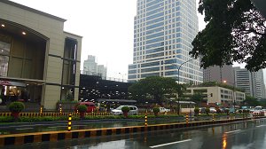
Use the pedestrian underpass to get to Makati Shangri-La Hotel which is located to the left corner of Makati Avenue and Ayala Avenue, follow the sign in the underpass pointing to Makati Avenue. 6750 Ayala, the building in the photo, is the tall tower before Makati Shangri-La Hotel. Glorietta 4 and 5 is located next to Rustan's. To get to Nielsen Tower, no need to get to the other side of Ayala Avenue, just walk towards Makati Avenue, go right in Makati Avenue and use the pedestrian crossing to get to the other side. Nielsen Tower is situated along Makati Avenue near corner of Ayala Avenue. To get to Makati Atrium Building and Peninsula Hotel, go to How To Get To Atrium Building Makati.
To get to PLDT also known as Ramon Cojuangco Bldg, Locsin Building, Allied Bank Center, Ansons Makati and Ayala Museum, follow the direction to Makati Shangri-La Hotel, i.e. from unloading area use the pedestrian underpass to get to the other side of Ayala Avenue. Walk towards Makati Avenue. At the corner of Makati Avenue and Ayala Avenue, here are the choices: Go left to get to Ansons which is next to Makati Shangri-La Hotel. Use another pedestrian underpass to get to the other side of Makati Avenue. Locsin Building is situated at the corner of Ayala Avenue and Makati Avenue, opposite Makati Shangri-la. Next to Locsin Building along Makati Avenue is the PLDT Building also known as Ramon Cojuangco Building. Ayala Museum is next to PLDT along Makati Avenue, to the other corner of Dela Rosa Street. Allied Bank Center is the second building along Ayala Avenue from the corner of Makati Avenue.
Next Unloading Area is after Paseo de Roxas. But before that, the jeep will cross Makati Avenue and stop in loading area between Makati Avenue and Paseo de Roxas to pick up passengers.
Now, to continue on the next part of this series, click here. Ops, don't forget to see the map.
And if you want to discover few simple ways not to miss new and upcoming articles on commuting and driving directions to lots of places in Metro Manila. Click HERE
Route Map Ayala-Washington Jeepney
4 May 2011
How To Commute From EDSA To Buildings Inside Ortigas Center
The sign in front of jeepneys that ply the route from the corner of EDSA and Ortigas Avenue to different buildings inside Ortigas Center CBD is 'Robinson's Galleria-Ortigas Complex'. The exact location where you can ride this jeep is in front of Galleria Corporate Center, the tall building connected to Robinson's Galleria Mall. Wait for a jeep to pass by at the corner of Galleria Corporate Center. This jeepney passes through the one way service road around Robinson's Galleria Mall from Ortigas Complex to its Terminal along Ortigas Avenue. The terminal is a long walk so commuters ride at Galleria Corporate Center and then they transfer to another jeepney at the terminal in going to Ortigas Center Complex.
'Robinson's Galleria-Ortigas Complex' jeepney route is a loop within Ortigas Center CBD that serves passengers from EDSA-Ortigas bus loading and unloading zone. So if you're traveling by bus in EDSA from either north (e.g. Monumento, Cubao, Fairview, Novaliches, Malanday, Valenzuela) or south (e.g. Baclaran, NAIA 1-2-3, Pasay, Alabang, Sucat, Bicutan, Pacita, Muntinlupa, Magallanes, Makati) of Metro Manila, all you need to do is get off the bus at Robinson's Galleria (just make sure you're riding a bus with "Ortigas Ilalim" sign and not "Ortigas Ibabaw") , ride this jeep, transfer to another jeep at the terminal and get off at the area in Ortigas Center Complex near to the building of your destination.
Riding a jeep from Galleria Corporate Center in EDSA to its terminal is FREE. Just get off the jeep and get in another jeep located to the front of the terminal. Minimum fare applies.
This post is a second part of series of articles on how to get to buildings located inside Ortigas Center CBD. Our first post entitled Walking Directions From MRT Station To Ortigas Center Buildings shares to you fastest way to reach some buildings from MRT-3 Ortigas Station. You can also read the third part of this series which explains how to commute to the buildings located to the southern side of Ortigas Center from MRT Shaw, click HERE. Meanwhile, the fourth chapter will give you walking directions from MRT Shaw to some important institutions nearer to the train station, i.e. San Properties Centre, EDSA Shangri-la Hotel, St. Francis Twin Towers, St. Francis of Assisi Church, etc., click HERE

 Ortigas Station is a long walk from jeepney route going to Ortigas Complex. I presume the time it takes to walk from MRT Ortigas Station to loading area of the jeepney plus the waiting time while the jeepney is being filled up is longer than the time it takes to walk from MRT-3 Ortigas Station to some of the buildings in Ortigas Center Complex.
To find out the buildings that are walking distance from MRT-3 Ortigas Station, go to Walking Directions From MRT Station To Ortigas Center Buildings or click here.

Now, if you're riding a bus and you get off at Ortigas Avenue, riding a jeepney in going to the location of a building inside Ortigas Center CBD is not quixotic. This is also true if you're riding a bus or jeepney or even taxi from Quiapo, Greenhills, San Juan, SM City Santa Mesa, Legarda, Gilmore, Ronac Arts Center, Ever Gotesco Ortigas, Libis, Antipolo, Taytay, etc. All you need to do is alight at unloading area along Ortigas Avenue in Robinson's Galleria, then ride the jeep at its terminal nearby.
Even so, there's no need to ride a jeep if you're going to any building located outside the opposite end of Robinsons Galleria such as Crowne Plaza, Holiday Inn, Robinson's Equitable Tower, Mega Plaza, AIC Burgundy, AIC Grande Tower, Corinthian Executive Regency, AIC Gold Tower, Greenhills Christian Fellowship and East of Galleria. These buidlings are just short walk away from the second main entrance of Robinson's Galleria located at the opposite end of the mall which is in ADB Avenue. Just enter the mall at EDSA main entrance, walk towards the opposite end of the mall, exit the mall at ADB main entrance and go towards the building of your destination.
Here's the route and direction of 'Robinson's Galleria-Ortigas Complex' jeepney from its terminal to different areas in Ortigas Center Complex where you can get off to go to your building destination.
To make it easier for you to determine when and where to get off the jeep, the buildings are listed in order of their locations along the route of 'Robinson's Galleria-Ortigas Complex' jeepney. Not all buildings have their photos taken.
From the terminal, the jeep enters Ortigas Center Complex by turning right onto F. Ortigas Jr Road formerly known as Emerald Avenue.
It will cross Sapphire Road where Ortigas Building and AIC Gold Tower is located. These buildings are walking distance from Robinson's Galleria.

The jeep will turn left on Garnet Road. Grand Emerald Tower is at the corner of Garnet and F Ortigas Jr formerly Emerald Avenue.
Next building to Grand Emerald Tower, along F. Ortigas Jr Road is Jollibee Plaza, followed by Padilla Building.
Along Garnet Road to the right, first stop is back entrance of PLDT. Followed by back entrances of Strata 2000 and Ortigas Center Post Office, respectively. Garnet Road is the back door of most buildings along F. Ortigas Jr Road formerly known as Emerald Avenue. If you're going to the main entrances of the buildings located along F. Ortigas Jr Road formerly Emerald Avenue, get off the jeep at the corner of Garnet Road and F. Ortigas Jr Road and walk your way to those buildings.
To the left of Garnet Road opposite Ortigas Center Post Office is Onyx Road, a T intersection. Get off at Onyx Road to go to Unionbank Plaza, Parc Chateau Condominium - corner of Garnet and Onyx, Horizon Codominium - along Sapphire and Onyx Road, Suntree Tower - next to Horizon Condominium, and the back of Millenium Place - next to Suntree.

After the jeep stops at Onyx Road, it continues on Garnet Road up to the corner of Garnet and Julia Vargas Avenue. To the right of Garnet Road from Ortigas Center Post Office located respectively are: back entrances of Emerald Mansion, Raffles Corporate Center, Prestige building and Taipan Place. The jeep stops at the corner of Garnet Road and Julia Vargas Avenue, opposite Centerpoint Building. It stands there for a while to wait for passengers leaving Ortigas Complex.
If you're going to One Corporate Center or Antel Global Corporate Center, get off at Centerpoint Building, corner of Julia Vargas Avenue and Garnet Road. The two buildings stand to your left if you're facing Julia Vargas. One Corporate Center is situated at the corner of Meralco Avenue and Julia Vargas Avenue. Next to it is the Antel Global. Just walk your way to Caltex, then walk across Julia Vargas.

From Garnet Road the jeep will turn right onto Julia Vargas. It will pass by T-intersection to the right. This intersection is F. Ortigas Jr Road formerly Emerald Avenue where the main entrances of the buildings and different coffee shops, fast food chains, food court and convenient stores are located. Among them are Jollibee, KFC, Greenwhich, Chowking, Starbucks, Figaro, Lasapin Food Court (also accessible through back door along Garnet Road), 7-11, etc.

There's pedestrian overpass at Julia Vargas and F. Ortigas Jr Road. If you're going to Tektite Towers or Octagon Building where Teleperformance and Sony Philippines are located, get off at T-intersection of Julia Vargas and F. Ortigas Jr Road.

Use the footbridge and get across Julia Vargas Avenue. Located at the foot of the overpass, opposite of F. Ortigas Jr Road alaong Julia Vargas is Amberland Plaza. Next to it is Parc Royale Condomium, followed by Nobleland Ventures.
Use the walkway located to the right of Amberland Plaza to get to Tektite Towers, located at the back of Amberland Plaza and Parc Royale. You need to pass through another walkway at the middle of a large parking lot behind Parc Royale to get to Exchange Road where Tektite Towers are located. Octagon Building can also be reached by using this direction. Just walk towards the building.
After F. Ortigas Jr Road, the jeep will turn right onto Ruby Road where El Pueblo is located to the left corner. El Pueblo is a commercial area where fast food chains, cafes, restaurants and bars are located. There's a McDonald's here. Along Ruby Road, to the right, are back entrances of buildings located along west side of F. Ortigas Jr Road formerly known as Emereal Avenue.
First building is Agustin 1, followed by The Orient Square, then Emerald Building. Fourth is Wynsum Corporate Plaza. Next is Hanston Building. Followed by Strata 100. To the left of Ruby Road, next to El Pueblo is a T-intersection which bends to the right. This street is called Topaz Road where after it bends THE JMT Building is located to its left, followed by Discovery Suites, then Anson's and lastly the Malayan Plaza.
Buildings along Ruby Road are nearer to the ones along Topaz Road, as what you see in our main photo from which Wynsum and Orient Square looked nearer to The JMT and Discovery Suites as if they're all situated along opposite sides of one street.
From Ruby Road, the jeep will turn left on Opal Road, the next T-intersection to the left of Ruby Road. Opposite Opal, to the right of Ruby Road is the Ortigas Park where Coffeebean is also located. It is important to note, that you can get to Ortigas Park faster if you get off the jeep at the corner of F. Ortigas Road and Garnet Road, just before the jeep turn left. Walk along F. Ortigas west side until you reach Ortigas Park. In Opal Road, the jeepney will turn right onto ADB Avenue on its way to Robinson's Galleria and the Bus Bay located in front of Robinson's Galleria EDSA entrance. At the corner of Opal and ADB is Yamaha Y-Zone. And along ADB Avenue's east side is the Joy Nostalg, next to Volvo Ortigas.
Below is the Route Map of Robinson's Galleria Ortigas Complex Jeepney that gives you clear view of how the jeepney traverses the locations of the buildings we've just discussed on this chapter.
Discover few simple ways not to miss new and upcoming articles on commuting and driving directions to lots of places in Metro Manila. Click HERE
Route Map of Robinson's Galleria Ortigas Complex Jeepney
Read more...
19 Apr 2011
Lagalag


'Robinson's Galleria-Ortigas Complex' jeepney route is a loop within Ortigas Center CBD that serves passengers from EDSA-Ortigas bus loading and unloading zone. So if you're traveling by bus in EDSA from either north (e.g. Monumento, Cubao, Fairview, Novaliches, Malanday, Valenzuela) or south (e.g. Baclaran, NAIA 1-2-3, Pasay, Alabang, Sucat, Bicutan, Pacita, Muntinlupa, Magallanes, Makati) of Metro Manila, all you need to do is get off the bus at Robinson's Galleria (just make sure you're riding a bus with "Ortigas Ilalim" sign and not "Ortigas Ibabaw") , ride this jeep, transfer to another jeep at the terminal and get off at the area in Ortigas Center Complex near to the building of your destination.
This post is a second part of series of articles on how to get to buildings located inside Ortigas Center CBD. Our first post entitled Walking Directions From MRT Station To Ortigas Center Buildings shares to you fastest way to reach some buildings from MRT-3 Ortigas Station. You can also read the third part of this series which explains how to commute to the buildings located to the southern side of Ortigas Center from MRT Shaw, click HERE. Meanwhile, the fourth chapter will give you walking directions from MRT Shaw to some important institutions nearer to the train station, i.e. San Properties Centre, EDSA Shangri-la Hotel, St. Francis Twin Towers, St. Francis of Assisi Church, etc., click HERE

From top-right clockwise: Orient Square, Wynsum Corporate Plaza, Discovery Suites, and JMT Corporate Condominium stand next to each other in this photo of Ortigas Center. Jeepneys with "Robinson's Galleria Ortigas Center Complex" sign passes through their location.

Now, if you're riding a bus and you get off at Ortigas Avenue, riding a jeepney in going to the location of a building inside Ortigas Center CBD is not quixotic. This is also true if you're riding a bus or jeepney or even taxi from Quiapo, Greenhills, San Juan, SM City Santa Mesa, Legarda, Gilmore, Ronac Arts Center, Ever Gotesco Ortigas, Libis, Antipolo, Taytay, etc. All you need to do is alight at unloading area along Ortigas Avenue in Robinson's Galleria, then ride the jeep at its terminal nearby.
Even so, there's no need to ride a jeep if you're going to any building located outside the opposite end of Robinsons Galleria such as Crowne Plaza, Holiday Inn, Robinson's Equitable Tower, Mega Plaza, AIC Burgundy, AIC Grande Tower, Corinthian Executive Regency, AIC Gold Tower, Greenhills Christian Fellowship and East of Galleria. These buidlings are just short walk away from the second main entrance of Robinson's Galleria located at the opposite end of the mall which is in ADB Avenue. Just enter the mall at EDSA main entrance, walk towards the opposite end of the mall, exit the mall at ADB main entrance and go towards the building of your destination.
Here's the route and direction of 'Robinson's Galleria-Ortigas Complex' jeepney from its terminal to different areas in Ortigas Center Complex where you can get off to go to your building destination.
To make it easier for you to determine when and where to get off the jeep, the buildings are listed in order of their locations along the route of 'Robinson's Galleria-Ortigas Complex' jeepney. Not all buildings have their photos taken.
From the terminal, the jeep enters Ortigas Center Complex by turning right onto F. Ortigas Jr Road formerly known as Emerald Avenue.
It will cross Sapphire Road where Ortigas Building and AIC Gold Tower is located. These buildings are walking distance from Robinson's Galleria.

The jeep will turn left on Garnet Road. Grand Emerald Tower is at the corner of Garnet and F Ortigas Jr formerly Emerald Avenue.
Next building to Grand Emerald Tower, along F. Ortigas Jr Road is Jollibee Plaza, followed by Padilla Building.
 |
| Unionbank Plaza, Onyx Road cor Sapphire |
Along Garnet Road to the right, first stop is back entrance of PLDT. Followed by back entrances of Strata 2000 and Ortigas Center Post Office, respectively. Garnet Road is the back door of most buildings along F. Ortigas Jr Road formerly known as Emerald Avenue. If you're going to the main entrances of the buildings located along F. Ortigas Jr Road formerly Emerald Avenue, get off the jeep at the corner of Garnet Road and F. Ortigas Jr Road and walk your way to those buildings.
 |
| Jeepney Stop in front Centerpoint Bldg |
To the left of Garnet Road opposite Ortigas Center Post Office is Onyx Road, a T intersection. Get off at Onyx Road to go to Unionbank Plaza, Parc Chateau Condominium - corner of Garnet and Onyx, Horizon Codominium - along Sapphire and Onyx Road, Suntree Tower - next to Horizon Condominium, and the back of Millenium Place - next to Suntree.

After the jeep stops at Onyx Road, it continues on Garnet Road up to the corner of Garnet and Julia Vargas Avenue. To the right of Garnet Road from Ortigas Center Post Office located respectively are: back entrances of Emerald Mansion, Raffles Corporate Center, Prestige building and Taipan Place. The jeep stops at the corner of Garnet Road and Julia Vargas Avenue, opposite Centerpoint Building. It stands there for a while to wait for passengers leaving Ortigas Complex.
 |
| One Corporate Center |
 |
| Antel Global |
If you're going to One Corporate Center or Antel Global Corporate Center, get off at Centerpoint Building, corner of Julia Vargas Avenue and Garnet Road. The two buildings stand to your left if you're facing Julia Vargas. One Corporate Center is situated at the corner of Meralco Avenue and Julia Vargas Avenue. Next to it is the Antel Global. Just walk your way to Caltex, then walk across Julia Vargas.

From Garnet Road the jeep will turn right onto Julia Vargas. It will pass by T-intersection to the right. This intersection is F. Ortigas Jr Road formerly Emerald Avenue where the main entrances of the buildings and different coffee shops, fast food chains, food court and convenient stores are located. Among them are Jollibee, KFC, Greenwhich, Chowking, Starbucks, Figaro, Lasapin Food Court (also accessible through back door along Garnet Road), 7-11, etc.

There's pedestrian overpass at Julia Vargas and F. Ortigas Jr Road. If you're going to Tektite Towers or Octagon Building where Teleperformance and Sony Philippines are located, get off at T-intersection of Julia Vargas and F. Ortigas Jr Road.

Use the footbridge and get across Julia Vargas Avenue. Located at the foot of the overpass, opposite of F. Ortigas Jr Road alaong Julia Vargas is Amberland Plaza. Next to it is Parc Royale Condomium, followed by Nobleland Ventures.
 |
| Tektite Towers |
Use the walkway located to the right of Amberland Plaza to get to Tektite Towers, located at the back of Amberland Plaza and Parc Royale. You need to pass through another walkway at the middle of a large parking lot behind Parc Royale to get to Exchange Road where Tektite Towers are located. Octagon Building can also be reached by using this direction. Just walk towards the building.
 |
| Octagon Bldg |
After F. Ortigas Jr Road, the jeep will turn right onto Ruby Road where El Pueblo is located to the left corner. El Pueblo is a commercial area where fast food chains, cafes, restaurants and bars are located. There's a McDonald's here. Along Ruby Road, to the right, are back entrances of buildings located along west side of F. Ortigas Jr Road formerly known as Emereal Avenue.
 |
| El Pueblo |
First building is Agustin 1, followed by The Orient Square, then Emerald Building. Fourth is Wynsum Corporate Plaza. Next is Hanston Building. Followed by Strata 100. To the left of Ruby Road, next to El Pueblo is a T-intersection which bends to the right. This street is called Topaz Road where after it bends THE JMT Building is located to its left, followed by Discovery Suites, then Anson's and lastly the Malayan Plaza.
|
| From top right: Orient Square, Wynsum, Discovery, JMT |
Buildings along Ruby Road are nearer to the ones along Topaz Road, as what you see in our main photo from which Wynsum and Orient Square looked nearer to The JMT and Discovery Suites as if they're all situated along opposite sides of one street.
 |
| Ortigas Park |
From Ruby Road, the jeep will turn left on Opal Road, the next T-intersection to the left of Ruby Road. Opposite Opal, to the right of Ruby Road is the Ortigas Park where Coffeebean is also located. It is important to note, that you can get to Ortigas Park faster if you get off the jeep at the corner of F. Ortigas Road and Garnet Road, just before the jeep turn left. Walk along F. Ortigas west side until you reach Ortigas Park. In Opal Road, the jeepney will turn right onto ADB Avenue on its way to Robinson's Galleria and the Bus Bay located in front of Robinson's Galleria EDSA entrance. At the corner of Opal and ADB is Yamaha Y-Zone. And along ADB Avenue's east side is the Joy Nostalg, next to Volvo Ortigas.
 |
| Joy Nostalg |
Below is the Route Map of Robinson's Galleria Ortigas Complex Jeepney that gives you clear view of how the jeepney traverses the locations of the buildings we've just discussed on this chapter.
Discover few simple ways not to miss new and upcoming articles on commuting and driving directions to lots of places in Metro Manila. Click HERE
Route Map of Robinson's Galleria Ortigas Complex Jeepney
Read more...
19 Apr 2011
NAIA 1-2-3 Shuttle Bus: Easy Way To Get To & From NAIA Terminals
Going to three terminals of Ninoy Aquino International Airport or NAIA presents problems for most of the commuters especially if they don't know what route of jeepneys or buses to take. Good for the old terminal 1 that its location is along the route of Metro Manila buses. One can get off the bus exactly at the old airport. In NAIA-2, you need to walk a little bit far to get to its ground. NAIA-3 is the most hard to reach by commuting among the three terminals because of its location.
FLASH! City buses from north of Metro Manila now go direct to NAIA 3 and 4. Read the latest article on how to go to terminal 4 and 3 in one bus ride from your location, go to City Buses Route Direct to NAIA-3 & 4 from North of Metro Manila
Thanks to NAIA Shuttle Bus, going to and from two terminals of our premier airport, NAIA-2 and NAIA-3, has never been this convenient for commuters. You can get in and out of these terminals even if you're not an arriving passenger. In Terminal 1, only arriving passengers can ride the shuttle bus but commuters going to the old airport can still get there by riding the shuttle bus.
IMPORTANT UPDATE (Sep 12, 2015): NAIA Shuttle is now called Airport Loop. The bus in the photo below no longer exists. They are replaced by Airport Loop buses. Also the location of new Airport Loop inside Pasay Bus Terminal has moved. The unloading spot in Terminal 3 is moved, too. So, I have created a new article that will guide you in locating and identifying the Airport Loop buses. In the new article, added are complete list of unloading areas and their locations along the entire route of the loop. Two unloading areas are now designated inside Newport City. You have to read the new article as it is fresh. Nevertheless, directions in this article are still usable in general so my recommendation is to read this and the new published article. Here's the link: Airport Loop: Where to Ride & Alight to and from NAIA Terminals.
If you're going to a NAIA Terminal to catch your flight, make sure you have enough time allowance. In addition to 3 hours requirement for international flight and 2 hours for local flight for a flying passenger to be at the airport before the time of the flight, an added 2 hours allowance is needed if you're going to NAIA-1 via Shuttle Bus to make up for the waiting time both in Bus Station at Pasay Rotonda and NAIA-3.
HOW TO GET TO EACH TERMINAL OF NAIA FROM SHUTTLE BUS STATION
For Commute Guide to Manila Domestic Airport aka Terminal 4, read
How To Commute To Manila Domestic Airport Terminal 4.
 Flash: Read new post published July 29, 2012 for NAIA 1-2-3-4 Shuttle Bus Updates.
NAIA Shuttle Bus Station is located inside the terminal of provincial bus Genesis Transport Services with exact location at EDSA corner Taft, Pasay Rotunda - at the back of Sogo Pasay Rotonda Branch.
 From LRT-1 EDSA Station, turn left after your exit at turnstile (exit machine), then use the footbridge to get across EDSA. Go towards Sogo until you get to the building of MRT-3 Taft Station. Use the stair and get to the ground where a McDonald's is situated next to MRT Station. McDonald (under major renovation as of July 2015) is located alongside Dunkin Donut, Chow King and Sogo. Between McDonald's and Dunkin Donut is an exit driveway of all buses and jeepneys coming from the terminal. Use this driveway to enter the bus terminal where NAIA shuttle buses stand waiting for passengers. Get in the bus and wait for conductor to collect payments of 20 pesos per passenger.
 From MRT-3 Taft Station, after your exit at the turnstile (exit machine where you insert ticket) located to the right of station, go towards the hallway where pedestrians walk to get to either side of EDSA. Walk towards the opposide of EDSA. At this point Sogo Hotel is already visible. Use the stair to get to the ground where you will immediately see McDonald's alongside Dunkin Donut, Chow King and Sogo itself. Between McDonald's and Dunkin Donut is a exit driveway of all buses and jeepneys coming from the terminal. Use this driveway to enter the bus terminal where NAIA shuttle buses stand waiting for passengers. Get in the bus and wait for conductor to collect payments of 20 pesos per passenger.
Direction #1
 From Genesis Bus Terminal at Pasay Rotunda to NAIA-3. Passengers going to NAIA-1 and NAIA-2 must also board at Genesis Bus Terminal at Pasay Rotonda. They will transfer to another NAIA Shuttle Bus at NAIA-3.
The bus will turn right onto EDSA from the terminal in Pasay Rotunda. Then it will turn right again onto Aurora Boulevard also known as Tramo. The bus will take the whole stretch of Aurora Boulevard up to its opposite end where the bus will turn left on Andrews Avenue. The bus will turn right on a large rotunda where it will take the dedicated lane going to NAIA-3. All passengers will alight at NAIA-3 Bus Station.
Direction #2
 From NAIA-3 to NAIA-1 and NAIA-2. If you're going to either NAIA-1 or NAIA-2, go to 'NAIA Bus Station Route 1' which is located alongside 'NAIA Bus Station Route 2' where you get off the shuttle bus from Pasay Taft Rotonda. If there's no bus yet, wait for one to arrive. Ride a bus and wait for a conductor to collect payment. The bus will wait for more passengers to fill up the bus before it leaves.
From NAIA-3, the bus will take Andrews Avenue again. It go towards Domestic Road past Aurora Boulevard via Airport Road which is the extension of Andrews Avenue. From Airport Road, the bus will turn left on Domestic Road, stay there up to the opposite end where it will turn left on NAIA Road. Then the bus will turn right onto Ninoy Aquino Avenue on its way to NAIA-1. All passengers going to NAIA-1 will get off the bus the moment it stops at the designated area. Passengers going to NAIA-2 will stay on board. No need for transfer.
Direction #3
 From NAIA-1, the bus will go directly and immediately to NAIA-2 without any waiting. The bus will take Ninoy Aquino Avenue again, then it will turn right onto NAIA Road on its way to NAIA-2, the last stop of the shuttle from NAIA-3. The shuttle bus will stop in front of 'International Arrivals'. It will wait for passengers going to NAIA-3 where they will transfer to another NAIA Shuttle Bus that will take them outside the airport area and into any point along the route going to its terminal in Pasay Rotunda where MRT and LRT Lines will bring them to any point in Metro Manila.
HOW TO GET FROM EACH TERMINAL OF NAIA TO MRT AND LRT LINES LOCATED IN PASAY ROTUNDA
Direction #4
 From NAIA-3 to Pasay Rotunda Bus Terminal, LRT EDSA Station and MRT Taft Station.
If you're an arriving passenger, you can immediately see the NAIA Bus Station. It is located in front of Arrival Exit. After you exit the NAIA-3 building via the Arrival Exit, walk across the access road. Go to the area under the 'NAIA Bus Station Route 2' sign and wait for a bus to arrive.
Direction #5
 From NAIA-2 to NAIA-3, Pasay Rotunda Terminal and LRT/MRT Stations.
Outside 'International Arrivals', between Bay 14 and Bay 15, an 'AIRPORT SHUTTLE' sign hangs conspicuously. There are benches just below it where passengers can wait for the bus. Go to that area and wait for NAIA Shuttle Bus. The bus will take you to NAIA-3 where you will transfer to another NAIA Shuttle Bus that will bring you to Baclaran, Heritage Hotel or LRT/MRT Stations in Taft Pasay Rotunda where the bus station is located. Please read Direction #4 for the information on how to ride NAIA Shuttle Bus at NAIA-3.
Direction #6
 From NAIA-1 to Baclaran, MRT/LRT Stations EDSA Taft Pasay Rotonda and other locations in Metro Manila.
If you're an arriving passengers, after your exit from Arrival Area, go towards the right of the NAIA-1 building where you will see 'SHUTTLE SERVICE Loading Area' sign along the access road of Arrival. Opposite the shuttle service loading area are hotel lounges.
 If you're a non-arriving passengers, go to the main road where public jeepneys and buses pass through. This road is located to the right of the building of NAIA-1. If you're going to Baclaran, you can just ride a jeepney with "Baclaran" sign. If you're going to LRT-1 EDSA Station or MRT-3 Taft Station, wait for a public bus that plies the route of NAIA-1 to Fairview or other areas in north Metro Manila and vice versa. This bus will also pass by Baclaran via Roxas Boulevard, Heritage Hotel in EDSA corner Roxas Boulevard and other important locations along EDSA such as Magallanes, Buendia EDSA where CyberTwo is located, Guadalupe, Boni EDSA, Shaw EDSA Crossing, Ortigas Center where SM Megamall is located, Ortigas Avenue corner EDSA where POEA is located, Santolan, Araneta Center Cubao, GMA Kamuning, etc.
Location Map Of NAIA Shuttle Bus Station At Pasay Taft Rotonda
Read more...
Thanks to NAIA Shuttle Bus, going to and from two terminals of our premier airport, NAIA-2 and NAIA-3, has never been this convenient for commuters. You can get in and out of these terminals even if you're not an arriving passenger. In Terminal 1, only arriving passengers can ride the shuttle bus but commuters going to the old airport can still get there by riding the shuttle bus.
If you're going to a NAIA Terminal to catch your flight, make sure you have enough time allowance. In addition to 3 hours requirement for international flight and 2 hours for local flight for a flying passenger to be at the airport before the time of the flight, an added 2 hours allowance is needed if you're going to NAIA-1 via Shuttle Bus to make up for the waiting time both in Bus Station at Pasay Rotonda and NAIA-3.
For Commute Guide to Manila Domestic Airport aka Terminal 4, read
How To Commute To Manila Domestic Airport Terminal 4.

NAIA Shuttle Bus Station is located inside the terminal of provincial bus Genesis Transport Services with exact location at EDSA corner Taft, Pasay Rotunda - at the back of Sogo Pasay Rotonda Branch.


Direction #1

The bus will turn right onto EDSA from the terminal in Pasay Rotunda. Then it will turn right again onto Aurora Boulevard also known as Tramo. The bus will take the whole stretch of Aurora Boulevard up to its opposite end where the bus will turn left on Andrews Avenue. The bus will turn right on a large rotunda where it will take the dedicated lane going to NAIA-3. All passengers will alight at NAIA-3 Bus Station.
Direction #2

From NAIA-3, the bus will take Andrews Avenue again. It go towards Domestic Road past Aurora Boulevard via Airport Road which is the extension of Andrews Avenue. From Airport Road, the bus will turn left on Domestic Road, stay there up to the opposite end where it will turn left on NAIA Road. Then the bus will turn right onto Ninoy Aquino Avenue on its way to NAIA-1. All passengers going to NAIA-1 will get off the bus the moment it stops at the designated area. Passengers going to NAIA-2 will stay on board. No need for transfer.
Direction #3

HOW TO GET FROM EACH TERMINAL OF NAIA TO MRT AND LRT LINES LOCATED IN PASAY ROTUNDA
Direction #4

If you're an arriving passenger, you can immediately see the NAIA Bus Station. It is located in front of Arrival Exit. After you exit the NAIA-3 building via the Arrival Exit, walk across the access road. Go to the area under the 'NAIA Bus Station Route 2' sign and wait for a bus to arrive.
Warning: Direction #4 has been changed since Jan 2013. For your convenience upon arrival at T3 commuting to MRT/LRT Taft, read NAIA Shuttle Bus Still OperationalThere are three major locations where passengers can get off the shuttle bus - Unloading Area near Redemptorist Church in Baclaran, Heritage Hotel which is located at the corner of EDSA and Roxas Boulevard, and the Bus Station inside Genesis Bus Terminal which is next to MRT and LRT Train Stations at Pasay Taft Rotonda.
Direction #5

Outside 'International Arrivals', between Bay 14 and Bay 15, an 'AIRPORT SHUTTLE' sign hangs conspicuously. There are benches just below it where passengers can wait for the bus. Go to that area and wait for NAIA Shuttle Bus. The bus will take you to NAIA-3 where you will transfer to another NAIA Shuttle Bus that will bring you to Baclaran, Heritage Hotel or LRT/MRT Stations in Taft Pasay Rotunda where the bus station is located. Please read Direction #4 for the information on how to ride NAIA Shuttle Bus at NAIA-3.
Direction #6

If you're an arriving passengers, after your exit from Arrival Area, go towards the right of the NAIA-1 building where you will see 'SHUTTLE SERVICE Loading Area' sign along the access road of Arrival. Opposite the shuttle service loading area are hotel lounges.

Location Map Of NAIA Shuttle Bus Station At Pasay Taft Rotonda
Subscribe to:
Posts (Atom)


Featured Directions
Ultimate Commute Guide to Cagayan Tourist Spots & Patapat Viaduct
Ultimate handbook for backpackers and first timers in Cagayan Province, the home of Callao Cave and Palaui Island where a season of Survivor...
Visit My Other Blog
Popular Directions This Week
-
 Bonifacio Global City is situated approx two kilometers to the east of MRT Ayala Station in EDSA, Makati. Boasts of world class destination...
 -
 Going to three terminals of Ninoy Aquino International Airport or NAIA presents problems for most of the commuters especially if they don...
 -
 If you're going to a building located inside Ortigas Center and you don't know how to get to its exact location, just continue readi...
 -
 Directions to Star City Location Map of Star City Photos of Star City Star City is one of the most affordable theme parks in the Philippin...
 -
 For driving directions, click here . Amoranto Sports Complex is situated along Don Alejandro Roces Avenue, simply known as Roces, with its...
 -
 Trinoma Transport Terminal stepped commuting up for commuters' convenience. Almost almost all locations within 360 radius of the surroun...
 -
 Driving to NAIA Terminals 1,2 and 3 is now in a breeze, thanks to the newly built NAIA Airport Skyway which opens this September. It is th...
 -
 SM Aura Mass schedule is as follows: Saturdays - 12NN & 6pm, Sundays - 10AM, 12NN, 3PM, 5PM & 7PM, Weekdays - 12:15NN & 6PM. SM...
 -
 For all commuters that have been affected by the removal of the terminal of jeepneys and Urvan Express vans in Mayflower inside the Greenfie...
 -
 The Public Transport Terminal in SM City North EDSA is located beneath Sky Garden and immediately below the Sky Dome. It's a bit small t...